Coed Gelli-grin

Wood, Forest in Merionethshire

Wales

Coed Gelli-grin

Ffestiniog Railway volunteers at Rhiw Goch Signalbox A wave and a smile from one of the volunteers working at Rhiw Goch Signalbox.
Ffestiniog Railway volunteers at Rhiw Goch Signalbox Credit: Jeff Buck

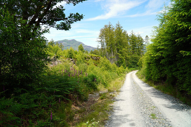
Coed Gelli-grin, located in Merionethshire, Wales, is a stunning woodland area renowned for its natural beauty and tranquil atmosphere. Covering an area of approximately 100 hectares, this ancient forest offers a diverse range of plant and animal species, making it a haven for nature enthusiasts and hikers alike.

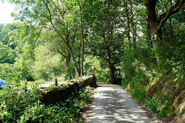
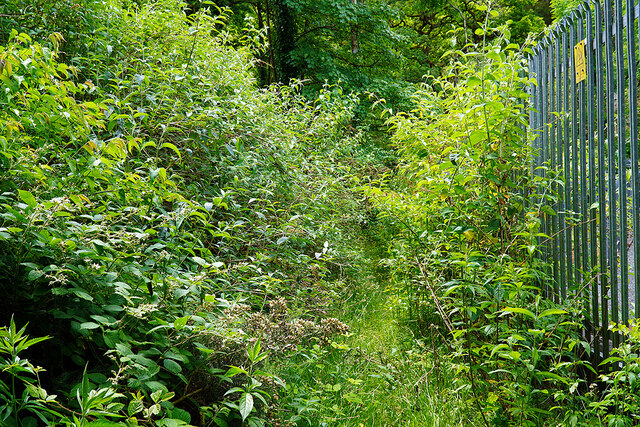
The woodland is predominantly composed of broadleaf trees such as oak, birch, and ash, creating a dense canopy overhead that filters sunlight and creates a cool, shaded environment below. The forest floor is carpeted with a rich array of ferns, mosses, and wildflowers, adding to the enchanting ambiance.

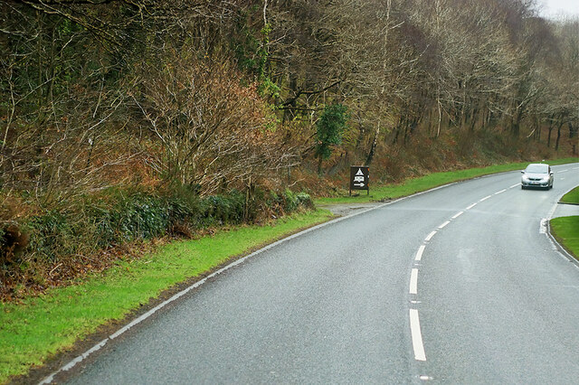
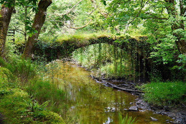
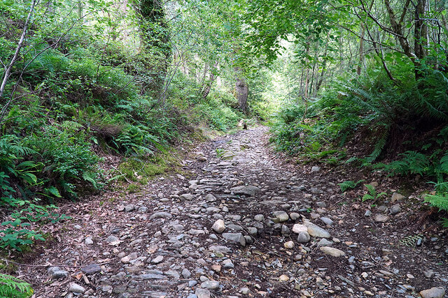
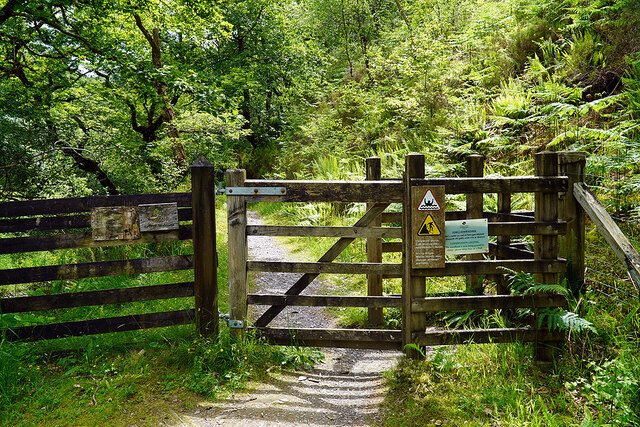
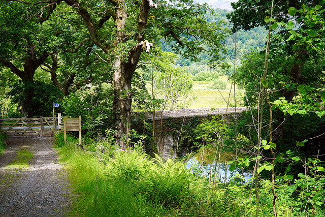
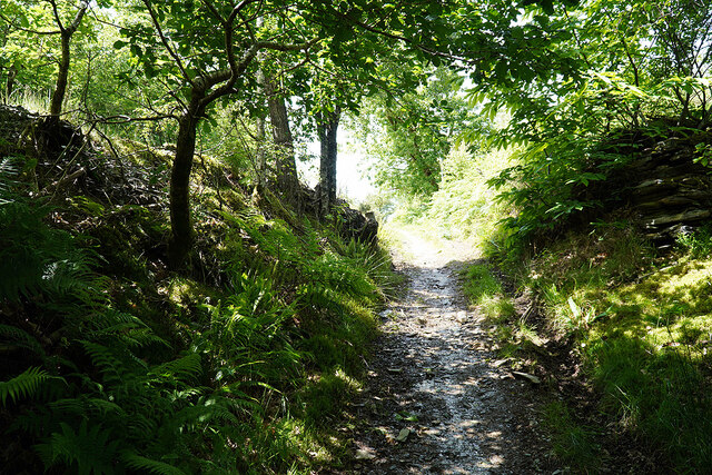
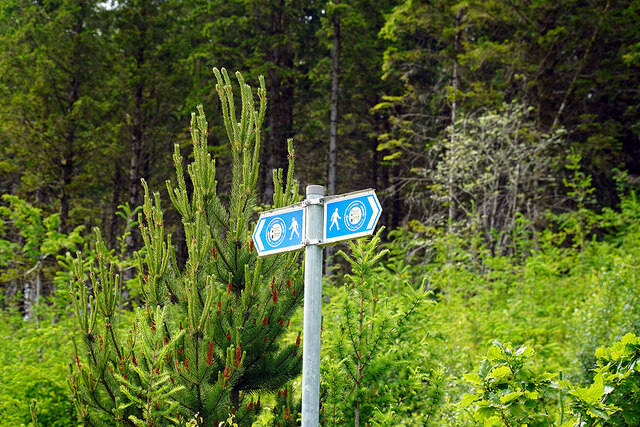
Coed Gelli-grin is crisscrossed by a network of well-maintained footpaths, allowing visitors to explore the woods at their own pace. These paths lead to various points of interest, including a picturesque waterfall and a tranquil river. The soothing sound of flowing water contributes to the overall sense of tranquility that permeates the forest.

The forest is also home to a wide range of wildlife, including birds such as woodpeckers, owls, and song thrushes, which can be spotted and heard throughout the year. Small mammals like squirrels and rabbits are also commonly sighted, while patient observers may catch a glimpse of larger mammals such as deer and foxes.

Coed Gelli-grin is not only a haven for flora and fauna but also a place of historical importance. Evidence of human activity can be found in the form of ancient ruins and remnants of old settlements, providing a fascinating glimpse into the area's past.

Overall, Coed Gelli-grin offers a serene escape into nature, providing visitors with a chance to immerse themselves in the beauty and tranquility of this ancient forest.

If you have any feedback on the listing, please let us know in the comments section below.

Coed Gelli-grin Images

Images are sourced within 2km of 52.933537/-4.0253247 or Grid Reference SH6339. Thanks to Geograph Open Source API. All images are credited.

Ffestiniog Railway volunteers at Rhiw Goch Signalbox A wave and a smile from one of the volunteers working at Rhiw Goch Signalbox.
Ffestiniog Railway volunteers at Rhiw Goch Signalbox
A wave and a smile from one of the volunteers working at Rhiw Goch Signalbox.
A487 passing Afon Dwyryd The A487 is one of the most important roads in Wales. It covers the majority of the west coast from St Davids to Menai Bridge, and is a primary route for most of its length, including a section where it multiplexes with the A470, another important north-south road. Along the way, it runs through two national parks: Snowdonia and Pembrokeshire Coast. Despite its length and importance, it is predominantly single carriageway, although the road has been upgraded in numerous places. It is 174 miles long.
<span class="nowrap"><a title="http://www.sabre-roads.org.uk/wiki/index.php?title=A487" rel="nofollow ugc noopener" href="http://www.sabre-roads.org.uk/wiki/index.php?title=A487">Link</a><img style="margin-left:2px;" alt="External link" title="External link - shift click to open in new window" src="https://s1.geograph.org.uk/img/external.png" width="10" height="10"/></span>
A487 passing Afon Dwyryd
The A487 is one of the most important roads in Wales. It covers the majority of the west coast from St Davids to Menai Bridge, and is a primary route for most of its length, including a section where it multiplexes with the A470, another important north-south road. Along the way, it runs through two national parks: Snowdonia and Pembrokeshire Coast. Despite its length and importance, it is predominantly single carriageway, although the road has been upgraded in numerous places. It is 174 miles long. LinkExternal link
Farm Buildings, Trwyn-y-garnedd The A487 is one of the most important roads in Wales. It covers the majority of the west coast from St Davids to Menai Bridge, and is a primary route for most of its length, including a section where it multiplexes with the A470, another important north-south road. Along the way, it runs through two national parks: Snowdonia and Pembrokeshire Coast. Despite its length and importance, it is predominantly single carriageway, although the road has been upgraded in numerous places. It is 174 miles long.
<span class="nowrap"><a title="http://www.sabre-roads.org.uk/wiki/index.php?title=A487" rel="nofollow ugc noopener" href="http://www.sabre-roads.org.uk/wiki/index.php?title=A487">Link</a><img style="margin-left:2px;" alt="External link" title="External link - shift click to open in new window" src="https://s1.geograph.org.uk/img/external.png" width="10" height="10"/></span>
Farm Buildings, Trwyn-y-garnedd
The A487 is one of the most important roads in Wales. It covers the majority of the west coast from St Davids to Menai Bridge, and is a primary route for most of its length, including a section where it multiplexes with the A470, another important north-south road. Along the way, it runs through two national parks: Snowdonia and Pembrokeshire Coast. Despite its length and importance, it is predominantly single carriageway, although the road has been upgraded in numerous places. It is 174 miles long. LinkExternal link
Scania R450, Coed Cae Fali CML Scania R450 (MD19 OXS) heading east on the A487, passing Coed Cae Fali.
Scania R450, Coed Cae Fali
CML Scania R450 (MD19 OXS) heading east on the A487, passing Coed Cae Fali.
A487 near Hafod-talog The A487 is one of the most important roads in Wales. It covers the majority of the west coast from St Davids to Menai Bridge, and is a primary route for most of its length, including a section where it multiplexes with the A470, another important north-south road. Along the way, it runs through two national parks: Snowdonia and Pembrokeshire Coast. Despite its length and importance, it is predominantly single carriageway, although the road has been upgraded in numerous places. It is 174 miles long.
<span class="nowrap"><a title="http://www.sabre-roads.org.uk/wiki/index.php?title=A487" rel="nofollow ugc noopener" href="http://www.sabre-roads.org.uk/wiki/index.php?title=A487">Link</a><img style="margin-left:2px;" alt="External link" title="External link - shift click to open in new window" src="https://s1.geograph.org.uk/img/external.png" width="10" height="10"/></span>
A487 near Hafod-talog
The A487 is one of the most important roads in Wales. It covers the majority of the west coast from St Davids to Menai Bridge, and is a primary route for most of its length, including a section where it multiplexes with the A470, another important north-south road. Along the way, it runs through two national parks: Snowdonia and Pembrokeshire Coast. Despite its length and importance, it is predominantly single carriageway, although the road has been upgraded in numerous places. It is 174 miles long. LinkExternal link
Ordnance Survey Flush Bracket (G2615) This Flush Bracket can be found on Ty-cae-fali. It marks a point 14.510m above mean sea level.
Ordnance Survey Flush Bracket (G2615)
This Flush Bracket can be found on Ty-cae-fali. It marks a point 14.510m above mean sea level.
Coed Felenrhyd Forest across the River Dwyryd on Moel Ysgyfarnogod
Coed Felenrhyd
Forest across the River Dwyryd on Moel Ysgyfarnogod
Westbound A487 The A487 is one of the most important roads in Wales. It covers the majority of the west coast from St Davids to Menai Bridge, and is a primary route for most of its length, including a section where it multiplexes with the A470, another important north-south road. Along the way, it runs through two national parks: Snowdonia and Pembrokeshire Coast. Despite its length and importance, it is predominantly single carriageway, although the road has been upgraded in numerous places. It is 174 miles long.
<span class="nowrap"><a title="http://www.sabre-roads.org.uk/wiki/index.php?title=A487" rel="nofollow ugc noopener" href="http://www.sabre-roads.org.uk/wiki/index.php?title=A487">Link</a><img style="margin-left:2px;" alt="External link" title="External link - shift click to open in new window" src="https://s1.geograph.org.uk/img/external.png" width="10" height="10"/></span>
Westbound A487
The A487 is one of the most important roads in Wales. It covers the majority of the west coast from St Davids to Menai Bridge, and is a primary route for most of its length, including a section where it multiplexes with the A470, another important north-south road. Along the way, it runs through two national parks: Snowdonia and Pembrokeshire Coast. Despite its length and importance, it is predominantly single carriageway, although the road has been upgraded in numerous places. It is 174 miles long. LinkExternal link
A487 passing Blaen-cefn Camp Site The A487 is one of the most important roads in Wales. It covers the majority of the west coast from St Davids to Menai Bridge, and is a primary route for most of its length, including a section where it multiplexes with the A470, another important north-south road. Along the way, it runs through two national parks: Snowdonia and Pembrokeshire Coast. Despite its length and importance, it is predominantly single carriageway, although the road has been upgraded in numerous places. It is 174 miles long.
<span class="nowrap"><a title="http://www.sabre-roads.org.uk/wiki/index.php?title=A487" rel="nofollow ugc noopener" href="http://www.sabre-roads.org.uk/wiki/index.php?title=A487">Link</a><img style="margin-left:2px;" alt="External link" title="External link - shift click to open in new window" src="https://s1.geograph.org.uk/img/external.png" width="10" height="10"/></span>
A487 passing Blaen-cefn Camp Site
The A487 is one of the most important roads in Wales. It covers the majority of the west coast from St Davids to Menai Bridge, and is a primary route for most of its length, including a section where it multiplexes with the A470, another important north-south road. Along the way, it runs through two national parks: Snowdonia and Pembrokeshire Coast. Despite its length and importance, it is predominantly single carriageway, although the road has been upgraded in numerous places. It is 174 miles long. LinkExternal link
Road by Felen Rhyd Fach Approaching Maentwrog power station and the junction with the A496.
Road by Felen Rhyd Fach
Approaching Maentwrog power station and the junction with the A496.
Path leading to Ivy Bridge Once an important thoroughfare, leading to the old crossing of Afon Prysor. Now seemingly little used, given the state of the overgrowth. The fence marks the boundary of the Maentwrog power station site.
Path leading to Ivy Bridge
Once an important thoroughfare, leading to the old crossing of Afon Prysor. Now seemingly little used, given the state of the overgrowth. The fence marks the boundary of the Maentwrog power station site.
Ivy Bridge across Afon Prysor Grade II listed, on the packhorse route from Maentwrog to Harlech. CADW <span class="nowrap"><a title="https://cadwpublic-api.azurewebsites.net/reports/listedbuilding/FullReport?lang=en&id=83453" rel="nofollow ugc noopener" href="https://cadwpublic-api.azurewebsites.net/reports/listedbuilding/FullReport?lang=en&id=83453">Link</a><img style="margin-left:2px;" alt="External link" title="External link - shift click to open in new window" src="https://s1.geograph.org.uk/img/external.png" width="10" height="10"/></span> has it as being C18 or earlier. Other reports show that it is as early as C16.
Ivy Bridge across Afon Prysor
Grade II listed, on the packhorse route from Maentwrog to Harlech. CADW LinkExternal link has it as being C18 or earlier. Other reports show that it is as early as C16.
The old packhorse road leading up from Ivy Bridge Heading for Landecwyn and thence Harlech. A long pull up to the summit in Coed Felenrhyd. Now also forms a part of the Maentwrog Circular Walk <span class="nowrap"><a title="https://www.visitsnowdonia.info/maentwrog-circular-walk" rel="nofollow ugc noopener" href="https://www.visitsnowdonia.info/maentwrog-circular-walk">Link</a><img style="margin-left:2px;" alt="External link" title="External link - shift click to open in new window" src="https://s1.geograph.org.uk/img/external.png" width="10" height="10"/></span>. Was also on the original route of the Wales Coast Path, but that was rerouted when Pont Briwet <a href="https://www.geograph.org.uk/gridref/SH616383">SH616383</a> was rebuilt with a pedestrian footway and opened in 2015, thereby avoiding a long inland incursion. The old bridge was too narrow to allow safe passage of walkers <a href="https://www.geograph.org.uk/photo/606781">SH6138 : Pont Briwet Toll Road</a>.
The old packhorse road leading up from Ivy Bridge
Heading for Landecwyn and thence Harlech. A long pull up to the summit in Coed Felenrhyd. Now also forms a part of the Maentwrog Circular Walk LinkExternal link. Was also on the original route of the Wales Coast Path, but that was rerouted when Pont Briwet SH616383 was rebuilt with a pedestrian footway and opened in 2015, thereby avoiding a long inland incursion. The old bridge was too narrow to allow safe passage of walkers SH6138 : Pont Briwet Toll Road.
Gate on a pathway beside Afon Prysor Running through Coed Cae'n-y-coed. Signs on the gate warn of steep drops and water levels changing without warning.
Gate on a pathway beside Afon Prysor
Running through Coed Cae'n-y-coed. Signs on the gate warn of steep drops and water levels changing without warning.
Pont Felenrhyd-fawr Carries the A496 road over Afon Prysor. The blue sign on the left is for the Maentwrog 10.5-mile circular walk route. It is interesting that hikers are advised to walk beside the main road, which is narrow for an A road and has no provision for pedestrians. Whereas, just a short distance inland is Ivy Bridge <a href="https://www.geograph.org.uk/photo/7203250">SH6539 : Ivy Bridge across Afon Prysor</a> which can be used to cross the river, with adequate (but somewhat overgrown) access paths either side <a href="https://www.geograph.org.uk/photo/7203245">SH6539 : Path leading to Ivy Bridge</a>, the use of which will keep walkers away from the road. I'm sure there is a valid reason for this approach, but it's a mystery to me!
Pont Felenrhyd-fawr
Carries the A496 road over Afon Prysor. The blue sign on the left is for the Maentwrog 10.5-mile circular walk route. It is interesting that hikers are advised to walk beside the main road, which is narrow for an A road and has no provision for pedestrians. Whereas, just a short distance inland is Ivy Bridge SH6539 : Ivy Bridge across Afon Prysor which can be used to cross the river, with adequate (but somewhat overgrown) access paths either side SH6539 : Path leading to Ivy Bridge, the use of which will keep walkers away from the road. I'm sure there is a valid reason for this approach, but it's a mystery to me!
Leaving the forest canopy over Coed Felenrhyd Approaching an area of conifer plantation, much of which has been cleared in recent times. This is a continuation of the packhorse route up from Ivy Bridge, but has been widened for forestry management purposes.
Leaving the forest canopy over Coed Felenrhyd
Approaching an area of conifer plantation, much of which has been cleared in recent times. This is a continuation of the packhorse route up from Ivy Bridge, but has been widened for forestry management purposes.
The packhorse road in Coed Felenrhyd in mixed woodland Still retains its original characteristics but a little further ahead it's been widened for forestry management purposes.
The packhorse road in Coed Felenrhyd in mixed woodland
Still retains its original characteristics but a little further ahead it's been widened for forestry management purposes.
Waymarker for the Maentwrog Circular Walk in Coed Felenrhyd
Show me another place!

Coed Gelli-grin is located at Grid Ref: SH6339 (Lat: 52.933537, Lng: -4.0253247)

Unitary Authority: Gwynedd

Police Authority: North Wales

What 3 Words

///employer.thirsty.political. Near Penrhyndeudraeth, Gwynedd

Nearby Locations

Coed Gelli-grin

Related Wikis

Maentwrog power station

Maentwrog power station was built by the North Wales Power Company and supplied electricity to North Wales, Deeside and Cheshire. It exploits the water...

Vale of Ffestiniog

The Vale of Ffestiniog is a valley in the Snowdonia National Park in Gwynedd, North Wales. It stretches from Ffestiniog in the east and runs in a westerly...

Llandecwyn

Llandecwyn () is a hamlet near Penrhyndeudraeth in Gwynedd, Wales. The bulk of the population (between 40 and 50 houses) is now located around Cilfor close...

Gwaith Powdwr

Gwaith Powdwr, (English: Powder Works), situated in Penrhyndeudraeth, Wales, is a decommissioned explosives works now managed as a Nature Reserve by the...

Nearby Amenities

Located within 500m of 52.933537,-4.0253247
Source: PGS
Lat/Long: 52.9369451/-4.0296172
Source: PGS
Lat/Long: 52.9371313/-4.0277715
Created By: dmgroom_coastlines
Source: PGS
Lat/Long: 52.937518/-4.026396
Created By: dmgroom_coastlines
Source: PGS
Lat/Long: 52.937781/-4.025554
Created By: dmgroom_coastlines
Source: PGS
Lat/Long: 52.936746/-4.026802
Created By: dmgroom_coastlines
Source: PGS
Lat/Long: 52.936479/-4.028068
Source: PGS
Lat/Long: 52.937544/-4.023428
Source: PGS
Lat/Long: 52.937803/-4.02301
Source: PGS
Lat/Long: 52.93728/-4.02427
Source: PGS
Lat/Long: 52.9369827/-4.026145
Source: PGS
Lat/Long: 52.937016/-4.025112
Source: PGS
Lat/Long: 52.937013/-4.025536
The data included in this document is from www.openstreetmap.org. The data is made available under ODbL.

Have you been to Coed Gelli-grin?

Leave your review of Coed Gelli-grin below (or comments, questions and feedback).