Valley Wood

Wood, Forest in Glamorgan

Wales

Valley Wood

Triangulation post in Penllegaer Forest Clearly unfit for the purpose it was created, this triangulation post is now almost invisible from the nearby footpath let alone being visible from miles around as Penllegaer Forest has since been planted and grown around it.
Triangulation post in Penllegaer Forest Credit: Hywel Williams

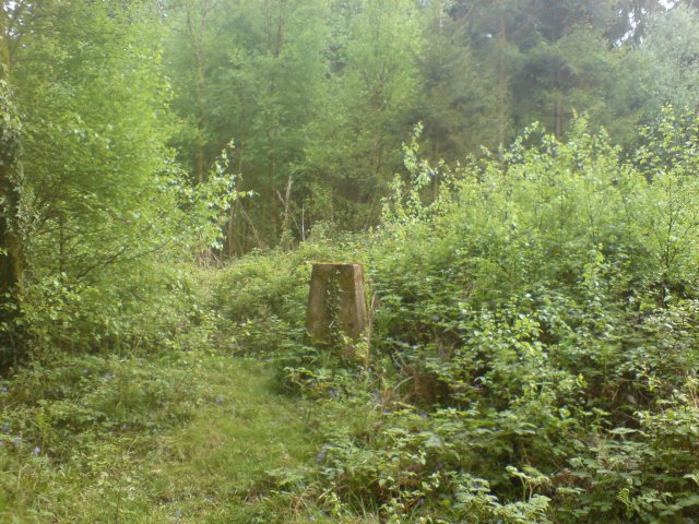
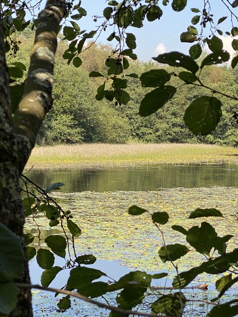
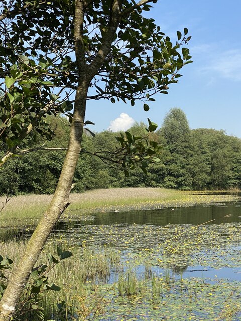
Valley Wood is a picturesque forest located in the county of Glamorgan, Wales. Stretching across a vast area, this woodland is renowned for its natural beauty and diverse range of flora and fauna. With its serene atmosphere and lush greenery, it offers a tranquil escape for nature enthusiasts and outdoor lovers alike.

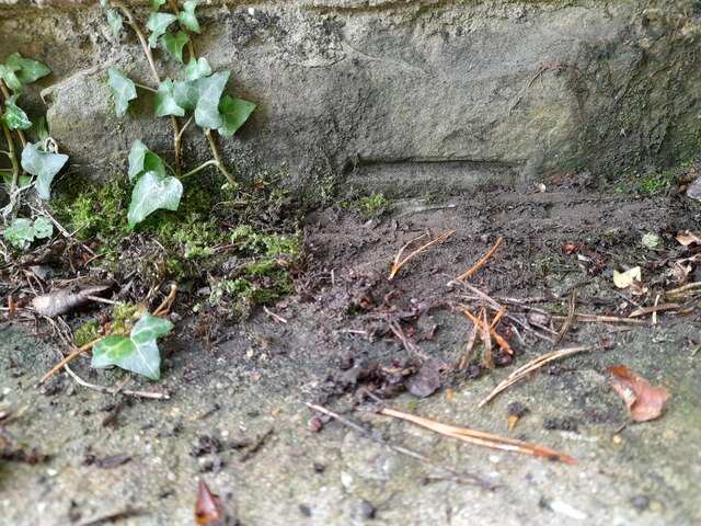
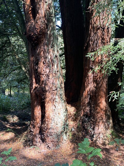
The wood is home to a variety of tree species, including oak, beech, and birch, creating a rich and vibrant landscape throughout the seasons. The forest floor is adorned with an array of wildflowers, ferns, and mosses, adding to the enchanting ambiance of the woodland.

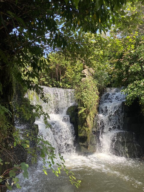
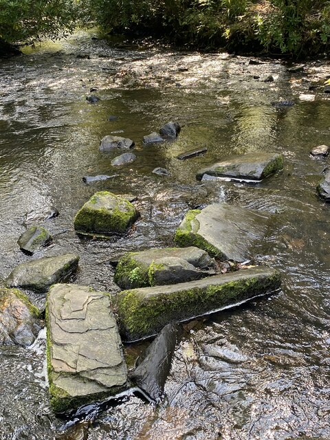
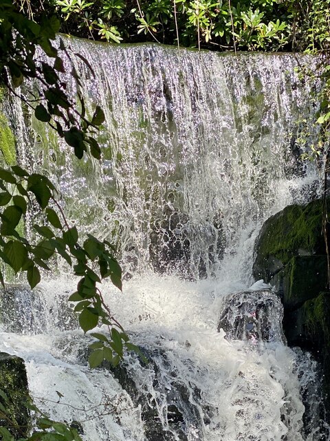
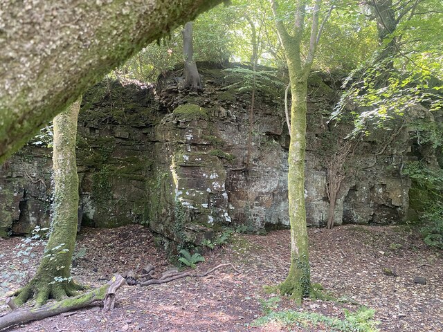
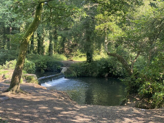
Valley Wood boasts an extensive network of walking trails, allowing visitors to explore its depths and discover hidden gems along the way. These paths meander through the trees, revealing stunning vistas, babbling brooks, and even small waterfalls. The forest also offers picnic areas and designated camping spots, making it a popular destination for families and outdoor enthusiasts looking to spend a day or even a weekend immersed in nature.

Wildlife thrives in Valley Wood, with sightings of deer, foxes, and a variety of bird species being common. The forest is also home to a number of rare and protected species, making it an important conservation area. Birdwatchers will particularly enjoy the forest, as it provides an ideal habitat for a wide range of species, including woodpeckers, owls, and songbirds.

Valley Wood, with its natural beauty and abundance of wildlife, is a true gem in the heart of Glamorgan. Its tranquil atmosphere and stunning scenery make it a must-visit destination for anyone seeking solace in nature.

If you have any feedback on the listing, please let us know in the comments section below.

Valley Wood Images

Images are sourced within 2km of 51.670847/-3.9859469 or Grid Reference SS6298. Thanks to Geograph Open Source API. All images are credited.

Triangulation post in Penllegaer Forest Clearly unfit for the purpose it was created, this triangulation post is now almost invisible from the nearby footpath let alone being visible from miles around as Penllegaer Forest has since been planted and grown around it.
Triangulation post in Penllegaer Forest
Clearly unfit for the purpose it was created, this triangulation post is now almost invisible from the nearby footpath let alone being visible from miles around as Penllegaer Forest has since been planted and grown around it.
Tircoed  Community Centre Tircoed is a large modern housing estate built in Penllergaer Forest over the last few years.  Much thought has been given to the estate (though the layout can be confusing if you don't know your way round) - it includes its own convenience store and a modern community centre.

A recent addition to this building is the antenna attached to the back of the building.  This is a quarter wave transmitter mast for the recently launched Radio Tircoed, a voluntary run community radio station.
Tircoed Community Centre
Tircoed is a large modern housing estate built in Penllergaer Forest over the last few years. Much thought has been given to the estate (though the layout can be confusing if you don't know your way round) - it includes its own convenience store and a modern community centre. A recent addition to this building is the antenna attached to the back of the building. This is a quarter wave transmitter mast for the recently launched Radio Tircoed, a voluntary run community radio station.
Radio Tircoed studios Behind the modern community centre for the newly built Tircoed housing estate are what appear to be two shipping containers. Their livery reveals that they are in fact the studios for Radio Tircoed which commenced broadcasting on 1st December 2008.

The station is self funded and is entirely run by volunteers and serves the communities of Tircoed, Penllergaer, Pontardulais, Gorseinon, Pontlliw and the M4 Corridor between junctions 47 and 48 - though the signal can be clearly heard much further.  

Along with its relatively powerful (for a community radio station) FM signal, the station also broadcasts on the internet on its web site, and DJs now frequently get requests from all over the world as well as the community in which it serves.

This was the original studio facility - it has since been replaced by a substantially larger structure.
Radio Tircoed studios
Behind the modern community centre for the newly built Tircoed housing estate are what appear to be two shipping containers. Their livery reveals that they are in fact the studios for Radio Tircoed which commenced broadcasting on 1st December 2008. The station is self funded and is entirely run by volunteers and serves the communities of Tircoed, Penllergaer, Pontardulais, Gorseinon, Pontlliw and the M4 Corridor between junctions 47 and 48 - though the signal can be clearly heard much further. Along with its relatively powerful (for a community radio station) FM signal, the station also broadcasts on the internet on its web site, and DJs now frequently get requests from all over the world as well as the community in which it serves. This was the original studio facility - it has since been replaced by a substantially larger structure.
Tircoed Village Hall - Radio Tircoed Radio Tircoed - community radio station.
Tircoed Village Hall - Radio Tircoed
Radio Tircoed - community radio station.
Play area Tircoed community play area.
Play area
Tircoed community play area.
Ordnance Survey Cut Mark This mostly buried OS cut mark can be found on the SW parapet of the railway bridge. It marks a point 62.868m above mean sea level.
Ordnance Survey Cut Mark
This mostly buried OS cut mark can be found on the SW parapet of the railway bridge. It marks a point 62.868m above mean sea level.
Swansea West Services, 2023 Interesting to note the walkway canopy has been removed since my last visit in 2013, <a href="https://www.geograph.org.uk/photo/3550352">SS6299 : Swansea West Services</a>.
Swansea West Services, 2023
Interesting to note the walkway canopy has been removed since my last visit in 2013, SS6299 : Swansea West Services.
Western Red Cedars Majestic trees in Valley Wood, Penllergaer.
Western Red Cedars
Majestic trees in Valley Wood, Penllergaer.
Waterfalls in Valley Wood, Penllergaer.
Pond in Graig-neddfwch Wood
Rocky stream in Penllergaer Woods
Spider’s web on Western Red Cedar
Entrance to Penllergaer Valley Woods
Waterfall close-up
Waterfall close-up
Woodland pond
Woodland pond
Quarry near Middle Lodge
Weir on Afon Llan, Penllergaer
Western Red Cedars Specimen trees on the Penllergaer estate.
Western Red Cedars
Specimen trees on the Penllergaer estate.
Show me another place!

Valley Wood is located at Grid Ref: SS6298 (Lat: 51.670847, Lng: -3.9859469)

Unitary Authority: Swansea

Police Authority: South Wales

What 3 Words

///deck.feast.pipe. Near Pontlliw, Swansea

Nearby Locations

Valley Wood

Related Wikis

Swansea services

Swansea services (Welsh: Gwasanaethau Gorllewin Abertawe, "Swansea West services") is a motorway service station on the M4 motorway at Junction 47 near...

Llangyfelach railway station

Llangyfelach railway station served the village of Llangyfelach, in the historical county of Glamorganshire, Wales, from 1923 to 1924 on the Swansea District...

Penllergaer

Penllergaer (Welsh: Penlle'r-gaer) is a village and community in the City and County of Swansea, Wales. It lies to the east of Gorseinon, within the electoral...

Penllergaer (electoral ward)

Penllergaer is the name of an electoral ward (and a community) in the City and County of Swansea, Wales, UK. Penllergaer has its own elected community...

Nearby Amenities

Located within 500m of 51.670847,-3.9859469
Waterway: waterfall
Lat/Long: 51.6725192/-3.9902456
Crossing
Lat/Long: 51.673187/-3.9839784
Crossing
Lat/Long: 51.6729544/-3.9846079
Crossing
Lat/Long: 51.6729242/-3.984087
Crossing
Lat/Long: 51.6740011/-3.9834954
Traffic Calming: yes
Lat/Long: 51.6728993/-3.9839583
Crossing
Lat/Long: 51.6732288/-3.9845941
Bench
Lat/Long: 51.6726804/-3.9913652
Waterway: waterfall
Lat/Long: 51.6699902/-3.9892848
Location Transition: yes
Power: pole
Lat/Long: 51.6752614/-3.987219
Location Transition: yes
Power: pole
Lat/Long: 51.6741919/-3.9887989
Power: pole
Lat/Long: 51.6731623/-3.9885762
Power: pole
Lat/Long: 51.6721293/-3.9883375
Power: pole
Lat/Long: 51.6691883/-3.9877447
Power: pole
Lat/Long: 51.667944/-3.9890644
Power: pole
Lat/Long: 51.6671022/-3.9899576
Direction: SSE
Generator Method: photovoltaic
Generator Output Electricity: yes
Generator Solar Modules: 10
Generator Source: solar
Generator Type: solar_photovoltaic_panel
Location: roof
Power: generator
Lat/Long: 51.6730924/-3.9921489
Direction: S
Generator Method: photovoltaic
Generator Output Electricity: yes
Generator Solar Modules: 7
Generator Source: solar
Generator Type: solar_photovoltaic_panel
Location: roof
Power: generator
Lat/Long: 51.6693904/-3.9892671
Direction: 85
Generator Method: photovoltaic
Generator Output Electricity: yes
Generator Solar Modules: 14
Generator Source: solar
Generator Type: solar_photovoltaic_panel
Location: roof
Power: generator
Lat/Long: 51.6693361/-3.9913557
Direction: 175
Generator Method: photovoltaic
Generator Output Electricity: yes
Generator Solar Modules: 16
Generator Source: solar
Generator Type: solar_photovoltaic_panel
Location: roof
Power: generator
Lat/Long: 51.6685986/-3.9904123
Direction: S
Generator Method: photovoltaic
Generator Output Electricity: yes
Generator Solar Modules: 16
Generator Source: solar
Generator Type: solar_photovoltaic_panel
Location: roof
Power: generator
Lat/Long: 51.6690162/-3.9905977
Direction: 125
Generator Method: photovoltaic
Generator Output Electricity: yes
Generator Solar Modules: 16
Generator Source: solar
Generator Type: solar_photovoltaic_panel
Location: roof
Power: generator
Lat/Long: 51.668458/-3.98911
Direction: 125
Generator Method: photovoltaic
Generator Output Electricity: yes
Generator Solar Modules: 16
Generator Source: solar
Generator Type: solar_photovoltaic_panel
Location: roof
Power: generator
Lat/Long: 51.6686227/-3.9889276
Direction: 215
Generator Method: photovoltaic
Generator Output Electricity: yes
Generator Solar Modules: 16
Generator Source: solar
Generator Type: solar_photovoltaic_panel
Location: roof
Power: generator
Lat/Long: 51.6689591/-3.9886613
Direction: S
Generator Method: photovoltaic
Generator Output Electricity: yes
Generator Solar Modules: 9
Generator Source: solar
Generator Type: solar_photovoltaic_panel
Location: roof
Power: generator
Lat/Long: 51.6693889/-3.989532
Direction: S
Generator Method: photovoltaic
Generator Output Electricity: yes
Generator Solar Modules: 16
Generator Source: solar
Generator Type: solar_photovoltaic_panel
Location: roof
Power: generator
Lat/Long: 51.6694013/-3.9897504
Direction: E
Generator Method: photovoltaic
Generator Output Electricity: yes
Generator Solar Modules: 6
Generator Source: solar
Generator Type: solar_photovoltaic_panel
Location: roof
Power: generator
Lat/Long: 51.6714751/-3.9926864
Direction: W
Generator Method: photovoltaic
Generator Output Electricity: yes
Generator Solar Modules: 10
Generator Source: solar
Generator Type: solar_photovoltaic_panel
Location: roof
Power: generator
Lat/Long: 51.6714689/-3.9927658
The data included in this document is from www.openstreetmap.org. The data is made available under ODbL.

Have you been to Valley Wood?

Leave your review of Valley Wood below (or comments, questions and feedback).