Allt Pantygourych

Wood, Forest in Cardiganshire

Wales

Allt Pantygourych

Pasture west of Tregaron, Ceredigion As is common in this region, cattle and sheep graze together. Beyond the foreground undulating fields is the Teifi valley. On the skyline, right of centre is the plantation on Bryn Du. More of the Cwm Berwyn plantation is to the left of centre.
Pasture west of Tregaron, Ceredigion Credit: Roger D Kidd

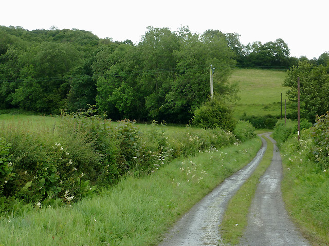
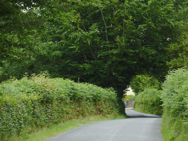
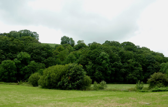
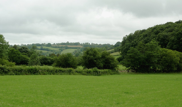
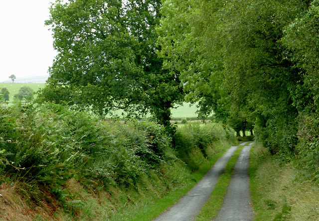
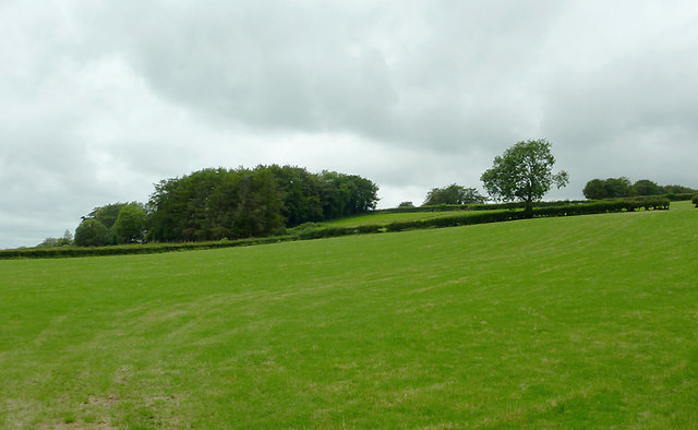
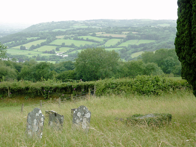
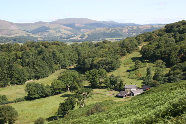
Allt Pantygourych is a wood located in the county of Cardiganshire, Wales. Nestled in the beautiful countryside, it is known for its picturesque scenery and diverse range of flora and fauna. The wood covers an area of approximately 100 acres and is a popular destination for nature lovers and outdoor enthusiasts.

The wood is predominantly made up of native tree species such as oak, beech, and ash, which create a dense and vibrant canopy. The forest floor is carpeted with a variety of wildflowers, ferns, and mosses, adding to its natural beauty. The wood is also home to a number of rare and protected species, including the red squirrel and the lesser horseshoe bat.

Allt Pantygourych offers a network of well-maintained walking trails, allowing visitors to explore its various habitats and enjoy the tranquility of the surroundings. The trails wind through the wood, providing opportunities for birdwatching and wildlife spotting. There are also designated picnic areas where visitors can relax and take in the stunning views.

The wood is managed by a local conservation organization, which ensures the preservation of its natural features and biodiversity. They conduct regular surveys and monitoring of the wildlife and maintain the trails to provide a safe and enjoyable experience for visitors.

Allt Pantygourych is a true gem of Cardiganshire, offering a peaceful retreat in nature for those seeking to escape the hustle and bustle of everyday life. Its beauty and ecological importance make it a must-visit destination for anyone with an appreciation for the great outdoors.

If you have any feedback on the listing, please let us know in the comments section below.

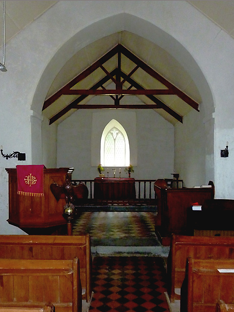
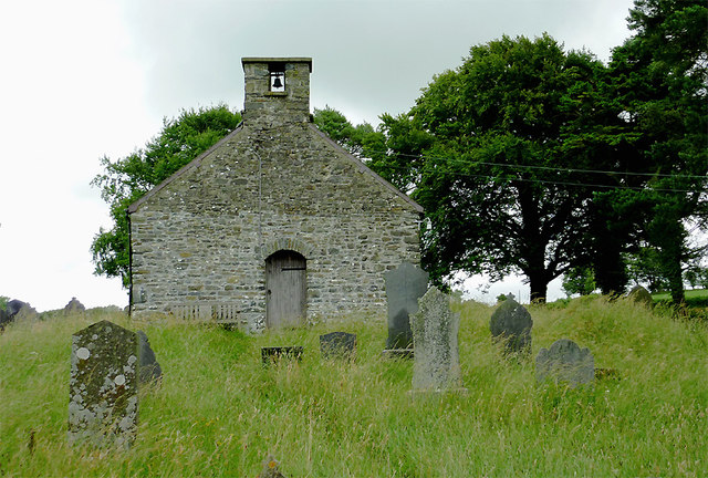
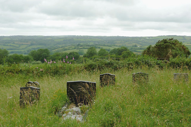
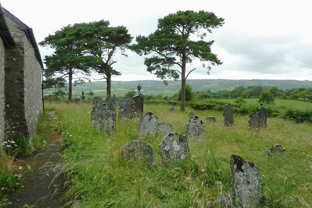
Allt Pantygourych Images

Images are sourced within 2km of 52.232568/-4.0111352 or Grid Reference SN6261. Thanks to Geograph Open Source API. All images are credited.

Pasture west of Tregaron, Ceredigion As is common in this region, cattle and sheep graze together. Beyond the foreground undulating fields is the Teifi valley. On the skyline, right of centre is the plantation on Bryn Du. More of the Cwm Berwyn plantation is to the left of centre.
Pasture west of Tregaron, Ceredigion
As is common in this region, cattle and sheep graze together. Beyond the foreground undulating fields is the Teifi valley. On the skyline, right of centre is the plantation on Bryn Du. More of the Cwm Berwyn plantation is to the left of centre.
Farm track north-east of Llangeitho, Ceredigion The bridleway along this track leads up Cwm Coch to the Llanbadarn Odwyn church on the hill, and onward to Sarn Helen (B4578) at Deri Odwen farm.
Farm track north-east of Llangeitho, Ceredigion
The bridleway along this track leads up Cwm Coch to the Llanbadarn Odwyn church on the hill, and onward to Sarn Helen (B4578) at Deri Odwen farm.
Lane north-east of Llangeitho, Ceredigion The lane leads towards the head of the Aeron Valley, and the B4578 near Tyncelyn.
Lane north-east of Llangeitho, Ceredigion
The lane leads towards the head of the Aeron Valley, and the B4578 near Tyncelyn.
Pasture and woodland by the Afon Aeron near Llangeitho, Ceredigion The river flows from right to left by the bushes in the middle of the image.
Pasture and woodland by the Afon Aeron near Llangeitho, Ceredigion
The river flows from right to left by the bushes in the middle of the image.
Upper Aeron Valley, Ceredigion The valley widens here north-east of Llangeitho, and contains rich pasture land for many miles.
Upper Aeron Valley, Ceredigion
The valley widens here north-east of Llangeitho, and contains rich pasture land for many miles.
Narrow lane north of Stags Head, Ceredigion The lane leads towards three farms, and continues across fields as a bridleway.
Narrow lane north of Stags Head, Ceredigion
The lane leads towards three farms, and continues across fields as a bridleway.
Pasture north of Stags Head, Ceredigion Recently cut grass, which will soon grow ready for sheep or cattle to graze. Pentre-Padarn farm is behind the clump of trees.
Pasture north of Stags Head, Ceredigion
Recently cut grass, which will soon grow ready for sheep or cattle to graze. Pentre-Padarn farm is behind the clump of trees.
Sarn Helen north of Stags Head, Ceredigion The B4578 now runs along the former Roman Road from the A485 at Llanio to the A485 at Tyncelyn, so is a short, straight, but attractive cut avoiding the A road's diversion to Tregaron.
Sarn Helen north of Stags Head, Ceredigion
The B4578 now runs along the former Roman Road from the A485 at Llanio to the A485 at Tyncelyn, so is a short, straight, but attractive cut avoiding the A road's diversion to Tregaron.
Pastoral landscape north-west of Tregaron, Ceredigion The Elenydd moorlands, beyond the wide Teifi valley,  are on the skyline to the right.
Pastoral landscape north-west of Tregaron, Ceredigion
The Elenydd moorlands, beyond the wide Teifi valley, are on the skyline to the right.
Pastoral landscape east of Tregaron, Ceredigion Tregaron in the wide Teifi valley is obscured beyond the low summit in the middle of the image and Trewarn Farm. On the skyline beyond the Teifi are the Elenydd moorlands.
Pastoral landscape east of Tregaron, Ceredigion
Tregaron in the wide Teifi valley is obscured beyond the low summit in the middle of the image and Trewarn Farm. On the skyline beyond the Teifi are the Elenydd moorlands.
Pasture north of Stags Head, Ceredigion On the distant skyline, beyond the wide Teifi Valley, beyond Tregaron and Llanddewi-Brefi, are the Elenydd moorlands.
Pasture north of Stags Head, Ceredigion
On the distant skyline, beyond the wide Teifi Valley, beyond Tregaron and Llanddewi-Brefi, are the Elenydd moorlands.
Farmland north-east of Stags Head, Ceredigion This image shows the pastoral landscape in the area north of Trewaun farm. On the skyline are the moorlands of the Elenydd, including Esgair Ambor, beyond the wide Teifi Valley.
Farmland north-east of Stags Head, Ceredigion
This image shows the pastoral landscape in the area north of Trewaun farm. On the skyline are the moorlands of the Elenydd, including Esgair Ambor, beyond the wide Teifi Valley.
View across Dyffryn Aeron, Ceredigion This is the scene looking west-south-west from the churchyard at Eglwys Llanbadarn Odwyn. The valley farm just left of centre is at Yagubordy, north of Llangeitho.
View across Dyffryn Aeron, Ceredigion
This is the scene looking west-south-west from the churchyard at Eglwys Llanbadarn Odwyn. The valley farm just left of centre is at Yagubordy, north of Llangeitho.
Eglwys Llanbadarn Odwyn near Llangeitho, Ceredigion This church is very isolated in the hills between Llangeitho and the B4578 north of Stags Head. I have not yet found out the date this church was built. Daniel Rowland preached here by special arrangement, but he was not the curate. <a title="https://www.geograph.org.uk/photo/2522378" href="https://www.geograph.org.uk/photo/2522378">Link</a>
Eglwys Llanbadarn Odwyn near Llangeitho, Ceredigion
This church is very isolated in the hills between Llangeitho and the B4578 north of Stags Head. I have not yet found out the date this church was built. Daniel Rowland preached here by special arrangement, but he was not the curate. Link
Eglwys Llanbadarn Odwyn near Llangeitho, Ceredigion This small church, consisting only of a nave and chancel, is very isolated in the hills between Llangeitho and the B4578 north of Stags Head. I have not yet found out the date this church was built. Daniel Rowland preached here by special arrangement, but he was not the curate. <a title="https://www.geograph.org.uk/photo/2522378" href="https://www.geograph.org.uk/photo/2522378">Link</a>
Eglwys Llanbadarn Odwyn near Llangeitho, Ceredigion
This small church, consisting only of a nave and chancel, is very isolated in the hills between Llangeitho and the B4578 north of Stags Head. I have not yet found out the date this church was built. Daniel Rowland preached here by special arrangement, but he was not the curate. Link
Eglwys Llanbadarn Odwyn near Llangeitho, Ceredigion This small church, consisting only of a nave and chancel, is very isolated in the hills between Llangeitho and the B4578 north of Stags Head. I have not yet found out the date of the church's was construction. Daniel Rowland preached here in the eighteenth century by special arrangement, but he was not the curate. <a title="https://www.geograph.org.uk/photo/2522378" href="https://www.geograph.org.uk/photo/2522378">Link</a>
Eglwys Llanbadarn Odwyn near Llangeitho, Ceredigion
This small church, consisting only of a nave and chancel, is very isolated in the hills between Llangeitho and the B4578 north of Stags Head. I have not yet found out the date of the church's was construction. Daniel Rowland preached here in the eighteenth century by special arrangement, but he was not the curate. Link
Churchyard at Eglwys Llanbadarn Odwyn, Ceredigion Looking across the Aeron Valley towards Penuwch (about three miles) and Bethania.

This small church, consisting only of a nave and chancel, is very isolated in the hills between Llangeitho and the B4578 north of Stags Head. I have not yet found out the date this church was built. Daniel Rowland preached here by special arrangement, but he was not the curate. <a title="https://www.geograph.org.uk/photo/2522378" href="https://www.geograph.org.uk/photo/2522378">Link</a>

<a href="https://www.geograph.org.uk/photo/2542430">SN6360 : Eglwys Llanbadarn Odwyn near Llangeitho, Ceredigion</a>
Churchyard at Eglwys Llanbadarn Odwyn, Ceredigion
Looking across the Aeron Valley towards Penuwch (about three miles) and Bethania. This small church, consisting only of a nave and chancel, is very isolated in the hills between Llangeitho and the B4578 north of Stags Head. I have not yet found out the date this church was built. Daniel Rowland preached here by special arrangement, but he was not the curate. Link SN6360 : Eglwys Llanbadarn Odwyn near Llangeitho, Ceredigion
Churchyard at Eglwys Llanbadarn Odwyn, Ceredigion Looking across the Aeron Valley towards Penuwch (about three miles) and Bethania.

This small church, consisting only of a nave and chancel, is very isolated in the hills between Llangeitho and the B4578 north of Stags Head. I have not yet found out the date this church was built. Daniel Rowland preached here by special arrangement, but he was not the curate. <a title="https://www.geograph.org.uk/photo/2522378" href="https://www.geograph.org.uk/photo/2522378">Link</a>
Churchyard at Eglwys Llanbadarn Odwyn, Ceredigion
Looking across the Aeron Valley towards Penuwch (about three miles) and Bethania. This small church, consisting only of a nave and chancel, is very isolated in the hills between Llangeitho and the B4578 north of Stags Head. I have not yet found out the date this church was built. Daniel Rowland preached here by special arrangement, but he was not the curate. Link
Show me another place!

Allt Pantygourych is located at Grid Ref: SN6261 (Lat: 52.232568, Lng: -4.0111352)

Unitary Authority: Ceredigion

Police Authority: Dyfed Powys

What 3 Words

///collected.isolating.reader. Near Tregaron, Ceredigion

Related Wikis

Llangeitho

Llangeitho is a village and community on the upper River Aeron in Ceredigion, Wales, about four miles (6 km) west of Tregaron and 11 kilometres (7 mi)...

Ceredigion

Ceredigion,Welsh pronunciation: [kɛrɛˈdɪɡjɔn], historically Cardiganshire,; is a county in the west of Wales. It borders Gwynedd across the Dyfi estuary...

Llettum-ddu

Llettum-ddu is a hamlet in the community of Tregaron, in the ancient market town of Ceredigion, Wales, which is 61.3 miles (98.6 km) from Cardiff and...

Tyncelyn

Tyncelyn is a hamlet in the community of Lledrod, Ceredigion, Wales, which is 63.7 miles (102.5 km) from Cardiff and 172.6 miles (277.7 km) from London...

Nearby Amenities

Located within 500m of 52.232568,-4.0111352
Source: npe
Lat/Long: 52.2290086/-4.010779
Source: npe
Lat/Long: 52.2299073/-4.0104782
Created By: POI Editor
Source: npe
Lat/Long: 52.2305744/-4.0111406
Created By: POI Editor
Source: npe
Lat/Long: 52.2310496/-4.0106935
Created By: POI Editor
Source: npe
Lat/Long: 52.2312422/-4.0099407
Source: npe
Lat/Long: 52.2321111/-4.0100306
Source: npe
Lat/Long: 52.2330719/-4.011618
Source: npe
Lat/Long: 52.2350226/-4.0113709
Source: npe
Lat/Long: 52.2358155/-4.0106116
Source: npe
Lat/Long: 52.2364551/-4.0076726
Source: npe
Lat/Long: 52.2367672/-4.0085126
Place: farm
Lat/Long: 52.2349668/-4.0172141
Direction: SSE
Generator Method: photovoltaic
Generator Output Electricity: yes
Generator Solar Modules: 8
Generator Source: solar
Generator Type: solar_photovoltaic_panel
Location: roof
Power: generator
Lat/Long: 52.2288188/-4.0149316
Barrier: cattle_grid
Lat/Long: 52.2320973/-4.008086
Ford: yes
Lat/Long: 52.2318284/-4.0100822
The data included in this document is from www.openstreetmap.org. The data is made available under ODbL.

Have you been to Allt Pantygourych?

Leave your review of Allt Pantygourych below (or comments, questions and feedback).