Coed Fryars

Wood, Forest in Anglesey

Wales

Coed Fryars

Former wartime BBC transmitter building - Penmon  (1) Situated near the modern BBC Wales radio transmitter at Penmon is the original BBC transmitter building that opened on 1st February 1937 broadcasting Welsh regional programmes. It became an important communications facility during the Second World War transmitting the BBC Home Service. The radio station's importance was such that it was ringed with a barbed wire fence, and a contingent of the 2nd Battalion Anglesey Home Guard was assigned to guard it. Today the old wartime fencing of barbed wire and concrete posts are still in-situ, despite the conversion of the building since into a private dwelling. One of the supporting posts with its barbed wire can be seen on the left.

<a href="https://www.geograph.org.uk/photo/6944001">SH6178 : Former wartime BBC transmitter building near Penmon  (2)</a>
Former wartime BBC transmitter building - Penmon (1) Credit: Mike Searle

The requested URL returned error: 429 Too Many Requests

If you have any feedback on the listing, please let us know in the comments section below.

Coed Fryars Images

Images are sourced within 2km of 53.278423/-4.0874095 or Grid Reference SH6077. Thanks to Geograph Open Source API. All images are credited.

Former wartime BBC transmitter building - Penmon  (1) Situated near the modern BBC Wales radio transmitter at Penmon is the original BBC transmitter building that opened on 1st February 1937 broadcasting Welsh regional programmes. It became an important communications facility during the Second World War transmitting the BBC Home Service. The radio station's importance was such that it was ringed with a barbed wire fence, and a contingent of the 2nd Battalion Anglesey Home Guard was assigned to guard it. Today the old wartime fencing of barbed wire and concrete posts are still in-situ, despite the conversion of the building since into a private dwelling. One of the supporting posts with its barbed wire can be seen on the left.

<a href="https://www.geograph.org.uk/photo/6944001">SH6178 : Former wartime BBC transmitter building near Penmon  (2)</a>
Former wartime BBC transmitter building - Penmon (1)
Situated near the modern BBC Wales radio transmitter at Penmon is the original BBC transmitter building that opened on 1st February 1937 broadcasting Welsh regional programmes. It became an important communications facility during the Second World War transmitting the BBC Home Service. The radio station's importance was such that it was ringed with a barbed wire fence, and a contingent of the 2nd Battalion Anglesey Home Guard was assigned to guard it. Today the old wartime fencing of barbed wire and concrete posts are still in-situ, despite the conversion of the building since into a private dwelling. One of the supporting posts with its barbed wire can be seen on the left. SH6178 : Former wartime BBC transmitter building near Penmon (2)
Former wartime BBC transmitter building near Penmon  (2) -
<a href="https://www.geograph.org.uk/photo/6943999">SH6178 : Former wartime BBC transmitter building - Penmon  (1)</a>
Former wartime BBC transmitter building near Penmon (2)
WWII defences of North Wales: Castell Aberlleiniog  (1) Traditionally thought to have been built by Hugh, Earl of Chester in 1088-90, its ruins consist of a medieval castle mound and earthworks surmounted by a mid-C17 fort that was occupied during the Second World War by the Home Guard. It was one of several such structures on Anglesey that were used as observation posts or defensive positions. Seen in this view is the North Tower to the right, whose interior was substantially reinforced with concrete during the war for the purposes of defence, possibly to defend the BBC's 'Penmon' transmitter. 
Google Earth view: <span class="nowrap"><a title="https://media.geograph.org.uk/files/7eabe3a1649ffa2b3ff8c02ebfd5659f/Castlell_Aberlliniog_GE-original.jpg" rel="nofollow ugc noopener" href="https://media.geograph.org.uk/files/7eabe3a1649ffa2b3ff8c02ebfd5659f/Castlell_Aberlliniog_GE-original.jpg">Link</a><img style="margin-left:2px;" alt="External link" title="External link - shift click to open in new window" src="https://s1.geograph.org.uk/img/external.png" width="10" height="10"/></span>

<a href="https://www.geograph.org.uk/photo/6944017">SH6179 : WWII defences of North Wales: Castell Aberlleiniog  (2)</a>
WWII defences of North Wales: Castell Aberlleiniog (1)
Traditionally thought to have been built by Hugh, Earl of Chester in 1088-90, its ruins consist of a medieval castle mound and earthworks surmounted by a mid-C17 fort that was occupied during the Second World War by the Home Guard. It was one of several such structures on Anglesey that were used as observation posts or defensive positions. Seen in this view is the North Tower to the right, whose interior was substantially reinforced with concrete during the war for the purposes of defence, possibly to defend the BBC's 'Penmon' transmitter. Google Earth view: LinkExternal link SH6179 : WWII defences of North Wales: Castell Aberlleiniog (2)
WWII defences of North Wales: Castell Aberlleiniog  (2) The North Tower was used as an observation post cum defensive position by the Home Guard during the Second World War, and substantially reinforced.

<a href="https://www.geograph.org.uk/photo/6944022">SH6179 : WWII defences of North Wales: Castell Aberlleiniog  (3)</a>
WWII defences of North Wales: Castell Aberlleiniog (2)
The North Tower was used as an observation post cum defensive position by the Home Guard during the Second World War, and substantially reinforced. SH6179 : WWII defences of North Wales: Castell Aberlleiniog (3)
WWII defences of North Wales: Castell Aberlleiniog  (3) North Tower interior view. The wartime concrete reinforcement is evident in this interior view of three of the five viewing slits that could also double as rifle loops. The reconstruction undertaken during the war has changed the original architecture of the North Tower beyond recognition.

<a href="https://www.geograph.org.uk/photo/6944025">SH6179 : WWII defences of North Wales: Castell Aberlleiniog (4)</a>
WWII defences of North Wales: Castell Aberlleiniog (3)
North Tower interior view. The wartime concrete reinforcement is evident in this interior view of three of the five viewing slits that could also double as rifle loops. The reconstruction undertaken during the war has changed the original architecture of the North Tower beyond recognition. SH6179 : WWII defences of North Wales: Castell Aberlleiniog (4)
WWII defences of North Wales: Castell Aberlleiniog (4) Possible original drain for waste water, built into the top of the wall of the C17 fort on its northwest side.

<a href="https://www.geograph.org.uk/photo/6944027">SH6179 : WWII defences of North Wales: Castell Aberlleiniog  (5)</a>
WWII defences of North Wales: Castell Aberlleiniog (4)
Possible original drain for waste water, built into the top of the wall of the C17 fort on its northwest side. SH6179 : WWII defences of North Wales: Castell Aberlleiniog (5)
WWII defences of North Wales: Castell Aberlleiniog  (5) The West Tower.

<a href="https://www.geograph.org.uk/photo/6944033">SH6179 : WWII defences of North Wales: Castell Aberlleiniog  (6)</a>
WWII defences of North Wales: Castell Aberlleiniog (5)
WWII defences of North Wales: Castell Aberlleiniog  (6) Buttressing of the SW wall.

START: <a href="https://www.geograph.org.uk/photo/6944013">SH6179 : WWII defences of North Wales: Castell Aberlleiniog  (1)</a>
WWII defences of North Wales: Castell Aberlleiniog (6)
The former Saunders Roe site at Beaumaris  (1) Saunders Roe (aka SARO) was a manufacturer of boats and aircraft flying boats based at Cowes on the Isle of Wight. The location on the south coast was in the frontline during the Battle of Britain, causing constant disruption to the works there. It was therefore decided to relocate part of the company to the Fryars Estate near Beaumaris on Anglesey, where a separate company called Saunders Shipyard Ltd was established. Design department staff began arriving in September and October of 1940, with Fryars country house (seen here in this view) used as offices, whilst workshops, hangars and ancillary buildings were constructed in the grounds of the estate.

By early 1941 SARO were contracted to convert American Consolidated PBY-5 Catalina flying boats for use by RAF Coastal Command in anti-submarine warfare. This was by no means the company's only work, although it was their principal source of employment for the company's workforce, and the mainstay of the company for most of the war. The spring of 1944 saw the completion of the bulk of the Catalina programme, with over three-hundred aircraft having been converted for the RAF.

<a href="https://www.geograph.org.uk/photo/6944545">SH6177 : The former Saunders Roe site at Beaumaris  (2)</a>
The former Saunders Roe site at Beaumaris (1)
Saunders Roe (aka SARO) was a manufacturer of boats and aircraft flying boats based at Cowes on the Isle of Wight. The location on the south coast was in the frontline during the Battle of Britain, causing constant disruption to the works there. It was therefore decided to relocate part of the company to the Fryars Estate near Beaumaris on Anglesey, where a separate company called Saunders Shipyard Ltd was established. Design department staff began arriving in September and October of 1940, with Fryars country house (seen here in this view) used as offices, whilst workshops, hangars and ancillary buildings were constructed in the grounds of the estate. By early 1941 SARO were contracted to convert American Consolidated PBY-5 Catalina flying boats for use by RAF Coastal Command in anti-submarine warfare. This was by no means the company's only work, although it was their principal source of employment for the company's workforce, and the mainstay of the company for most of the war. The spring of 1944 saw the completion of the bulk of the Catalina programme, with over three-hundred aircraft having been converted for the RAF. SH6177 : The former Saunders Roe site at Beaumaris (2)
The former Saunders Roe site at Beaumaris  (2) Catalina aircraft for conversion at the SARO site were first flown in to be moored along the Strait. This concrete slipway was constructed in April 1941 from where Catalina aircraft were hauled from the water. They would be transferred up the slipway, then across the road and thence through a gap in the estate wall to the workshops on the other side.

<a href="https://www.geograph.org.uk/photo/6944547">SH6077 : The former Saunders Roe site at Beaumaris  (3)</a>
The former Saunders Roe site at Beaumaris (2)
Catalina aircraft for conversion at the SARO site were first flown in to be moored along the Strait. This concrete slipway was constructed in April 1941 from where Catalina aircraft were hauled from the water. They would be transferred up the slipway, then across the road and thence through a gap in the estate wall to the workshops on the other side. SH6077 : The former Saunders Roe site at Beaumaris (3)
The former Saunders Roe site at Beaumaris  (3) Looking back up the old wartime slipway from where Catalina aircraft were winched up before crossing the road to the workshops through a gap in the estate wall. The darker stone of the repair work that took place post-war to reinstate the wall can be seen across the road above the slipway, the different stonework is more apparent on the left.

<a href="https://www.geograph.org.uk/photo/6944548">SH6077 : The former Saunders Roe site at Beaumaris  (4)</a>
The former Saunders Roe site at Beaumaris (3)
Looking back up the old wartime slipway from where Catalina aircraft were winched up before crossing the road to the workshops through a gap in the estate wall. The darker stone of the repair work that took place post-war to reinstate the wall can be seen across the road above the slipway, the different stonework is more apparent on the left. SH6077 : The former Saunders Roe site at Beaumaris (4)
The former Saunders Roe site at Beaumaris  (4) The repaired estate wall (distinguished by the darker stone) through which Catalina aircraft once passed after being hauled up across the road from the slipway opposite.

<a href="https://www.geograph.org.uk/photo/6944550">SH6077 : The former Saunders Roe site at Beaumaris  (5)</a>
The former Saunders Roe site at Beaumaris (4)
The repaired estate wall (distinguished by the darker stone) through which Catalina aircraft once passed after being hauled up across the road from the slipway opposite. SH6077 : The former Saunders Roe site at Beaumaris (5)
The former Saunders Roe site at Beaumaris  (5) After the conversion work on each Catalina was completed, the aircraft would be moved to the circular concrete compass base where its compass would be recalibrated. It exists today in the grounds of Fryars House unseen behind this wall, its centrepiece is now the fountain in the photo.

<a href="https://www.geograph.org.uk/photo/6944552">SH6077 : The former Saunders Roe site at Beaumaris  (6)</a>
The former Saunders Roe site at Beaumaris (5)
After the conversion work on each Catalina was completed, the aircraft would be moved to the circular concrete compass base where its compass would be recalibrated. It exists today in the grounds of Fryars House unseen behind this wall, its centrepiece is now the fountain in the photo. SH6077 : The former Saunders Roe site at Beaumaris (6)
The former Saunders Roe site at Beaumaris  (6) The T2 hangar was where the bulk of the Catalina work during the war years was conducted, and where in the late 1940s and early 1950s the Marine Assembly Shop was located. After the war the company diversified into a range of aluminium products from bus bodies to fast torpedo boats. During this period of what became the boat building era, the hangar was extended on its west side for sub assembly work, thus freeing up space in the main hangar for boat hull construction. As well as the building of fast patrol boats for the Navies of several different countries, 'Dark' Class boats for the Royal Navy were also constructed here.

<a href="https://www.geograph.org.uk/photo/6944556">SH6077 : The former Saunders Roe site at Beaumaris  (7)</a>
The former Saunders Roe site at Beaumaris (6)
The T2 hangar was where the bulk of the Catalina work during the war years was conducted, and where in the late 1940s and early 1950s the Marine Assembly Shop was located. After the war the company diversified into a range of aluminium products from bus bodies to fast torpedo boats. During this period of what became the boat building era, the hangar was extended on its west side for sub assembly work, thus freeing up space in the main hangar for boat hull construction. As well as the building of fast patrol boats for the Navies of several different countries, 'Dark' Class boats for the Royal Navy were also constructed here. SH6077 : The former Saunders Roe site at Beaumaris (7)
The former Saunders Roe site at Beaumaris  (7) The B1 hangar was built in November 1943, and has three extensions to the right. Known as the 'West' hangar, it was used as a central store for the whole site. A number of ventilated spray booths for bus bodywork were built along the left side in the early 1950s, just one of which can be seen in the photo on the end. In the distance can be seen a part of the VR2 hangar which housed by the mid-1950s, the General Stores and Main Detail Shop.

<a href="https://www.geograph.org.uk/photo/6944557">SH6177 : The former Saunders Roe site at Beaumaris  (8)</a>
The former Saunders Roe site at Beaumaris (7)
The B1 hangar was built in November 1943, and has three extensions to the right. Known as the 'West' hangar, it was used as a central store for the whole site. A number of ventilated spray booths for bus bodywork were built along the left side in the early 1950s, just one of which can be seen in the photo on the end. In the distance can be seen a part of the VR2 hangar which housed by the mid-1950s, the General Stores and Main Detail Shop. SH6177 : The former Saunders Roe site at Beaumaris (8)
The former Saunders Roe site at Beaumaris  (8) The abandoned B2 hangar was built in September 1942 with a two-storey side extension added in December 1943. This can be seen on the side facing the camera. Upstairs was used for fabric and electrical work, whilst the ground floor was used as a paint and detail shop, and for accumulator charging. These offices became an apprentice training school by the 1960s.

<a href="https://www.geograph.org.uk/photo/6944562">SH6077 : The former Saunders Roe site at Beaumaris  (9)</a>
The former Saunders Roe site at Beaumaris (8)
The abandoned B2 hangar was built in September 1942 with a two-storey side extension added in December 1943. This can be seen on the side facing the camera. Upstairs was used for fabric and electrical work, whilst the ground floor was used as a paint and detail shop, and for accumulator charging. These offices became an apprentice training school by the 1960s. SH6077 : The former Saunders Roe site at Beaumaris (9)
The former Saunders Roe site at Beaumaris  (9) Some of the early craft manufactured at the site were launched from the old wartime slipway, but this proved to be inadequate, and a more advanced system was introduced to streamline the process. A new funicular slipway was built here between 1952 and 1953 and north of the wartime slipway; it ran from these access doors in the centre of the Main Assembly Shed of the T2 Hangar to the shore. This allowed boats to be transported down to the bottom of the site, before crossing the road to the sea. 

The view is from the top of the 1952/53 slipway looking across the road towards the T2 hangar's Main Assembly Shed, whose access doors to the slipway can be seen in the centre. It was from here that the funicular slipway led down across the road to the sea. There was a gated opening in the wall to allow boats to pass through across the road to the waters of the Strait. When boat production ceased at the site in the late 1950s, the opening was repaired with a new wall, where it can be seen that the stone is distinctly different.

<a href="https://www.geograph.org.uk/photo/6944581">SH6177 : The former Saunders Roe site at Beaumaris  (10)</a>
The former Saunders Roe site at Beaumaris (9)
Some of the early craft manufactured at the site were launched from the old wartime slipway, but this proved to be inadequate, and a more advanced system was introduced to streamline the process. A new funicular slipway was built here between 1952 and 1953 and north of the wartime slipway; it ran from these access doors in the centre of the Main Assembly Shed of the T2 Hangar to the shore. This allowed boats to be transported down to the bottom of the site, before crossing the road to the sea. The view is from the top of the 1952/53 slipway looking across the road towards the T2 hangar's Main Assembly Shed, whose access doors to the slipway can be seen in the centre. It was from here that the funicular slipway led down across the road to the sea. There was a gated opening in the wall to allow boats to pass through across the road to the waters of the Strait. When boat production ceased at the site in the late 1950s, the opening was repaired with a new wall, where it can be seen that the stone is distinctly different. SH6177 : The former Saunders Roe site at Beaumaris (10)
The former Saunders Roe site at Beaumaris  (10) The funicular slipway continued across the road from the T2 Hangar to end at a concrete slipway in the sea. This is what remains of it today, it continues to be marked in its entirety however on 1:50,000 and 1:25,000 OS maps.

<a href="https://www.geograph.org.uk/photo/6944582">SH6177 : The former Saunders Roe site at Beaumaris  (11)</a>
The former Saunders Roe site at Beaumaris (10)
The funicular slipway continued across the road from the T2 Hangar to end at a concrete slipway in the sea. This is what remains of it today, it continues to be marked in its entirety however on 1:50,000 and 1:25,000 OS maps. SH6177 : The former Saunders Roe site at Beaumaris (11)
Show me another place!

Coed Fryars is located at Grid Ref: SH6077 (Lat: 53.278423, Lng: -4.0874095)

Unitary Authority: Isle of Anglesey

Police Authority: North Wales

What 3 Words

///embedded.guarding.discussed. Near Llangoed, Isle of Anglesey

Related Wikis

Llanfaes Friary

Llanfaes Friary was a Franciscan friary in the now vanished medieval town of Llanfaes, close to what is now Beaumaris, in south east Anglesey, Wales. It...

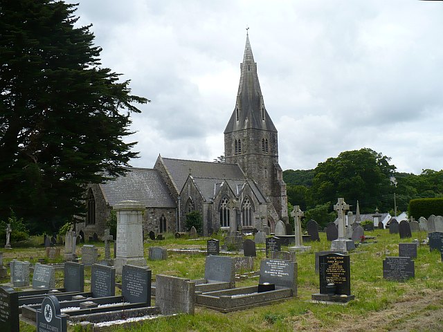
St Catherine's Church, Llanfaes

St Catherine's Church is a church in the village of Llanfaes, Anglesey, Wales. The building dates from the 19th century. It was designated as Grade II...

Llanfaes

Llanfaes (formerly also known as Llanmaes) is a small village on the island of Anglesey, Wales, located on the shore of the eastern entrance to the Menai...

Tre-Castell

Tre-Castell is a hamlet in the community of Beaumaris, Anglesey, Wales, which is 130.4 miles (209.9 km) from Cardiff and 207.2 miles (333.4 km) from London...

Nearby Amenities

Located within 500m of 53.278423,-4.0874095
Bus Stop
Hampton Way
Bus: yes
Public Transport: platform
Lat/Long: 53.2777734/-4.0925149
Llanfaes
Place: village
Source: NPE
Wikidata: Q3461209
Wikipedia: en:Llanfaes
Lat/Long: 53.2779935/-4.0909562
Siop Llanfaes
Shop: convenience
Lat/Long: 53.2781128/-4.0927334
Barrier: kissing_gate
Bicycle: yes
Foot: yes
Lat/Long: 53.2822457/-4.086553
Barrier: kissing_gate
Bicycle: yes
Foot: yes
Lat/Long: 53.2792022/-4.094594
Barrier: kissing_gate
Bicycle: yes
Foot: yes
Lat/Long: 53.2819957/-4.0913903
Barrier: kissing_gate
Bicycle: yes
Foot: yes
Lat/Long: 53.2821054/-4.0906559
Barrier: kissing_gate
Bicycle: yes
Foot: yes
Lat/Long: 53.2821252/-4.0886547
Bus Stop
Bus: yes
Naptan AtcoCode: 5410AWD70097
Naptan NaptanCode: ynyapta
Public Transport: platform
Lat/Long: 53.2773268/-4.0916124
Historic: monument
Lat/Long: 53.2768775/-4.0916747
Power: pole
Lat/Long: 53.280045/-4.0939065
Fountain
Lat/Long: 53.2745173/-4.0871037
Power: substation
Lat/Long: 53.278212/-4.090464
Power: substation
Lat/Long: 53.276543/-4.090477
Direction: SSW
Generator Method: photovoltaic
Generator Output Electricity: yes
Generator Solar Modules: 16
Generator Source: solar
Generator Type: solar_photovoltaic_panel
Location: roof
Power: generator
Lat/Long: 53.2775939/-4.0917676
Post Box
Collection Times: Mo-Fr 11:00; Sa 10:00
Operator: Royal Mail
Post Box Type: lamp
Ref: LL58 18
Royal Cypher: EIIR
Royal Cypher Wikidata: Q33102113
Lat/Long: 53.2773222/-4.091337
The data included in this document is from www.openstreetmap.org. The data is made available under ODbL.

Have you been to Coed Fryars?

Leave your review of Coed Fryars below (or comments, questions and feedback).