Long Wood

Wood, Forest in Cardiganshire

Wales

Long Wood

Derry Ormond Tower <span class="nowrap"><a title="https://en.wikipedia.org/wiki/Derry_Ormond_Tower" rel="nofollow ugc noopener" href="https://en.wikipedia.org/wiki/Derry_Ormond_Tower">Link</a><img style="margin-left:2px;" alt="External link" title="External link - shift click to open in new window" src="https://s1.geograph.org.uk/img/external.png" width="10" height="10"/></span>
Derry Ormond Tower Credit: Sandy Gerrard

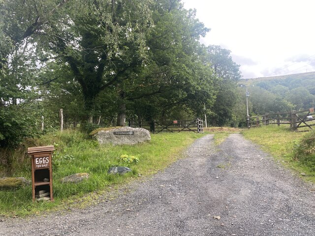
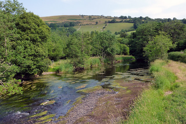
Long Wood is a sprawling forest located in the county of Cardiganshire, Wales. Covering an area of approximately 500 acres, it is a prominent natural feature in the region. The wood is situated on sloping terrain, with its highest point reaching an elevation of around 600 feet.

Characterized by a diverse range of tree species, Long Wood boasts a rich and vibrant ecosystem. Dominated by native species such as oak, beech, and birch, the forest also includes pockets of coniferous trees, providing a varied habitat for wildlife. The forest floor is covered in a dense carpet of ferns, mosses, and wildflowers, adding to its natural beauty.

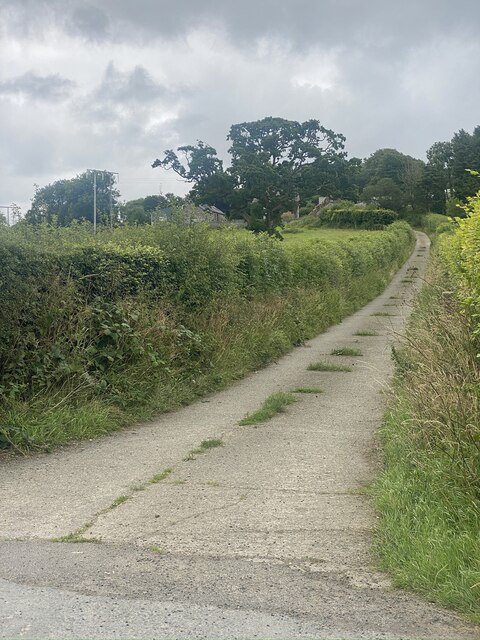
Long Wood is crisscrossed by a network of well-maintained footpaths, allowing visitors to explore its enchanting surroundings. These trails lead to scenic viewpoints, hidden glades, and tranquil streams that meander through the forest. The wood is a haven for nature enthusiasts, offering opportunities for birdwatching, wildlife spotting, and photography.

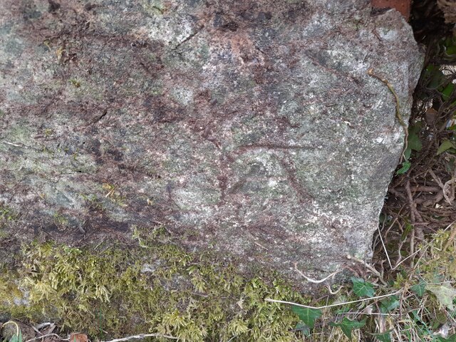
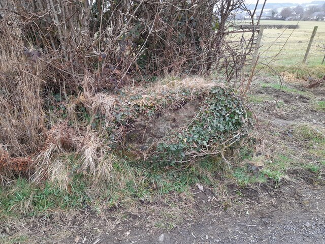
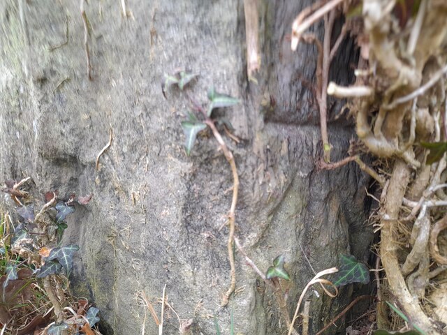
In addition to its ecological significance, Long Wood holds historical importance. It is believed to have been a part of the ancient woodland that once covered much of the region. Remnants of old charcoal pits and stone tools have been discovered, providing evidence of human activity dating back centuries.

Managed by the local authorities, Long Wood is accessible to the public throughout the year. The forest provides a peaceful escape from the hustle and bustle of urban life, offering visitors a chance to connect with nature and appreciate the beauty of the Welsh countryside.

If you have any feedback on the listing, please let us know in the comments section below.

Long Wood Images

Images are sourced within 2km of 52.143726/-4.038069 or Grid Reference SN6051. Thanks to Geograph Open Source API. All images are credited.

Derry Ormond Tower <span class="nowrap"><a title="https://en.wikipedia.org/wiki/Derry_Ormond_Tower" rel="nofollow ugc noopener" href="https://en.wikipedia.org/wiki/Derry_Ormond_Tower">Link</a><img style="margin-left:2px;" alt="External link" title="External link - shift click to open in new window" src="https://s1.geograph.org.uk/img/external.png" width="10" height="10"/></span>
Derry Ormond Tower
Ordnance Survey Cut Mark This OS cut mark can be found on the churn stand east side of the road. It marks a point 141.877m above mean sea level. <a title="https://www.geograph.org.uk/photo/7412328" href="https://www.geograph.org.uk/photo/7412328">Link</a>
Ordnance Survey Cut Mark
This OS cut mark can be found on the churn stand east side of the road. It marks a point 141.877m above mean sea level. Link
Churn Stand There is an Ordnance Survey cut mark on the front of the stand. <a title="https://www.geograph.org.uk/photo/7412325" href="https://www.geograph.org.uk/photo/7412325">Link</a>
Churn Stand
There is an Ordnance Survey cut mark on the front of the stand. Link
Ordnance Survey Cut Mark This OS cut mark can be found on the gatepost south side of the road. It marks a point 189.311m above mean sea level.
Ordnance Survey Cut Mark
This OS cut mark can be found on the gatepost south side of the road. It marks a point 189.311m above mean sea level.
Ordnance Survey Cut Mark This OS cut mark can be found on the SW angle of St Bledrws' Church. It marks a point 133.707m above mean sea level.
Ordnance Survey Cut Mark
This OS cut mark can be found on the SW angle of St Bledrws' Church. It marks a point 133.707m above mean sea level.
Ordnance Survey Flush Bracket (G3325) This OS Flush Bracket can be found on the roadside barn at Bettws Farm. It marks a point 133.651m above mean sea level.
Ordnance Survey Flush Bracket (G3325)
This OS Flush Bracket can be found on the roadside barn at Bettws Farm. It marks a point 133.651m above mean sea level.
A485 in Betws Bledrws
A485 by Bettws Plantation
Entrance to Llysybarcud
Track to Pentre Farm
St Mary’s Church Llanfair Clygodau.
St Mary’s Church
Llanfair Clygodau.
Ordnance Survey Cut Mark This OS cut mark can be found on the porch of All Saints Church. It marks a point 135.740m above mean sea level.
Ordnance Survey Cut Mark
This OS cut mark can be found on the porch of All Saints Church. It marks a point 135.740m above mean sea level.
All Saints Church, Cellan
Church of All Saints at Cellan, Ceredigion The church of All Saints, erected in 1668, is a building of stone, in the Gothic style.......restored in 1865, and affords 90 sittings. (from Genuki <span class="nowrap"><a title="http://www.genuki.org.uk/big/wal/CGN/Cellan/Kellys1910.html" rel="nofollow ugc noopener" href="http://www.genuki.org.uk/big/wal/CGN/Cellan/Kellys1910.html">Link</a><img style="margin-left:2px;" alt="External link" title="External link - shift click to open in new window" src="https://s1.geograph.org.uk/img/external.png" width="10" height="10"/></span> )
Church of All Saints at Cellan, Ceredigion
The church of All Saints, erected in 1668, is a building of stone, in the Gothic style.......restored in 1865, and affords 90 sittings. (from Genuki LinkExternal link )
The Afon Teifi near Cellan, Ceredigion This is the Afon Teifi looking south-east from the footbridge. Very little rain has fallen for the last few weeks.
The Afon Teifi near Cellan, Ceredigion
This is the Afon Teifi looking south-east from the footbridge. Very little rain has fallen for the last few weeks.
Church of All Saints, Cellan
Show me another place!

Long Wood is located at Grid Ref: SN6051 (Lat: 52.143726, Lng: -4.038069)

Unitary Authority: Ceredigion

Police Authority: Dyfed Powys

What 3 Words

///diverged.tornado.chart. Near Llangybi, Ceredigion

Nearby Locations

Long Wood

Related Wikis

Derry Ormond railway station

Derry Ormond railway station served the hamlet and rural locale of Betws Bledrws near Llangybi, as well as the mansion and estate of Derry Ormond (demolished...

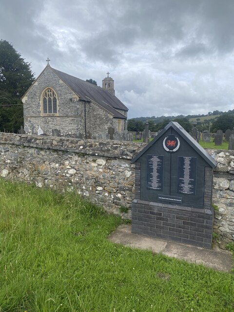
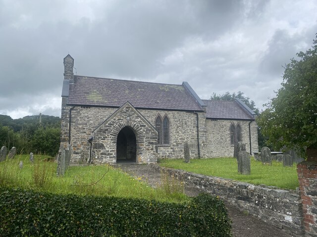
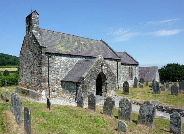
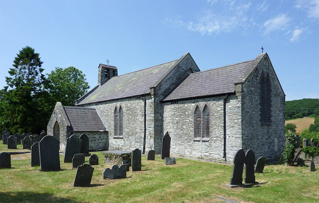
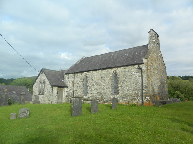
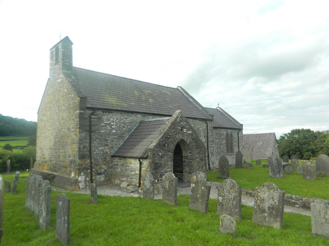
Betws Bledrws Church

The present church of St Bledrws, in the village of Betws Bledrws (sometimes spelt Bettws Bledrws), near Lampeter, Ceredigion, Wales, is a 19th-century...

Betws Bledrws

Betws Bledrws, is a village between Lampeter and Llangybi, Ceredigion, Wales that was also known as Derry Ormond when under the influence of Derry Ormond...

Llangybi railway station (Ceredigion)

Llangybi railway station, previously served the village and rural locale of Llangybi on the Carmarthen Aberystwyth Line in the Welsh county of Ceredigion...

Llanfair Clydogau

Llanfair Clydogau is a small village and community encompassing 3,232 hectares (7,990 acres), located about 4 miles (6.4 km) north-east of Lampeter on...
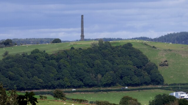
Derry Ormond Tower

Derry Ormond Tower is a Grade II*-listed folly situated above Betws Bledrws, 3 miles (4.8 km) north of Lampeter in the county of Ceredigion, Wales. It...

Llangybi, Ceredigion

Llangybi is a village and parish in the south of Ceredigion, Wales. It is located on the A485 between Tregaron to the north and Lampeter to the south,...

Derry Ormond

Derry Ormond is a farm and a small village in the community of Llangybi, Ceredigion, Wales, which is 60.1 miles (96.7 km) from Cardiff and 173.8 miles...

Nearby Amenities

Located within 500m of 52.143726,-4.038069
Bench
Lat/Long: 52.1423182/-4.0373753
Bench
Backrest: yes
Material: wood
Lat/Long: 52.1439884/-4.0368787
Board Type: welcome_sign
Information: board
Tourism: information
Lat/Long: 52.1429238/-4.0382315
Bench
Lat/Long: 52.144024/-4.033292
To Begin At The Beginning..
Tourism: artwork
Lat/Long: 52.1440652/-4.0332236
Bench
Lat/Long: 52.144042/-4.0332647
Direction: 260
Generator Method: photovoltaic
Generator Output Electricity: yes
Generator Solar Modules: 17
Generator Source: solar
Generator Type: solar_photovoltaic_panel
Location: roof
Power: generator
Lat/Long: 52.1473042/-4.0337098
The data included in this document is from www.openstreetmap.org. The data is made available under ODbL.

Have you been to Long Wood?

Leave your review of Long Wood below (or comments, questions and feedback).