Burnley

Settlement in Lancashire Burnley

England

Burnley

WWII Lancashire: Ghost Signs of the Home Front  (22) -
Emergency Water Supply, Hand Bridge, Todmorden Road, Burnley

"EWS Hatch"

A rare EWS sign of metal on the bridge over the River Calder. "EWS Hatch" may refer to a facility to obtain an emergency supply of water from the river (below the bridge).

<a href="https://www.geograph.org.uk/photo/6945367">SD8432 : WWII Lancashire: Ghost Signs of the Home Front  (23)</a>
WWII Lancashire: Ghost Signs of the Home Front (22) Credit: Mike Searle

Burnley is a historic market town located in the county of Lancashire, England. Situated in the eastern part of the county, it lies about 21 miles north of Manchester and 20 miles east of Preston. With a population of around 73,000 residents, Burnley is known for its industrial heritage and picturesque surrounding countryside.

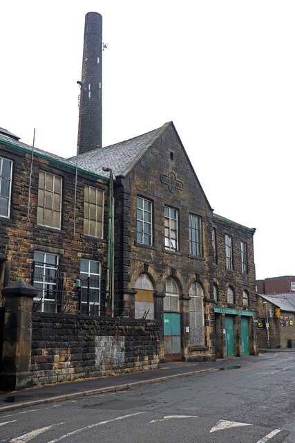
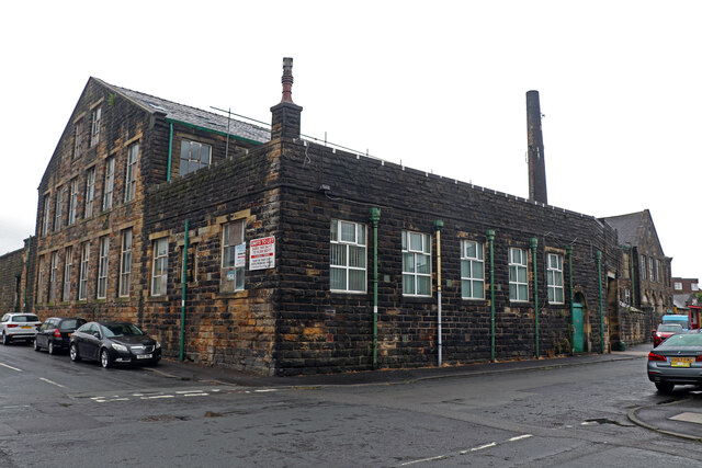
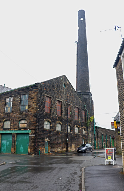
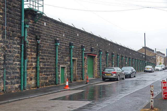
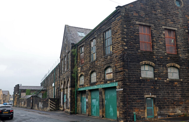
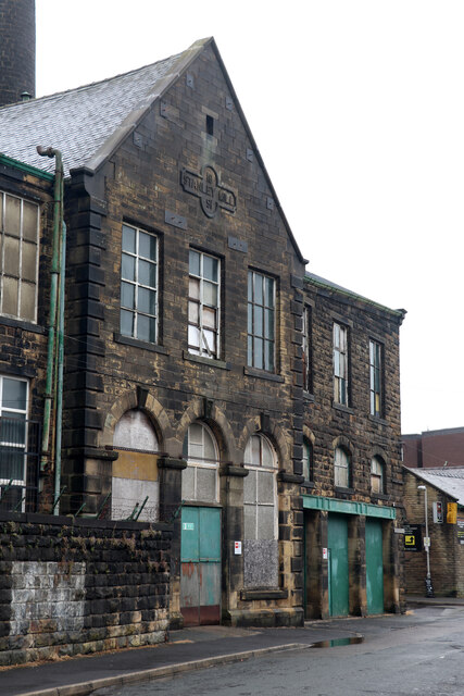
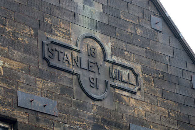
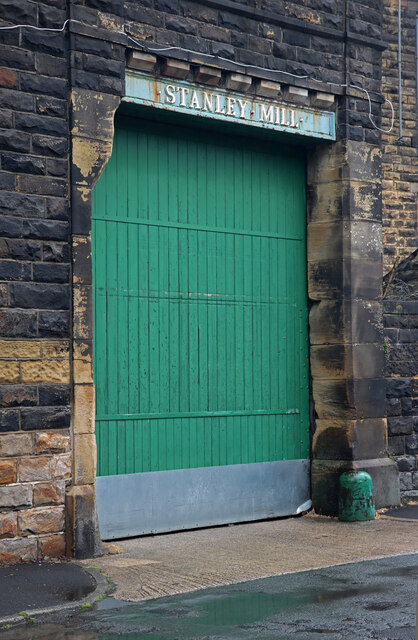
The town's history is closely tied to the textile industry, which was a major source of employment and prosperity during the 19th and early 20th centuries. Many of the old mills and warehouses still stand as a testament to this industrial past. Today, Burnley has diversified its economy, with sectors such as aerospace, manufacturing, and distribution playing a significant role.

Burnley is home to several notable landmarks and attractions. The historic Burnley Mechanics Theatre, built in 1855, offers a range of performances and events throughout the year. The town also boasts a number of beautiful parks and green spaces, including Towneley Park, which features stunning gardens, woodlands, and a historic hall.

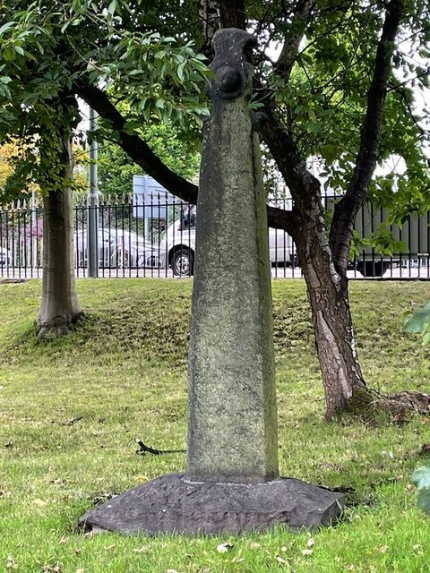
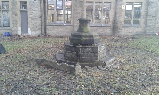
Residents and visitors can explore the town's heritage by visiting the Weavers' Triangle, an area that showcases the industrial history of Burnley. The area is home to the Queen Street Mill Textile Museum, where visitors can learn about the cotton industry and see working machinery from the past.

Surrounded by the stunning countryside of the Pennines and the Forest of Bowland, Burnley offers opportunities for outdoor activities such as walking, cycling, and fishing. The nearby Pendle Hill is a popular destination for hikers and provides breathtaking views of the surrounding area.

Overall, Burnley combines its industrial past with natural beauty, making it an appealing destination for history enthusiasts, outdoor lovers, and those seeking a glimpse into Lancashire's rich heritage.

If you have any feedback on the listing, please let us know in the comments section below.
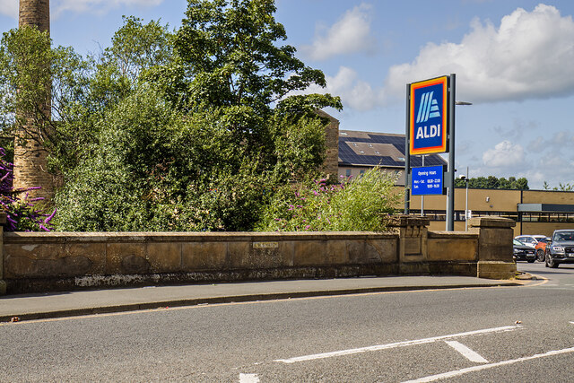
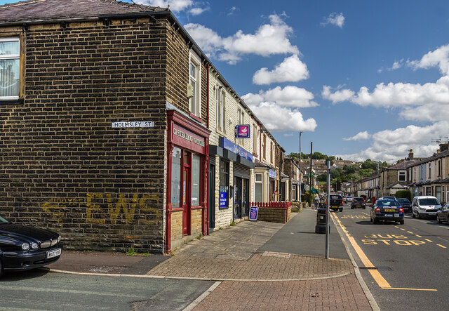
Burnley Images

Images are sourced within 2km of 53.787515/-2.244398 or Grid Reference SD8332. Thanks to Geograph Open Source API. All images are credited.

WWII Lancashire: Ghost Signs of the Home Front  (22) -
Emergency Water Supply, Hand Bridge, Todmorden Road, Burnley

"EWS Hatch"

A rare EWS sign of metal on the bridge over the River Calder. "EWS Hatch" may refer to a facility to obtain an emergency supply of water from the river (below the bridge).

<a href="https://www.geograph.org.uk/photo/6945367">SD8432 : WWII Lancashire: Ghost Signs of the Home Front  (23)</a>
WWII Lancashire: Ghost Signs of the Home Front (22)
- Emergency Water Supply, Hand Bridge, Todmorden Road, Burnley "EWS Hatch" A rare EWS sign of metal on the bridge over the River Calder. "EWS Hatch" may refer to a facility to obtain an emergency supply of water from the river (below the bridge). SD8432 : WWII Lancashire: Ghost Signs of the Home Front (23)
WWII Lancashire: Ghost Signs of the Home Front  (24) -
Emergency Water Supply, Holmsley Street, at junction with Lyndhurst Road, Burnley

"EWS 100 yds"

<a href="https://www.geograph.org.uk/photo/6945363">SD8432 : WWII Lancashire: Ghost Signs of the Home Front  (25)</a>
WWII Lancashire: Ghost Signs of the Home Front (24)
- Emergency Water Supply, Holmsley Street, at junction with Lyndhurst Road, Burnley "EWS 100 yds" SD8432 : WWII Lancashire: Ghost Signs of the Home Front (25)
WWII Lancashire: Ghost Signs of the Home Front  (25) -
Emergency Water Supply, Holmsley Street, at junction with Lyndhurst Road, Burnley

"EWS 100 yds"

                              *********
START: <a href="https://www.geograph.org.uk/photo/6944970">SJ8498 : WWII Lancashire: Ghost Signs of the Home Front  (1)</a>
WWII Lancashire: Ghost Signs of the Home Front (25)
- Emergency Water Supply, Holmsley Street, at junction with Lyndhurst Road, Burnley "EWS 100 yds" ********* START: SJ8498 : WWII Lancashire: Ghost Signs of the Home Front (1)
WWII Lancashire: Ghost Signs of the Home Front  (23) -
Emergency Water Supply,  Hand Bridge, Todmorden Road, Burnley

"EWS Hatch"

<a href="https://www.geograph.org.uk/photo/6945359">SD8432 : WWII Lancashire: Ghost Signs of the Home Front  (24)</a>
WWII Lancashire: Ghost Signs of the Home Front (23)
- Emergency Water Supply, Hand Bridge, Todmorden Road, Burnley "EWS Hatch" SD8432 : WWII Lancashire: Ghost Signs of the Home Front (24)
Old Central Cross in the garden of Burnley College Adult Education Centre on Bank Parade Cross of St Paulinus, a central cross with an old shaft and base. Moved to the garden of Burnley College Adult Education Centre on Bank Parade in Burnley. Probably erected in the former market place east of St Peter's church; moved to Godley Lane c1617, and moved to this site in 1881. Grade II Listed <span class="nowrap"><a title="https://historicengland.org.uk/listing/the-list/list-entry/1022617" rel="nofollow ugc noopener" href="https://historicengland.org.uk/listing/the-list/list-entry/1022617">Link</a><img style="margin-left:2px;" alt="External link" title="External link - shift click to open in new window" src="https://s1.geograph.org.uk/img/external.png" width="10" height="10"/></span>. See also <span class="nowrap"><a title="https://commons.wikimedia.org/wiki/File:Cross_of_St_Paulinus_(Market_Cross),_Burnley.jpg" rel="nofollow ugc noopener" href="https://commons.wikimedia.org/wiki/File:Cross_of_St_Paulinus_(Market_Cross),_Burnley.jpg">Link</a><img style="margin-left:2px;" alt="External link" title="External link - shift click to open in new window" src="https://s1.geograph.org.uk/img/external.png" width="10" height="10"/></span>.

Milestone Society National ID: LABU_BUR01
Old Central Cross in the garden of Burnley College Adult Education Centre on Bank Parade
Cross of St Paulinus, a central cross with an old shaft and base. Moved to the garden of Burnley College Adult Education Centre on Bank Parade in Burnley. Probably erected in the former market place east of St Peter's church; moved to Godley Lane c1617, and moved to this site in 1881. Grade II Listed LinkExternal link. See also LinkExternal link. Milestone Society National ID: LABU_BUR01
Old Central Cross in the garden of Burnley College Adult Education Centre on Bank Parade The Market Cross, a central cross with an old base. Moved to in the garden of Burnley College Adult Education Centre on Bank Parade in Burnley. Erected in the former market place east of St Peter's church in 1617 and moved to this site in 1881. Grade II Listed <span class="nowrap"><a title="https://historicengland.org.uk/listing/the-list/list-entry/1022618" rel="nofollow ugc noopener" href="https://historicengland.org.uk/listing/the-list/list-entry/1022618">Link</a><img style="margin-left:2px;" alt="External link" title="External link - shift click to open in new window" src="https://s1.geograph.org.uk/img/external.png" width="10" height="10"/></span>.

Milestone Society National ID: LABU_BUR02
Old Central Cross in the garden of Burnley College Adult Education Centre on Bank Parade
The Market Cross, a central cross with an old base. Moved to in the garden of Burnley College Adult Education Centre on Bank Parade in Burnley. Erected in the former market place east of St Peter's church in 1617 and moved to this site in 1881. Grade II Listed LinkExternal link. Milestone Society National ID: LABU_BUR02
Stanley Mill, Shackleton Street, Burnley A typical Burnley weaving shed, Listed Grade II. The warehouse is on the left with the gable ended engine house, dated 1891, in the centre and the bloiler house on the right. The chimney is associated with this mill. There is a small and rusty steam pump under the pavement by the engine house but we were told it is not easily accessible. The mill is in multiple occupancy.
Stanley Mill, Shackleton Street, Burnley
A typical Burnley weaving shed, Listed Grade II. The warehouse is on the left with the gable ended engine house, dated 1891, in the centre and the bloiler house on the right. The chimney is associated with this mill. There is a small and rusty steam pump under the pavement by the engine house but we were told it is not easily accessible. The mill is in multiple occupancy.
Stanley Mill, Shackleton Street, Burnley A large weaving shed that is Listed Grade II and now in multiple occupancy. Nearest the camera is the single storey office block with the two storey warehouse beyond. The northlight shed is on the extreme left. In the distance on the right is the gable end of the engine house that is dated 1891. The chimney is part of this shed but has lost its cap. It was dull and drizzling.
Stanley Mill, Shackleton Street, Burnley
A large weaving shed that is Listed Grade II and now in multiple occupancy. Nearest the camera is the single storey office block with the two storey warehouse beyond. The northlight shed is on the extreme left. In the distance on the right is the gable end of the engine house that is dated 1891. The chimney is part of this shed but has lost its cap. It was dull and drizzling.
Stanley Mill, Shackleton Street, Burnley A former weaving shed that is now in multiple occupancy and Listed Grade II. The two doors on the left are on the former boiler house. The northlight shed is seen in the distance on the right. It was dull and drizzling.
Stanley Mill, Shackleton Street, Burnley
A former weaving shed that is now in multiple occupancy and Listed Grade II. The two doors on the left are on the former boiler house. The northlight shed is seen in the distance on the right. It was dull and drizzling.
Stanley Mill, Burnley This view is on Cleaver Street and shows the large northlight weaving shed that is part of the Grade II Listed complex. The edge of the warehouse block is included on the left. The downpipes indicate the location of the valleys in the northlight roof. It was dull and drizzling.
Stanley Mill, Burnley
This view is on Cleaver Street and shows the large northlight weaving shed that is part of the Grade II Listed complex. The edge of the warehouse block is included on the left. The downpipes indicate the location of the valleys in the northlight roof. It was dull and drizzling.
Stanley Mill, Shackleton Street, Burnley This is a grade II listed former weaving shed with warehouse, engine house, boiler house and chimney. Nearest the camera, the three doors mark the boiler house. The gable end is the engine house with the warehouse beyond. The single storey block in the distance is the office block. Apparently under the pavement in front of the engine house is a small horizontal duplex rotative steam pump. This is now inaccessible. I would think it was either a fire pump or a pump to supply water for the boilers. Could have been for both. The mill is in multiple occupancy and part is used for producing felt for pipe insulation, which is still a textile use of sorts.
Stanley Mill, Shackleton Street, Burnley
This is a grade II listed former weaving shed with warehouse, engine house, boiler house and chimney. Nearest the camera, the three doors mark the boiler house. The gable end is the engine house with the warehouse beyond. The single storey block in the distance is the office block. Apparently under the pavement in front of the engine house is a small horizontal duplex rotative steam pump. This is now inaccessible. I would think it was either a fire pump or a pump to supply water for the boilers. Could have been for both. The mill is in multiple occupancy and part is used for producing felt for pipe insulation, which is still a textile use of sorts.
Stanley Mill, Shackleton Street, Burnley A Grade II Listed former weaving shed that is now in multiple occupancy. The tall section is the engine house with a stone declaring it to be Stanley Mill, 1891. The three doors to the right are the former boiler house. Part of the chimney is seen on the extreme left.
Stanley Mill, Shackleton Street, Burnley
A Grade II Listed former weaving shed that is now in multiple occupancy. The tall section is the engine house with a stone declaring it to be Stanley Mill, 1891. The three doors to the right are the former boiler house. Part of the chimney is seen on the extreme left.
Stanley Mill, Shackleton Street, Burnley Date and name stone high on the engine house of this Grade II Listed former weaving shed.
Stanley Mill, Shackleton Street, Burnley
Date and name stone high on the engine house of this Grade II Listed former weaving shed.
Stanley Mill, Shackleton Street, Burnley A Grade II Listed former weaving shed that is now in multiple occupancy. This is a cart door in the office block, complete with cast iron lintel bearing the mill's name.
Stanley Mill, Shackleton Street, Burnley
A Grade II Listed former weaving shed that is now in multiple occupancy. This is a cart door in the office block, complete with cast iron lintel bearing the mill's name.
The junction of Manchester Road and Rossendale Road
Towneley Railway Tunnel The north portal
Towneley Railway Tunnel
The north portal
Beehive Coke Oven The charging hole decorated for Halloween
Beehive Coke Oven
The charging hole decorated for Halloween
Entrance to Burnley Bus Station
Show me another place!

Burnley is located at Grid Ref: SD8332 (Lat: 53.787515, Lng: -2.244398)

Administrative County: Lancashire

District: Burnley

Police Authority: Lancashire

What 3 Words

///even.ridge.class. Near Burnley, Lancashire

Nearby Locations

Burnley

Related Wikis

Burnley Town Hall

Burnley Town Hall is a municipal building in Manchester Road, Burnley, Lancashire, England. The town hall, which is the headquarters of Burnley Borough...

Borough of Burnley

The Borough of Burnley () is a local government district with the borough status in Lancashire, England. It has an area of 42.7 square miles (110.7 km2...

Burnley (UK Parliament constituency)

Burnley is a constituency centred on the town of Burnley in Lancashire which has been represented since 2019 by Antony Higginbotham, a Conservative....

Burnley Law Courts

Burnley Law Courts is a Crown Court venue, which deals with criminal cases, and a County Court venue, which deals with civil cases, in Hammerton Street...

Nearby Amenities

Located within 500m of 53.787515,-2.244398
Burnley
Name Ur: برنلی
Place: town
Population: 73500
Wikidata: Q209096
Wikipedia: en:Burnley
Lat/Long: 53.7907262/-2.2439196
Created By: YahooApplet 1.0
Lat/Long: 53.786878/-2.2517291
Created By: YahooApplet 1.0
Lat/Long: 53.7864977/-2.2502271
Traffic Signals
Lat/Long: 53.7868432/-2.2495927
Created By: YahooApplet 1.0
Lat/Long: 53.7860593/-2.2421696
Created By: YahooApplet 1.0
Lat/Long: 53.7862194/-2.2415205
Created By: YahooApplet 1.0
Lat/Long: 53.7863779/-2.2411504
Created By: YahooApplet 1.0
Lat/Long: 53.786511/-2.2409278
Created By: YahooApplet 1.0
Lat/Long: 53.7876281/-2.2395974
Created By: YahooApplet 1.0
Lat/Long: 53.7878722/-2.239356
Created By: YahooApplet 1.0
Lat/Long: 53.788132/-2.2391334
Created By: YahooApplet 1.0
Lat/Long: 53.7883998/-2.238951
Created By: YahooApplet 1.0
Lat/Long: 53.7886423/-2.2388249
Created By: YahooApplet 1.0
Lat/Long: 53.7888768/-2.2387498
Created By: YahooApplet 1.0
Lat/Long: 53.7888593/-2.2386103
Created By: YahooApplet 1.0
Lat/Long: 53.7886248/-2.2387069
Created By: YahooApplet 1.0
Lat/Long: 53.7883729/-2.2388383
Created By: YahooApplet 1.0
Lat/Long: 53.7864729/-2.2408473
Created By: YahooApplet 1.0
Lat/Long: 53.7863272/-2.2410726
Created By: YahooApplet 1.0
Lat/Long: 53.7861623/-2.2414508
Traffic Signals
Lat/Long: 53.7868797/-2.2452674
Created By: YahooApplet 1.0
Lat/Long: 53.7892456/-2.2378834
Traffic Signals
Lat/Long: 53.7881549/-2.2435382
Traffic Signals
Direction: clockwise
Traffic Signals: signal
Traffic Signals Direction: forward
Lat/Long: 53.7899749/-2.2491752
Crossing
Crossing: traffic_signals
Crossing Ref: puffin
Kerb: lowered
Tactile Paving: yes
Lat/Long: 53.7900087/-2.2486883
Crossing
Button Operated: yes
Crossing: traffic_signals
Crossing Island: yes
Crossing Ref: puffin
Kerb: lowered
Tactile Paving: yes
Lat/Long: 53.7911595/-2.2480963
Crossing
Crossing: uncontrolled
Lat/Long: 53.7906466/-2.2429905
Source: www.npemap.org.uk
Lat/Long: 53.7839701/-2.2488605
Crossing
Crossing: traffic_signals
Crossing Ref: toucan
Kerb: lowered
Tactile Paving: yes
Lat/Long: 53.7897789/-2.24895
Taxi
Lat/Long: 53.7885791/-2.2395071
Kitchens
Shop: doityourself
Lat/Long: 53.7877491/-2.2504997
Fast Food
McDonald's
Brand: McDonald's
Brand Wikidata: Q38076
Brand Wikipedia: en:McDonald's
Contact Website: https://www.mcdonalds.com/gb/en-gb/location/burnley/burnley---burnham-gate/1-burnham-gate/8261126.html
Cuisine: burger
Takeaway: yes
Lat/Long: 53.7868488/-2.2502271
Wacky Warehouse
Addr City: Burnley
Addr Country: GB
Addr Postcode: BB11 2EG
Addr Street: Manchester Road
Brand: Wacky Warehouse
Brand Wikidata: Q104215014
Fhrs Id: 120062
Internet Access: wlan
Internet Access Fee: no
Leisure: indoor_play
Operator: Greene King
Operator Wikidata: Q5564162
Website: https://www.wackywarehouse.co.uk/star/
Lat/Long: 53.7850565/-2.2469969
Cafe
Zara Cafe
Cuisine: british
Old Name: Atlantis
Lat/Long: 53.7888814/-2.239848
Pub
The Inn on the Wharf
Addr City: Burnley
Addr Postcode: BB11 1JG
Addr Street: Manchester Road
Dogs: no
Fhrs Id: 1693957
Food: yes
Real Ale: 1
Lat/Long: 53.786637/-2.246338
Pub
The Bridge Bier Huis
Addr City: Burnley
Addr Postcode: BB11 1UH
Fixme: real_ale=10 is estimated
Real Ale: 10
Website: http://www.thebridgebierhuis.co.uk/
Lat/Long: 53.7901554/-2.2417155
Entrance: yes
Lat/Long: 53.78816/-2.2399461
Entrance: yes
Lat/Long: 53.7884977/-2.2397995
Mini Roundabout
Direction: clockwise
Lat/Long: 53.7867358/-2.2394091
Mini Roundabout
Direction: clockwise
Lat/Long: 53.7869589/-2.2393076
Crossing
Crossing: traffic_signals
Crossing Ref: pelican
Kerb: lowered
Tactile Paving: yes
Lat/Long: 53.7871628/-2.239671
Crossing
Crossing: traffic_signals
Crossing Ref: pelican
Kerb: lowered
Tactile Paving: yes
Lat/Long: 53.7872372/-2.2400566
Crossing
Crossing: traffic_signals
Crossing Ref: pelican
Kerb: lowered
Tactile Paving: yes
Lat/Long: 53.7872458/-2.2394277
Crossing
Crossing: traffic_signals
Crossing Ref: pelican
Kerb: lowered
Tactile Paving: yes
Lat/Long: 53.7872431/-2.2396101
Crossing
Crossing: traffic_signals
Crossing Ref: pelican
Kerb: lowered
Tactile Paving: yes
Lat/Long: 53.7874853/-2.2395853
Crossing
Crossing: traffic_signals
Crossing Ref: pelican
Kerb: lowered
Tactile Paving: yes
Lat/Long: 53.7874841/-2.2400772
Cafe
KC's
Source: survey
Lat/Long: 53.7882822/-2.2399261
Clock
Source: survey
Lat/Long: 53.787894/-2.2407252
Taxi
Source: survey
Lat/Long: 53.7883219/-2.2402347
Fast Food
Planet Pizza
Addr City: Burnley
Addr County: Lancashire
Addr Housenumber: 45
Addr Postcode: BB11 2EF
Addr Street: Croft Street
Cuisine: pizza
Fhrs Id: 1543444
Source: survey
Lat/Long: 53.7880113/-2.2408783
Crossing
Crossing: zebra
Kerb: lowered
Tactile Paving: yes
Lat/Long: 53.7868069/-2.25153
Cafe
Costa
Addr City: Burnley
Addr Housenumber: 2
Addr Postcode: BB11 1QE
Addr Street: Fleet Walk
Brand: Costa
Brand Wikidata: Q608845
Brand Wikipedia: en:Costa Coffee
Cuisine: coffee_shop
Fhrs Id: 657244
Takeaway: yes
Lat/Long: 53.7892896/-2.2430129
Bank
Bank on Dave
Source: survey
Lat/Long: 53.7897539/-2.2394597
Pharmacy
Boots
Brand: Boots
Brand Wikidata: Q6123139
Brand Wikipedia: en:Boots (company)
Healthcare: pharmacy
Shop: beauty
Website: https://www.boots.com/stores/503-burnley-st-james-street-bb11-1ql
Lat/Long: 53.7894396/-2.2419955
Burnley Home Brew
Shop: brewing
Lat/Long: 53.7910111/-2.2431842
Bank
Halifax
Brand: Halifax
Brand Wikidata: Q3310164
Brand Wikipedia: en:Halifax (bank)
Lat/Long: 53.7903939/-2.244338
Bank
RBS
Brand: RBS
Brand Wikidata: Q160126
Brand Wikipedia: en:Royal Bank of Scotland
Official Name: Royal Bank of Scotland
Lat/Long: 53.7888782/-2.2419947
Pub
Craft
Addr City: Burnley
Addr County: Lancashire
Addr Housenumber: 16 - 18
Addr Postcode: BB11 2AE
Addr Street: Red Lion Street
Brand: Thwaites
Brand Wikidata: Q7799526
Brewery: Thwaites
Fhrs Id: 1621818
Food: yes
Old Name: The Swan
Operator: Thwaites
Real Ale: thwaites
Lat/Long: 53.7888865/-2.2423217
Pub
White Lion
Addr City: Burnley
Addr County: Lancashire
Addr Housenumber: 22
Addr Postcode: BB11 1NQ
Addr Street: St Jamess Street
Fhrs Id: 119750
Lat/Long: 53.7888643/-2.2412018
Disused Shop: houseware
Lat/Long: 53.7906874/-2.2446043
Post Box
Brand: Royal Mail
Brand Wikidata: Q638098
Brand Wikipedia: en:Royal Mail
Collection Times: Mo-Fr 17:00; Sa 11:00
Operator: Royal Mail
Operator Wikidata: Q638098
Post Box Apertures: 2
Post Box Design: double_type_g
Post Box Type: pillar
Ref: BB11 209;BB11 210
Royal Cypher: EIIR
Royal Cypher Wikidata: Q33102113
Lat/Long: 53.7888433/-2.244985
Atm
RBS
Brand: RBS
Brand Wikidata: Q160126
Brand Wikipedia: en:Royal Bank of Scotland
Official Name: Royal Bank of Scotland
Operator: RBS
Operator Wikidata: Q160126
Lat/Long: 53.7888907/-2.2419852
Atm
Operator: McDonald's
Lat/Long: 53.7892253/-2.2410078
Entrance: yes
Level: 1
Lat/Long: 53.7899363/-2.2435352
Entrance: yes
Level: 1
Lat/Long: 53.7903147/-2.2433316
Atm
Halifax
Brand: Halifax
Brand Wikidata: Q3310164
Brand Wikipedia: en:Halifax (bank)
Operator: Halifax
Operator Wikidata: Q3310164
Lat/Long: 53.7904063/-2.2444038
Toilets
Male: yes
Lat/Long: 53.7904828/-2.243045
Toilets
Female: yes
Lat/Long: 53.7905088/-2.2431407
Grit Bin
Access: private
Lat/Long: 53.7849478/-2.2488494
Grit Bin
Access: private
Lat/Long: 53.7850269/-2.2487729
Grit Bin
Access: private
Lat/Long: 53.7851939/-2.2495061
Entrance: yes
Lat/Long: 53.7853998/-2.2494278
Entrance: yes
Lat/Long: 53.7854435/-2.2493222
Motorcycle Parking
Capacity: 2
Lat/Long: 53.7855262/-2.2492357
Bar
Blu Bar
Lat/Long: 53.7887214/-2.246659
Bar
Sanctuary Rock Bar
Leisure: music_venue
Lat/Long: 53.7892051/-2.2463481
Screwfix
Addr City: Burnley
Addr Postcode: BB11 1TQ
Addr Street: Trafalgar Street
Brand: Screwfix
Brand Wikidata: Q7439115
Brand Wikipedia: en:Screwfix
Operator: Screwfix
Shop: doityourself
Website: https://www.screwfix.com/stores/VT1/burnley
Lat/Long: 53.7861835/-2.249824
Burnley Manchester Road
Public Transport: stop_position
Railway: stop
Train: yes
Lat/Long: 53.7851832/-2.2493002
Burnley Manchester Road
Naptan AtcoCode: 9100BURNMR
Network: National Rail
Network Website: https://www.nationalrail.co.uk/stations/bym/
Network Wikidata: Q26334
Operator: Northern Rail
Operator Website: https://www.northernrailway.co.uk/stations/burnley-manchester-road
Operator Wikidata: Q85789775
Platforms: 2
Public Transport: station
Railway: station
Ref Crs: BYM
Source: npe
Train: yes
Wikidata: Q4539321
Wikipedia: en:Burnley Manchester Road railway station
Lat/Long: 53.7851712/-2.2493172
Restaurant
Baltic Homeland
Addr City: Burnley
Addr Housenumber: 133
Addr Postcode: BB11 1PP
Addr Street: St James's Street
Capacity: 50
Cuisine: continental
Opening Hours: 12:00+
Smoking: outside
Takeaway: no
Lat/Long: 53.7898127/-2.2466856
Traffic Calming: bump
Lat/Long: 53.7852629/-2.2489727
Bus Stop
St James's Street
Bus: yes
Local Ref: 3
Naptan AtcoCode: 2500IMG2621
Naptan NaptanCode: langdmpa
Public Transport: platform
Lat/Long: 53.789772/-2.245818
Bus Stop
St James's Street
Bus: yes
Local Ref: 1
Naptan AtcoCode: 2500416
Naptan NaptanCode: lanawgtj
Public Transport: platform
Lat/Long: 53.7896742/-2.2458539
Bus Stop
Hargreaves Street
Bus: yes
Public Transport: platform
Lat/Long: 53.7885676/-2.2444126
Bus Stop
Burnley Bus Station (Stand 9)
Bus: yes
Local Ref: 9
Public Transport: platform
Lat/Long: 53.7877747/-2.2399674
Bus Stop
Burnley Bus Station (Stand 8)
Bus: yes
Local Ref: 8
Public Transport: platform
Lat/Long: 53.7878436/-2.2398936
Bus Stop
Burnley Bus Station (Stand 7)
Bus: yes
Local Ref: 7
Public Transport: platform
Lat/Long: 53.7879213/-2.2398265
Bus Stop
Burnley Bus Station (Stand 6)
Bus: yes
Local Ref: 6
Public Transport: platform
Lat/Long: 53.787997/-2.2397728
Bus Stop
Burnley Bus Station (Stand 5)
Bus: yes
Local Ref: 5
Public Transport: platform
Lat/Long: 53.788075/-2.2397232
Bus Stop
Burnley Bus Station (Stand 4)
Bus: yes
Local Ref: 4
Public Transport: platform
Lat/Long: 53.788155/-2.2396803
Bus Stop
Burnley Bus Station (Stand 3)
Bus: yes
Local Ref: 3
Public Transport: platform
Lat/Long: 53.7882247/-2.2396327
Bus Stop
Burnley Bus Station (Stand 2)
Bus: yes
Local Ref: 2
Public Transport: platform
Lat/Long: 53.788319/-2.2396261
Bus Stop
Burnley Bus Station (Stand 1)
Bus: yes
Local Ref: 1
Public Transport: platform
Lat/Long: 53.7884149/-2.2396314
Bus Stop
Burnley Bus Station (Stand 10)
Bus: yes
Local Ref: 10
Naptan AtcoCode: 2500LAA00001
Naptan NaptanCode: langtawt
Public Transport: platform
Lat/Long: 53.7877033/-2.2404954
Bus Stop
Burnley Bus Station (Stand 11)
Bus: yes
Local Ref: 11
Public Transport: platform
Lat/Long: 53.7880099/-2.2406316
Bus Stop
Bevington Close
Bus: yes
Naptan AtcoCode: 2500IMG2827
Naptan NaptanCode: langjatj
Public Transport: platform
Lat/Long: 53.7866832/-2.2510273
Bus Stop
Trafalgar Street
Bus: yes
Public Transport: platform
Lat/Long: 53.7860388/-2.2483455
Bus Stop
Trafalgar Street
Bus: yes
Naptan AtcoCode: 2500414
Naptan NaptanCode: lanawgtg
Public Transport: platform
Lat/Long: 53.7861026/-2.2482472
Bus Stop
Burnley Mechanics
Bus: yes
Public Transport: platform
Lat/Long: 53.7877464/-2.2441323
Bus Stop
Burnley Mechanics
Bus: yes
Public Transport: platform
Lat/Long: 53.7878302/-2.2439444
Cafe
Costa
Addr City: Burnley
Addr Postcode: BB11 2HE
Addr Street: Finsley Gate
Brand: Costa
Brand Wikidata: Q608845
Brand Wikipedia: en:Costa Coffee
Cuisine: coffee_shop
Fhrs Id: 120081
Takeaway: yes
Lat/Long: 53.7857994/-2.2414796
Bus Stop
St James's Street
Bus: yes
Local Ref: 2
Naptan AtcoCode: 2500IMG2622
Naptan NaptanCode: langdmpd
Public Transport: platform
Lat/Long: 53.7896776/-2.2463108
Bus Stop
Spring Hill Road
Bus: yes
Public Transport: platform
Lat/Long: 53.7833351/-2.2466033
Restaurant
Zil Mil
Cuisine: indian
Lat/Long: 53.7851903/-2.2481856
Veterinary
Lat/Long: 53.7856633/-2.2479429
Cafe
Choc Stop
Cuisine: dessert
Description: Dessert Cafe
Lat/Long: 53.7853093/-2.2486626
Crossing
Crossing: traffic_signals
Crossing Ref: pelican
Kerb: lowered
Tactile Paving: yes
Lat/Long: 53.7901346/-2.2386208
Crossing
Crossing: traffic_signals
Crossing Ref: pelican
Kerb: lowered
Tactile Paving: yes
Lat/Long: 53.7902836/-2.2384931
Crossing
Crossing: traffic_signals
Crossing Ref: puffin
Kerb: lowered
Tactile Paving: yes
Lat/Long: 53.7899138/-2.2486174
Crossing
Crossing: traffic_signals
Crossing Ref: toucan
Kerb: lowered
Tactile Paving: yes
Lat/Long: 53.7896863/-2.2488952
Crossing
Crossing: traffic_signals
Crossing Ref: puffin
Kerb: lowered
Tactile Paving: yes
Lat/Long: 53.7870311/-2.2452753
Crossing
Crossing: traffic_signals
Crossing Ref: puffin
Kerb: lowered
Tactile Paving: yes
Lat/Long: 53.7869608/-2.2453848
Crossing
Crossing: traffic_signals
Crossing Ref: pelican
Kerb: lowered
Tactile Paving: yes
Lat/Long: 53.7872599/-2.2398508
Crossing
Crossing: traffic_signals
Crossing Ref: pelican
Kerb: lowered
Tactile Paving: yes
Lat/Long: 53.7874562/-2.240092
Crossing
Crossing: traffic_signals
Crossing Ref: pelican
Kerb: lowered
Tactile Paving: yes
Lat/Long: 53.7874595/-2.2397924
Crossing
Crossing: traffic_signals
Crossing Ref: toucan
Kerb: lowered
Tactile Paving: yes
Lat/Long: 53.7857752/-2.2477672
Crossing
Crossing: traffic_signals
Crossing Ref: toucan
Kerb: lowered
Tactile Paving: yes
Lat/Long: 53.7857843/-2.2476105
Crossing
Crossing: zebra
Kerb: lowered
Tactile Paving: yes
Lat/Long: 53.787356/-2.2504586
Crossing
Crossing: traffic_signals
Crossing Ref: pelican
Kerb: lowered
Tactile Paving: yes
Lat/Long: 53.7867516/-2.2497685
Barrier: yes
Lat/Long: 53.7865084/-2.2372902
Bicycle Parking
Bicycle Parking: stands
Capacity: 6
Covered: no
Fee: no
Lat/Long: 53.7892008/-2.2405791
Bicycle Parking
Bicycle Parking: stands
Capacity: 6
Covered: no
Fee: no
Lat/Long: 53.7889346/-2.242632
Bicycle Parking
Bicycle Parking: stands
Capacity: 6
Covered: no
Fee: no
Lat/Long: 53.7897319/-2.2449186
Cafe
one sixty
Addr City: Burnley
Addr Housenumber: 160
Addr Street: St James's Street
Diet Vegan: yes
Internet Access: wlan
Lat/Long: 53.7896132/-2.2476093
Green Party - Burnley, Pendle, Rossendale
Addr City: Burnley
Addr Housenumber: 160
Addr Street: St James's Street
Office: political_party
Lat/Long: 53.7895911/-2.2476021
Addr City: Burnley
Addr Housenumber: 19
Addr Postcode: BB11 2ED
Addr Street: Croft Street
Old Name: Skipton Mill Shop
Shop: yes
Lat/Long: 53.7886876/-2.2400335
British Heart Foundation
Branch: Furniture & Electrical
Brand: British Heart Foundation
Brand Wikidata: Q4970039
Brand Wikipedia: en:British Heart Foundation
Shop: furniture
Website: https://www.bhf.org.uk/what-we-do/find-bhf-near-you/burnley-furniture-electrical-store
Lat/Long: 53.7885069/-2.2403848
Addr City: Burnley
Addr Housenumber: 13-17
Addr Postcode: BB11 2ED
Addr Street: Croft Street
Old Name: Farmfoods
Lat/Long: 53.7887633/-2.2399416
Bus Stop
Sutcliffe Street
Bus: yes
Public Transport: platform
Lat/Long: 53.7886266/-2.2483979
Bus Stop
Sutcliffe Street
Bus: yes
Public Transport: platform
Lat/Long: 53.7888634/-2.2485723
Bus Stop
Railway Station
Bus: yes
Naptan AtcoCode: 2500IMG2873
Naptan NaptanCode: langjdmp
Public Transport: platform
Lat/Long: 53.7849142/-2.2493749
Bus Stop
Railway Station
Bus: yes
Naptan AtcoCode: 2500IMG2874
Naptan NaptanCode: langjdmt
Public Transport: platform
Lat/Long: 53.7847074/-2.2492572
Bus Stop
Bowling Alley
Bus: yes
Naptan AtcoCode: 2500LAA16708
Naptan NaptanCode: lanpataj
Public Transport: platform
Lat/Long: 53.7851388/-2.2419894
Crossing
Crossing: marked
Crossing Markings: yes
Lat/Long: 53.790174/-2.2392065
Crossing
Crossing: marked
Crossing Markings: yes
Lat/Long: 53.790434/-2.2390648
Card Factory
Brand: Card Factory
Brand Wikidata: Q5038192
Brand Wikipedia: en:Card Factory
Shop: gift
Lat/Long: 53.7894053/-2.2434737
Bank
NatWest
Brand: NatWest
Brand Wikidata: Q2740021
Brand Wikipedia: en:NatWest
Website: https://www.natwest.com/search-results/locator/branch.html?sortcode=010135&name=Burnley
Lat/Long: 53.7894335/-2.2436518
Cafe
Little Barista
Addr City: Burnley
Addr County: Lancashire
Addr Housenumber: 7
Addr Postcode: BB11 1QB
Cuisine: coffee_shop
Diet Vegan: yes
Diet Vegetarian: yes
Fhrs Id: 903702
Internet Access: wlan
Outdoor Seating: yes
Start Date: 2016
Lat/Long: 53.7895137/-2.2434068
Bicycle Parking
Access: yes
Bicycle Parking: stands
Capacity: 6
Covered: no
Fee: no
Lat/Long: 53.7907357/-2.2442674
Burnley Manchester Road
Public Transport: stop_position
Railway: stop
Train: yes
Lat/Long: 53.7855053/-2.2498091
Xercise4Less
Addr City: Burnley
Addr Housename: Kingsway House
Addr Postcode: BB11 1BJ
Addr Street: Kingsway
Brand: Xercise4Less
Brand Wikidata: Q79244612
Leisure: fitness_centre
Lat/Long: 53.7914782/-2.2424975
Traffic Signals
Traffic Signals: signal
Lat/Long: 53.7897021/-2.2490069
Traffic Signals
Traffic Signals: signal
Lat/Long: 53.7899955/-2.2485328
Cycleway: asl
Lat/Long: 53.789951/-2.2485789
Cycleway: asl
Direction: forward
Lat/Long: 53.7899433/-2.249103
Cycleway: asl
Lat/Long: 53.7897471/-2.2489736
Traffic Signals
Traffic Signals: signal
Traffic Signals Direction: backward
Lat/Long: 53.7898035/-2.2485051
Bicycle Parking
Access: yes
Bicycle Parking: stands
Capacity: 6
Covered: no
Fee: no
Lat/Long: 53.7881887/-2.2414812
Bicycle Parking
Access: yes
Bicycle Parking: stands
Capacity: 6
Covered: yes
Fee: no
Lat/Long: 53.7904789/-2.2389185
Crossing
Crossing: unmarked
Crossing Island: yes
Crossing Markings: no
Tactile Paving: yes
Lat/Long: 53.7917024/-2.2468595
Crossing
Crossing: unmarked
Crossing Island: yes
Crossing Markings: no
Tactile Paving: yes
Lat/Long: 53.7917639/-2.2467612
Traffic Signals
Traffic Signals: crossing
Lat/Long: 53.7911157/-2.2480922
Traffic Signals
Traffic Signals: crossing
Lat/Long: 53.7912346/-2.2479741
Crossing
Crossing: traffic_signals
Crossing Island: yes
Crossing Ref: puffin
Kerb: lowered
Tactile Paving: yes
Lat/Long: 53.7911894/-2.2479814
Noexit: yes
Lat/Long: 53.7857037/-2.2510278
Iceland
Addr City: Burnley
Addr County: Lancashire
Addr Housename: Charter Walk Shopping Centre
Addr Postcode: BB11 1AE
Addr Unit: Unit 42A
Brand: Iceland
Brand Wikidata: Q721810
Fhrs Id: 1110237
Shop: frozen_food
Website: https://www.iceland.co.uk/store-finder/store?StoreID=1623&StoreName=BURNLEY%20CHARTER%20WALK
Lat/Long: 53.7896161/-2.2432414
Entrance: yes
Lat/Long: 53.7878202/-2.2400896
The data included in this document is from www.openstreetmap.org. The data is made available under ODbL.

Have you been to Burnley?

Leave your review of Burnley below (or comments, questions and feedback).