Allt Goch

Wood, Forest in Cardiganshire

Wales

Allt Goch

Paragleidwr ar arfordir Ceredigion A paraglider cruises the cliffs of Allt-wen, with Aberystwyth in the distance.
Paragleidwr ar arfordir Ceredigion Credit: Mike Parker

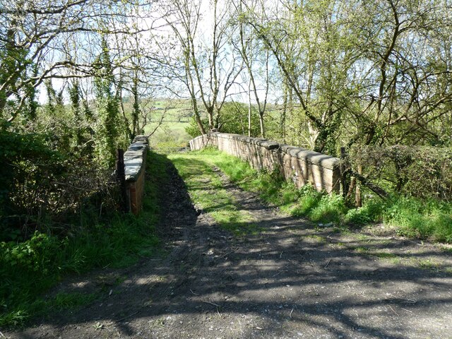
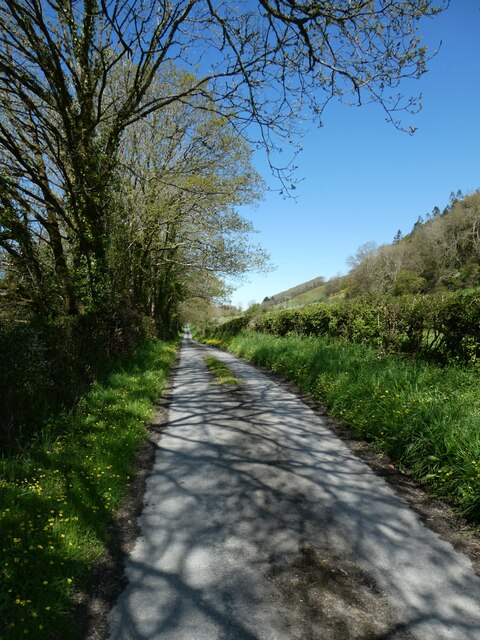
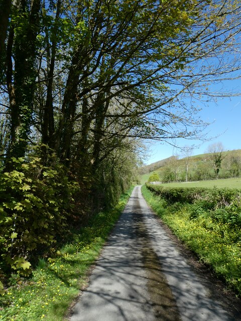
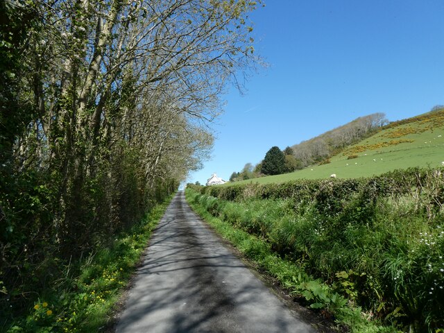
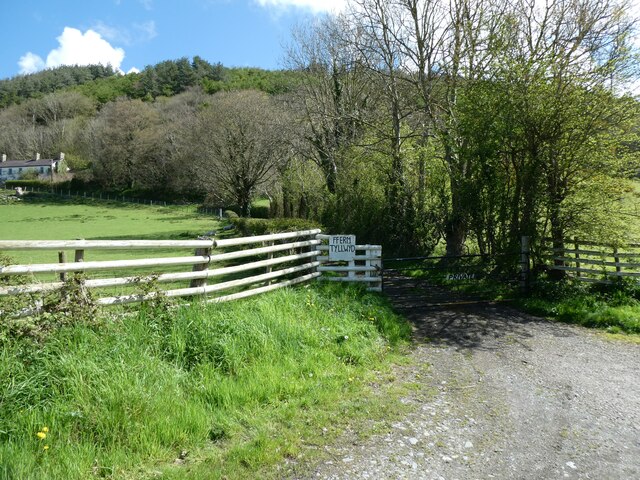
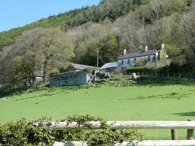
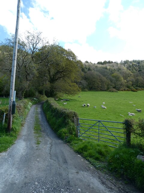
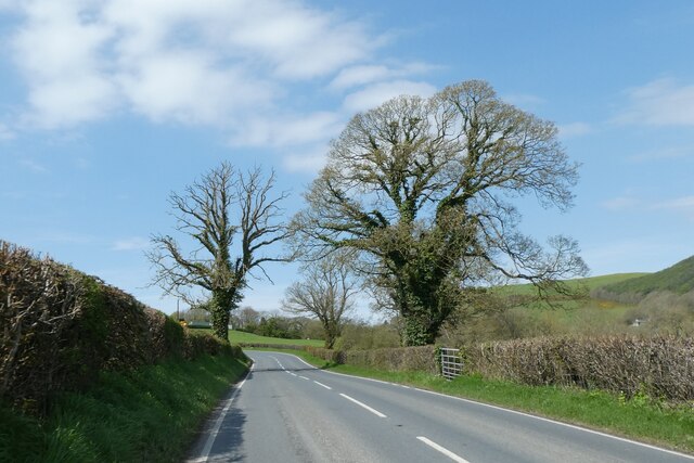
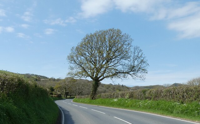
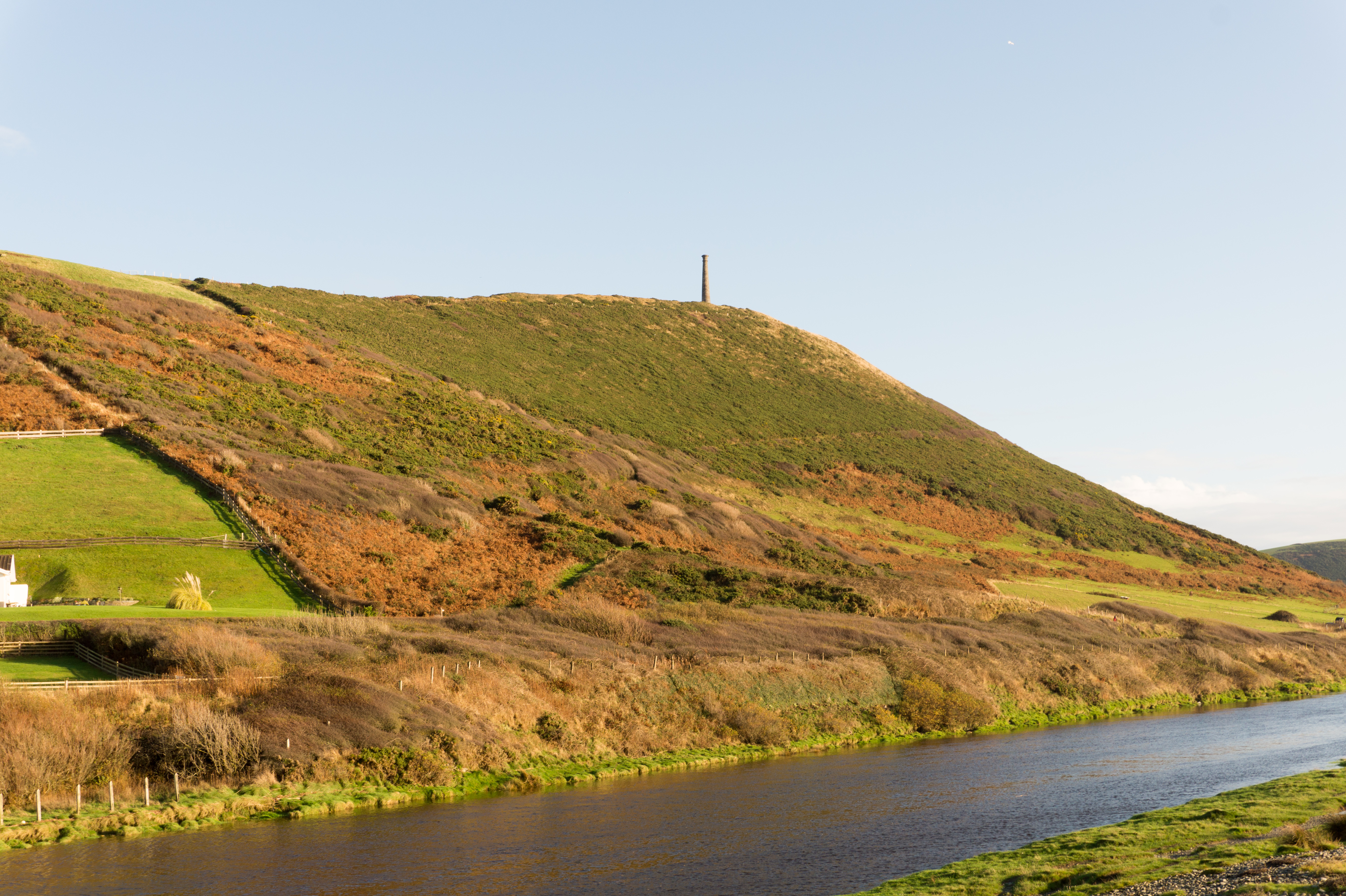
Allt Goch, located in Cardiganshire, is a picturesque wood and forest that offers visitors a serene and enchanting experience. Situated in the beautiful countryside of West Wales, Allt Goch spans over a vast area of land, characterized by rolling hills, verdant meadows, and dense woodland.

The forest is predominantly composed of native tree species, including oak, beech, and birch, creating a rich and diverse ecosystem. The canopy of leaves forms a lush green roof, filtering the sunlight and providing a cool and shaded environment below. The forest floor is covered in a thick carpet of moss, ferns, wildflowers, and bracken, creating a vibrant and colorful undergrowth.

Allt Goch is home to a variety of wildlife, making it a haven for nature enthusiasts. Visitors may spot deer grazing peacefully among the trees, squirrels scampering across branches, and a plethora of bird species, including woodpeckers, owls, and thrushes.

For those seeking tranquility and solace in nature, Allt Goch offers an array of walking trails, allowing visitors to explore the woodland at their own pace. The paths wind through the forest, offering breathtaking views of the surrounding landscape and opportunities for birdwatching and photography.

Allt Goch is a cherished natural gem in Cardiganshire, attracting locals and tourists alike. Its untouched beauty, serene atmosphere, and diverse flora and fauna make it an ideal destination for those seeking to connect with nature and escape the hustle and bustle of everyday life.

If you have any feedback on the listing, please let us know in the comments section below.

Allt Goch Images

Images are sourced within 2km of 52.384628/-4.068312 or Grid Reference SN5978. Thanks to Geograph Open Source API. All images are credited.

Paragleidwr ar arfordir Ceredigion A paraglider cruises the cliffs of Allt-wen, with Aberystwyth in the distance.
Paragleidwr ar arfordir Ceredigion
A paraglider cruises the cliffs of Allt-wen, with Aberystwyth in the distance.
Barcuta uwchben Aberystwyth A hang-glider cruises above the Wales Coast Path. Having steered expertly up and down the cliffs of Allt-Wen, he is now heading down to land on Tanybwlch beach below. Behind that is Aberystwyth.
Barcuta uwchben Aberystwyth
A hang-glider cruises above the Wales Coast Path. Having steered expertly up and down the cliffs of Allt-Wen, he is now heading down to land on Tanybwlch beach below. Behind that is Aberystwyth.
Ordnance Survey Cut Mark This OS cut mark can be found on the wall west side of Antaron Avenue. It marks a point 44.640m above mean sea level.
Ordnance Survey Cut Mark
This OS cut mark can be found on the wall west side of Antaron Avenue. It marks a point 44.640m above mean sea level.
Ceredigion Coastal Footpath
Tanybwlch House View from Allt-wen.
Tanybwlch House
View from Allt-wen.
Tanybwlch Mansion The view to the mansion from Pendinas
Tanybwlch Mansion
The view to the mansion from Pendinas
Bridge over former railway, near Tynrhelyg This track leads to the river and the site of a ford
Bridge over former railway, near Tynrhelyg
This track leads to the river and the site of a ford
Cycle route (NCN81) near Tynrhelyg towards Llanfarian
Cycle route to Llanfarian (NCN81)
Looking to the edge of Llanfarian along cycle route NCN81
Houses in Llanfarian
Access gate for Tyllwyd Farm
Former farm buildings at Tyllwyd
Track to Cwm Cati
Track to Cwm Cati
Trees by A485
Trees by A485
Wildflowers on the verge, by the A485
Car wash, former garage and filling station, Llanfarian
Bus shelter, Llanfarian
Show me another place!

Allt Goch is located at Grid Ref: SN5978 (Lat: 52.384628, Lng: -4.068312)

Unitary Authority: Ceredigion

Police Authority: Dyfed Powys

What 3 Words

///manliness.blinking.stung. Near Penparcau, Ceredigion

Nearby Locations

Allt Goch

Related Wikis

Llanrhystyd Road railway station

Llanrhystyd Road railway station was located on the Carmarthen to Aberystwyth Line, originally called the Manchester and Milford Railway, before being...

Llanfarian

Llanfarian is a village, electoral ward and community in the district county of Ceredigion, Mid-Wales, south of the administrative centre Aberystwyth....

Pont Paith

Pont Paith is a hamlet in the community of Llanfarian, Ceredigion, Wales, 73 miles (117.5 km) from Cardiff and 177.9 miles (286.2 km) from London. Pont...

Tan-y-Bwlch, Aberystwyth

Tan-y-Bwlch ( translates to Under the pass/gap) beach near Aberystwyth, Wales, forms part of the Pen Dinas and Tan-y-Bwlch Local Nature Reserve (LNR)....

Penparcau

Penparcau is a village and electoral ward in Ceredigion, Wales, situated to the south of Aberystwyth. The village has the largest number of Welsh language...

Chancery, Ceredigion

Chancery (Welsh: Rhydgaled) is a hamlet in Llanfarian community, in the district county of Ceredigion, Mid-Wales, south of the administrative centre Aberystwyth...

Penparcau F.C.

Penparcau Football Club are a Welsh football club from Penparcau, Ceredigion. They currently play in the Central Wales Southern Division, the fourth tier...

Pen Dinas

Pen Dinas is the name of a large hill within the boundary of the village of Penparcau, on the coast of Ceredigion, Wales, (just south of Aberystwyth)...

Nearby Amenities

Located within 500m of 52.384628,-4.068312
Source: npe
Lat/Long: 52.3823445/-4.0743634
Parking
Parking: layby
Lat/Long: 52.3868089/-4.0714647
Parking
Parking: layby
Lat/Long: 52.3842976/-4.0713728
Turning Circle
Lat/Long: 52.3833278/-4.0723571
Bus Stop
Marian House
Bay: yes
Public Transport: platform
Shelter: yes
Source: photograph
Lat/Long: 52.3812934/-4.0723172
Llanrhystyd Road
Alt Name: Llanrhystud Road
Historic Railway: station
Railway: site
Wikidata: Q6661724
Wikipedia: en:Llanrhystyd Road railway station
Lat/Long: 52.3806513/-4.0709588
Bus Stop
Bryn Eglur
Kerb: raised
Naptan AtcoCode: 5230AWD71715
Naptan NaptanCode: cejdagd
Public Transport: platform
Shelter: yes
Source: photograph
Lat/Long: 52.3819241/-4.0721559
Place: farm
Lat/Long: 52.3882195/-4.0727361
Place: farm
Lat/Long: 52.3865039/-4.0685948
Direction: WSW
Generator Method: photovoltaic
Generator Output Electricity: yes
Generator Solar Modules: 9
Generator Source: solar
Generator Type: solar_photovoltaic_panel
Location: roof
Power: generator
Lat/Long: 52.3804875/-4.0706377
Direction: ENE
Generator Method: photovoltaic
Generator Output Electricity: yes
Generator Solar Modules: 4
Generator Source: solar
Generator Type: solar_photovoltaic_panel
Location: roof
Power: generator
Lat/Long: 52.3804957/-4.0706103
Direction: 10
Generator Method: photovoltaic
Generator Output Electricity: yes
Generator Solar Modules: 10
Generator Source: solar
Generator Type: solar_photovoltaic_panel
Location: roof
Power: generator
Lat/Long: 52.3833739/-4.0740931
Direction: 4
Generator Method: photovoltaic
Generator Output Electricity: yes
Generator Solar Modules: 13
Generator Source: solar
Generator Type: solar_photovoltaic_panel
Location: roof
Power: generator
Lat/Long: 52.3831132/-4.0739054
Direction: WSW
Generator Method: photovoltaic
Generator Output Electricity: yes
Generator Solar Modules: 14
Generator Source: solar
Generator Type: solar_photovoltaic_panel
Location: roof
Power: generator
Lat/Long: 52.3827346/-4.0707672
Direction: SSW
Generator Method: photovoltaic
Generator Output Electricity: yes
Generator Solar Modules: 4
Generator Source: solar
Generator Type: solar_photovoltaic_panel
Location: roof
Power: generator
Lat/Long: 52.3829644/-4.0730641
Direction: SSW
Generator Method: photovoltaic
Generator Output Electricity: yes
Generator Solar Modules: 7
Generator Source: solar
Generator Type: solar_photovoltaic_panel
Location: roof
Power: generator
Lat/Long: 52.3830162/-4.0731785
Direction: 215
Generator Method: photovoltaic
Generator Output Electricity: yes
Generator Solar Modules: 3
Generator Source: solar
Generator Type: solar_photovoltaic_panel
Location: roof
Power: generator
Lat/Long: 52.3826699/-4.0739107
Direction: SW
Generator Method: photovoltaic
Generator Output Electricity: yes
Generator Solar Modules: 16
Generator Source: solar
Generator Type: solar_photovoltaic_panel
Location: roof
Power: generator
Lat/Long: 52.3823899/-4.0734417
Direction: 215
Generator Method: photovoltaic
Generator Output Electricity: yes
Generator Solar Modules: 13
Generator Source: solar
Generator Type: solar_photovoltaic_panel
Location: roof
Power: generator
Lat/Long: 52.3826298/-4.0738893
Direction: SW
Generator Method: photovoltaic
Generator Output Electricity: yes
Generator Solar Modules: 5
Generator Source: solar
Generator Type: solar_photovoltaic_panel
Location: roof
Power: generator
Lat/Long: 52.3827853/-4.0732723
Direction: 255
Generator Method: photovoltaic
Generator Output Electricity: yes
Generator Solar Modules: 12
Generator Source: solar
Generator Type: solar_photovoltaic_panel
Location: roof
Power: generator
Lat/Long: 52.3810221/-4.0705338
Direction: WSW
Generator Method: photovoltaic
Generator Output Electricity: yes
Generator Solar Modules: 7
Generator Source: solar
Generator Type: solar_photovoltaic_panel
Location: roof
Power: generator
Lat/Long: 52.3808014/-4.0708892
Direction: WSW
Generator Method: photovoltaic
Generator Output Electricity: yes
Generator Solar Modules: 4
Generator Source: solar
Generator Type: solar_photovoltaic_panel
Location: roof
Power: generator
Lat/Long: 52.3807413/-4.0708449
Direction: ENE
Generator Method: photovoltaic
Generator Output Electricity: yes
Generator Solar Modules: 3
Generator Source: solar
Generator Type: solar_photovoltaic_panel
Location: roof
Power: generator
Lat/Long: 52.3803565/-4.0705124
Direction: ENE
Generator Method: photovoltaic
Generator Output Electricity: yes
Generator Solar Modules: 7
Generator Source: solar
Generator Type: solar_photovoltaic_panel
Location: roof
Power: generator
Lat/Long: 52.3803999/-4.0705486
Direction: WSW
Generator Method: photovoltaic
Generator Output Electricity: yes
Generator Solar Modules: 4
Generator Source: solar
Generator Type: solar_photovoltaic_panel
Location: roof
Power: generator
Lat/Long: 52.3803802/-4.070566
Direction: WSW
Generator Method: photovoltaic
Generator Output Electricity: yes
Generator Solar Modules: 10
Generator Source: solar
Generator Type: solar_photovoltaic_panel
Location: roof
Power: generator
Lat/Long: 52.3804957/-4.0701529
Direction: ENE
Generator Method: photovoltaic
Generator Output Electricity: yes
Generator Solar Modules: 6
Generator Source: solar
Generator Type: solar_photovoltaic_panel
Location: roof
Power: generator
Lat/Long: 52.3805137/-4.0700859
The data included in this document is from www.openstreetmap.org. The data is made available under ODbL.

Have you been to Allt Goch?

Leave your review of Allt Goch below (or comments, questions and feedback).