Allt y Gorden

Wood, Forest in Cardiganshire

Wales

Allt y Gorden

Llanfarian Looking towards Llanfarian from above Allt Wen.
Llanfarian Credit: Ian Capper

Allt y Gorden is a picturesque wood located in Cardiganshire, Wales. Covering an area of approximately 100 acres, it is a tranquil and enchanting forest that is home to a diverse range of flora and fauna.

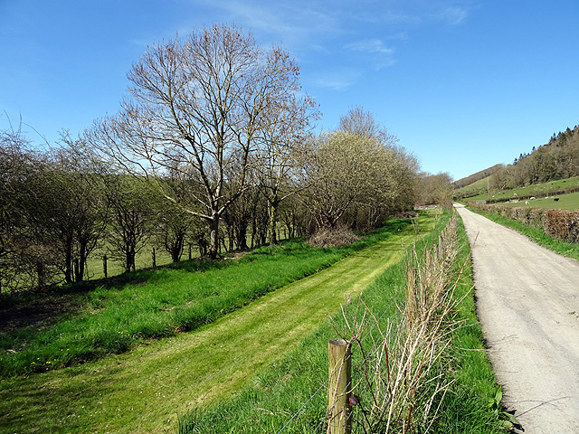
The wood is situated on a hillside, providing visitors with stunning panoramic views of the surrounding countryside. It is primarily composed of deciduous trees, including oak, beech, and ash, which create a vibrant and colorful canopy during the autumn months. The forest floor is covered in a thick layer of moss, ferns, and wildflowers, adding to its natural beauty.

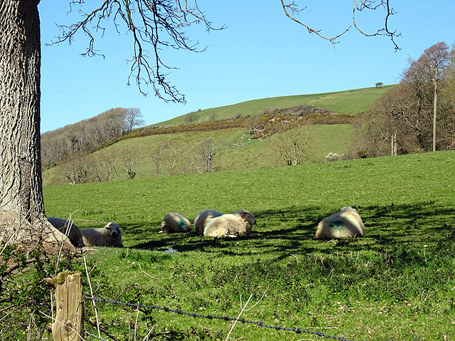
Allt y Gorden is a haven for wildlife enthusiasts, as it offers a habitat for a variety of animals. Visitors may spot red squirrels, badgers, and foxes, as well as a wide range of bird species such as woodpeckers, owls, and finches. The wood is also home to several rare and protected species, including the silver-washed fritillary butterfly.

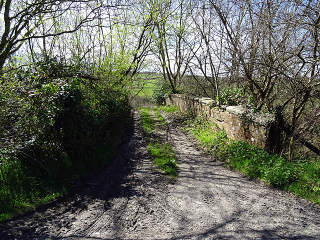
The wood features several walking trails that meander through its peaceful surroundings. These trails are well-maintained and suitable for all levels of fitness, providing opportunities for leisurely strolls or more challenging hikes. Along the paths, visitors will find informative signage that educates them about the local wildlife and history of the area.

Allt y Gorden is a popular destination for nature lovers and those seeking solace in the beauty of the natural world. With its stunning scenery, diverse ecosystem, and well-maintained trails, it offers a truly immersive experience for anyone who visits.

If you have any feedback on the listing, please let us know in the comments section below.

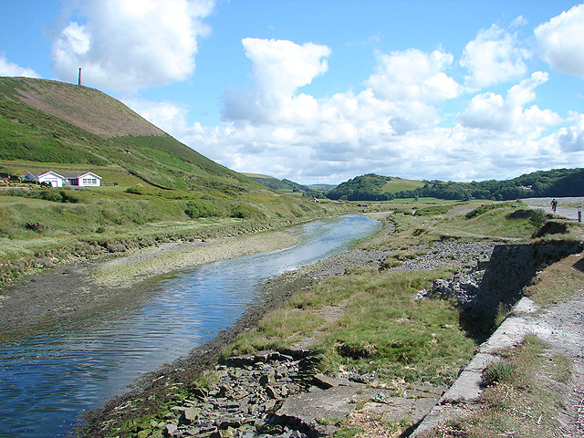
Allt y Gorden Images

Images are sourced within 2km of 52.371704/-4.0684425 or Grid Reference SN5976. Thanks to Geograph Open Source API. All images are credited.

Llanfarian Looking towards Llanfarian from above Allt Wen.
Llanfarian
Looking towards Llanfarian from above Allt Wen.
Ordnance Survey Flush Bracket S8282 This can be found on the wall of a former school building - now a private dwelling.
For more detail see : <span class="nowrap"><a title="http://www.bench-marks.org.uk/bm271" rel="nofollow ugc noopener" href="http://www.bench-marks.org.uk/bm271">Link</a><img style="margin-left:2px;" alt="External link" title="External link - shift click to open in new window" src="https://s1.geograph.org.uk/img/external.png" width="10" height="10"/></span>
Ordnance Survey Flush Bracket S8282
This can be found on the wall of a former school building - now a private dwelling. For more detail see : LinkExternal link
The Ystwyth Trail leaves 'urban' Llanfarian Back into open countryside after passing through the village of Llanfarian.
The Ystwyth Trail leaves 'urban' Llanfarian
Back into open countryside after passing through the village of Llanfarian.
Bryn Eglur Along which the Ystwyh Trail runs.
Bryn Eglur
Along which the Ystwyh Trail runs.
Old railway overbridge A farm crossing over the trackbed of the long closed Aberystwyth to Carmarthen railway line. The track also forms a right of way but you will need to don your waders to cross Afon Ystwyth a short distance ahead.
Old railway overbridge
A farm crossing over the trackbed of the long closed Aberystwyth to Carmarthen railway line. The track also forms a right of way but you will need to don your waders to cross Afon Ystwyth a short distance ahead.
The Ystwyth Trail The Ystwyth Trail runs along the paved road here as it heads towards Llanfarian. The trackbed of the old Carmarthen to Aberystwyth railway runs to the left of the mown strip seen here.
The Ystwyth Trail
The Ystwyth Trail runs along the paved road here as it heads towards Llanfarian. The trackbed of the old Carmarthen to Aberystwyth railway runs to the left of the mown strip seen here.
Spring is springing A glorious manifestation of Spring in a field at Tyllwd Farm beside the Ystwyth Trail.
Spring is springing
A glorious manifestation of Spring in a field at Tyllwd Farm beside the Ystwyth Trail.
That tree again... Couldn't resist another view of this tree in a field at Tyllwyd Farm. See also <a href="https://www.geograph.org.uk/photo/4915076">SN5977 : Spring is springing</a>.
That tree again...
Couldn't resist another view of this tree in a field at Tyllwyd Farm. See also SN5977 : Spring is springing.
Shade from the sun Sheep shelter from the April sunshine at Tyllwyd Farm.
Shade from the sun
Sheep shelter from the April sunshine at Tyllwyd Farm.
Bridge removed The Carmarthen to Aberystwyth railway line crossed a farm track here.
Bridge removed
The Carmarthen to Aberystwyth railway line crossed a farm track here.
Almost missed it! A right of way runs up the hillside here, almost obscured by the household gate.
Almost missed it!
A right of way runs up the hillside here, almost obscured by the household gate.
The A487 road at Llanfarian The Ystwyth Trail crosses the road here as it progresses towards Aberystwyth.
The A487 road at Llanfarian
The Ystwyth Trail crosses the road here as it progresses towards Aberystwyth.
Traffic queue at Llanfarian Emergency roadworks between Llanfarian and Rhydyfelin caused a long tailback through Llanfarian.
Traffic queue at Llanfarian
Emergency roadworks between Llanfarian and Rhydyfelin caused a long tailback through Llanfarian.
The Ystwth Trail signposted off the A487 road at Llanfarian The Ystwyth Trail runs along Bryn Eglur to the left.
The Ystwth Trail signposted off the A487 road at Llanfarian
The Ystwyth Trail runs along Bryn Eglur to the left.
Llanrystud Road railway station (site), Ceredigion Opened in 1867 by the Manchester & Milford Railway, later part of the Great Western Railway, on the line from Aberystwyth to Carmarthen, this station closed in 1964.
View south east towards Llanilar and Carmarthen. The site has been redeveloped and includes a village hall.
Llanrystud Road railway station (site), Ceredigion
Opened in 1867 by the Manchester & Milford Railway, later part of the Great Western Railway, on the line from Aberystwyth to Carmarthen, this station closed in 1964. View south east towards Llanilar and Carmarthen. The site has been redeveloped and includes a village hall.
River at Rhydyfelin The river passing through Rhydyfelin on its way to the sea at Aberystwyth.
River at Rhydyfelin
The river passing through Rhydyfelin on its way to the sea at Aberystwyth.
Milestone - Aberystwyth 3
Old Milestone by the A487, Heol Antaron/Antaron Avenue, Llanfarian Aberystwyth tombstone by the A487, in parish of Llanfarian (Ceredigion District), Llanfarian, near drive to Aber-Llolwyn.

Inscription reads:-
ABERYSTWYTH
4
Miles

Grade II listed by Cadw. Reference Number: 82505
<span class="nowrap"><a title="https://cadwpublic-api.azurewebsites.net/reports/listedbuilding/FullReport?lang=&id=82505" rel="nofollow ugc noopener" href="https://cadwpublic-api.azurewebsites.net/reports/listedbuilding/FullReport?lang=&id=82505">Link</a><img style="margin-left:2px;" alt="External link" title="External link - shift click to open in new window" src="https://s1.geograph.org.uk/img/external.png" width="10" height="10"/></span>

Surveyed

Milestone Society National ID: CRD_AYCA04.
Old Milestone by the A487, Heol Antaron/Antaron Avenue, Llanfarian
Aberystwyth tombstone by the A487, in parish of Llanfarian (Ceredigion District), Llanfarian, near drive to Aber-Llolwyn. Inscription reads:- ABERYSTWYTH 4 Miles Grade II listed by Cadw. Reference Number: 82505 LinkExternal link Surveyed Milestone Society National ID: CRD_AYCA04.
Show me another place!

Allt y Gorden is located at Grid Ref: SN5976 (Lat: 52.371704, Lng: -4.0684425)

Unitary Authority: Ceredigion

Police Authority: Dyfed Powys

What 3 Words

///slick.owns.perch. Near Llanilar, Ceredigion

Related Wikis

Llanfarian

Llanfarian is a village, electoral ward and community in the district county of Ceredigion, Mid-Wales, south of the administrative centre Aberystwyth....

Llanrhystyd Road railway station

Llanrhystyd Road railway station was located on the Carmarthen to Aberystwyth Line, originally called the Manchester and Milford Railway, before being...

Chancery, Ceredigion

Chancery (Welsh: Rhydgaled) is a hamlet in Llanfarian community, in the district county of Ceredigion, Mid-Wales, south of the administrative centre Aberystwyth...

Blaenplwyf

Blaenplwyf (Pontllanio previously) is a village in Ceredigion, to the southwest of Aberystwyth. It is noted for the Blaenplwyf transmitting station, which...

Pont Paith

Pont Paith is a hamlet in the community of Llanfarian, Ceredigion, Wales, 73 miles (117.5 km) from Cardiff and 177.9 miles (286.2 km) from London. Pont...

Blaenplwyf transmitting station

The Blaenplwyf transmitting station (sometimes written "Blaen Plwyf" or "Blaen-Plwyf") is a broadcasting and telecommunications facility located near the...

Tan-y-Bwlch, Aberystwyth

Tan-y-Bwlch ( translates to Under the pass/gap) beach near Aberystwyth, Wales, forms part of the Pen Dinas and Tan-y-Bwlch Local Nature Reserve (LNR)....

Ystwyth Trail

The Ystwyth Trail is a 21-mile (34 km) multi-use rail trail linking Aberystwyth, Llanfarian, Ystrad Meurig and Tregaron in Ceredigion, Wales. Cycling and...

Nearby Amenities

Located within 500m of 52.371704,-4.0684425
Source: npe
Lat/Long: 52.3748635/-4.0719916
Source: npe
Lat/Long: 52.3723553/-4.069038
Source: npe
Lat/Long: 52.371851/-4.0673847
Source: npe
Lat/Long: 52.3705188/-4.0647919
Source: npe
Lat/Long: 52.3690753/-4.0645596
Source: npe
Lat/Long: 52.3689213/-4.0633103
Place: farm
Lat/Long: 52.3684273/-4.0713414
Building: yes
Lat/Long: 52.3709096/-4.0686078
Building: yes
Lat/Long: 52.3731367/-4.0641017
Building: yes
Lat/Long: 52.3716694/-4.0626855
Power: pole
Lat/Long: 52.3705785/-4.0685222
Power: pole
Lat/Long: 52.3702051/-4.0676531
Power: pole
Lat/Long: 52.3699365/-4.0670416
Power: pole
Lat/Long: 52.3694518/-4.0658855
Power: pole
Lat/Long: 52.3679107/-4.0674359
Power: pole
Lat/Long: 52.368556/-4.065553
Power: pole
Lat/Long: 52.3689073/-4.0646692
Power: pole
Lat/Long: 52.3694551/-4.0633079
Power: pole
Lat/Long: 52.3695304/-4.0620473
Power: pole
Lat/Long: 52.374209/-4.065848
Power: pole
Lat/Long: 52.373459/-4.0649924
Power: pole
Lat/Long: 52.3727581/-4.0641448
Power: pole
Lat/Long: 52.3722505/-4.0635493
Power: pole
Lat/Long: 52.3717404/-4.0629539
Power: pole
Lat/Long: 52.3711467/-4.0614063
The data included in this document is from www.openstreetmap.org. The data is made available under ODbL.

Have you been to Allt y Gorden?

Leave your review of Allt y Gorden below (or comments, questions and feedback).