Coed Aber-dunant

Wood, Forest in Caernarfonshire

Wales

Coed Aber-dunant

Mynydd Gorllwyn Viewed across Traeth Mawr from the Cob.
Mynydd Gorllwyn Credit: John Lucas

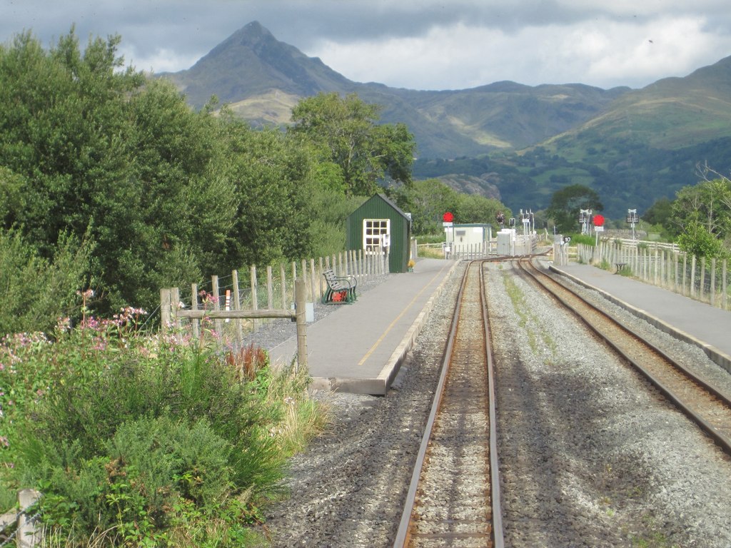
Coed Aber-dunant, located in the county of Caernarfonshire in North Wales, is a stunning woodland area known for its natural beauty and rich biodiversity. The name "Coed Aber-dunant" translates to "Wood, Forest" in English, perfectly capturing the essence of this captivating landscape.

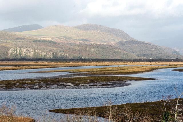
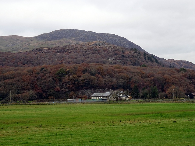
Covering an area of approximately 100 acres, Coed Aber-dunant is nestled within the Snowdonia National Park, which is renowned for its breathtaking scenery. The woodland is primarily composed of native trees, such as oak, ash, beech, and birch, which create a diverse and vibrant ecosystem.

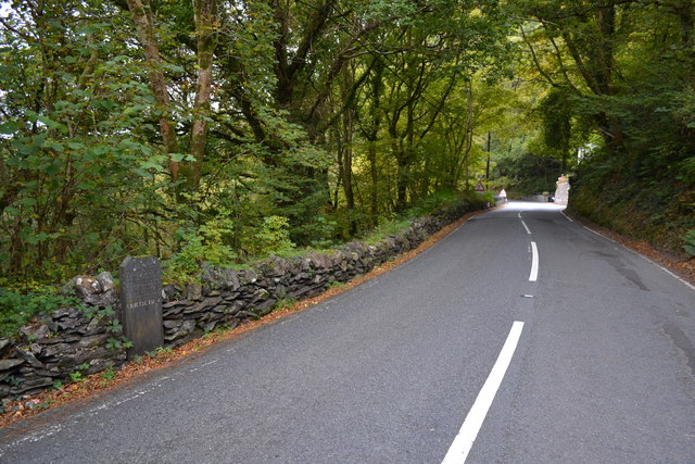
The woodland is crisscrossed by well-maintained paths and trails, making it a popular destination for nature enthusiasts and hikers. These paths offer visitors the opportunity to explore the woodland at their own pace while immersing themselves in the tranquility of the surroundings. Along the way, visitors can admire the picturesque views, listen to the soothing sounds of birdsong, and breathe in the fresh, crisp air.

Coed Aber-dunant is also home to a variety of wildlife, making it a haven for nature lovers and wildlife enthusiasts alike. The woodland provides a habitat for numerous species, including birds, mammals, insects, and plants. Visitors may encounter red squirrels, deer, foxes, and a wide range of bird species as they wander through the forest.

In addition to its natural beauty, Coed Aber-dunant offers educational opportunities and facilities for visitors. Interpretive signs and information boards provide insights into the ecology and history of the woodland, ensuring a rich and informative experience for all who explore this enchanting forest.

Overall, Coed Aber-dunant is a must-visit destination for those seeking solace in nature, with its awe-inspiring scenery, diverse wildlife, and educational resources providing a truly memorable experience.

If you have any feedback on the listing, please let us know in the comments section below.

Coed Aber-dunant Images

Images are sourced within 2km of 52.956888/-4.1058745 or Grid Reference SH5842. Thanks to Geograph Open Source API. All images are credited.

Mynydd Gorllwyn Viewed across Traeth Mawr from the Cob.
Mynydd Gorllwyn
Viewed across Traeth Mawr from the Cob.
Double-headed Garratts at Pont Croesor Double-headed NGG16 Garratt locomotives No. 130 and No. 87 arrive at Pont Croesor with a Caernarfon to Porthmadog service during the WHR100 Welsh Highland Railway Centenary event.
Double-headed Garratts at Pont Croesor
Double-headed NGG16 Garratt locomotives No. 130 and No. 87 arrive at Pont Croesor with a Caernarfon to Porthmadog service during the WHR100 Welsh Highland Railway Centenary event.
Old Milestone Old milestone on the A498 near to Prenteg, Gwynedd. For overall view see <a title="https://www.geograph.org.uk/photo/4775940" href="https://www.geograph.org.uk/photo/4775940">Link</a>
Old Milestone
Old milestone on the A498 near to Prenteg, Gwynedd. For overall view see Link
Tremadog 3 Old milestone on the A498 near to Prenteg, Gwynedd. For close up view see <a title="https://www.geograph.org.uk/photo/4775937" href="https://www.geograph.org.uk/photo/4775937">Link</a>
Tremadog 3
Old milestone on the A498 near to Prenteg, Gwynedd. For close up view see Link
Portreuddyn Castle and farm Viewed from a Welsh Highland Railway train.
Portreuddyn Castle and farm
Viewed from a Welsh Highland Railway train.
View at Pont Croesor station On board a Welsh Highland Railway train bound for Rhyd-Ddu.
View at Pont Croesor station
On board a Welsh Highland Railway train bound for Rhyd-Ddu.
Crossing the Afon Glaslyn On board a Welsh Highland Railway train bound for Rhyd Ddu.
Crossing the Afon Glaslyn
On board a Welsh Highland Railway train bound for Rhyd Ddu.
Grassland near Bwlch-y-moch Viewed from a Welsh Highland Railway train heading for Porthmadog.
Grassland near Bwlch-y-moch
Viewed from a Welsh Highland Railway train heading for Porthmadog.
Old Milestone Old milestone on the A498 at Prenteg, Gwynedd. For overall view see <a title="https://www.geograph.org.uk/photo/5073598" href="https://www.geograph.org.uk/photo/5073598">Link</a>
Old Milestone
Old milestone on the A498 at Prenteg, Gwynedd. For overall view see Link
Tremadog 2 Old milestone on the A.498 at Prenteg, Gwynedd. For close up view see <a title="https://www.geograph.org.uk/photo/5073595" href="https://www.geograph.org.uk/photo/5073595">Link</a>
Tremadog 2
Old milestone on the A.498 at Prenteg, Gwynedd. For close up view see Link
Farm track level crossing near Pont Croesor Level crossing on the Welsh Highland Railway
Farm track level crossing near Pont Croesor
Level crossing on the Welsh Highland Railway
Afon Glaslyn at Pont Croesor View from train on the Welsh Highland Railway
Afon Glaslyn at Pont Croesor
View from train on the Welsh Highland Railway
Prenteg viewed from the Welsh Highland Railway With Moel-ddu in view.
Prenteg viewed from the Welsh Highland Railway
With Moel-ddu in view.
Pont Croesor Viewed from the combined rail/road bridge across the river.
Pont Croesor
Viewed from the combined rail/road bridge across the river.
Platform at Pont Croesor station, Welsh Highland Railway
Track to Ty'n-y-celyn Running round the foot of Ynys Fawr, a former island outcrop on the Glaslyn levels.
Track to Ty'n-y-celyn
Running round the foot of Ynys Fawr, a former island outcrop on the Glaslyn levels.
Sheep pen, Ynys Fawr An old pen made from slabs of slate has been modified and extended using corrugated iron and anything else that came to hand. The slate probably came down from the quarries via the nearby Croesor Tramway. The route of the tramway here was later incorporated into the Welsh Highland Railway.
Sheep pen, Ynys Fawr
An old pen made from slabs of slate has been modified and extended using corrugated iron and anything else that came to hand. The slate probably came down from the quarries via the nearby Croesor Tramway. The route of the tramway here was later incorporated into the Welsh Highland Railway.
Flooded fields near Pont Croesor Afon Glaslyn is making full use of its flood plain. Moel-ddu sits behind.
Flooded fields near Pont Croesor
Afon Glaslyn is making full use of its flood plain. Moel-ddu sits behind.
Show me another place!

Coed Aber-dunant is located at Grid Ref: SH5842 (Lat: 52.956888, Lng: -4.1058745)

Unitary Authority: Gwynedd

Police Authority: North Wales

What 3 Words

///twinkling.roadmap.sunflower. Near Penrhyndeudraeth, Gwynedd

Related Wikis

Prenteg

Prenteg is a hamlet that lies 3 miles (4.8 km) from Porthmadog, Wales, between Tremadog and Beddgelert. == See also == The July 2010 wind storms in Global...

Glaslyn Osprey Project

The Glaslyn Osprey Project is located in the Glaslyn Valley at Pont Croesor near Porthmadog in Gwynedd, north-west Wales. The project has supported ospreys...

Pont Croesor railway station

Pont Croesor is a railway halt in Wales, on the Welsh Highland Railway, which runs through the Snowdonia National Park from Caernarfon to Porthmadog. It...

Traeth Mawr Loop

Traeth Mawr Loop was a short-lived terminus during the restoration of the Welsh Highland Railway (WHR). The run-around loop was located within Traeth Mawr...

Coed Tremadog National Nature Reserve

Coed Tremadog National Nature Reserve is located near Porthmadog, Gwynedd, Wales. Its most striking features are huge volcanic cliffs which drop down to...

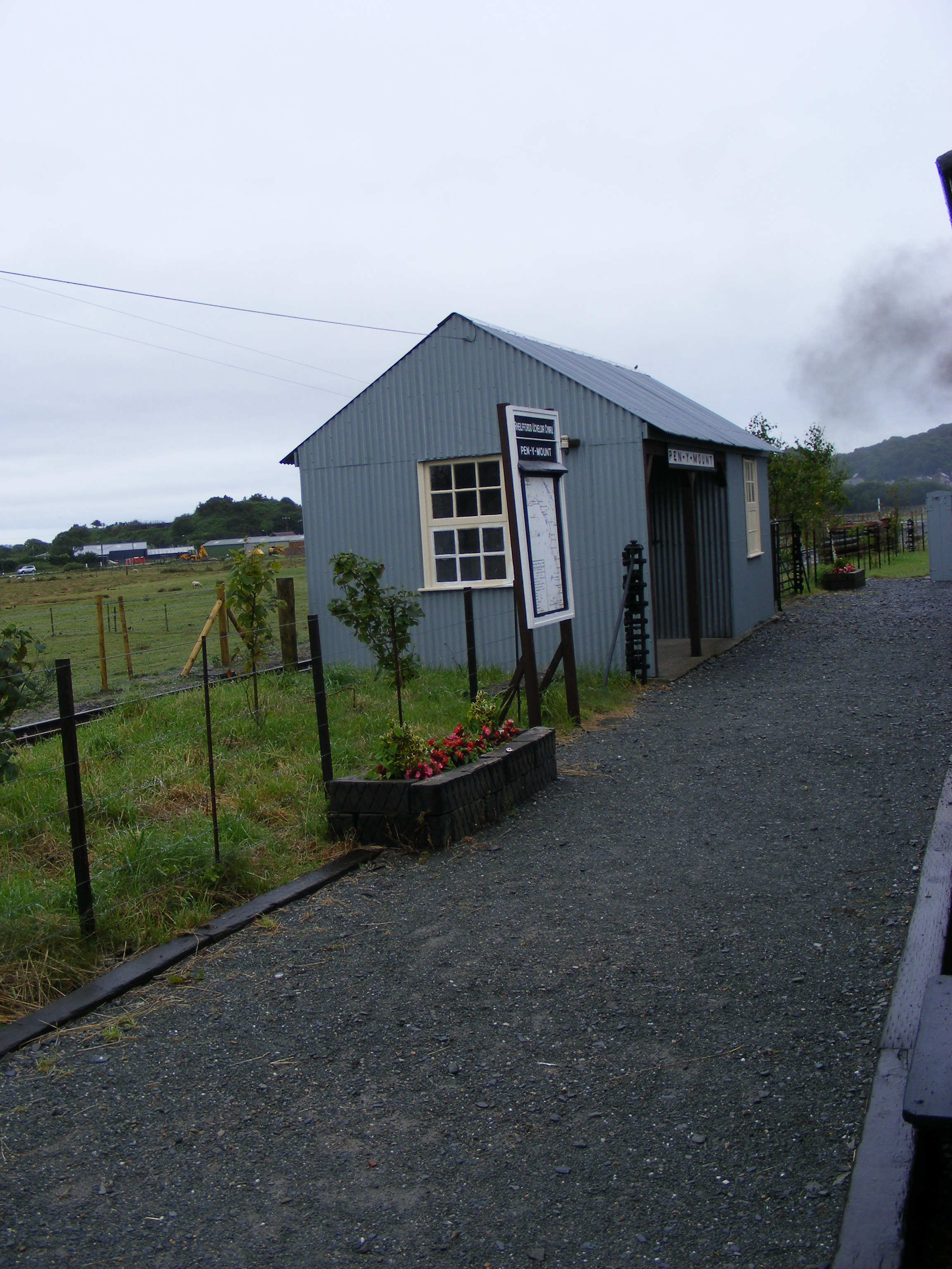
Pen-y-Mount Junction railway station

Pen-y-Mount Junction station is the northern terminus of the Welsh Highland Heritage Railway (WHHR) in Porthmadog, Wales. With the opening of all three...

Y Traeth

Y Traeth (English: The Beach) is a multi-use stadium in Porthmadog, Wales. It is currently used mostly for football matches as the home ground of Porthmadog...

Plas Brondanw

Plas Brondanw (grid reference SH616422) in Garreg, Llanfrothen, Gwynedd, North Wales, was the family home of Clough Williams-Ellis, creator of the Italianate...

Nearby Amenities

Located within 500m of 52.956888,-4.1058745
Turning Circle
Lat/Long: 52.9566242/-4.1120146
The data included in this document is from www.openstreetmap.org. The data is made available under ODbL.

Have you been to Coed Aber-dunant?

Leave your review of Coed Aber-dunant below (or comments, questions and feedback).