Coed Llethr

Wood, Forest in Carmarthenshire

Wales

Coed Llethr

Lan Ddu Cilwenau Top and trig with Phil Cooper. Parked in Rhydcymerau to use bridleway from north to wiggle our way along the route to the flat track through the flat summit forest. Then via overgrown track gain access to sheep fields to bag trig at forest edge then walked down sheep field in a NNE direction to track to forest picnic spot and back onto road to finish this circular walk.

Name:Lan Ddu Cilwenau
Hill number:5239
Height:328m / 1076ft
Area:31C: South-West Wales
Class:Hu
Grid ref:SN576370 (est)
Drop:120m
Col:208m SN564376
Lan Ddu Cilwenau Credit: Rude Health

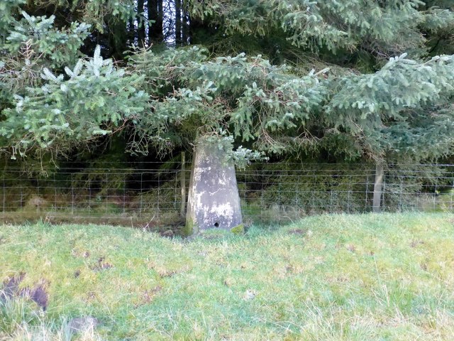
Coed Llethr is a stunning woodland located in Carmarthenshire, Wales. Covering an area of approximately 500 acres, this forest is known for its natural beauty and diverse range of flora and fauna. It is situated in the heart of the Brecon Beacons National Park, making it a popular destination for nature enthusiasts and outdoor adventurers alike.

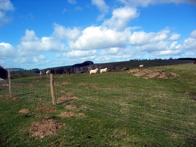
The woodland is predominantly composed of native trees such as oak, beech, and birch, creating a rich and vibrant ecosystem. These trees provide a habitat for numerous species of birds, mammals, and insects, making it a haven for wildlife lovers. Visitors can often spot red kites soaring overhead, while deer and squirrels can be seen darting among the trees.

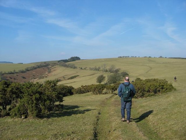
Numerous walking trails crisscross the forest, allowing visitors to explore its beauty at their own pace. These trails range in difficulty, catering to both casual strollers and avid hikers. There are also designated picnic areas and viewpoints, providing opportunities to rest and take in the breathtaking panoramic views of the surrounding countryside.

Coed Llethr is not only a haven for wildlife but also plays a vital role in the conservation of the local ecosystem. The forest is managed sustainably, with efforts made to preserve its natural beauty and protect its delicate balance of wildlife.

Overall, Coed Llethr is a must-visit destination for those seeking a tranquil escape in the heart of nature. Its diverse range of flora and fauna, coupled with its breathtaking landscapes, make it a truly enchanting woodland experience.

If you have any feedback on the listing, please let us know in the comments section below.

Coed Llethr Images

Images are sourced within 2km of 52.022073/-4.0680383 or Grid Reference SN5837. Thanks to Geograph Open Source API. All images are credited.

Lan Ddu Cilwenau Top and trig with Phil Cooper. Parked in Rhydcymerau to use bridleway from north to wiggle our way along the route to the flat track through the flat summit forest. Then via overgrown track gain access to sheep fields to bag trig at forest edge then walked down sheep field in a NNE direction to track to forest picnic spot and back onto road to finish this circular walk.

Name:Lan Ddu Cilwenau
Hill number:5239
Height:328m / 1076ft
Area:31C: South-West Wales
Class:Hu
Grid ref:SN576370 (est)
Drop:120m
Col:208m SN564376
Lan Ddu Cilwenau
Top and trig with Phil Cooper. Parked in Rhydcymerau to use bridleway from north to wiggle our way along the route to the flat track through the flat summit forest. Then via overgrown track gain access to sheep fields to bag trig at forest edge then walked down sheep field in a NNE direction to track to forest picnic spot and back onto road to finish this circular walk. Name:Lan Ddu Cilwenau Hill number:5239 Height:328m / 1076ft Area:31C: South-West Wales Class:Hu Grid ref:SN576370 (est) Drop:120m Col:208m SN564376
Lan Ddu Cilwenau Trig Top and trig with Phil Cooper. Parked in Rhydcymerau to use bridleway from north to wiggle our way along the route to the flat track through the flat summit forest. Then via overgrown track gain access to sheep fields to bag trig at forest edge then walked down sheep field in a NNE direction to track to forest picnic spot and back onto road to finish this circular walk.
Lan Ddu Cilwenau Trig
Top and trig with Phil Cooper. Parked in Rhydcymerau to use bridleway from north to wiggle our way along the route to the flat track through the flat summit forest. Then via overgrown track gain access to sheep fields to bag trig at forest edge then walked down sheep field in a NNE direction to track to forest picnic spot and back onto road to finish this circular walk.
Banc Cwm-coed-ifor Walked up from Rhydcymerau with Phil Cooper. Top near edge of summit copse but walked around flattish field until far away fence boundary to NW as not much in it.

Name:Banc Cwm-coed-ifor
Hill number:5240
Height:309m / 1014ft
Area:31C: South-West Wales
Class:Hu
Grid ref:SN593385 (est)
Drop:111m
Col:198m SN580395
Banc Cwm-coed-ifor
Walked up from Rhydcymerau with Phil Cooper. Top near edge of summit copse but walked around flattish field until far away fence boundary to NW as not much in it. Name:Banc Cwm-coed-ifor Hill number:5240 Height:309m / 1014ft Area:31C: South-West Wales Class:Hu Grid ref:SN593385 (est) Drop:111m Col:198m SN580395
Banc Cwm-coed-ifor Walked to this Fence Walked up from Rhydcymerau with Phil Cooper. Top near edge of summit copse but walked around flattish field until far away fence boundary to NW as not much in it.
Banc Cwm-coed-ifor Walked to this Fence
Walked up from Rhydcymerau with Phil Cooper. Top near edge of summit copse but walked around flattish field until far away fence boundary to NW as not much in it.
Llwybr Trawsgoed Path Cerddwyr yn dilyn llwybr cyhoeddus o anhedd-dy o'r enw Trawsgoed Isaf i Afon Gorlech.

Walkers following a path from a property called Trawsgoed Isaf to the Gorlech River
Llwybr Trawsgoed Path
Cerddwyr yn dilyn llwybr cyhoeddus o anhedd-dy o'r enw Trawsgoed Isaf i Afon Gorlech. Walkers following a path from a property called Trawsgoed Isaf to the Gorlech River
Cart & Horses Olion Tafarn Cart & Horses, Rhydcymerau. Cyn iddo gied roedd gan y tafarn ddau lawr ac am ddegawdau y tafarnwr oedd y porthmon, John Jenkins, ond ei wraig 'Nellie'r Cart' a gadwai'r lle i fynd. Heddiw, fe'i defnyddir fel adeilad amaethyddol. 

The remains of the former Cart & Horses Public House. Prior to its closure it was a two storey building and the publican for approximately 50 years was the drover, John Jenkins, but it was his wife 'Nelli'r Cart' who did the day to day running of the pub. Today, it is used as an agricultural building.
Cart & Horses
Olion Tafarn Cart & Horses, Rhydcymerau. Cyn iddo gied roedd gan y tafarn ddau lawr ac am ddegawdau y tafarnwr oedd y porthmon, John Jenkins, ond ei wraig 'Nellie'r Cart' a gadwai'r lle i fynd. Heddiw, fe'i defnyddir fel adeilad amaethyddol. The remains of the former Cart & Horses Public House. Prior to its closure it was a two storey building and the publican for approximately 50 years was the drover, John Jenkins, but it was his wife 'Nelli'r Cart' who did the day to day running of the pub. Today, it is used as an agricultural building.
Banc Cwm Hywel Cilfordd sy'n cysylltu Rhydcymerau a Llansawel.

A byway linking Rhydcymerau with Llansawel.
Banc Cwm Hywel
Cilfordd sy'n cysylltu Rhydcymerau a Llansawel. A byway linking Rhydcymerau with Llansawel.
Banc Cwm Hywel Ffens ar draws hen gilffordd ar Fanc Cwm Hywel

Fence across an old byway on Banc Cwm Hywel
Banc Cwm Hywel
Ffens ar draws hen gilffordd ar Fanc Cwm Hywel Fence across an old byway on Banc Cwm Hywel
Capel CM Rhydycymerau The website of the Welsh Presbyterians says that there are still services held at this impressive chapel.
Capel CM Rhydycymerau
The website of the Welsh Presbyterians says that there are still services held at this impressive chapel.
Banc yr Esgair Hewl y coedwigoedd ar Fanc yr Esgair.

A forestry road on Banc yr Esgair (trans. ridge bank).
Banc yr Esgair
Hewl y coedwigoedd ar Fanc yr Esgair. A forestry road on Banc yr Esgair (trans. ridge bank).
Llwybr ceffyl ger Pwllcynbyd /  Bridleway near Pwllcynbyd Llwybr ceffyl yn agosau at anhedd-dy o'r enw Pwllcynbyd.

A bridleway approaching a property known as Pwllcynbyd.
Llwybr ceffyl ger Pwllcynbyd / Bridleway near Pwllcynbyd
Llwybr ceffyl yn agosau at anhedd-dy o'r enw Pwllcynbyd. A bridleway approaching a property known as Pwllcynbyd.
Heol i Rydcymerau / Road to Rhydcymerau Heol ger Ffarm Dolau Uchaf yn mynd i gyfeiriad Rhydcymerau.

A road near Dolau Uchaf (trans. meadows upper farm) heads in the direction of Rhydcymerau (trans. confluence of fords).
Heol i Rydcymerau / Road to Rhydcymerau
Heol ger Ffarm Dolau Uchaf yn mynd i gyfeiriad Rhydcymerau. A road near Dolau Uchaf (trans. meadows upper farm) heads in the direction of Rhydcymerau (trans. confluence of fords).
Cyrraedd Rhydcymerau / Entering Rhydcymerau Y B4337 yn cyrraedd pentre Rhydcymerau.

The B4337 enters the village of Rhydcymerau (trans. ford of confluences).
Cyrraedd Rhydcymerau / Entering Rhydcymerau
Y B4337 yn cyrraedd pentre Rhydcymerau. The B4337 enters the village of Rhydcymerau (trans. ford of confluences).
Pont Rhydcymerau Y B4337 yn croesi Pont Rhydcymerau sy'n rhychwantu Afon Melinddwr.

The B4337 crosses Pont Rhydcymerau (trans. ford of confluences bridge) which spans Afon Melinddwr (trans. watermill river).
Pont Rhydcymerau
Y B4337 yn croesi Pont Rhydcymerau sy'n rhychwantu Afon Melinddwr. The B4337 crosses Pont Rhydcymerau (trans. ford of confluences bridge) which spans Afon Melinddwr (trans. watermill river).
Cyn Ysgol Rhydcymerau / The former Rhydcymerau School Hen Ysgol Gynradd Rhydcymerau a gaewyd ar 31ain Awst 2012. Cyn ddisgybl enwog yn ystod 1891-1898 oedd D.J. Williams (1885-1970), llenor, cenedlaetholwr a heddychwr. 

The former Rhydcymerau Primary School which closed on 31st August 2012. A famous ex pupil who attended the school during 1891-98 was D.J. Williams (1885-1970), writer, Welsh nationalist and pacifist.
Cyn Ysgol Rhydcymerau / The former Rhydcymerau School
Hen Ysgol Gynradd Rhydcymerau a gaewyd ar 31ain Awst 2012. Cyn ddisgybl enwog yn ystod 1891-1898 oedd D.J. Williams (1885-1970), llenor, cenedlaetholwr a heddychwr. The former Rhydcymerau Primary School which closed on 31st August 2012. A famous ex pupil who attended the school during 1891-98 was D.J. Williams (1885-1970), writer, Welsh nationalist and pacifist.
Rhydcymerau Cerddwyr yn mynd trwy bentre Rhydcymerau.

Walkers going through the village of Rhydcymerau (trans. ford of the confluences).
Rhydcymerau
Cerddwyr yn mynd trwy bentre Rhydcymerau. Walkers going through the village of Rhydcymerau (trans. ford of the confluences).
Ordnance Survey Cut Mark This OS cut mark can be found on the NE parapet of Pont Rhydcymerau. It marks a point 196.669m above mean sea level.
Ordnance Survey Cut Mark
This OS cut mark can be found on the NE parapet of Pont Rhydcymerau. It marks a point 196.669m above mean sea level.
Ordnance Survey Cut Mark This OS cut mark can be found on the steps of the building west side of the road. It marks a point 226.643m above mean sea level. <a title="https://www.geograph.org.uk/photo/7395976" href="https://www.geograph.org.uk/photo/7395976">Link</a>
Ordnance Survey Cut Mark
This OS cut mark can be found on the steps of the building west side of the road. It marks a point 226.643m above mean sea level. Link
Show me another place!

Coed Llethr is located at Grid Ref: SN5837 (Lat: 52.022073, Lng: -4.0680383)

Unitary Authority: Carmarthenshire

Police Authority: Dyfed Powys

What 3 Words

///grid.unearthly.fluffed. Near Llansawel, Carmarthenshire

Related Wikis

Rhydcymerau

Rhydcymerau is a small village 8.5 kilometres to the south-east of Llanybydder, around the side of Mynydd Llanybydder, in Carmarthenshire, south-west Wales...

Cefn Blaenau

Cefn Blaenau is a 23-hectare Site of Special Scientific Interest in a small upland valley in Carmarthen and Dinefwr, Wales. It was designated an SSSI in...

Llansawel transmitting station

The Llansawel television relay station is sited on high ground to the north of the village of Llansawel in Carmarthenshire, South Wales. It was originally...

Llansawel

Llansawel is a village and community in Carmarthenshire, Wales, about ten miles north of Llandeilo. It covers an area of 4,079 hectares (15.75 sq mi)....

Abergorlech

Abergorlech is a village 8 miles (13 km) to the north-west of Llandeilo in Carmarthenshire, Wales. It lies on the River Cothi on the B4310 road, between...

Mynydd Pencarreg transmitting station

The Mynydd Pencarreg transmitting station is a broadcasting and telecommunications facility located on high ground about 10 kilometres (6.2 mi) south...

Llanfihangel Rhos-y-Corn

Llanfihangel Rhos-y-Corn is a sparsely populated community of Carmarthenshire, Wales. The population of the community taken at the 2011 census was 468...

Edwinsford

Edwinsford is a small hamlet situated about the historic Edwinsford Estate and fishery on the river Cothi, a tributary of the River Tywi, in Carmarthenshire...

Related Videos

Valleys Enduro Round 5 - Hafod Wen

After racing Ard Moors, I wanted something more chill and easier event, therefore I have entered the fun category on the last round ...

Have you been to Coed Llethr?

Leave your review of Coed Llethr below (or comments, questions and feedback).