Allt Beili-coch

Wood, Forest in Carmarthenshire

Wales

Allt Beili-coch

Road to Lampeter Bowls Club and to tennis courts, Road to sports facilities at Lampeter.
Road to Lampeter Bowls Club and to tennis courts, Credit: M J Roscoe

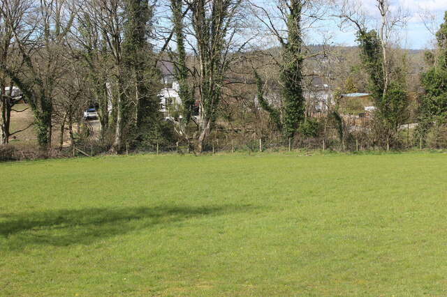
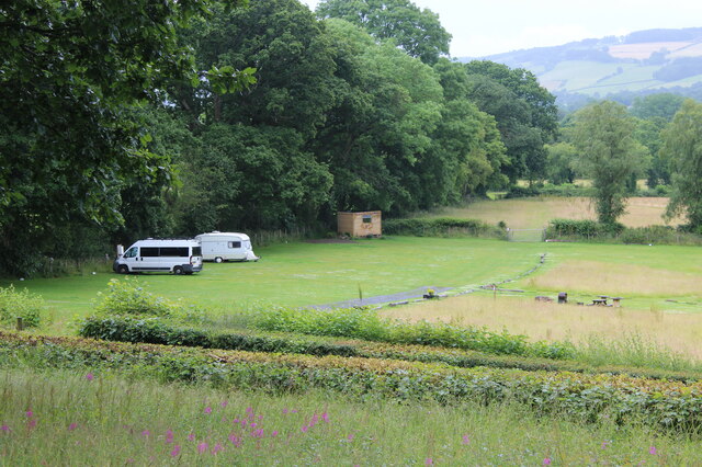
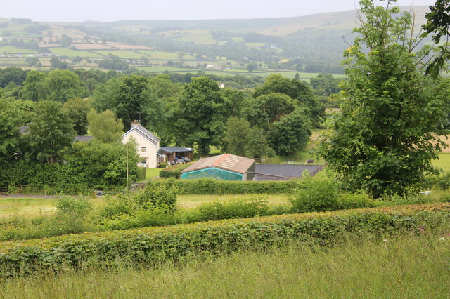
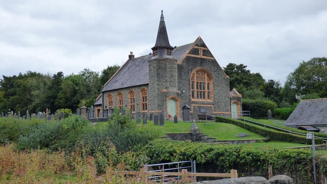
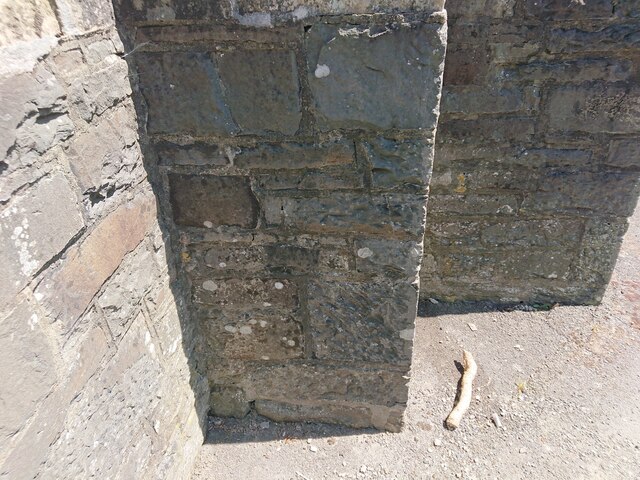
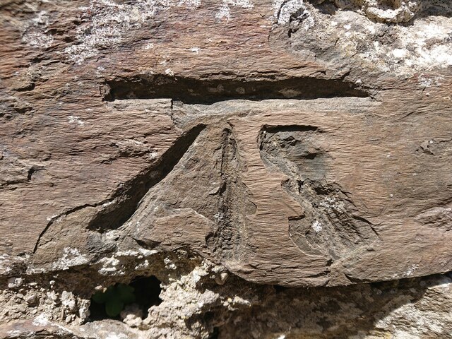
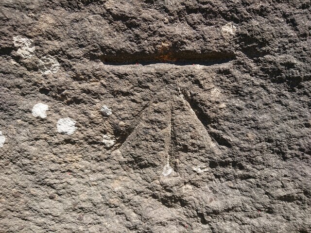
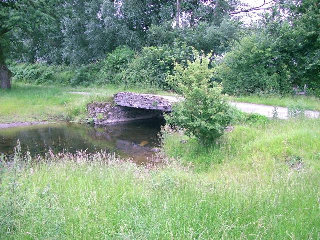
Allt Beili-coch is a picturesque woodland located in Carmarthenshire, Wales. Spanning over a vast area, this forest is renowned for its natural beauty and diverse ecosystem. The name "Allt Beili-coch" translates to "Red Axe Hill" in English, which is believed to be derived from the iron ore mining history of the area.

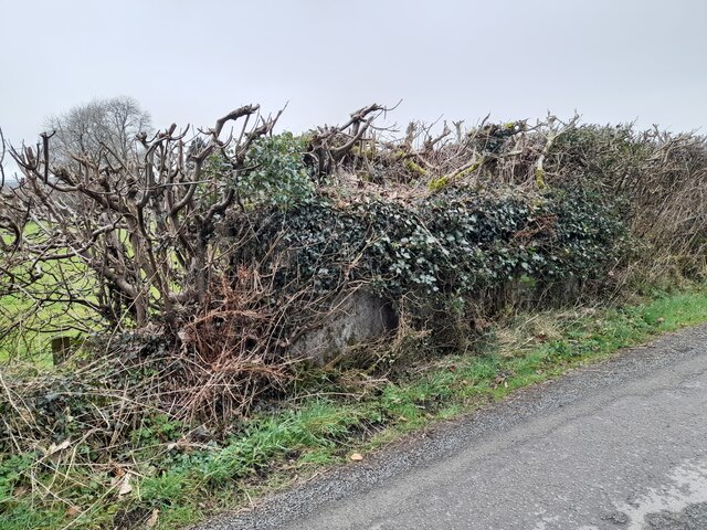
The forest is characterized by its dense canopy of trees, predominantly consisting of native species such as oak, beech, and ash. These towering trees provide a haven for a wide variety of wildlife, including birds, mammals, and insects. The forest floor is covered with a thick carpet of ferns, mosses, and wildflowers, adding to its enchanting atmosphere.

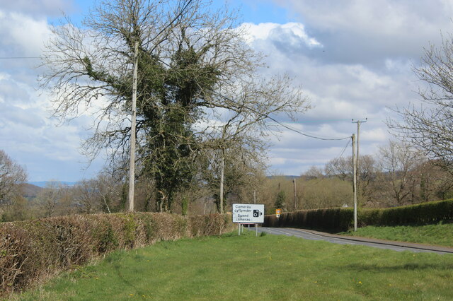
Allt Beili-coch is a popular destination for nature lovers and outdoor enthusiasts, offering numerous walking trails and paths that wind through the forest. These trails provide visitors with the opportunity to explore the woodland at their own pace, immersing themselves in the tranquility of nature. The forest also boasts a small stream that meanders through its heart, adding to its charm.

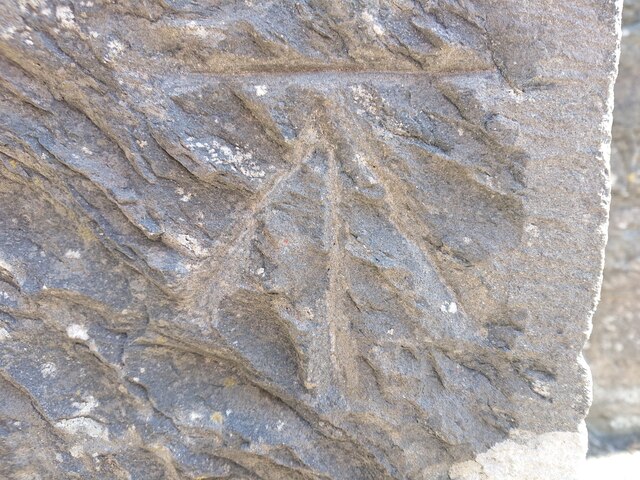
In addition to its natural beauty, Allt Beili-coch holds historical significance. The remains of old mining infrastructure, such as disused mine shafts and quarries, can still be found within the forest, serving as a reminder of its industrial past.

Overall, Allt Beili-coch is a captivating woodland that showcases the beauty of nature in Carmarthenshire. Its rich biodiversity, scenic trails, and historical remnants make it a must-visit destination for anyone seeking a peaceful retreat or an opportunity to reconnect with the natural world.

If you have any feedback on the listing, please let us know in the comments section below.

Allt Beili-coch Images

Images are sourced within 2km of 52.100448/-4.0756784 or Grid Reference SN5746. Thanks to Geograph Open Source API. All images are credited.

Road to Lampeter Bowls Club and to tennis courts, Road to sports facilities at Lampeter.
Road to Lampeter Bowls Club and to tennis courts,
Road to sports facilities at Lampeter.
Timber Lorry sheding its load Fortunately nobody was hurt.
Timber Lorry sheding its load
Fortunately nobody was hurt.
Field next to A482 by Neuadd-fach Roadside field on the outskirts of Ram.
Field next to A482 by Neuadd-fach
Roadside field on the outskirts of Ram.
Signs on A482 on western side of Ram Signs on the approach to the 30 mph zone.
Signs on A482 on western side of Ram
Signs on the approach to the 30 mph zone.
Drive to Bank Hall
Drive to Bank Hall
Llanwnen Road, A475 Road just to the south west of Lampeter on a rainy day.
Llanwnen Road, A475
Road just to the south west of Lampeter on a rainy day.
Camping & caravan site, near A475 Campsite outside Lampeter; the parallel hedges, foreground, line a lane to Maesypwll <a href="https://www.geograph.org.uk/photo/7214838">SN5647 : Maesypwll</a>.
Camping & caravan site, near A475
Campsite outside Lampeter; the parallel hedges, foreground, line a lane to Maesypwll SN5647 : Maesypwll.
Maesypwll The hedges, foreground, bordering a lane are a continuation of those in <a href="https://www.geograph.org.uk/photo/7214615">SN5647 : Camping & caravan site, near A475</a>, and the lane leads to the farm buildings, centre.
Maesypwll
The hedges, foreground, bordering a lane are a continuation of those in SN5647 : Camping & caravan site, near A475, and the lane leads to the farm buildings, centre.
Looking along Bridge Street
Old Building and Medieval Motte at University of Wales Trinity Saint David's
Brondeifi Unitarian Chapel
Churn Stand There should be an Ordnance Survey cut mark on the stand.
Churn Stand
There should be an Ordnance Survey cut mark on the stand.
Ordnance Survey Cut Mark This OS cut mark can be found on the outbuilding at Brynderw . It marks a point 162.932m above mean sea level.
Ordnance Survey Cut Mark
This OS cut mark can be found on the outbuilding at Brynderw . It marks a point 162.932m above mean sea level.
Ordnance Survey Benchmark - Lampeter, St. Peter’s Church Ordnance Survey Benchmark (OSBM) used for levelling height above Ordnance Datum (OD).
Height (1972): 136.9200m OD (Newlyn). Mark verified by the Ordnance Survey in 1971. Description: TWR ST PETERS CH W FACE SW ANG. 0.5m above ground. 2nd Order BM.

Context: <a href="https://www.geograph.org.uk/photo/7506634">SN5748 : Ordnance Survey Benchmark - Lampeter, St. Peter’s Church</a>
Ordnance Survey Benchmark - Lampeter, St. Peter’s Church
Ordnance Survey Benchmark (OSBM) used for levelling height above Ordnance Datum (OD). Height (1972): 136.9200m OD (Newlyn). Mark verified by the Ordnance Survey in 1971. Description: TWR ST PETERS CH W FACE SW ANG. 0.5m above ground. 2nd Order BM. Context: SN5748 : Ordnance Survey Benchmark - Lampeter, St. Peter’s Church
Ordnance Survey Benchmark - Lampeter, St. Peter’s Church Ordnance Survey Benchmark (OSBM) used for levelling height above Ordnance Datum (OD).
Height (1972): 136.9200m OD (Newlyn). Mark verified by the Ordnance Survey in 1971. Description: TWR ST PETERS CH W FACE SW ANG. 0.5m above ground. 2nd Order BM.

Close-up: <a href="https://www.geograph.org.uk/photo/7506633">SN5748 : Ordnance Survey Benchmark - Lampeter, St. Peter’s Church</a>
Ordnance Survey Benchmark - Lampeter, St. Peter’s Church
Ordnance Survey Benchmark (OSBM) used for levelling height above Ordnance Datum (OD). Height (1972): 136.9200m OD (Newlyn). Mark verified by the Ordnance Survey in 1971. Description: TWR ST PETERS CH W FACE SW ANG. 0.5m above ground. 2nd Order BM. Close-up: SN5748 : Ordnance Survey Benchmark - Lampeter, St. Peter’s Church
Ordnance Survey Benchmark - Lampeter, Delville Ordnance Survey Benchmark (OSBM) used for levelling height above Ordnance Datum (OD).
Height: 120.8400m OD (Newlyn). Mark verified by the Ordnance Survey in 1972. Description: WALL DELVILLE 3M ANG WALL SE FACE. 0.4m above ground. 3rd Order BM.

Context: <a href="https://www.geograph.org.uk/photo/7506641">SN5747 : Ordnance Survey Benchmark - Lampeter, Delville</a>
Ordnance Survey Benchmark - Lampeter, Delville
Ordnance Survey Benchmark (OSBM) used for levelling height above Ordnance Datum (OD). Height: 120.8400m OD (Newlyn). Mark verified by the Ordnance Survey in 1972. Description: WALL DELVILLE 3M ANG WALL SE FACE. 0.4m above ground. 3rd Order BM. Context: SN5747 : Ordnance Survey Benchmark - Lampeter, Delville
Ordnance Survey Benchmark - Lampeter, Delville Ordnance Survey Benchmark (OSBM) used for levelling height above Ordnance Datum (OD).
Height: 120.8400m OD (Newlyn). Mark verified by the Ordnance Survey in 1972. Description: WALL DELVILLE 3M ANG WALL SE FACE. 0.4m above ground. 3rd Order BM.

Close-up: <a href="https://www.geograph.org.uk/photo/7506640">SN5747 : Ordnance Survey Benchmark - Lampeter, Delville</a>
Ordnance Survey Benchmark - Lampeter, Delville
Ordnance Survey Benchmark (OSBM) used for levelling height above Ordnance Datum (OD). Height: 120.8400m OD (Newlyn). Mark verified by the Ordnance Survey in 1972. Description: WALL DELVILLE 3M ANG WALL SE FACE. 0.4m above ground. 3rd Order BM. Close-up: SN5747 : Ordnance Survey Benchmark - Lampeter, Delville
Ordnance Survey Benchmark - Lampeter, Pont Stephen Ordnance Survey Benchmark (OSBM) used for levelling height above Ordnance Datum (OD).
Height: 116.588m OD (Newlyn). Mark verified by the Ordnance Survey in 1972. Description: PONT STEPHEN NE PARA SW FACE. 0.3m above ground. 3rd Order BM.

Context: <a href="https://www.geograph.org.uk/photo/7506643">SN5847 : Ordnance Survey Benchmark - Lampeter, Pont Stephen</a>
Ordnance Survey Benchmark - Lampeter, Pont Stephen
Ordnance Survey Benchmark (OSBM) used for levelling height above Ordnance Datum (OD). Height: 116.588m OD (Newlyn). Mark verified by the Ordnance Survey in 1972. Description: PONT STEPHEN NE PARA SW FACE. 0.3m above ground. 3rd Order BM. Context: SN5847 : Ordnance Survey Benchmark - Lampeter, Pont Stephen
Show me another place!

Allt Beili-coch is located at Grid Ref: SN5746 (Lat: 52.100448, Lng: -4.0756784)

Unitary Authority: Carmarthenshire

Police Authority: Dyfed Powys

What 3 Words

///absorbing.copper.magical. Near Lampeter, Ceredigion

Related Wikis

Cwmann

Cwmann is a small village in Carmarthenshire, Wales, in the community of Pencarreg. It is just on the border with Ceredigion and near Lampeter, with Cwmann...

Parc y Rhos

Parc y Rhos is a small village in Carmarthenshire in mid Wales about 2 miles outside of Lampeter. Once a thriving community with a small shop, two pubs...

River Dulas

The River Dulas (Welsh: Afon Dulas) is a tributary of the River Teifi and has its source near the village of Llangybi, Ceredigion, Wales. Its confluence...

A482 road

The A482 road is in Ceredigion and Carmarthenshire, Wales. It links Aberaeron at the junction with the A487 road with the A40 road at Llanwrda near Llandovery...

Ysgol Bro Pedr

Ysgol Bro Pedr is a mixed middle school for pupils aged 3–19. The school is situated in Lampeter, Ceredigion, Wales. The school is a product of the amalgamation...

Roderic Bowen Library and Archive

The Roderic Bowen Library and Archives (or RBLA), housing university archives and special collections, is located inside the library building of the University...

Harford Fountain

Harford Fountain, is a 19th-century grade II listed fountain in Harford Square, in Lampeter, Ceredigion. == History == The Fountain was built in 1862,...

Lampeter Town Hall

Lampeter Town Hall (Welsh: Neuadd y Dref Llanbedr Pont Steffan) is a municipal structure in the High Street, Lampeter, Wales. The town hall, which was...

Nearby Amenities

Located within 500m of 52.100448,-4.0756784
Addr Postcode: SA48 8DN
Source Addr Postcode: OS_OpenData_Code-Point
Lat/Long: 52.1031869/-4.0722511
Addr Postcode: SA48 8DT
Source Addr Postcode: OS_OpenData_Code-Point
Lat/Long: 52.1045458/-4.0727402
Addr City: Cwmann
Addr Country: GB
Addr Housename: Belli-coch
Addr Postcode: SA48 8EF
Lat/Long: 52.1017608/-4.0806258
Addr City: Cwmann
Addr Country: GB
Addr Housename: Ddeunant
Source Name: OS_OpenData_StreetView
Lat/Long: 52.096234/-4.0761021
Addr City: Cwmann
Addr Country: GB
Addr Housename: Pen-lan
Addr Postcode: SA48 8DS
Source Addr Postcode: OS_OpenData_Code-Point
Source Name: OS_OpenData_StreetView
Lat/Long: 52.099548/-4.0724479
Addr City: Cwmann
Addr Country: GB
Addr Postcode: SA48 8EF
Source Addr Postcode: OS_OpenData_Code-Point
Lat/Long: 52.1017602/-4.0756567
Fixme: continue
Lat/Long: 52.1033393/-4.07173
Addr City: Cwmann
Addr Country: GB
Addr Housename: Tanlan
Source Name: OS_OpenData_StreetView
Lat/Long: 52.098582/-4.0763503
Addr City: Cwmann
Addr Country: GB
Addr Housename: Bryndolau
Addr Postcode: SA48 8DU
Lat/Long: 52.0988875/-4.0807843
Addr City: Cwmann
Addr Country: GB
Addr Housename: Fronhaul
Addr Postcode: SA48 8DU
Lat/Long: 52.0996554/-4.0786929
Addr City: Cwmann
Addr Country: GB
Addr Housename: Hafod
Addr Postcode: SA48 8DU
Lat/Long: 52.0993838/-4.0807177
Place Of Worship
Addr City: Cwmann
Addr Country: GB
Addr Postcode: SA48 8DU
Religion: christian
Lat/Long: 52.0998802/-4.0791777
Power: pole
Lat/Long: 52.1015759/-4.0693898
Power: pole
Lat/Long: 52.1003006/-4.0701824
Power: pole
Lat/Long: 52.0986794/-4.0709683
Power: pole
Lat/Long: 52.0982641/-4.0717971
Power: pole
Lat/Long: 52.0978357/-4.0727225
Power: pole
Lat/Long: 52.097816/-4.0738356
Power: pole
Lat/Long: 52.0977929/-4.0757158
Power: pole
Lat/Long: 52.0978028/-4.077124
Power: pole
Lat/Long: 52.0978407/-4.0787011
Power: pole
Lat/Long: 52.0970547/-4.0800342
Power: pole
Lat/Long: 52.1042811/-4.0758714
Power: pole
Lat/Long: 52.1033948/-4.0766332
Power: pole
Lat/Long: 52.1026798/-4.0772393
Power: pole
Lat/Long: 52.102038/-4.0782237
Power: pole
Lat/Long: 52.1014383/-4.0790914
Power: pole
Lat/Long: 52.099841/-4.0824696
Power: pole
Lat/Long: 52.1003575/-4.0813082
Power: pole
Lat/Long: 52.1001886/-4.0807155
Power: pole
Lat/Long: 52.0998237/-4.0815282
Power: pole
Lat/Long: 52.0993697/-4.0825032
Direction: SSE
Generator Method: photovoltaic
Generator Output Electricity: yes
Generator Solar Modules: 16
Generator Source: solar
Generator Type: solar_photovoltaic_panel
Location: roof
Power: generator
Lat/Long: 52.1028099/-4.0716845
The data included in this document is from www.openstreetmap.org. The data is made available under ODbL.

Have you been to Allt Beili-coch?

Leave your review of Allt Beili-coch below (or comments, questions and feedback).