Allt Pen-lan-goch

Wood, Forest in Cardiganshire

Wales

Allt Pen-lan-goch

Pencwm Mawr farm North of Llanddeiniol
Pencwm Mawr farm Credit: Eirian Evans

Allt Pen-lan-goch is a charming woodland located in Cardiganshire, Wales. Situated in the picturesque countryside, this forest covers a vast area of land and is known for its natural beauty and tranquility. The name "Allt Pen-lan-goch" translates to "wood of the red headland," which is a fitting description of the stunning landscape.

The forest is made up of a variety of tree species, including oak, beech, and ash, which create a diverse and vibrant ecosystem. The dense canopy provides shade and shelter for a range of wildlife, such as deer, foxes, and numerous bird species. Walking through the forest, visitors can enjoy the peaceful atmosphere and listen to the soothing sounds of birdsong.

Allt Pen-lan-goch offers numerous walking trails, allowing visitors to explore the forest at their own pace. These trails lead through ancient woodland, across babbling brooks, and up gentle slopes, providing breathtaking views of the surrounding countryside. There are also designated picnic areas where visitors can relax and enjoy a meal amidst the natural surroundings.

The forest is a popular destination for nature enthusiasts, photographers, and those seeking a peaceful getaway. It offers a chance to escape the hustle and bustle of everyday life and immerse oneself in the beauty of nature. Whether it's a leisurely stroll, a bird-watching expedition, or simply finding a quiet spot to relax and unwind, Allt Pen-lan-goch is a haven for nature lovers of all ages.

If you have any feedback on the listing, please let us know in the comments section below.

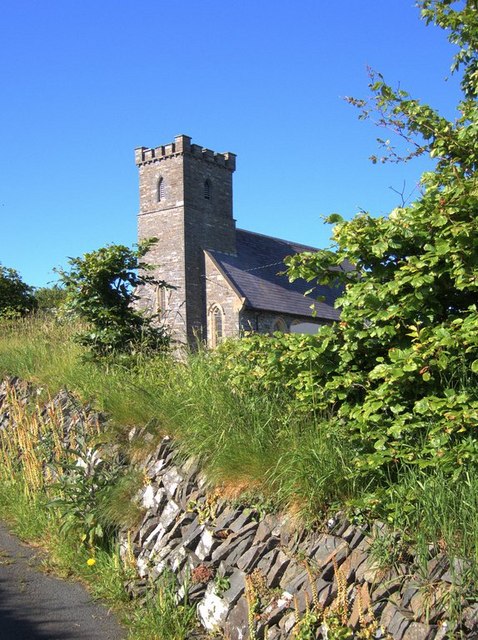
Allt Pen-lan-goch Images

Images are sourced within 2km of 52.331048/-4.098291 or Grid Reference SN5772. Thanks to Geograph Open Source API. All images are credited.

Pencwm Mawr farm North of Llanddeiniol
Pencwm Mawr farm
North of Llanddeiniol
A487 near Y Meini
A487 near Y Meini
Milestone - Aberystwyth 6
Milestone - Aberystwyth 7
Ordnance Survey 1GL Bolt This OS Bolt can be found on the west angle of St Deiniol's Church. It marks a point 107.930m above mean sea level.
Ordnance Survey 1GL Bolt
This OS Bolt can be found on the west angle of St Deiniol's Church. It marks a point 107.930m above mean sea level.
Old Milestone by the A487, Y Meini, Llanfarian Parish Aberystwyth tombstone by the A487, in parish of Llanfarian (Ceredigion District),  near Y Meini, in embankment, West side of road.

Inscription reads:-
ABERYSTWYTH
6
Miles
OSBM bench mark recorded on this stone.

Grade II Listed by Cadw.
Reference Number 82508: <span class="nowrap"><a title="https://cadwpublic-api.azurewebsites.net/reports/listedbuilding/FullReport?lang=&id=82508" rel="nofollow ugc noopener" href="https://cadwpublic-api.azurewebsites.net/reports/listedbuilding/FullReport?lang=&id=82508">Link</a><img style="margin-left:2px;" alt="External link" title="External link - shift click to open in new window" src="https://s1.geograph.org.uk/img/external.png" width="10" height="10"/></span>

Surveyed

Milestone Society National ID: CRD_AYCA06
Old Milestone by the A487, Y Meini, Llanfarian Parish
Aberystwyth tombstone by the A487, in parish of Llanfarian (Ceredigion District), near Y Meini, in embankment, West side of road. Inscription reads:- ABERYSTWYTH 6 Miles OSBM bench mark recorded on this stone. Grade II Listed by Cadw. Reference Number 82508: LinkExternal link Surveyed Milestone Society National ID: CRD_AYCA06
Old Milestone by the A487, Llanddeiniol Aberystwyth tombstone by the A487, in parish of Llanrhystyd (Ceredigion District), Llanddeiniol, just North of village turn, in embankment, West side of road.

Inscription reads:-
ABERYSTWYTH
7
MILES

Grade II listed by Cadw.
Reference Number: 17141 <span class="nowrap"><a title="https://cadwpublic-api-staging.azurewebsites.net/reports/listedbuilding/FullReport?lang=&id=17141" rel="nofollow ugc noopener" href="https://cadwpublic-api-staging.azurewebsites.net/reports/listedbuilding/FullReport?lang=&id=17141">Link</a><img style="margin-left:2px;" alt="External link" title="External link - shift click to open in new window" src="https://s1.geograph.org.uk/img/external.png" width="10" height="10"/></span>

Surveyed

Milestone Society National ID: CRD_AYCA07
Old Milestone by the A487, Llanddeiniol
Aberystwyth tombstone by the A487, in parish of Llanrhystyd (Ceredigion District), Llanddeiniol, just North of village turn, in embankment, West side of road. Inscription reads:- ABERYSTWYTH 7 MILES Grade II listed by Cadw. Reference Number: 17141 LinkExternal link Surveyed Milestone Society National ID: CRD_AYCA07
Lane looking towards Brynhir farm Looking south along the lane towards Brynhir farm
Lane looking towards Brynhir farm
Looking south along the lane towards Brynhir farm
Llanddeiniol church Llanddeiniol is a small village (with church and chapel but sadly no pub) just inland of the Cardigan Bay coast and the A487.  A few minor roads cross the square.  Most of the square is grazing land of the surrounding farms, with a few trees in less accessible areas such as near streams.
Llanddeiniol church
Llanddeiniol is a small village (with church and chapel but sadly no pub) just inland of the Cardigan Bay coast and the A487. A few minor roads cross the square. Most of the square is grazing land of the surrounding farms, with a few trees in less accessible areas such as near streams.
Track and flowering bushes near Carrog farm This is located on an old trackway between two fields of the Carrog estate north of Llanddeiniol.
Track and flowering bushes near Carrog farm
This is located on an old trackway between two fields of the Carrog estate north of Llanddeiniol.
Damp patch amidst farmland Although most of this square is farmland (grazing), there are a few rough damp patches, particularly in E.  The A487 Aberystwyth to Cardigan/Aberteifi crosses the W of the square.
Damp patch amidst farmland
Although most of this square is farmland (grazing), there are a few rough damp patches, particularly in E. The A487 Aberystwyth to Cardigan/Aberteifi crosses the W of the square.
Wind-shaped trees Wind has shaped these trees about a mile inland from the Cardigan Bay coast.  Needless to say, west is on the left!
Wind-shaped trees
Wind has shaped these trees about a mile inland from the Cardigan Bay coast. Needless to say, west is on the left!
Country lane near Llangwyryfon Early morning mist formed at sunrise after skies cleared from a very wet night. Taken above sharp bend on a unclassified road between Llangwyryfon and Llanrhystud.
Country lane near Llangwyryfon
Early morning mist formed at sunrise after skies cleared from a very wet night. Taken above sharp bend on a unclassified road between Llangwyryfon and Llanrhystud.
Bryngwyn Tir amaethyddol ger Bryngwyn
Agricultural Land near Bryngwyn
Bryngwyn
Tir amaethyddol ger Bryngwyn Agricultural Land near Bryngwyn
Country lane near Pencwmcanol Lôn gul a thir amaethyddol ger Pencwmcanol
Country lane in farmland near Pencwmcanol
Country lane near Pencwmcanol
Lôn gul a thir amaethyddol ger Pencwmcanol Country lane in farmland near Pencwmcanol
Penygraig Fferm Penygraig a hen dy pwmp
Penygraig farm and a feature labelled on O.S. map as a pump house next to it.
Penygraig
Fferm Penygraig a hen dy pwmp Penygraig farm and a feature labelled on O.S. map as a pump house next to it.
Afon Carrog Yr Afon Carrog yn llifo trwy ceunant ar ôl gadael Llanddeiniol

Afon Carrog flowing in a gorge like valley as it leaves the village of Llanddeiniol.
Afon Carrog
Yr Afon Carrog yn llifo trwy ceunant ar ôl gadael Llanddeiniol Afon Carrog flowing in a gorge like valley as it leaves the village of Llanddeiniol.
Afon Carrog Cwm agored Afon Carrog ger Fferm Blaencarrog

Broad valley of the Afon Carrog near Blaencarrog Farm
Afon Carrog
Cwm agored Afon Carrog ger Fferm Blaencarrog Broad valley of the Afon Carrog near Blaencarrog Farm
Show me another place!

Allt Pen-lan-goch is located at Grid Ref: SN5772 (Lat: 52.331048, Lng: -4.098291)

Unitary Authority: Ceredigion

Police Authority: Dyfed Powys

What 3 Words

///bluff.schooling.suffice. Near Llanilar, Ceredigion

Nearby Locations

Allt Pen-lan-goch

Related Wikis

Rhos Blaen Carrog

Rhos Blaen Carrog is a Site of Special Scientific Interest in Ceredigion, west Wales, due to its population of Wavy St. John's Wort (Hypericum undulatum...
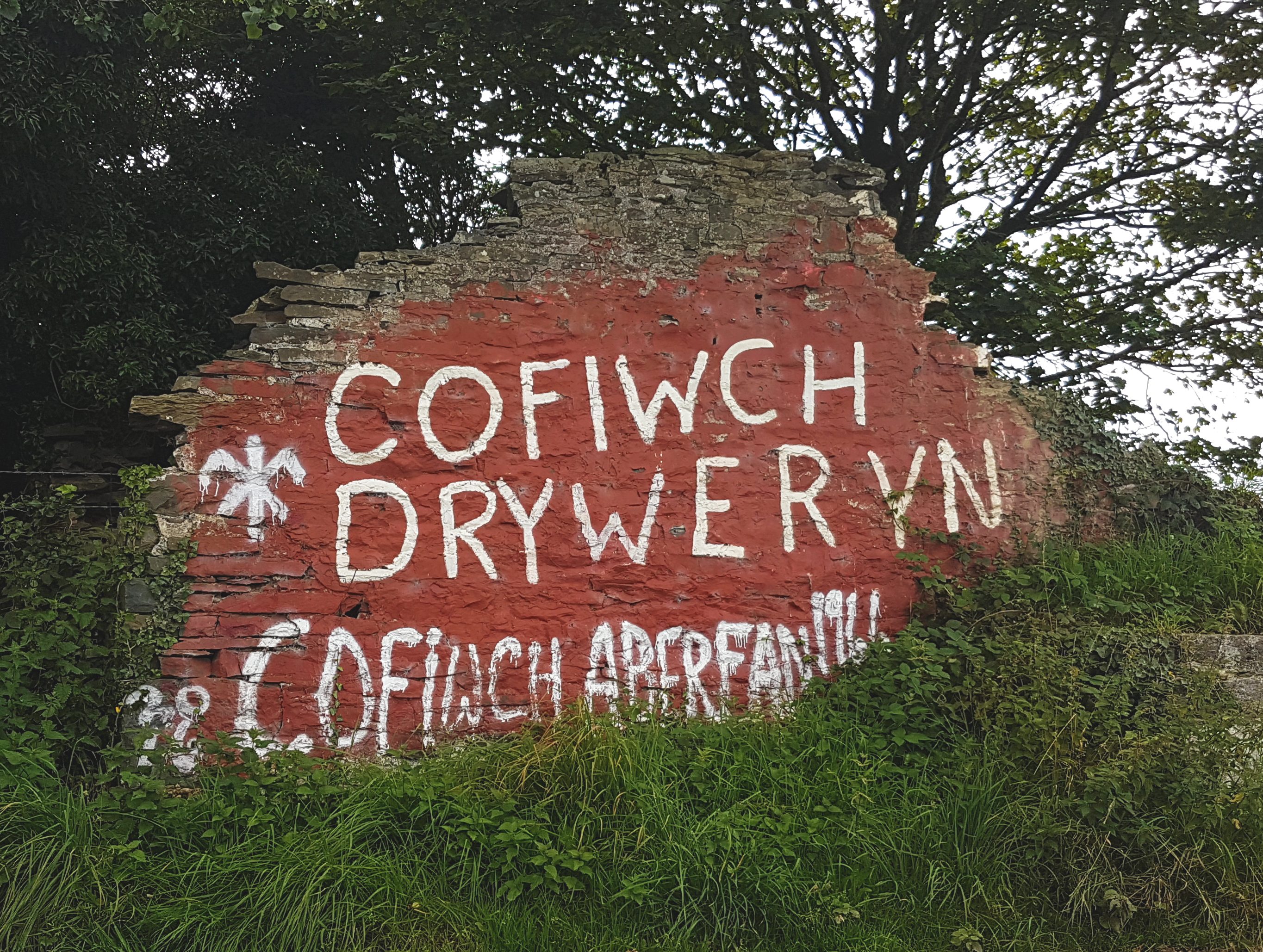
Cofiwch Dryweryn

Cofiwch Dryweryn (English: "Remember Tryweryn") is a graffitied stone wall near Llanrhystud, Ceredigion, Wales. Author and journalist Meic Stephens originally...

Blaenplwyf transmitting station

The Blaenplwyf transmitting station (sometimes written "Blaen Plwyf" or "Blaen-Plwyf") is a broadcasting and telecommunications facility located near the...

Llangwyryfon

Llangwyryfon is a village and community in the county of Ceredigion, Wales. It lies on the B4576 about 8 miles to the south and east of Aberystwyth. The...

Blaenplwyf

Blaenplwyf (Pontllanio previously) is a village in Ceredigion, to the southwest of Aberystwyth. It is noted for the Blaenplwyf transmitting station, which...

Gaer Penrhôs

Gaer Penrhôs, in Ceredigion, Wales, was a ringwork castle at the summit of a steep hill near the village of Llanrhystud; now all that remains are the outlines...
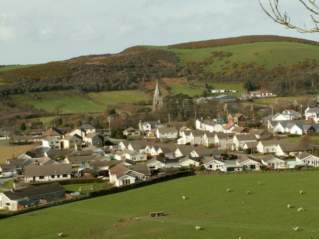
Llanrhystud

Llanrhystud is a seaside village and electoral division on the A487 road in the county of Ceredigion, in Wales, 9 miles (14 km) south of Aberystwyth, and...

Chancery, Ceredigion

Chancery (Welsh: Rhydgaled) is a hamlet in Llanfarian community, in the district county of Ceredigion, Mid-Wales, south of the administrative centre Aberystwyth...

Nearby Amenities

Located within 500m of 52.331048,-4.098291
Place: farm
Lat/Long: 52.3304213/-4.0949168
Place: farm
Lat/Long: 52.3292936/-4.1012683
Access: no
Barrier: stile
Foot: yes
Material: wood
Stile: stepover
Lat/Long: 52.329175/-4.1048865
Direction: 190
Generator Method: photovoltaic
Generator Output Electricity: yes
Generator Solar Modules: 12
Generator Source: solar
Generator Type: solar_photovoltaic_panel
Location: roof
Power: generator
Lat/Long: 52.3305498/-4.0949741
The data included in this document is from www.openstreetmap.org. The data is made available under ODbL.

Have you been to Allt Pen-lan-goch?

Leave your review of Allt Pen-lan-goch below (or comments, questions and feedback).