Burnhead

Settlement in Kincardineshire

Scotland

Burnhead

Former Cookney parish kirk Built 1885 in fake Gothic style and C-listed (LB9358): <span class="nowrap"><a title="http://portal.historicenvironment.scot/designation/LB9358" rel="nofollow ugc noopener" href="http://portal.historicenvironment.scot/designation/LB9358">Link</a><img style="margin-left:2px;" alt="External link" title="External link - shift click to open in new window" src="https://s1.geograph.org.uk/img/external.png" width="10" height="10"/></span> .  Now occupied by an environmental consulting firm.
Former Cookney parish kirk Credit: Bill Harrison

Burnhead is a small rural village located in the picturesque region of Kincardineshire, Scotland. Situated in the northeast part of the country, the village is nestled amidst stunning natural landscapes and offers a peaceful and tranquil setting for its residents.

With a population of just over 200 people, Burnhead is known for its close-knit community and friendly atmosphere. The village is characterized by its charming old stone cottages and traditional architecture, which adds to its rustic and quaint appeal. The surrounding area boasts rolling hills, lush green fields, and meandering streams, providing a beautiful backdrop to the village.

Despite its small size, Burnhead offers some amenities to cater to the needs of its residents. There is a local village hall that serves as a gathering place for community events and social activities. Additionally, the village has a primary school, ensuring that the educational needs of its younger population are met.

For outdoor enthusiasts, Burnhead is a fantastic location. The surrounding countryside provides ample opportunities for walking, hiking, and cycling, allowing residents to explore and enjoy the stunning natural beauty of the area. The nearby River Dee is also popular for fishing, attracting anglers from far and wide.

While Burnhead may be a peaceful retreat away from the hustle and bustle of larger towns and cities, it is within easy reach of major urban centers. The city of Aberdeen is approximately 25 miles away, offering a range of amenities including shopping, entertainment, and employment opportunities.

In conclusion, Burnhead is a charming rural village in Kincardineshire that offers a tight-knit community, stunning natural landscapes, and a peaceful way of life. It is an idyllic haven for those seeking a slower pace of life and a deep connection with nature.

If you have any feedback on the listing, please let us know in the comments section below.
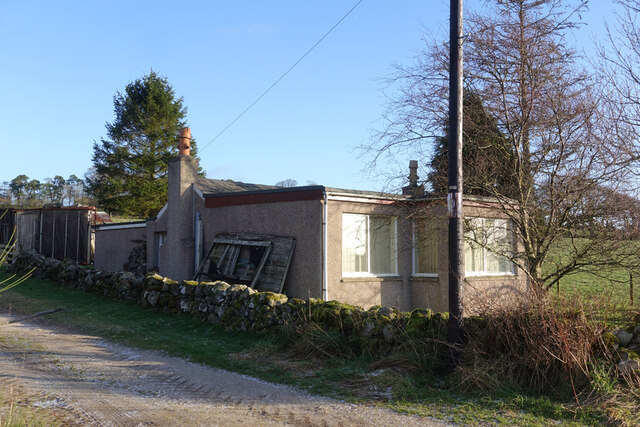
Burnhead Images

Images are sourced within 2km of 57.027895/-2.2322562 or Grid Reference NO8693. Thanks to Geograph Open Source API. All images are credited.

Former Cookney parish kirk Built 1885 in fake Gothic style and C-listed (LB9358): <span class="nowrap"><a title="http://portal.historicenvironment.scot/designation/LB9358" rel="nofollow ugc noopener" href="http://portal.historicenvironment.scot/designation/LB9358">Link</a><img style="margin-left:2px;" alt="External link" title="External link - shift click to open in new window" src="https://s1.geograph.org.uk/img/external.png" width="10" height="10"/></span> .  Now occupied by an environmental consulting firm.
Former Cookney parish kirk
Built 1885 in fake Gothic style and C-listed (LB9358): LinkExternal link . Now occupied by an environmental consulting firm.
Cookney war memorial
B979 past Allochie Croft Heading towards Stonehaven. The new Aberdeen Western Bypass is just out of shot left.
B979 past Allochie Croft
Heading towards Stonehaven. The new Aberdeen Western Bypass is just out of shot left.
Track towards Allochie Farm From its junction with the B979, south of Netherley.
Track towards Allochie Farm
From its junction with the B979, south of Netherley.
Access to a new house at Woodend, Netherley Off the west side of B979.
Access to a new house at Woodend, Netherley
Off the west side of B979.
Field by B979 With a view to the hamlet of Hilton in NO8692.
Field by B979
With a view to the hamlet of Hilton in NO8692.
View over the upper Burn of Muchalls From B979, towards Cookney hill, on left skyline.
View over the upper Burn of Muchalls
From B979, towards Cookney hill, on left skyline.
The A90 at Cookney The A90, Aberdeen Western Peripheral Route (AWPR), at Cookney
The A90 at Cookney
The A90, Aberdeen Western Peripheral Route (AWPR), at Cookney
A90 at Elrick The A90, Aberdeen Western Peripheral Route (AWPR), at Elrick
A90 at Elrick
The A90, Aberdeen Western Peripheral Route (AWPR), at Elrick
Access to Mains of Netherley
B979 road through Netherley
Balnagub Balnagub is well protected by a clump of mature trees.
Balnagub
Balnagub is well protected by a clump of mature trees.
Moss-side The cottage at Mosside seems to have had a large extension added.
Moss-side
The cottage at Mosside seems to have had a large extension added.
Rocky Outcrops I can't make up my mind whether the rocky features in the field are outcops, erratics, dykes or field boulders.
Rocky Outcrops
I can't make up my mind whether the rocky features in the field are outcops, erratics, dykes or field boulders.
Icy Track The track between Lairhillock and Cookney is mostly frozen, but the ice has been shsttered by tractors and horses' hooves.
Icy Track
The track between Lairhillock and Cookney is mostly frozen, but the ice has been shsttered by tractors and horses' hooves.
Red Moss Willows and rushes, as well as Moss in the place name, tell me that this is boggy ground.
Red Moss
Willows and rushes, as well as Moss in the place name, tell me that this is boggy ground.
Mud by the Gate The gate is the access to some small fields on the fringe of <a href="https://www.geograph.org.uk/photo/7062136">NO8694 : Red Moss</a>. The fields themselves are evidently fairly damp, judging by the clumps of rushes.
Mud by the Gate
The gate is the access to some small fields on the fringe of NO8694 : Red Moss. The fields themselves are evidently fairly damp, judging by the clumps of rushes.
Open Field There is no gate at either end of the track across this long strip of field. However it is next to Cookney Stables and could no doubt be secured for horses by temporary electric fences.
Open Field
There is no gate at either end of the track across this long strip of field. However it is next to Cookney Stables and could no doubt be secured for horses by temporary electric fences.
Show me another place!

Burnhead is located at Grid Ref: NO8693 (Lat: 57.027895, Lng: -2.2322562)

Unitary Authority: Aberdeenshire

Police Authority: North East

What 3 Words

///ombudsman.satin.spilling. Near Newtonhill, Aberdeenshire

Nearby Locations

Burnhead Red Moss

Related Wikis

Netherley, Aberdeenshire

Netherley, Scotland is a village in Aberdeenshire, situated approximately five miles northwest of Stonehaven. Netherley is located in the Mounth area...

Red Moss, Aberdeenshire

Red Moss is a wetland bog in Aberdeenshire, Scotland, located at the northwestern edge of the village of Netherley. (Grid Reference NO 955 856) The moss...
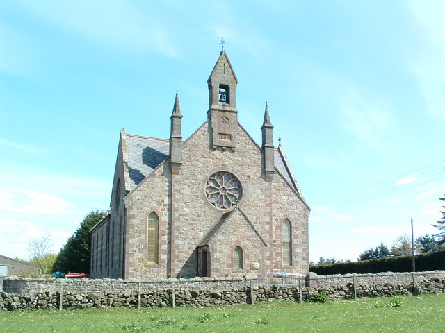
Cookney Church

Cookney Parish Church, now business premises within a converted listed building, was a Christian place of worship in the village of Cookney, Aberdeenshire...

Netherley House

Netherley House is a mansion built by Alexander Silver in the late 18th century in Netherley, Aberdeenshire, Scotland. It is situated near the northerly...

Nearby Amenities

Located within 500m of 57.027895,-2.2322562
Power: pole
Lat/Long: 57.0288738/-2.2243769
Power: pole
Lat/Long: 57.0283227/-2.2255122
Power: pole
Lat/Long: 57.0277557/-2.2266954
Power: pole
Lat/Long: 57.0272091/-2.227835
Power: pole
Lat/Long: 57.0272272/-2.229014
Power: pole
Lat/Long: 57.0272295/-2.230166
Power: pole
Lat/Long: 57.0272442/-2.2313118
Power: pole
Lat/Long: 57.0270422/-2.2328028
Power: pole
Lat/Long: 57.0268441/-2.2342116
Power: pole
Lat/Long: 57.0266597/-2.2355549
Power: pole
Lat/Long: 57.0264729/-2.2368983
Power: pole
Lat/Long: 57.0264593/-2.2382977
Power: pole
Lat/Long: 57.0264514/-2.2398781
Power: pole
Lat/Long: 57.031076/-2.2265624
Power: pole
Lat/Long: 57.0307976/-2.2273609
Power: pole
Lat/Long: 57.0277574/-2.2241884
Power: pole
Lat/Long: 57.0281833/-2.2250071
Power: pole
Lat/Long: 57.0286843/-2.2259658
Power: pole
Lat/Long: 57.0293029/-2.2266784
The data included in this document is from www.openstreetmap.org. The data is made available under ODbL.

Have you been to Burnhead?

Leave your review of Burnhead below (or comments, questions and feedback).