Coed Rhos-fawr

Wood, Forest in Caernarfonshire

Wales

Coed Rhos-fawr

Llanddeiniolen, Gwynedd Sheep grazing on pasture land to the east of Llanddeiniolen and to the south of Snowdonia, which can be seen in the distance.
Llanddeiniolen, Gwynedd Credit: Rebecca A Wills

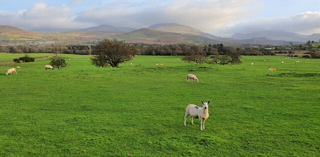
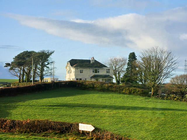
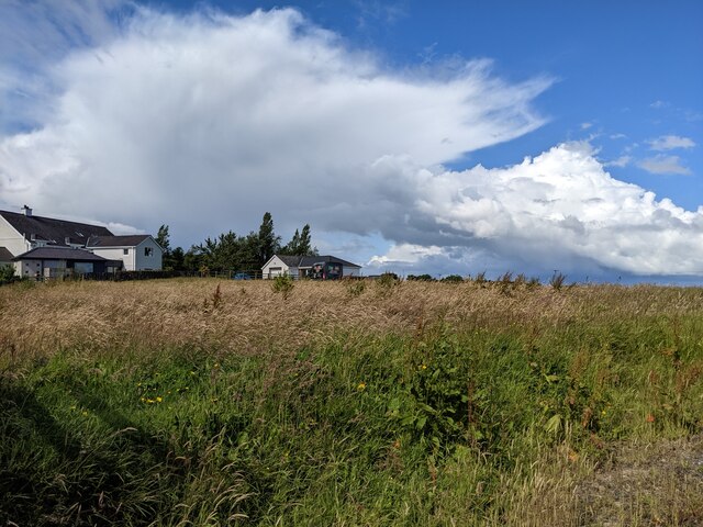
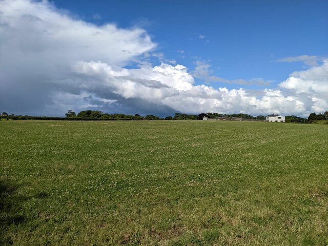
Coed Rhos-fawr is a picturesque woodland located in Caernarfonshire, Wales. Covering an area of approximately 100 acres, it is a haven for nature enthusiasts and hikers alike. The name "Coed Rhos-fawr" translates to "Wood, Forest" in English, which aptly describes its abundant tree population.

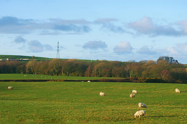
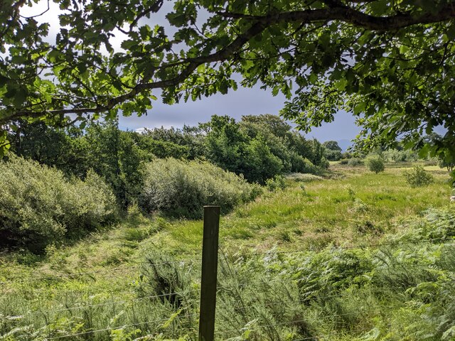
The woodland features a diverse range of tree species, including oak, beech, birch, and pine, creating a rich and vibrant ecosystem. These trees provide a vital habitat for numerous bird species, such as woodpeckers, tits, and finches, as well as a variety of small mammals, including squirrels and rabbits.

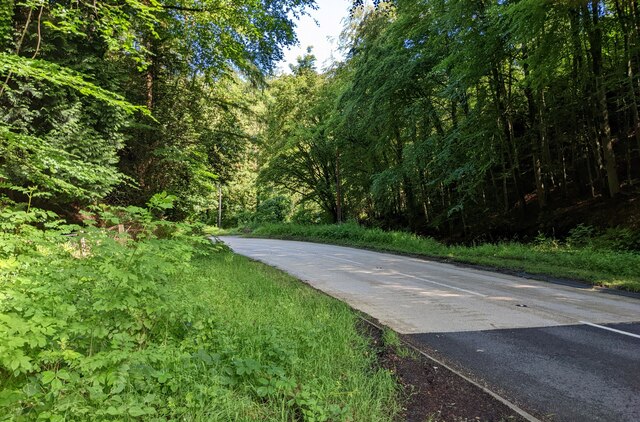
Visitors to Coed Rhos-fawr can enjoy a network of well-maintained trails that wind through the woodland, allowing for leisurely walks and exploration. The paths are surrounded by lush vegetation, wildflowers, and ferns, creating a serene and tranquil ambiance.

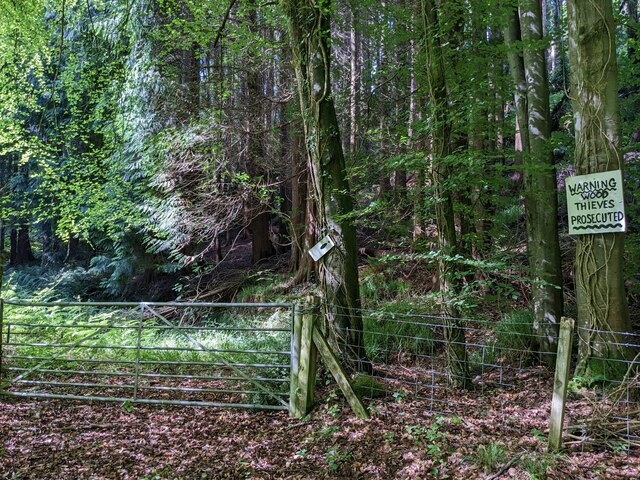
Aside from its natural beauty, Coed Rhos-fawr also holds historical significance. The woodland is believed to have been part of an ancient Welsh estate and has remnants of old stone walls and ruins scattered throughout, offering glimpses into its past.

Coed Rhos-fawr is a popular destination for outdoor activities, such as birdwatching, photography, and picnicking. Its proximity to nearby towns and villages makes it easily accessible for both locals and tourists looking to escape the hustle and bustle of city life and immerse themselves in the beauty of nature.

If you have any feedback on the listing, please let us know in the comments section below.

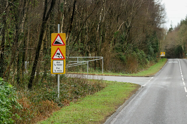
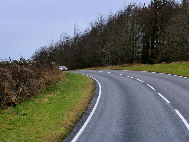
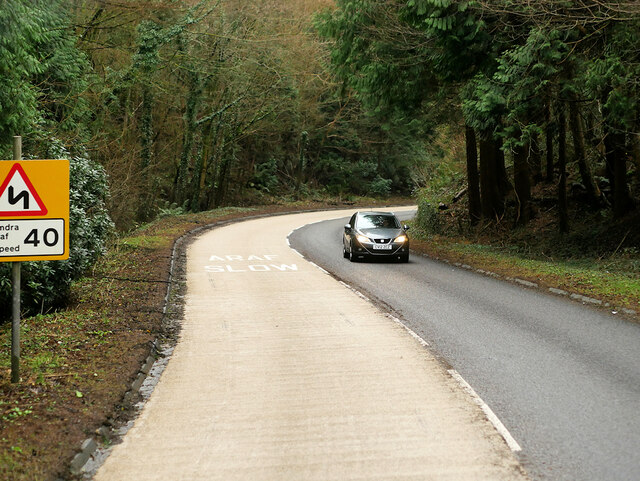
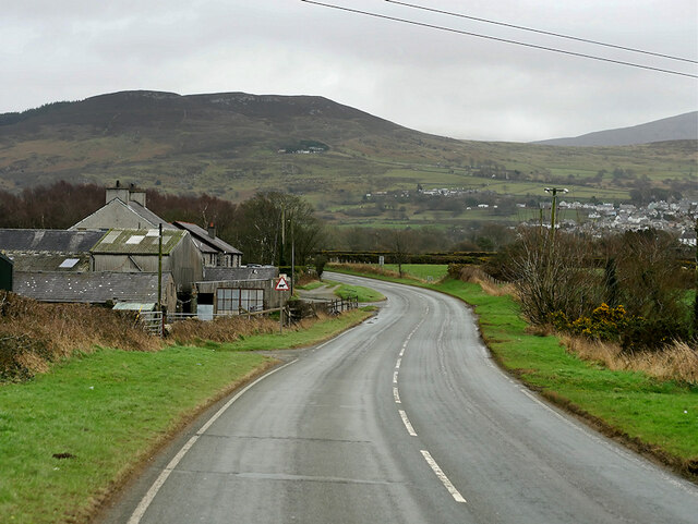
Coed Rhos-fawr Images

Images are sourced within 2km of 53.189924/-4.1558262 or Grid Reference SH5668. Thanks to Geograph Open Source API. All images are credited.

Llanddeiniolen, Gwynedd Sheep grazing on pasture land to the east of Llanddeiniolen and to the south of Snowdonia, which can be seen in the distance.
Llanddeiniolen, Gwynedd
Sheep grazing on pasture land to the east of Llanddeiniolen and to the south of Snowdonia, which can be seen in the distance.
A typical road bridge over the A55, near Bangor An Eastbound view, showing the snow-covered mountains of Snowdonia ahead. This section of the A55 makes up the Bangor Bypass and opened in 1983.
A typical road bridge over the A55, near Bangor
An Eastbound view, showing the snow-covered mountains of Snowdonia ahead. This section of the A55 makes up the Bangor Bypass and opened in 1983.
Service Bus on the A4244 Gwynfor Coaches Alexander Dennis Enviro 200 Dart, YX11 AEJ on route number 85 towards Bangor. (A4244, Ynys lago bus stop).
Service Bus on the A4244
Gwynfor Coaches Alexander Dennis Enviro 200 Dart, YX11 AEJ on route number 85 towards Bangor. (A4244, Ynys lago bus stop).
Tractor passing Ty Mawr Cottage
B4547 near Tyddyn-Forgan
B4547 near Coed Ty'n-llwyn
Bends on the B4547
Bends on the B4547
A4244, Glanrhyd
A4244, Glanrhyd
Large House near to Pentir
Sheep Grazing near to Pentir
A4244, Pentir The A4244 is a relatively short (6½ miles) rural A-road in north Caernarfonshire. It connects the A5/A55 (near the Llys-y-gwynt junction) with the A4086 at Brynrefail, just outside Llanberis.
A4244, Pentir
The A4244 is a relatively short (6½ miles) rural A-road in north Caernarfonshire. It connects the A5/A55 (near the Llys-y-gwynt junction) with the A4086 at Brynrefail, just outside Llanberis.
Eddie Stobart truck, Bangor
Eddie Stobart tanker, Bangor kathleen Amy H5953 PF19 WDK
Eddie Stobart tanker, Bangor
kathleen Amy H5953 PF19 WDK
Vegetation and trees by the B4547
A warning sign in Coed Nant-y-garth "Thieves will be prosecuted" has been amended to specify that this means 'wood' thieves will be prosecuted. It looks like there isn't much else to steal - maybe the gate?
A warning sign in Coed Nant-y-garth
"Thieves will be prosecuted" has been amended to specify that this means 'wood' thieves will be prosecuted. It looks like there isn't much else to steal - maybe the gate?
Rough ground and bushes near Garth Farm
Housing near Garth Farm
A large field near Fodol Newydd
Show me another place!

Coed Rhos-fawr is located at Grid Ref: SH5668 (Lat: 53.189924, Lng: -4.1558262)

Unitary Authority: Gwynedd

Police Authority: North Wales

What 3 Words

///lands.economics.linen. Near Y Felinheli, Gwynedd

Nearby Locations

Coed Rhos-fawr

Related Wikis

Pentir

Pentir is a community and electoral ward in the county of Gwynedd, Wales, and is 124 miles (199.9 km) from Cardiff and 205 miles (329.4 km) from London...

Aber Dinlle Fault

The Aber Dinlle Fault is a SW-NE trending fault in North Wales. It forms part of the Menai Strait Fault System, with the Berw and Dinorwic Faults. It lies...
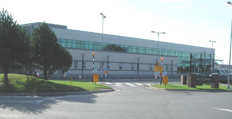
Ysbyty Gwynedd

Ysbyty Gwynedd (English: Gwynedd Hospital) is a district general hospital in Bangor, Gwynedd, Wales. It is managed by Betsi Cadwaladr University Health...

Llanddeiniolen

Llanddeiniolen (Welsh: [ɬanðɛinɪˈɔlɛn]; ) is the name of a community area, in the county of Gwynedd, Wales, and is 124 miles (200 km) from Cardiff and...
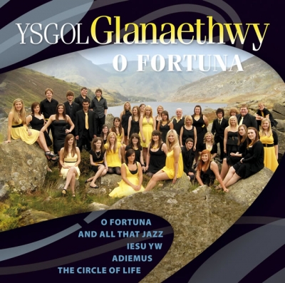
Ysgol Glanaethwy

Ysgol Glanaethwy is a drama school in Bangor, Gwynedd, Wales. It is known in particular for its choir, Côr Glanaethwy. == History == Ysgol Glanaethwy was...

Y Felinheli F.C.

Clwb Pêl Droed Y Felinheli (English: Y Felinheli Football Club) is a Welsh football team based in the village of Y Felinheli (formerly known in English...

Glasinfryn

Glasinfryn is a small village in Gwynedd, Wales. It is situated between the village of Tregarth and the city of Bangor, Gwynedd, and in the community of...

Treborth railway station

Treborth railway station was a railway station located on the Bangor and Carnarvon Railway, about half a mile south of the Britannia Bridge, Caernarfonshire...

Nearby Amenities

Located within 500m of 53.189924,-4.1558262
Power: tower
Lat/Long: 53.188582/-4.1569843
Power: tower
Lat/Long: 53.1916752/-4.159074
Power: tower
Lat/Long: 53.1885534/-4.1525351
Power: tower
Lat/Long: 53.1891004/-4.1485681
Power: tower
Lat/Long: 53.1880512/-4.1559768
Power: tower
Lat/Long: 53.1898785/-4.1579207
Power: tower
Lat/Long: 53.1869767/-4.157516
Power: tower
Lat/Long: 53.1863617/-4.1580054
Power: tower
Lat/Long: 53.191187/-4.15074
Power: switch
Voltage: 400000
Lat/Long: 53.1881747/-4.1593016
Frequency: 50
Power: transformer
Voltage-high: 400000
Voltage-low: 132000
Lat/Long: 53.1870446/-4.1582657
Power: switch
Voltage: 400000
Lat/Long: 53.1878994/-4.1588478
Frequency: 50
Power: transformer
Voltage-high: 400000
Voltage-low: 132000
Lat/Long: 53.1876069/-4.1593171
Frequency: 50
Power: transformer
Voltage-high: 400000
Voltage-low: 132000
Lat/Long: 53.1882048/-4.1598267
Power: switch
Voltage: 400000
Lat/Long: 53.1873451/-4.1578041
Power: terminal
Lat/Long: 53.1866733/-4.1573677
Power: pole
Lat/Long: 53.1855823/-4.1570866
The data included in this document is from www.openstreetmap.org. The data is made available under ODbL.

Have you been to Coed Rhos-fawr?

Leave your review of Coed Rhos-fawr below (or comments, questions and feedback).