Allt-wen

Wood, Forest in Caernarfonshire

Wales

Allt-wen

Llyn Du
Llyn Du Credit: Chris Andrews

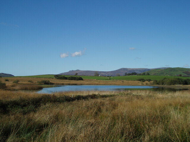
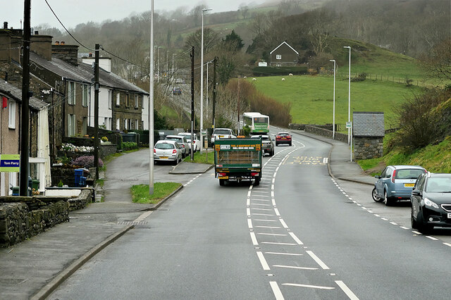
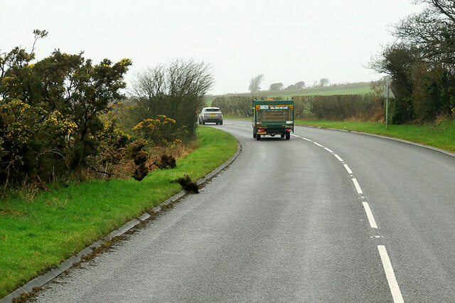
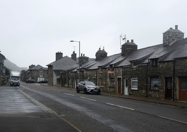
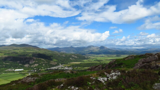
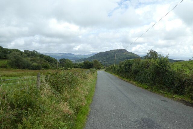
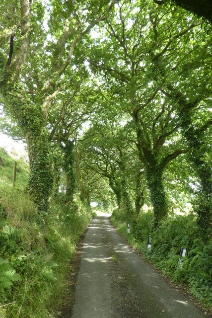
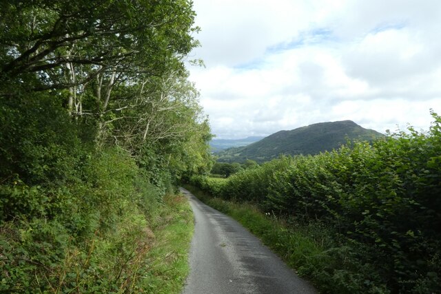
Allt-wen, located in Caernarfonshire, is a small village nestled in the picturesque countryside of North Wales. The name Allt-wen translates to "Wood" or "Forest" in English, which aptly describes the area's abundant natural beauty. Surrounded by rolling hills, lush green meadows, and dense woodlands, Allt-wen is a haven for nature enthusiasts and outdoor adventurers.

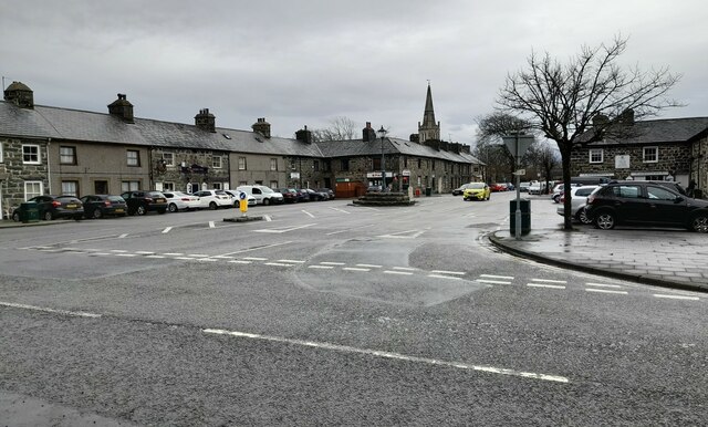
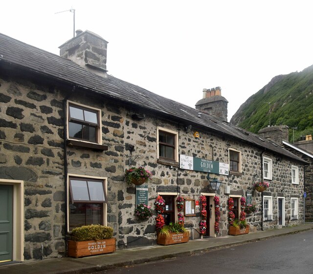
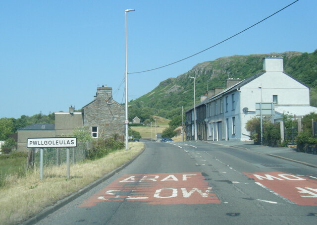
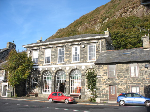
The village itself is home to a close-knit community, with a population of around 500 residents. It offers a peaceful and tranquil atmosphere, making it an ideal place for those seeking a retreat from the hustle and bustle of city life. The architecture in Allt-wen reflects its traditional heritage, with charming stone cottages and farmhouses dotting the landscape.

Despite its small size, Allt-wen boasts a few local amenities that cater to the needs of its residents. The village has a cozy pub, where locals gather to socialize and enjoy a pint. There is also a village hall, which hosts various community events and gatherings throughout the year.

One of the main attractions in Allt-wen is its natural surroundings. The village is surrounded by vast woodlands that offer ample opportunities for hiking, cycling, and wildlife spotting. The nearby hills provide breathtaking panoramic views of the surrounding countryside, making it a popular spot for nature lovers and photographers.

Overall, Allt-wen is a tranquil and picturesque village, offering a chance to connect with nature and experience the beauty of rural Wales.

If you have any feedback on the listing, please let us know in the comments section below.

Allt-wen Images

Images are sourced within 2km of 52.944039/-4.1535784 or Grid Reference SH5540. Thanks to Geograph Open Source API. All images are credited.

St Beuno's Church, Penmorfa
Medieval Stained Glass, St Beuno's Church, Penmorfa
Tremadog Market Square, Tremadog.
Tremadog
Market Square, Tremadog.
A487, Tremadog Roundabout The A487 is one of the most important roads in Wales. It covers the majority of the west coast from St Davids to Menai Bridge, and is a primary route for most of its length, including a section where it multiplexes with the A470, another important north-south road. Along the way, it runs through two national parks: Snowdonia and Pembrokeshire Coast. Despite its length and importance, it is predominantly single carriageway, although the road has been upgraded in numerous places. It is 174 miles long.
<span class="nowrap"><a title="http://www.sabre-roads.org.uk/wiki/index.php?title=A487" rel="nofollow ugc noopener" href="http://www.sabre-roads.org.uk/wiki/index.php?title=A487">Link</a><img style="margin-left:2px;" alt="External link" title="External link - shift click to open in new window" src="https://s1.geograph.org.uk/img/external.png" width="10" height="10"/></span>
A487, Tremadog Roundabout
The A487 is one of the most important roads in Wales. It covers the majority of the west coast from St Davids to Menai Bridge, and is a primary route for most of its length, including a section where it multiplexes with the A470, another important north-south road. Along the way, it runs through two national parks: Snowdonia and Pembrokeshire Coast. Despite its length and importance, it is predominantly single carriageway, although the road has been upgraded in numerous places. It is 174 miles long. LinkExternal link
A487, Pwllgoleulas The A487 is one of the most important roads in Wales. It covers the majority of the west coast from St Davids to Menai Bridge, and is a primary route for most of its length, including a section where it multiplexes with the A470, another important north-south road. Along the way, it runs through two national parks: Snowdonia and Pembrokeshire Coast. Despite its length and importance, it is predominantly single carriageway, although the road has been upgraded in numerous places. It is 174 miles long.
<span class="nowrap"><a title="http://www.sabre-roads.org.uk/wiki/index.php?title=A487" rel="nofollow ugc noopener" href="http://www.sabre-roads.org.uk/wiki/index.php?title=A487">Link</a><img style="margin-left:2px;" alt="External link" title="External link - shift click to open in new window" src="https://s1.geograph.org.uk/img/external.png" width="10" height="10"/></span>
A487, Pwllgoleulas
The A487 is one of the most important roads in Wales. It covers the majority of the west coast from St Davids to Menai Bridge, and is a primary route for most of its length, including a section where it multiplexes with the A470, another important north-south road. Along the way, it runs through two national parks: Snowdonia and Pembrokeshire Coast. Despite its length and importance, it is predominantly single carriageway, although the road has been upgraded in numerous places. It is 174 miles long. LinkExternal link
Pwllgoleulas The A487 is one of the most important roads in Wales. It covers the majority of the west coast from St Davids to Menai Bridge, and is a primary route for most of its length, including a section where it multiplexes with the A470, another important north-south road. Along the way, it runs through two national parks: Snowdonia and Pembrokeshire Coast. Despite its length and importance, it is predominantly single carriageway, although the road has been upgraded in numerous places. It is 174 miles long.
<span class="nowrap"><a title="http://www.sabre-roads.org.uk/wiki/index.php?title=A487" rel="nofollow ugc noopener" href="http://www.sabre-roads.org.uk/wiki/index.php?title=A487">Link</a><img style="margin-left:2px;" alt="External link" title="External link - shift click to open in new window" src="https://s1.geograph.org.uk/img/external.png" width="10" height="10"/></span>
Pwllgoleulas
The A487 is one of the most important roads in Wales. It covers the majority of the west coast from St Davids to Menai Bridge, and is a primary route for most of its length, including a section where it multiplexes with the A470, another important north-south road. Along the way, it runs through two national parks: Snowdonia and Pembrokeshire Coast. Despite its length and importance, it is predominantly single carriageway, although the road has been upgraded in numerous places. It is 174 miles long. LinkExternal link
Volvo Truck on the A487 near Penmorfa The A487 is one of the most important roads in Wales. It covers the majority of the west coast from St Davids to Menai Bridge, and is a primary route for most of its length, including a section where it multiplexes with the A470, another important north-south road. Along the way, it runs through two national parks: Snowdonia and Pembrokeshire Coast. Despite its length and importance, it is predominantly single carriageway, although the road has been upgraded in numerous places. It is 174 miles long.
<span class="nowrap"><a title="http://www.sabre-roads.org.uk/wiki/index.php?title=A487" rel="nofollow ugc noopener" href="http://www.sabre-roads.org.uk/wiki/index.php?title=A487">Link</a><img style="margin-left:2px;" alt="External link" title="External link - shift click to open in new window" src="https://s1.geograph.org.uk/img/external.png" width="10" height="10"/></span>
Volvo Truck on the A487 near Penmorfa
The A487 is one of the most important roads in Wales. It covers the majority of the west coast from St Davids to Menai Bridge, and is a primary route for most of its length, including a section where it multiplexes with the A470, another important north-south road. Along the way, it runs through two national parks: Snowdonia and Pembrokeshire Coast. Despite its length and importance, it is predominantly single carriageway, although the road has been upgraded in numerous places. It is 174 miles long. LinkExternal link
A487, Penmorfa The A487 is one of the most important roads in Wales. It covers the majority of the west coast from St Davids to Menai Bridge, and is a primary route for most of its length, including a section where it multiplexes with the A470, another important north-south road. Along the way, it runs through two national parks: Snowdonia and Pembrokeshire Coast. Despite its length and importance, it is predominantly single carriageway, although the road has been upgraded in numerous places. It is 174 miles long.
<span class="nowrap"><a title="http://www.sabre-roads.org.uk/wiki/index.php?title=A487" rel="nofollow ugc noopener" href="http://www.sabre-roads.org.uk/wiki/index.php?title=A487">Link</a><img style="margin-left:2px;" alt="External link" title="External link - shift click to open in new window" src="https://s1.geograph.org.uk/img/external.png" width="10" height="10"/></span>
A487, Penmorfa
The A487 is one of the most important roads in Wales. It covers the majority of the west coast from St Davids to Menai Bridge, and is a primary route for most of its length, including a section where it multiplexes with the A470, another important north-south road. Along the way, it runs through two national parks: Snowdonia and Pembrokeshire Coast. Despite its length and importance, it is predominantly single carriageway, although the road has been upgraded in numerous places. It is 174 miles long. LinkExternal link
A487 west of Penmorfa The A487 is one of the most important roads in Wales. It covers the majority of the west coast from St Davids to Menai Bridge, and is a primary route for most of its length, including a section where it multiplexes with the A470, another important north-south road. Along the way, it runs through two national parks: Snowdonia and Pembrokeshire Coast. Despite its length and importance, it is predominantly single carriageway, although the road has been upgraded in numerous places. It is 174 miles long.
<span class="nowrap"><a title="http://www.sabre-roads.org.uk/wiki/index.php?title=A487" rel="nofollow ugc noopener" href="http://www.sabre-roads.org.uk/wiki/index.php?title=A487">Link</a><img style="margin-left:2px;" alt="External link" title="External link - shift click to open in new window" src="https://s1.geograph.org.uk/img/external.png" width="10" height="10"/></span>
A487 west of Penmorfa
The A487 is one of the most important roads in Wales. It covers the majority of the west coast from St Davids to Menai Bridge, and is a primary route for most of its length, including a section where it multiplexes with the A470, another important north-south road. Along the way, it runs through two national parks: Snowdonia and Pembrokeshire Coast. Despite its length and importance, it is predominantly single carriageway, although the road has been upgraded in numerous places. It is 174 miles long. LinkExternal link
Study in grey (Dublin Street, Tremadog) An exceptionally grey day even for the vicinity and I have lightened the photo as much as I dare. Each house in the terrace has a separate Cadw grade-II listing, with No. 15 as an example (85316 <span class="nowrap"><a title="https://cadwpublic-api.azurewebsites.net/reports/listedbuilding/FullReport?lang=&id=85316" rel="nofollow ugc noopener" href="https://cadwpublic-api.azurewebsites.net/reports/listedbuilding/FullReport?lang=&id=85316">Link</a><img style="margin-left:2px;" alt="External link" title="External link - shift click to open in new window" src="https://s1.geograph.org.uk/img/external.png" width="10" height="10"/></span> ), which notes that the terrace is probably the earliest surviving structure in Tremadog. Note the 'raked half dormer' roofs and huge chimney breasts.  The name Dublin Street refers to the hope in the early 19th Century that this would be on the route to Dublin (via Porth Dinllaen) although Holyhead eventually took that prize.
Study in grey (Dublin Street, Tremadog)
An exceptionally grey day even for the vicinity and I have lightened the photo as much as I dare. Each house in the terrace has a separate Cadw grade-II listing, with No. 15 as an example (85316 LinkExternal link ), which notes that the terrace is probably the earliest surviving structure in Tremadog. Note the 'raked half dormer' roofs and huge chimney breasts. The name Dublin Street refers to the hope in the early 19th Century that this would be on the route to Dublin (via Porth Dinllaen) although Holyhead eventually took that prize.
The Golden Fleece Inn, Tremadog Compare the same building taken in bright sunshine... <a title="https://www.geograph.org.uk/photo/5627105" href="https://www.geograph.org.uk/photo/5627105">Link</a> .   The inn was built ca. 1810 and is grade-II listed by Cadw: 85353 <span class="nowrap"><a title="https://cadwpublic-api.azurewebsites.net/reports/listedbuilding/FullReport?lang=&id=85353" rel="nofollow ugc noopener" href="https://cadwpublic-api.azurewebsites.net/reports/listedbuilding/FullReport?lang=&id=85353">Link</a><img style="margin-left:2px;" alt="External link" title="External link - shift click to open in new window" src="https://s1.geograph.org.uk/img/external.png" width="10" height="10"/></span> .
The Golden Fleece Inn, Tremadog
Compare the same building taken in bright sunshine... Link . The inn was built ca. 1810 and is grade-II listed by Cadw: 85353 LinkExternal link .
On Moel-y-Gest - view to Tremadog, Cnicht & Moelwyn Mawr
A487 at Pwllgoleulas village boundary
A487 west of Penmorfa
Road descending to the A487 A minor road descending to meet the A487 to the west of Porthmadog.
Road descending to the A487
A minor road descending to meet the A487 to the west of Porthmadog.
Tree lined lane towards Penmorfa A minor road running between Golan and Penmorfa. The lane forms part of National Cycle Network route 8.
Tree lined lane towards Penmorfa
A minor road running between Golan and Penmorfa. The lane forms part of National Cycle Network route 8.
Lane near Llwyn Derw A minor road running between Golan and Penmorfa. The lane forms part of National Cycle Network route 8.
Lane near Llwyn Derw
A minor road running between Golan and Penmorfa. The lane forms part of National Cycle Network route 8.
Show me another place!

Allt-wen is located at Grid Ref: SH5540 (Lat: 52.944039, Lng: -4.1535784)

Unitary Authority: Gwynedd

Police Authority: North Wales

What 3 Words

///small.boost.glossed. Near Porthmadog, Gwynedd

Nearby Locations

Allt-wen

Related Wikis

Ysbyty Alltwen

Ysbyty Alltwen (English: Alltwen Hospital) is a health facility in Tremadog, Gwynedd, Wales. It is managed by the Betsi Cadwaladr University Health Board...

Coed Tremadog National Nature Reserve

Coed Tremadog National Nature Reserve is located near Porthmadog, Gwynedd, Wales. Its most striking features are huge volcanic cliffs which drop down to...

Tremadog Town Hall

Tremadog Town Hall (Welsh: Neuadd y Dref Tremadog) is a municipal building on Stryd Fawr, in Tremadog, Gwynedd, Wales. The structure, which was most recently...

Tremadog

Tremadog (formerly Tremadoc) is a village in the community of Porthmadog, in Gwynedd, north west Wales; about one mile (1.6 km) north of Porthmadog town...

St Beuno's Church, Penmorfa

St Beuno's Church, Penmorfa, is a redundant church near the settlement of Penmorfa, some 2 miles (3 km) to the northwest of Porthmadog, Gwynedd, Wales...
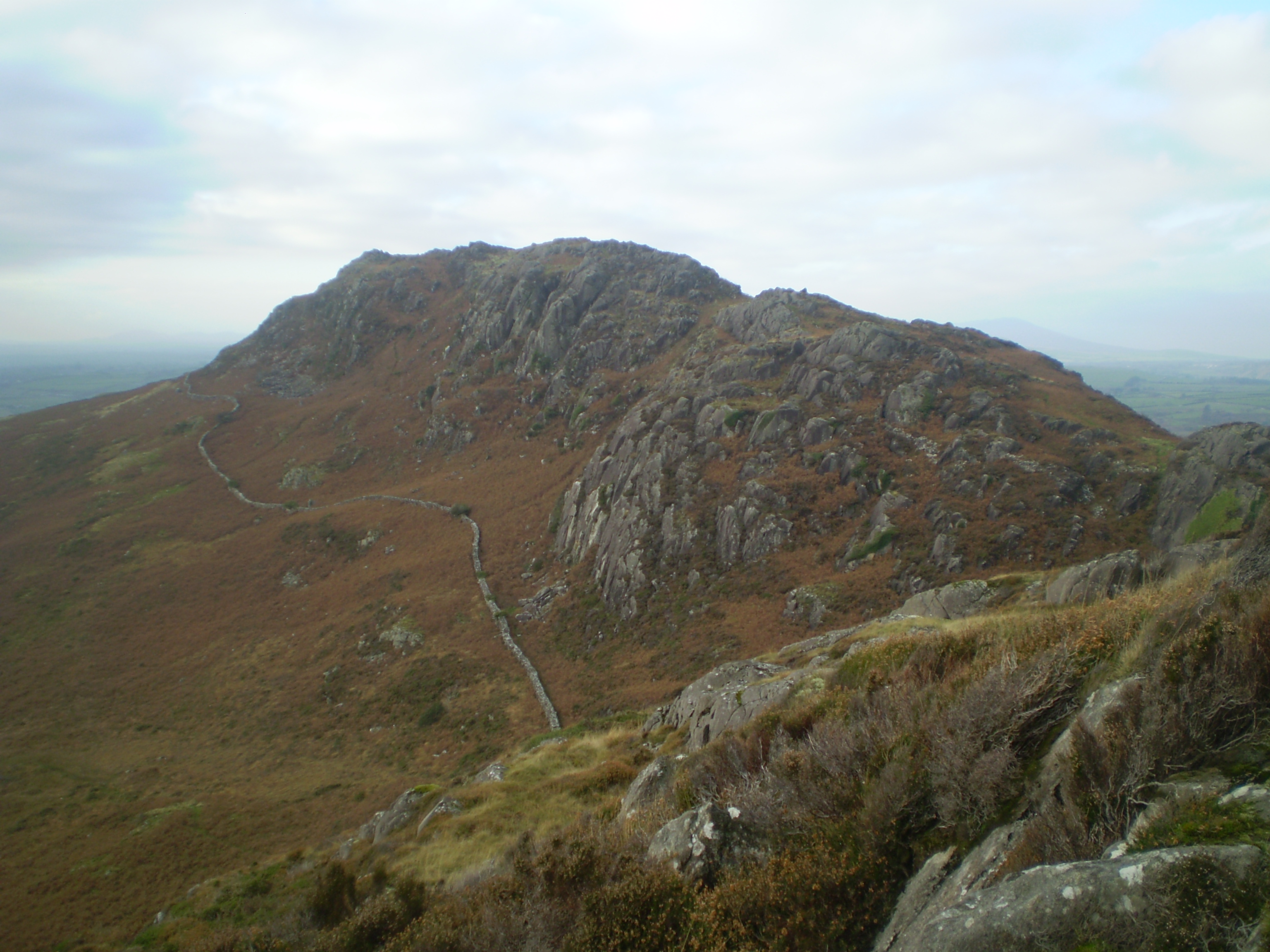
Moel y Gest

Moel y Gest is a 263 m (863 ft) hill to the west of Porthmadog in North Wales. It is a very rocky hill with high topographic prominence because of the...

Porthmadog railway station

Porthmadog railway station serves the town of Porthmadog on the Llŷn Peninsula in Gwynedd, Wales. The station is on the Cambrian Coast Railway with passenger...

Portmadoc, Beddgelert and South Snowdon Railway

The Porthmadog, Beddgelert and South Snowdon Railway (PB&SSR) was a 1 ft 11+1⁄2 in (597 mm) narrow gauge railway intended to connect Porthmadog with the...

Nearby Amenities

Located within 500m of 52.944039,-4.1535784
Crossing
Bicycle: yes
Crossing: uncontrolled
Crossing Ref: zebra
Lat/Long: 52.9410702/-4.1509451
Crossing
Bicycle: yes
Crossing: uncontrolled
Crossing Ref: zebra
Lat/Long: 52.9412661/-4.1512725
Pwllgoleulas
Place: hamlet
Population: 32
Lat/Long: 52.9413586/-4.1539944
Building: yes
Lat/Long: 52.9482496/-4.154159
Barrier: cycle_barrier
Bicycle: yes
Foot: yes
Lat/Long: 52.9413074/-4.1513717
Power: pole
Lat/Long: 52.9462124/-4.1480994
Power: pole
Lat/Long: 52.9466132/-4.1489846
Power: pole
Lat/Long: 52.9469995/-4.1498402
Power: pole
Lat/Long: 52.9484508/-4.1537938
Yr Pwllgolaulas Farn
Ele: 164
Natural: peak
Lat/Long: 52.9428591/-4.1475439
Pwllgolaulas
Place: hamlet
Population: 32
Lat/Long: 52.9421974/-4.1560948
Direction: SSW
Generator Method: photovoltaic
Generator Output Electricity: yes
Generator Solar Modules: 20
Generator Source: solar
Generator Type: solar_photovoltaic_panel
Location: roof
Power: generator
Lat/Long: 52.9415224/-4.1540404
Gorseddau Junction
Historic Railway: junction
Railway: site
Lat/Long: 52.940089/-4.1504951
The data included in this document is from www.openstreetmap.org. The data is made available under ODbL.

Have you been to Allt-wen?

Leave your review of Allt-wen below (or comments, questions and feedback).