Troserch Wood
Wood, Forest in Carmarthenshire
Wales
Troserch Wood

Troserch Wood is a picturesque woodland located in the county of Carmarthenshire, Wales. Spanning an area of approximately 40 acres, it is known for its diverse range of flora and fauna, making it a popular destination for nature lovers and hikers alike.
The wood is dominated by a mixture of broadleaf trees, including oak, beech, and ash, which provide a rich canopy that provides shade and shelter for a variety of wildlife. The forest floor is adorned with a carpet of bluebells during spring, creating a stunning visual display.
Visitors to Troserch Wood can enjoy a network of well-maintained footpaths that meander through the forest, offering opportunities to explore its beauty and discover hidden gems. These paths lead to a tranquil stream that flows through the wood, enhancing the overall serenity of the environment.
The wood is also home to a diverse range of wildlife, including birds such as woodpeckers, owls, and songbirds. Mammals like badgers, foxes, and deer can also be spotted in the area, adding to the allure of the wood for wildlife enthusiasts.
Troserch Wood is easily accessible by car, with a small parking area available for visitors. The wood is open to the public year-round, allowing visitors to experience its beauty in different seasons, from the vibrant colors of autumn to the lush greenery of summer.
Overall, Troserch Wood offers a peaceful and enchanting retreat for those seeking to immerse themselves in the natural beauty of Carmarthenshire.
If you have any feedback on the listing, please let us know in the comments section below.
Troserch Wood Images
Images are sourced within 2km of 51.7163/-4.0999316 or Grid Reference SN5504. Thanks to Geograph Open Source API. All images are credited.


Troserch Wood is located at Grid Ref: SN5504 (Lat: 51.7163, Lng: -4.0999316)
Unitary Authority: Carmarthenshire
Police Authority: Dyfed Powys
What 3 Words
///apprehend.blanking.systems. Near Pontarddulais, Swansea
Nearby Locations
Related Wikis

Llangennech
Llangennech ([ɬæn'ɡenƏx]()) is a village and community in the area of Llanelli, Carmarthenshire, Wales, which covers an area of 1,222 hectares (4.72 sq...

Llangennech derailment
On 26 August 2020 a freight train carrying diesel fuel and gas oil in tank wagons derailed at Morlais Junction, Llangennech, Carmarthenshire, Wales. Some...

Hendy
Hendy (Welsh: Yr Hendy) is a village in the community of Llanelli, Carmarthenshire, Wales. It is situated at the Carmarthenshire and the City and County...
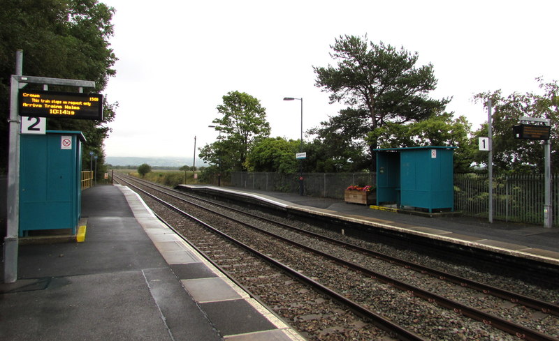
Llangennech railway station
Llangennech railway station is a railway station in the village of Llangennech. It lies on the Heart of Wales line with services operated by Transport...
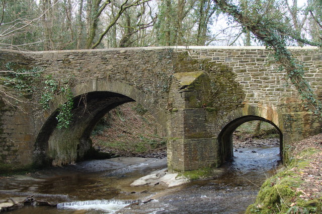
Afon Morlais
The Afon Morlais is a small river in south Wales, a tributary of the River Loughor. It rises in the village of Cross Hands and then flows southwards through...
Bryn, Llanelli
Bryn (locally known using the Welsh: Y Bryn; meaning: "the Hill") is a village situated east of Llanelli in Carmarthenshire, Wales. It is part of the Llanelli...

Afon Gwili (Loughor)
For the river which is a tributary of the River Towy see River GwiliThe Afon Gwili is a right-bank tributary of the River Loughor in the east of Carmarthenshire...

St Michael's School, Llanelli
St. Michael's School (Welsh: Ysgol Mihangel Sant) is a private day and boarding school for pupils aged from 3 to 18 years old in Llanelli, Wales. The school...
Nearby Amenities
Located within 500m of 51.7163,-4.0999316Have you been to Troserch Wood?
Leave your review of Troserch Wood below (or comments, questions and feedback).