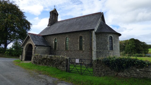
Allt Fawr
Wood, Forest in Cardiganshire
Wales
Allt Fawr

Allt Fawr is a small woodland located in Cardiganshire, Wales. Covering an area of approximately 200 acres, it is situated in a rural and picturesque setting, surrounded by rolling hills and meandering rivers. The woodland consists primarily of native tree species such as oak, birch, and beech, creating a diverse and vibrant ecosystem.
The dense vegetation and tall trees provide a habitat for a wide range of wildlife, including various bird species, mammals, and insects. It is not uncommon to spot red kites soaring above the treetops or catch a glimpse of a badger or fox scurrying through the undergrowth. The forest floor is also home to a rich array of flora, with bluebells, wild garlic, and ferns carpeting the ground during the spring and summer months.
Allt Fawr is a popular destination for nature enthusiasts, hikers, and those seeking a peaceful retreat. There are several well-maintained walking trails that wind their way through the woodland, allowing visitors to explore its beauty at their own pace. These paths offer stunning views of the surrounding countryside and provide an opportunity to experience the tranquility and serenity of the natural environment.
Managed by the local forestry commission, Allt Fawr is carefully preserved and maintained to ensure the sustainability of the woodland ecosystem. Conservation efforts include the removal of invasive species, monitoring of wildlife populations, and the promotion of responsible visitor behavior.
Overall, Allt Fawr is a remarkable woodland that showcases the natural beauty of Cardiganshire, providing a haven for both wildlife and visitors alike.
If you have any feedback on the listing, please let us know in the comments section below.
Allt Fawr Images
Images are sourced within 2km of 52.108548/-4.1271974 or Grid Reference SN5447. Thanks to Geograph Open Source API. All images are credited.
Allt Fawr is located at Grid Ref: SN5447 (Lat: 52.108548, Lng: -4.1271974)
Unitary Authority: Ceredigion
Police Authority: Dyfed Powys
What 3 Words
///wooden.stir.assess. Near Lampeter, Ceredigion
Nearby Locations
Related Wikis
Neudd-fawr
Neudd-fawr (also spelt Neuadd Fawr) is a small village in the community of Llanwnnen, Ceredigion, Wales, which is 59.9 miles (96.4 km) from Cardiff and...
Pentre-bach, Ceredigion
Pentre-bach is a small village in the community of Lampeter, Ceredigion, Wales. Pentre-bach is represented in the Senedd by Elin Jones (Plaid Cymru) and...
Llanwnnen
Llanwnnen is a village, parish and community located in the county of Ceredigion, Wales. The population of the community taken at the 2011 census was 490...
Maestir
Maestir is a hamlet in the community of Llanwnnen, Ceredigion, Wales, which is 59.9 miles (96.3 km) from Cardiff and 175.5 miles (282.4 km) from London...
Corsydd a Rwyth Cilyblaidd
Corsydd a Rwyth Cilyblaidd is a wetland area that is a Site of Special Scientific Interest in Carmarthen & Dinefwr, Wales. == See also == List of Sites...
Llyn Pencarreg
Llyn Pencarreg is an oligotrophic lake that is Site of Special Scientific Interest in Carmarthen & Dinefwr, Wales. == See also == List of Sites of Special...
Falcondale
Falcondale (Welsh: Glyn Hebog) is a hamlet in the community of Lampeter, Ceredigion, Wales, and occupies a low bluff overlooking the Nant Creuddyn north...
Pencarreg Halt railway station
Pencarreg Halt railway station served the hamlet and rural locale of Pencarreg from 1930 to 1965 on the old Carmarthen Aberystwyth Line in the Welsh county...
Nearby Amenities
Located within 500m of 52.108548,-4.1271974Have you been to Allt Fawr?
Leave your review of Allt Fawr below (or comments, questions and feedback).


