Cwm-hendryd Wood

Wood, Forest in Cardiganshire

Wales

Cwm-hendryd Wood

Former Fish & Anchor is now a Private Dwelling In the early 1980's this was a wonderful place for a pub meal.
Former Fish & Anchor is now a Private Dwelling Credit: Sandy Gerrard

Cwm-hendryd Wood is a picturesque woodland located in Cardiganshire, Wales. Spread over an area of approximately 100 hectares, it is known for its diverse flora and fauna, making it a popular destination for nature enthusiasts and hikers.

The wood is situated in a tranquil valley, surrounded by rolling hills and meandering streams. It consists mainly of broadleaf trees, such as oak, beech, and ash, which provide a dense canopy and create a soothing ambiance. The forest floor is covered with a carpet of ferns and wildflowers, adding to the enchanting atmosphere.

The wood is home to a wide range of wildlife, including deer, badgers, foxes, and various bird species. It offers a haven for birdwatchers, with sightings of woodpeckers, buzzards, and owls being common. The streams that run through the wood are inhabited by trout and other aquatic creatures, adding to the biodiversity of the area.

There are several walking trails that wind their way through the wood, offering visitors the opportunity to explore its natural beauty. These trails vary in difficulty, catering to both casual strollers and more avid hikers. Along the paths, one can discover hidden waterfalls, ancient ruins, and breathtaking viewpoints that offer stunning vistas of the surrounding countryside.

Cwm-hendryd Wood is managed by the local forestry commission, ensuring its preservation and maintenance. It is open to the public throughout the year, with designated picnic areas and parking facilities available. With its tranquil setting and abundant wildlife, Cwm-hendryd Wood is a serene and captivating destination for nature lovers to immerse themselves in the wonders of the Welsh countryside.

If you have any feedback on the listing, please let us know in the comments section below.

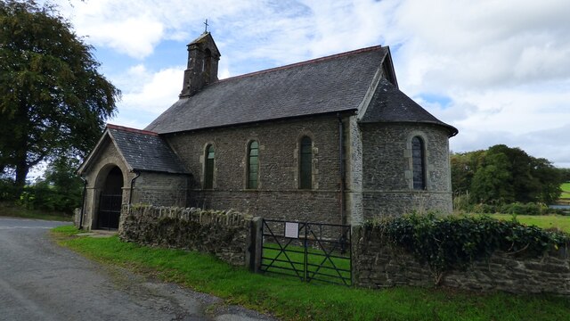
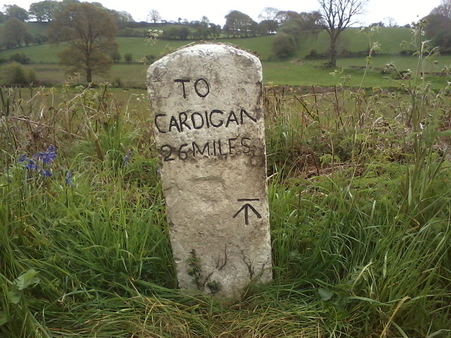
Cwm-hendryd Wood Images

Images are sourced within 2km of 52.113338/-4.1293534 or Grid Reference SN5448. Thanks to Geograph Open Source API. All images are credited.

Former Fish & Anchor is now a Private Dwelling In the early 1980's this was a wonderful place for a pub meal.
Former Fish & Anchor is now a Private Dwelling
In the early 1980's this was a wonderful place for a pub meal.
St Mary's Church, Maestir <span class="nowrap"><a title="https://coflein.gov.uk/cy/safle/310150/" rel="nofollow ugc noopener" href="https://coflein.gov.uk/cy/safle/310150/">Link</a><img style="margin-left:2px;" alt="External link" title="External link - shift click to open in new window" src="https://s1.geograph.org.uk/img/external.png" width="10" height="10"/></span>
St Mary's Church, Maestir
A475 at Pentre-bach
A475 at Pentre-bach
A475 at Murco filling station
A475 at Llanwnnen village boundary
Ordnance Survey Cut Mark This OS cut mark can be found on the gatepost SE side of the road. It marks a point 125.470m above mean sea level.
Ordnance Survey Cut Mark
This OS cut mark can be found on the gatepost SE side of the road. It marks a point 125.470m above mean sea level.
Ordnance Survey Cut Mark This OS cut mark can be found on the outbuilding of the Fish & Anchor PH. It marks a point 133.457m above mean sea level.
Ordnance Survey Cut Mark
This OS cut mark can be found on the outbuilding of the Fish & Anchor PH. It marks a point 133.457m above mean sea level.
Churn Stand
Churn Stand
Ordnance Survey Flush Bracket (S0454) This OS Flush Bracket can be found on the wall of the former post office. It marks a point 127.823m above mean sea level.
Ordnance Survey Flush Bracket (S0454)
This OS Flush Bracket can be found on the wall of the former post office. It marks a point 127.823m above mean sea level.
Milestone - Cardigan 26 The OS cut mark on the front of the stone marks a point 125.647m above mean sea level.
Milestone - Cardigan 26
The OS cut mark on the front of the stone marks a point 125.647m above mean sea level.
Barn on a sharp bend
The B4337 at Llanwnnen The parish church of St Lucia & St Gwynin is on the east side of the road
The B4337 at Llanwnnen
The parish church of St Lucia & St Gwynin is on the east side of the road
Gwesty'r Grannell Hotel Hotel at the centre of the village, at the junction of the A475 and Bro Cadarn (B4337)
Gwesty'r Grannell Hotel
Hotel at the centre of the village, at the junction of the A475 and Bro Cadarn (B4337)
Maesllan Farm
Maesllan Farm
The Grannell Hotel The hotel comes into view as the A475 makes a steep climb to a tricky crossing of the B4337. It's a bit depressing to see Christmas being advertised in early October.
The Grannell Hotel
The hotel comes into view as the A475 makes a steep climb to a tricky crossing of the B4337. It's a bit depressing to see Christmas being advertised in early October.
OSBM Flush Bracket S0454 - Llanwnnen Post Office Ordnance Survey Benchmark (OSBM) used for levelling height above Ordnance Datum (OD).  
Height (1972): 127.8230m OD (Newlyn).  Mark verified by the Ordnance Survey in 1973.  Description: FL BR S0454 WALL PO LLANWNNEN E FACE.  0.4m above ground.  2nd Order BM.  The Post Office closed in 2011.

The bracket was used on the Lampeter to Carmarthen secondary line of the Second Geodetic Levelling of England & Wales in 1942. It was levelled with a height of 419.427' above OD (Newlyn).  Description: Flush Bracket on wall, 6' N. of building, W. side of road.  Abstract A 491: <span class="nowrap"><a title="http://discovery.nationalarchives.gov.uk/details/r/C11178833" rel="nofollow ugc noopener" href="http://discovery.nationalarchives.gov.uk/details/r/C11178833">Link</a><img style="margin-left:2px;" alt="External link" title="External link - shift click to open in new window" src="https://s1.geograph.org.uk/img/external.png" width="10" height="10"/></span> [OS 54/154]  It was levelled at 419.425' in the 1930s.  Abstract A 284: <span class="nowrap"><a title="http://discovery.nationalarchives.gov.uk/details/r/C11178737" rel="nofollow ugc noopener" href="http://discovery.nationalarchives.gov.uk/details/r/C11178737">Link</a><img style="margin-left:2px;" alt="External link" title="External link - shift click to open in new window" src="https://s1.geograph.org.uk/img/external.png" width="10" height="10"/></span> [OS 54/58]
OSBM Flush Bracket S0454 - Llanwnnen Post Office
Ordnance Survey Benchmark (OSBM) used for levelling height above Ordnance Datum (OD). Height (1972): 127.8230m OD (Newlyn). Mark verified by the Ordnance Survey in 1973. Description: FL BR S0454 WALL PO LLANWNNEN E FACE. 0.4m above ground. 2nd Order BM. The Post Office closed in 2011. The bracket was used on the Lampeter to Carmarthen secondary line of the Second Geodetic Levelling of England & Wales in 1942. It was levelled with a height of 419.427' above OD (Newlyn). Description: Flush Bracket on wall, 6' N. of building, W. side of road. Abstract A 491: LinkExternal link [OS 54/154] It was levelled at 419.425' in the 1930s. Abstract A 284: LinkExternal link [OS 54/58]
Llanwnnen, Milestone - Cardigan 26 Milestone with Ordnance Survey Benchmark (OSBM) used for levelling height above Ordnance Datum (OD).
Height (1972): 125.6470m OD (Newlyn). Mark verified by the Ordnance Survey in 1972. Description: NBM MS CARDIGAN 26 NW FACE. 0.4m above ground. 2nd Order BM.
Llanwnnen, Milestone - Cardigan 26
Milestone with Ordnance Survey Benchmark (OSBM) used for levelling height above Ordnance Datum (OD). Height (1972): 125.6470m OD (Newlyn). Mark verified by the Ordnance Survey in 1972. Description: NBM MS CARDIGAN 26 NW FACE. 0.4m above ground. 2nd Order BM.
Ordnance Survey Benchmark - Llanwnnen, Castell-du Ordnance Survey Benchmark (OSBM) used for levelling height above Ordnance Datum (OD).  
Height (1972): 148.2430m OD (Newlyn). Mark verified by the Ordnance Survey in 1972. Description: GTP NW SIDE RD JUNC HEDGE SW FACE. 0.5m above ground. 2nd Order BM.

Context: <a href="https://www.geograph.org.uk/photo/3903959">SN5347 : Ordnance Survey Benchmark - Llanwnnen, Castell-du</a>
Ordnance Survey Benchmark - Llanwnnen, Castell-du
Ordnance Survey Benchmark (OSBM) used for levelling height above Ordnance Datum (OD). Height (1972): 148.2430m OD (Newlyn). Mark verified by the Ordnance Survey in 1972. Description: GTP NW SIDE RD JUNC HEDGE SW FACE. 0.5m above ground. 2nd Order BM. Context: SN5347 : Ordnance Survey Benchmark - Llanwnnen, Castell-du
Show me another place!

Cwm-hendryd Wood is located at Grid Ref: SN5448 (Lat: 52.113338, Lng: -4.1293534)

Unitary Authority: Ceredigion

Police Authority: Dyfed Powys

What 3 Words

///ground.sends.truckload. Near Lampeter, Ceredigion

Nearby Locations

Bank Wood Cwm-hendryd Wood

Related Wikis

Neudd-fawr

Neudd-fawr (also spelt Neuadd Fawr) is a small village in the community of Llanwnnen, Ceredigion, Wales, which is 59.9 miles (96.4 km) from Cardiff and...

Llanwnnen

Llanwnnen is a village, parish and community located in the county of Ceredigion, Wales. The population of the community taken at the 2011 census was 490...

Pentre-bach, Ceredigion

Pentre-bach is a small village in the community of Lampeter, Ceredigion, Wales. Pentre-bach is represented in the Senedd by Elin Jones (Plaid Cymru) and...

Maestir

Maestir is a hamlet in the community of Llanwnnen, Ceredigion, Wales, which is 59.9 miles (96.3 km) from Cardiff and 175.5 miles (282.4 km) from London...

Nearby Amenities

Located within 500m of 52.113338,-4.1293534
Place: farm
Lat/Long: 52.1160911/-4.1317575
The data included in this document is from www.openstreetmap.org. The data is made available under ODbL.

Have you been to Cwm-hendryd Wood?

Leave your review of Cwm-hendryd Wood below (or comments, questions and feedback).