Allt Ffrwdywhiaid

Wood, Forest in Cardiganshire

Wales

Allt Ffrwdywhiaid

Main road through Cribyn The B4337 Temple Bar to Llanybydder road.
Main road through Cribyn Credit: Eirian Evans

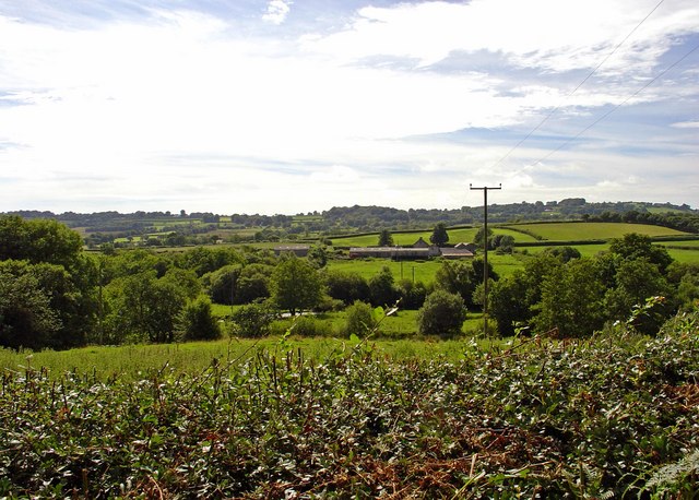
Allt Ffrwdywhiaid is a picturesque wood located in the county of Cardiganshire, Wales. Situated in the heart of the countryside, this enchanting forest covers an area of approximately 100 acres and is renowned for its natural beauty and tranquility.

The wood is home to a diverse range of flora and fauna, making it a haven for nature lovers and wildlife enthusiasts. It features a dense canopy of trees, including oak, ash, and beech, which provide shelter and shade to a variety of woodland creatures such as deer, foxes, and a wide array of bird species.

One of the highlights of Allt Ffrwdywhiaid is the charming stream that runs through it. The gentle babbling of the water adds to the peaceful ambiance of the forest, creating a soothing and calming atmosphere for visitors. The stream is also home to a number of aquatic animals, including small fish and frogs.

The wood offers several walking trails that wind through its enchanting landscape, providing visitors with the opportunity to explore its hidden treasures. These pathways are well-maintained and suitable for all ages and fitness levels, offering a pleasant and immersive experience in nature.

Allt Ffrwdywhiaid is a popular destination for outdoor activities such as hiking, picnicking, and birdwatching. It also serves as an educational resource, with informative signs and markers scattered throughout the forest, providing interesting facts about the local flora and fauna.

Overall, Allt Ffrwdywhiaid is a captivating wood that showcases the natural beauty of Cardiganshire. With its lush vegetation, diverse wildlife, and tranquil atmosphere, it offers a serene escape from the hustle and bustle of everyday life.

If you have any feedback on the listing, please let us know in the comments section below.

Allt Ffrwdywhiaid Images

Images are sourced within 2km of 52.131027/-4.1381748 or Grid Reference SN5350. Thanks to Geograph Open Source API. All images are credited.

Main road through Cribyn The B4337 Temple Bar to Llanybydder road.
Main road through Cribyn
The B4337 Temple Bar to Llanybydder road.
Semi-detached houses at Cribyn
St Mary's Church, Maestir <span class="nowrap"><a title="https://coflein.gov.uk/cy/safle/310150/" rel="nofollow ugc noopener" href="https://coflein.gov.uk/cy/safle/310150/">Link</a><img style="margin-left:2px;" alt="External link" title="External link - shift click to open in new window" src="https://s1.geograph.org.uk/img/external.png" width="10" height="10"/></span>
St Mary's Church, Maestir
Ordnance Survey Cut Mark This OS cut mark can be found on the house which was once the Mynach Arms. It marks a point 174.524m above mean sea level.
Ordnance Survey Cut Mark
This OS cut mark can be found on the house which was once the Mynach Arms. It marks a point 174.524m above mean sea level.
Old Milepost by the B4337, Cribyn, Llanfihangel Ystrad parish Flat top casting by the B4337, Cribyn, in parish of Llanfihangel Ystrad (Ceredigion District).

Inscription reads:-
: TEMPLE BAR / 3 / MILES : : LLANYBYTHER / 5 / MILES :
Maker:-
: Eagle Foundry, Aberystwyth. :

Grade II listed by Cadw.
Reference Number: 17437 <span class="nowrap"><a title="https://cadwpublic-api.azurewebsites.net/reports/listedbuilding/FullReport?lang=&id=17437" rel="nofollow ugc noopener" href="https://cadwpublic-api.azurewebsites.net/reports/listedbuilding/FullReport?lang=&id=17437">Link</a><img style="margin-left:2px;" alt="External link" title="External link - shift click to open in new window" src="https://s1.geograph.org.uk/img/external.png" width="10" height="10"/></span>

Surveyed

Milestone Society National ID: CRD_TBLY03
Old Milepost by the B4337, Cribyn, Llanfihangel Ystrad parish
Flat top casting by the B4337, Cribyn, in parish of Llanfihangel Ystrad (Ceredigion District). Inscription reads:- : TEMPLE BAR / 3 / MILES : : LLANYBYTHER / 5 / MILES : Maker:- : Eagle Foundry, Aberystwyth. : Grade II listed by Cadw. Reference Number: 17437 LinkExternal link Surveyed Milestone Society National ID: CRD_TBLY03
Capel Undodaidd, Cribyn Cribyn Welsh Unitarian Chapel.  
Cribyn Unitarian Chapel was built in 1790 and rebuilt in 1851. The present chapel, dated 1851, is built in the Simple Round-Headed style of the gable entry type.
Capel Undodaidd, Cribyn
Cribyn Welsh Unitarian Chapel. Cribyn Unitarian Chapel was built in 1790 and rebuilt in 1851. The present chapel, dated 1851, is built in the Simple Round-Headed style of the gable entry type.
Three Horse Shoes, Cribyn Formerly a pub but now a private residence.  Note the three horse shoes above the front door.
Three Horse Shoes, Cribyn
Formerly a pub but now a private residence. Note the three horse shoes above the front door.
Cribyn Post Office See the sign set into the wall on the corner of the property.
Cribyn Post Office
See the sign set into the wall on the corner of the property.
Ordnance Survey Cut Mark This OS cut mark can be found on the gatepost south side of the road junction. It marks a point 176.671m above mean sea level.
Ordnance Survey Cut Mark
This OS cut mark can be found on the gatepost south side of the road junction. It marks a point 176.671m above mean sea level.
Ordnance Survey Cut Mark This OS cut mark can be found on the gatepost NW side of the road. It marks a point 239.084m above mean sea level.
Ordnance Survey Cut Mark
This OS cut mark can be found on the gatepost NW side of the road. It marks a point 239.084m above mean sea level.
Lane east of Capel-y-Groes The Moelfre sign stands opposite the track leading to the farm.
Lane east of Capel-y-Groes
The Moelfre sign stands opposite the track leading to the farm.
Hendryd Farm lying in the valley of a tiny tributary of the Afon Teifi north east of Llanwnnen.
Hendryd
Farm lying in the valley of a tiny tributary of the Afon Teifi north east of Llanwnnen.
St Mary's Church, Maestir Maestir, about two miles from Lampeter, consists of little more than this church at a lonely crossroads, and a nearby farm. However, there was once a school here which was provided mainly for children of the Falcondale Estate. Until 1880 lessons were held in the church, but in that year a dedicated building was erected which was used until 1916 when the school closed. The building was then converted into a dwelling, but was dismantled in 1981 and moved to the National Museum of Wales in St Fagans where it is now used to demonstrate traditional village school life to modern children.
St Mary's Church, Maestir
Maestir, about two miles from Lampeter, consists of little more than this church at a lonely crossroads, and a nearby farm. However, there was once a school here which was provided mainly for children of the Falcondale Estate. Until 1880 lessons were held in the church, but in that year a dedicated building was erected which was used until 1916 when the school closed. The building was then converted into a dwelling, but was dismantled in 1981 and moved to the National Museum of Wales in St Fagans where it is now used to demonstrate traditional village school life to modern children.
Llysfaen Isaf, Llanwnnen
Cae gyda cnydau wedi'i medi / Field with cut crops Golygfa dros caeau tua Capel-y-Groes / View across fields towards Capel-y-Groes
Cae gyda cnydau wedi'i medi / Field with cut crops
Golygfa dros caeau tua Capel-y-Groes / View across fields towards Capel-y-Groes
Banc y Moelfre Cae amaethyddol ar Fanc y Moelfre / Agricultural field on Banc y Moelfre
Banc y Moelfre
Cae amaethyddol ar Fanc y Moelfre / Agricultural field on Banc y Moelfre
Lon wledig rhwng Cribyn a Capel-y-Groes /  Country lane between Cribyn and Capel-y-Groes Lon gul ger Capel-y-Groes / Country lane near Capel-y-Groes
Lon wledig rhwng Cribyn a Capel-y-Groes / Country lane between Cribyn and Capel-y-Groes
Lon gul ger Capel-y-Groes / Country lane near Capel-y-Groes
Troedrhiwfallen, Cribyn, Lampeter This is a delightful eighteenth century thatched cottage.
Troedrhiwfallen, Cribyn, Lampeter
This is a delightful eighteenth century thatched cottage.
Show me another place!

Allt Ffrwdywhiaid is located at Grid Ref: SN5350 (Lat: 52.131027, Lng: -4.1381748)

Unitary Authority: Ceredigion

Police Authority: Dyfed Powys

What 3 Words

///roving.slope.instructs. Near Lampeter, Ceredigion

Nearby Locations

Allt Ffrwdywhiaid

Related Wikis

Maestir

Maestir is a hamlet in the community of Llanwnnen, Ceredigion, Wales, which is 59.9 miles (96.3 km) from Cardiff and 175.5 miles (282.4 km) from London...

Cribyn

Cribyn is a small village in Ceredigion, Wales, about 7 miles (11 km) north of Lampeter and with the villages of Troed y Rhiw, Mydroilyn and Dihewyd to...

Neudd-fawr

Neudd-fawr (also spelt Neuadd Fawr) is a small village in the community of Llanwnnen, Ceredigion, Wales, which is 59.9 miles (96.4 km) from Cardiff and...

Falcondale

Falcondale (Welsh: Glyn Hebog) is a hamlet in the community of Lampeter, Ceredigion, Wales, and occupies a low bluff overlooking the Nant Creuddyn north...

Llanwnnen

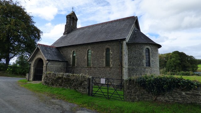
Llanwnnen is a village, parish and community located in the county of Ceredigion, Wales. The population of the community taken at the 2011 census was 490...
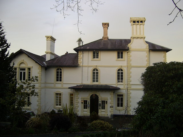
Falcondale House

Falcondale House is a Grade II listed former country house, now the Falcondale Mansion Hotel, which is situated some 1 mile north-west of Lampeter, Ceredigion...

Ffynnon-oer

Ffynnon-oer is a hamlet in the community of Llanfihangel Ystrad, Ceredigion, Wales, which is 62.6 miles (100.8 km) from Cardiff and 177.4 miles (285.6...

Falcondale Lake

Falcondale Lake is a man-made lake in the hamlet of Falcondale near Lampeter in Ceredigion It was created as part of the landscaping for Falcondale House...

Nearby Amenities

Located within 500m of 52.131027,-4.1381748
Place: farm
Lat/Long: 52.1307672/-4.1437309
The data included in this document is from www.openstreetmap.org. The data is made available under ODbL.

Have you been to Allt Ffrwdywhiaid?

Leave your review of Allt Ffrwdywhiaid below (or comments, questions and feedback).