Burneston
Settlement in Yorkshire Hambleton
England
Burneston

Burneston is a small village located in the Hambleton district of North Yorkshire, England. Situated approximately 6 miles southeast of the market town of Bedale, Burneston is nestled in the picturesque countryside of the Vale of Mowbray.
With a population of around 250 residents, Burneston exudes a tranquil and close-knit community atmosphere. The village is known for its charming, traditional stone-built houses and scenic views of the surrounding farmland. The nearby Burneston Hall, a Grade II listed building, adds a touch of historic grandeur to the village.
Despite its small size, Burneston offers several amenities to its residents. The village is home to the Burneston and District Tennis Club, providing opportunities for locals to engage in recreational activities. Additionally, the village has a primary school, ensuring that children have access to education within the community.
For those seeking to explore the area, Burneston boasts convenient transport links. The A1(M) motorway is easily accessible, offering connections to larger towns and cities in the region. The nearby Bedale railway station provides train services to destinations such as Leeds and Northallerton.
In summary, Burneston is a peaceful village in the heart of the Yorkshire countryside. With its stunning landscapes, historic buildings, and strong sense of community, it offers a tranquil retreat for residents and visitors alike.
If you have any feedback on the listing, please let us know in the comments section below.
Burneston Images
Images are sourced within 2km of 54.260276/-1.528952 or Grid Reference SE3085. Thanks to Geograph Open Source API. All images are credited.


Burneston is located at Grid Ref: SE3085 (Lat: 54.260276, Lng: -1.528952)
Division: North Riding
Administrative County: North Yorkshire
District: Hambleton
Police Authority: North Yorkshire
What 3 Words
///having.legs.baths. Near Bedale, North Yorkshire
Nearby Locations
Related Wikis

Burneston
Burneston is a village and civil parish in North Yorkshire, England. According to the 2001 Census it had a population of 244, increasing to 311 at the...
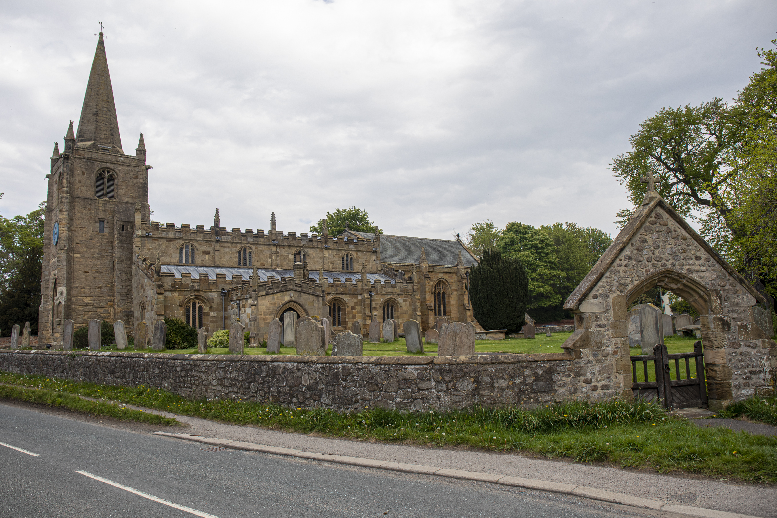
Church of St Lambert, Burneston
The Church of St Lambert, Burneston, is the Anglican parish church for the village of Burneston in North Yorkshire, England. The church was built progressively...

Theakston, North Yorkshire
Theakston is a village and civil parish in North Yorkshire, England. The population of the civil parish at the 2011 census was 143. == Geography == The...

Carthorpe
Carthorpe is a small village and civil parish in North Yorkshire, England. It is located about 4 miles (6.4 km) south of Bedale. Village services include...
Related Videos


British Aerospace Hawk T.1 100 Squadron RAF Leeming
British Aerospace Hawk T.1 100 Squadron RAF Leeming.

Airbus A400M Atlas at RAF Leeming
Airbus A400M Atlas at RAF Leeming 29th August 2023.
Nearby Amenities
Located within 500m of 54.260276,-1.528952Have you been to Burneston?
Leave your review of Burneston below (or comments, questions and feedback).