Cae-tŵr-isaf Covert

Wood, Forest in Caernarfonshire

Wales

Cae-tŵr-isaf Covert

Tir Plas Porthamel / Land at Plas Porthamel
Tir Plas Porthamel / Land at Plas Porthamel Credit: Ceri Thomas

Cae-tŵr-isaf Covert is a picturesque woodland located in Caernarfonshire, Wales. Situated amidst the stunning landscape of Snowdonia National Park, this woodland is renowned for its natural beauty and diverse flora and fauna. Covering an area of approximately 50 acres, Cae-tŵr-isaf Covert offers visitors a tranquil retreat away from the hustle and bustle of urban life.

The woodland is primarily composed of native deciduous trees, including oak, ash, and beech, which create a dense canopy, offering shade and shelter to a wide variety of wildlife. The forest floor is adorned with an array of wildflowers, such as bluebells, primroses, and foxgloves, adding a vibrant splash of color to the surroundings.

Cae-tŵr-isaf Covert is a haven for birdwatchers, as it is home to a multitude of bird species, including woodpeckers, owls, and various songbirds. Visitors may also catch sight of mammals like badgers, foxes, and squirrels, as they navigate through the undergrowth.

The woodland offers several walking trails, allowing visitors to explore its natural wonders at their own pace. These paths wind through the forest, leading to hidden glades, babbling brooks, and enchanting viewpoints. Additionally, picnic areas and benches are scattered throughout the woodland, providing opportunities for visitors to relax and soak in the serene atmosphere.

Cae-tŵr-isaf Covert is a cherished natural gem, attracting nature enthusiasts, photographers, and families seeking a peaceful escape. Its stunning landscapes, rich biodiversity, and tranquil ambiance make it a must-visit destination for those looking to reconnect with nature in the heart of Caernarfonshire.

If you have any feedback on the listing, please let us know in the comments section below.

Cae-tŵr-isaf Covert Images

Images are sourced within 2km of 53.169597/-4.2304403 or Grid Reference SH5165. Thanks to Geograph Open Source API. All images are credited.
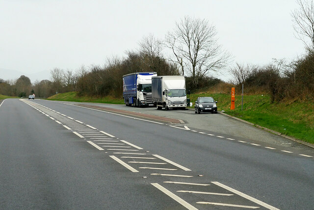
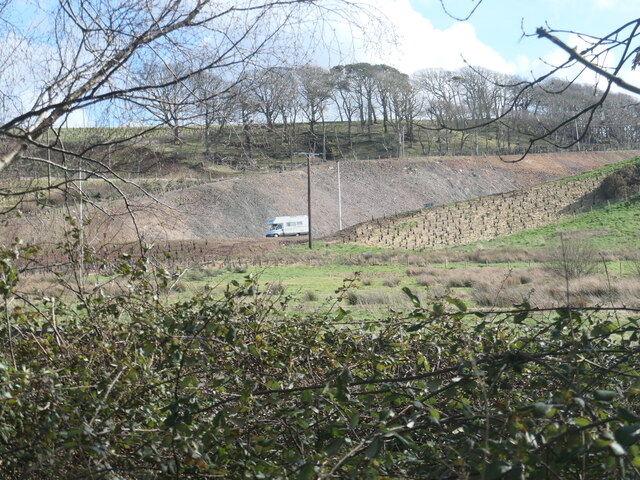
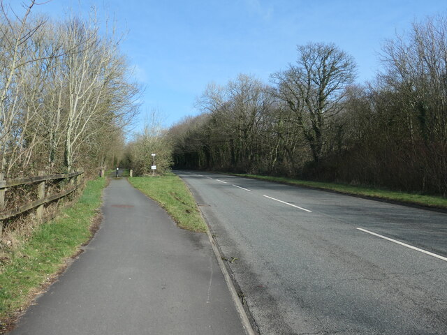
Tir Plas Porthamel / Land at Plas Porthamel
Creyr Glas / Grey Heron
O Fôn i'r Felinheli / Felinheli from Anglesey
Y Felinheli a'r Wyddfa / Felinheli and Snowdon
Layby on Felinheli Bypass (Eastbound)
Truck on the Y Felinheli Bypass (A487) DAF XF (CX18 MON) on the A487 near Y Felinheli.
Truck on the Y Felinheli Bypass (A487)
DAF XF (CX18 MON) on the A487 near Y Felinheli.
Bridge over the Y Felinheli Bypass near Carreg Goch
A487 at Plas Menai Roundabout Roadworks at the Plas Menai Roundabout as the diversion to the A487 (the new Caernarfon to Bontnewydd bypass <span class="nowrap"><a title="https://gov.wales/a487-caernarfon-bontnewydd-bypass" rel="nofollow ugc noopener" href="https://gov.wales/a487-caernarfon-bontnewydd-bypass">Link</a><img style="margin-left:2px;" alt="External link" title="External link - shift click to open in new window" src="https://s1.geograph.org.uk/img/external.png" width="10" height="10"/></span> ) is nearing completion (it would be opened later in the week).
A487 at Plas Menai Roundabout
Roadworks at the Plas Menai Roundabout as the diversion to the A487 (the new Caernarfon to Bontnewydd bypass LinkExternal link ) is nearing completion (it would be opened later in the week).
Open-sided barn, Parciau Farm Above some holiday cottages and the road to Caernarfon.
Open-sided barn, Parciau Farm
Above some holiday cottages and the road to Caernarfon.
This way to Griffiths Crossing and Caernarfon Lon Las Menai, heading south-west. Built on the track bed of the former railway between Bangor and Caernarfon.
This way to Griffiths Crossing and Caernarfon
Lon Las Menai, heading south-west. Built on the track bed of the former railway between Bangor and Caernarfon.
Unknown structures in a stream bed At the downstream end of a culvert under the former Bangor - Caernarfon railway.
Unknown structures in a stream bed
At the downstream end of a culvert under the former Bangor - Caernarfon railway.
Gash in the hillside, below Bryn Covert The northern end of the new Caernarfon and Bontnewydd by-pass.
Gash in the hillside, below Bryn Covert
The northern end of the new Caernarfon and Bontnewydd by-pass.
A487, old and new In the foreground, the old A487 from Y Felinheli to Caernarfon [now the A4871]. Cutting through the hillside, the new A487 from Y Felinheli, bypassing both Caernarfon and Bontnewydd.
A487, old and new
In the foreground, the old A487 from Y Felinheli to Caernarfon [now the A4871]. Cutting through the hillside, the new A487 from Y Felinheli, bypassing both Caernarfon and Bontnewydd.
Lon Las Menai, near Llanfair Hall Farm The end of a short stretch along the pavement of Ffordd Caernarfon / Caernarfon Road.
Lon Las Menai, near Llanfair Hall Farm
The end of a short stretch along the pavement of Ffordd Caernarfon / Caernarfon Road.
The southern edge of Llanfair Wood Descending to the shore of the Menai Straits.
The southern edge of Llanfair Wood
Descending to the shore of the Menai Straits.
Trees along a field boundary, near Plas Llanfair Seen from Lon Las Menai.
Trees along a field boundary, near Plas Llanfair
Seen from Lon Las Menai.
Lon Las Menai, nearing Y Felinheli A recreational route built on the trackbed of the former Caernarfon - Bangor railway.
Lon Las Menai, nearing Y Felinheli
A recreational route built on the trackbed of the former Caernarfon - Bangor railway.
Crossing Cottage, Y Felinheli Now you just have to cross Glan y Mor / Beach Road to reach this house. But the name refers to the former level crossing here on the Bangor - Caernarfon railway line.
Crossing Cottage, Y Felinheli
Now you just have to cross Glan y Mor / Beach Road to reach this house. But the name refers to the former level crossing here on the Bangor - Caernarfon railway line.
Show me another place!

Cae-tŵr-isaf Covert is located at Grid Ref: SH5165 (Lat: 53.169597, Lng: -4.2304403)

Unitary Authority: Gwynedd

Police Authority: North Wales

What 3 Words

///retraced.secretly.instead. Near Y Felinheli, Gwynedd

Nearby Locations

Cae-tŵr-isaf Covert

Related Wikis

Griffith's Crossing railway station

Griffith's Crossing railway station was a former railway station located on the Bangor and Carnarvon Railway about a mile and a half south west of Port...

Llanfair-is-gaer

Llanfair-is-gaer was an ecclesiastical parish in Caernarfon, Gwynedd: the parish church was St Mary's. == References ==

Menai Strait

The Menai Strait (Welsh: Afon Menai, the "river Menai") is a narrow stretch of shallow tidal water about 25 km (16 mi) long, which separates the island...

Bethel, Gwynedd

Bethel is a village in Gwynedd, Wales. It lies east of Caernarfon on the B4366 road. Bethel Primary School is located in the village. The population of...

Old Church of St Nidan, Llanidan

The Old Church of St Nidan, Llanidan is a medieval church in the community of Llanidan, in Anglesey, North Wales, close to the Menai Strait. The first...

Y Felinheli

Y Felinheli (), formerly known in English as Port Dinorwic, is a village and community beside the Menai Strait (Welsh: Y Fenai or Afon Menai) between Bangor...

Moel-y-don

Moel-y-don is a community in Llanddaniel Fab, Anglesey, Wales, which is 126 miles (202.7 km) from Cardiff and 208.1 miles (334.9 km) from London. ��2...

St Edwen's Church, Llanedwen

St Edwen's Church, Llanedwen, is a 19th-century parish church near the Menai Strait, in Anglesey, north Wales. The first church was founded here by St...

Nearby Amenities

Located within 500m of 53.169597,-4.2304403
Power: pole
Lat/Long: 53.1656993/-4.2304441
Power: pole
Lat/Long: 53.1656249/-4.2280036
Power: pole
Lat/Long: 53.1656559/-4.2291781
Power: pole
Lat/Long: 53.1658649/-4.231407
Barrier: stile
Lat/Long: 53.1704312/-4.2317693
Barrier: stile
Source: visual
Lat/Long: 53.1705469/-4.2318927
Power: pole
Lat/Long: 53.1655292/-4.2310631
Power: pole
Lat/Long: 53.1651341/-4.2313199
Barrier: bollard
Bicycle: yes
Foot: yes
Lat/Long: 53.170027/-4.2340469
Barrier: bollard
Bicycle: yes
Foot: yes
Lat/Long: 53.1700527/-4.2339505
Bryn
Building: yes
Lat/Long: 53.1670706/-4.2307292
Barrier: bollard
Bicycle: yes
Bollard: removable
Foot: yes
Lat/Long: 53.1714321/-4.2298152
The data included in this document is from www.openstreetmap.org. The data is made available under ODbL.

Have you been to Cae-tŵr-isaf Covert?

Leave your review of Cae-tŵr-isaf Covert below (or comments, questions and feedback).