Boathouse Plantation

Wood, Forest in Anglesey

Wales

Boathouse Plantation

Tir Plas Porthamel / Land at Plas Porthamel
Tir Plas Porthamel / Land at Plas Porthamel Credit: Ceri Thomas

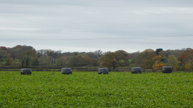
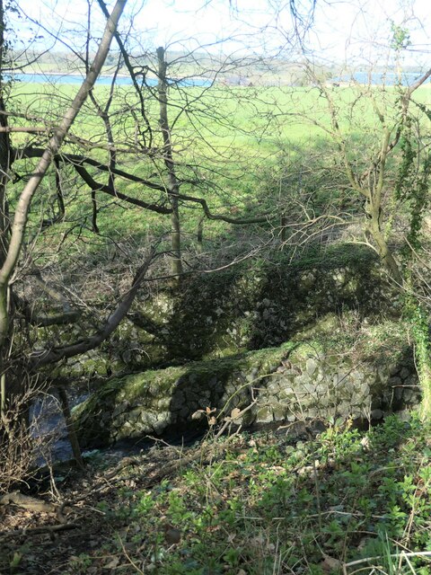
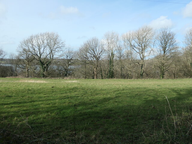
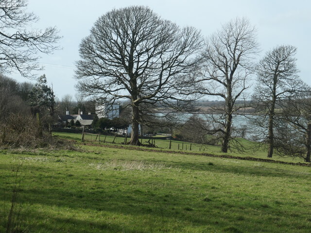
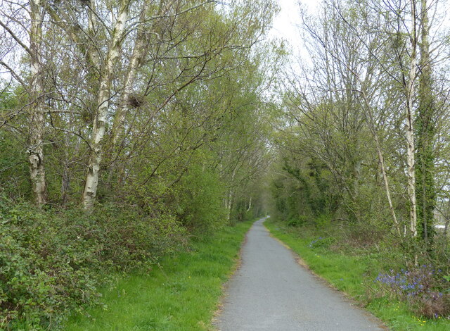
Boathouse Plantation, located in Anglesey, is a picturesque wood and forest area that offers visitors a tranquil and immersive experience amidst nature. Spanning approximately 200 acres, this plantation is known for its diverse range of tree species and abundant wildlife.

The woodland at Boathouse Plantation is primarily composed of broadleaf trees, such as oak, beech, and birch, which create a stunning canopy that provides shade and shelter for various flora and fauna. Walking through the forest, visitors can enjoy the calming sound of leaves rustling underfoot and the sweet aroma of wildflowers that bloom throughout the year.

Boathouse Plantation is not only a haven for nature enthusiasts but also a habitat for several species of wildlife. It is home to a variety of birds, including woodpeckers, owls, and songbirds, making it a popular spot for birdwatching. Small mammals like squirrels and hedgehogs can also be spotted scurrying through the undergrowth.

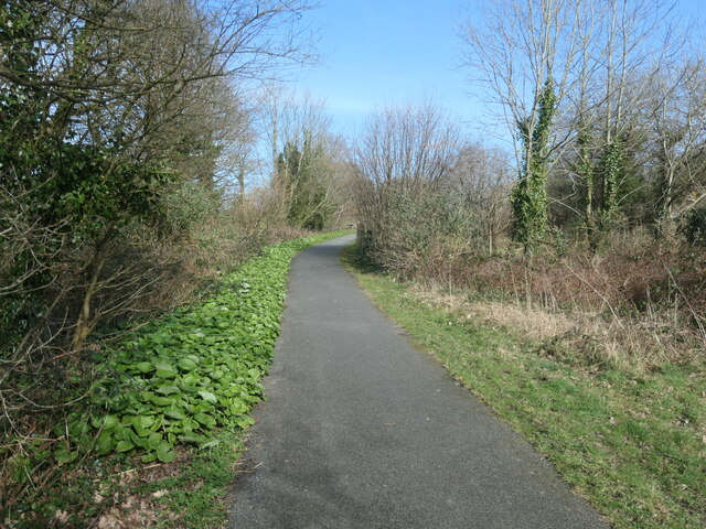
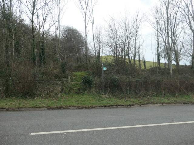
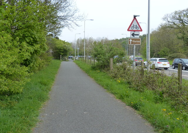
The plantation offers several walking trails that allow visitors to explore the area at their own pace. These well-maintained paths wind through the woodland, offering glimpses of stunning viewpoints and serene ponds along the way. Nature lovers can take advantage of the numerous benches scattered throughout the plantation, providing a perfect opportunity to rest and take in the beauty of the surroundings.

Overall, Boathouse Plantation in Anglesey is a captivating destination for those seeking tranquility and a chance to connect with nature. With its breathtaking woodland, diverse wildlife, and peaceful atmosphere, it is a place that leaves a lasting impression on all who visit.

If you have any feedback on the listing, please let us know in the comments section below.

Boathouse Plantation Images

Images are sourced within 2km of 53.176698/-4.2482428 or Grid Reference SH4966. Thanks to Geograph Open Source API. All images are credited.
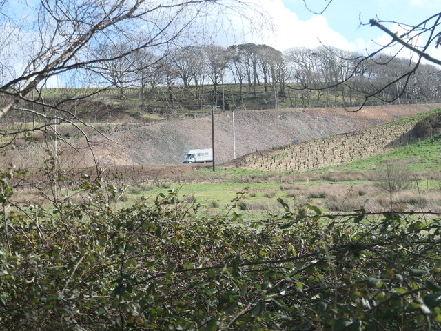
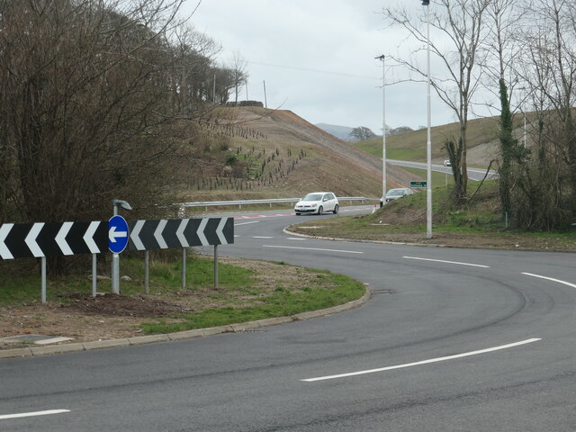
Tir Plas Porthamel / Land at Plas Porthamel
A487 at Plas Menai Roundabout Roadworks at the Plas Menai Roundabout as the diversion to the A487 (the new Caernarfon to Bontnewydd bypass <span class="nowrap"><a title="https://gov.wales/a487-caernarfon-bontnewydd-bypass" rel="nofollow ugc noopener" href="https://gov.wales/a487-caernarfon-bontnewydd-bypass">Link</a><img style="margin-left:2px;" alt="External link" title="External link - shift click to open in new window" src="https://s1.geograph.org.uk/img/external.png" width="10" height="10"/></span> ) is nearing completion (it would be opened later in the week).
A487 at Plas Menai Roundabout
Roadworks at the Plas Menai Roundabout as the diversion to the A487 (the new Caernarfon to Bontnewydd bypass LinkExternal link ) is nearing completion (it would be opened later in the week).
Open-sided barn, Parciau Farm Above some holiday cottages and the road to Caernarfon.
Open-sided barn, Parciau Farm
Above some holiday cottages and the road to Caernarfon.
This way to Griffiths Crossing and Caernarfon Lon Las Menai, heading south-west. Built on the track bed of the former railway between Bangor and Caernarfon.
This way to Griffiths Crossing and Caernarfon
Lon Las Menai, heading south-west. Built on the track bed of the former railway between Bangor and Caernarfon.
Unknown structures in a stream bed At the downstream end of a culvert under the former Bangor - Caernarfon railway.
Unknown structures in a stream bed
At the downstream end of a culvert under the former Bangor - Caernarfon railway.
Gash in the hillside, below Bryn Covert The northern end of the new Caernarfon and Bontnewydd by-pass.
Gash in the hillside, below Bryn Covert
The northern end of the new Caernarfon and Bontnewydd by-pass.
A487, old and new In the foreground, the old A487 from Y Felinheli to Caernarfon [now the A4871]. Cutting through the hillside, the new A487 from Y Felinheli, bypassing both Caernarfon and Bontnewydd.
A487, old and new
In the foreground, the old A487 from Y Felinheli to Caernarfon [now the A4871]. Cutting through the hillside, the new A487 from Y Felinheli, bypassing both Caernarfon and Bontnewydd.
Lon Las Menai, near Llanfair Hall Farm The end of a short stretch along the pavement of Ffordd Caernarfon / Caernarfon Road.
Lon Las Menai, near Llanfair Hall Farm
The end of a short stretch along the pavement of Ffordd Caernarfon / Caernarfon Road.
The southern edge of Llanfair Wood Descending to the shore of the Menai Straits.
The southern edge of Llanfair Wood
Descending to the shore of the Menai Straits.
Trees along a field boundary, near Plas Llanfair Seen from Lon Las Menai.
Trees along a field boundary, near Plas Llanfair
Seen from Lon Las Menai.
Lon Las Menai, nearing Y Felinheli A recreational route built on the trackbed of the former Caernarfon - Bangor railway.
Lon Las Menai, nearing Y Felinheli
A recreational route built on the trackbed of the former Caernarfon - Bangor railway.
Public footpath heading south-east towards Bethel On the south side of Caernarfon Road, near Llanfair Hall Farm.
Public footpath heading south-east towards Bethel
On the south side of Caernarfon Road, near Llanfair Hall Farm.
An entrance to Llanfair Hall Farm On the north side of Caernarfon Road.
An entrance to Llanfair Hall Farm
On the north side of Caernarfon Road.
The A487, just west of Y Felinheli The new road descends to the roundabout at the western end of the Y Felinheli bypass.
The A487, just west of Y Felinheli
The new road descends to the roundabout at the western end of the Y Felinheli bypass.
Caernarfon Road in Y Felinheli
National Cycle Route 8 along the A4871 Caernarfon Road Route 8 of the National Cycle Network, also known as Lôn Las Cymru, runs for 436km (271 miles) between Cardiff and Holyhead via Brecon, Builth Wells, Machynlleth, Porthmadog and Bangor.  Between Machynlleth and Porthmadog there are alternative routes - one coastal, the other inland via Dolgellau, Coed y Brenin and Trawsfynydd.
National Cycle Route 8 along the A4871 Caernarfon Road
Route 8 of the National Cycle Network, also known as Lôn Las Cymru, runs for 436km (271 miles) between Cardiff and Holyhead via Brecon, Builth Wells, Machynlleth, Porthmadog and Bangor. Between Machynlleth and Porthmadog there are alternative routes - one coastal, the other inland via Dolgellau, Coed y Brenin and Trawsfynydd.
Wales Coast Path towards Y Felinheli The Wales Coast Path (Welsh: Llwybr Arfordir Cymru) is a long distance footpath which follows the whole of the coastline of Wales. It opened on 5 May 2012, and offers a 870 mile long route from Chepstow in the south to Queensferry in the north.
Wales is the first country in the world to provide a dedicated footpath along its entire coastline. The Path runs through eleven National Nature Reserves and other nature reserves, including those managed by The Wildlife Trusts or Royal Society for the Protection of Birds (RSPB).
Logo can be seen at<a href="https://www.geograph.org.uk/photo/3738617">SS0897 : Logo, Wales Coast Path</a>.
Website: <span class="nowrap"><a title="http://www.walescoastpath.gov.uk/default.aspx" rel="nofollow ugc noopener" href="http://www.walescoastpath.gov.uk/default.aspx">Link</a><img style="margin-left:2px;" alt="External link" title="External link - shift click to open in new window" src="https://s1.geograph.org.uk/img/external.png" width="10" height="10"/></span>
Wales Coast Path towards Y Felinheli
The Wales Coast Path (Welsh: Llwybr Arfordir Cymru) is a long distance footpath which follows the whole of the coastline of Wales. It opened on 5 May 2012, and offers a 870 mile long route from Chepstow in the south to Queensferry in the north. Wales is the first country in the world to provide a dedicated footpath along its entire coastline. The Path runs through eleven National Nature Reserves and other nature reserves, including those managed by The Wildlife Trusts or Royal Society for the Protection of Birds (RSPB). Logo can be seen atSS0897 : Logo, Wales Coast Path. Website: LinkExternal link
Wales Coast Path along the A4871 The Wales Coast Path (Welsh: Llwybr Arfordir Cymru) is a long distance footpath which follows the whole of the coastline of Wales. It opened on 5 May 2012, and offers a 870 mile long route from Chepstow in the south to Queensferry in the north.
Wales is the first country in the world to provide a dedicated footpath along its entire coastline. The Path runs through eleven National Nature Reserves and other nature reserves, including those managed by The Wildlife Trusts or Royal Society for the Protection of Birds (RSPB).
Logo can be seen at<a href="https://www.geograph.org.uk/photo/3738617">SS0897 : Logo, Wales Coast Path</a>.
Website: <span class="nowrap"><a title="http://www.walescoastpath.gov.uk/default.aspx" rel="nofollow ugc noopener" href="http://www.walescoastpath.gov.uk/default.aspx">Link</a><img style="margin-left:2px;" alt="External link" title="External link - shift click to open in new window" src="https://s1.geograph.org.uk/img/external.png" width="10" height="10"/></span>
Wales Coast Path along the A4871
The Wales Coast Path (Welsh: Llwybr Arfordir Cymru) is a long distance footpath which follows the whole of the coastline of Wales. It opened on 5 May 2012, and offers a 870 mile long route from Chepstow in the south to Queensferry in the north. Wales is the first country in the world to provide a dedicated footpath along its entire coastline. The Path runs through eleven National Nature Reserves and other nature reserves, including those managed by The Wildlife Trusts or Royal Society for the Protection of Birds (RSPB). Logo can be seen atSS0897 : Logo, Wales Coast Path. Website: LinkExternal link
Show me another place!

Boathouse Plantation is located at Grid Ref: SH4966 (Lat: 53.176698, Lng: -4.2482428)

Unitary Authority: Isle of Anglesey

Police Authority: North Wales

What 3 Words

///reverses.singled.safety. Near Y Felinheli, Gwynedd

Related Wikis

Old Church of St Nidan, Llanidan

The Old Church of St Nidan, Llanidan is a medieval church in the community of Llanidan, in Anglesey, North Wales, close to the Menai Strait. The first...

Llanfair-is-gaer

Llanfair-is-gaer was an ecclesiastical parish in Caernarfon, Gwynedd: the parish church was St Mary's. == References ==

Menai Strait

The Menai Strait (Welsh: Afon Menai, lit. 'River Menai') is a strait which separates the island of Anglesey from Gwynedd, on the mainland of Wales. It...

St Nidan's Church, Llanidan

St Nidan's Church, Llanidan is a 19th-century parish church near the village of Brynsiencyn, in Anglesey, north Wales. Built between 1839 and 1843, it...

Nearby Amenities

Located within 500m of 53.176698,-4.2482428
Source: PGS
Lat/Long: 53.174183/-4.2530322
Source: PGS
Lat/Long: 53.1752383/-4.2498777
Source: PGS
Lat/Long: 53.1762345/-4.2478613
Source: PGS
Lat/Long: 53.1772659/-4.2467932
Source: PGS
Lat/Long: 53.1790256/-4.2451635
Source: PGS
Lat/Long: 53.1795062/-4.2431514
Location Transition: yes
Power: pole
Lat/Long: 53.1803774/-4.2485628
The data included in this document is from www.openstreetmap.org. The data is made available under ODbL.

Have you been to Boathouse Plantation?

Leave your review of Boathouse Plantation below (or comments, questions and feedback).