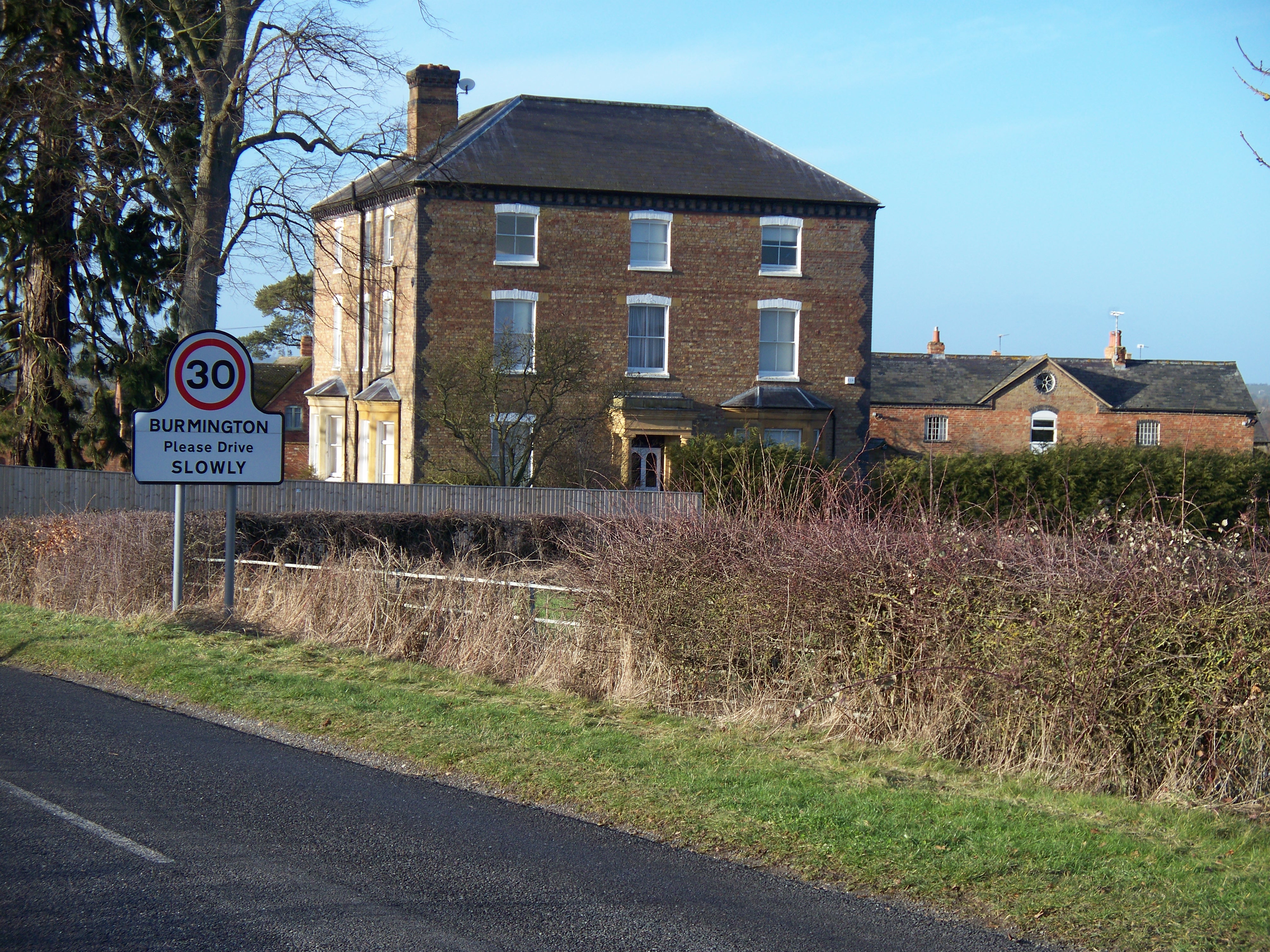
Burmington

Settlement in Warwickshire Stratford-on-Avon

England

Burmington

Raised granary Old staddle stones used as ornaments are a common sight in country districts,  but it is rare to find them still in their original position as in this timber-framed granary with brick infilling, where their purpose is to support the structure clear of the ground and out of the reach of vermin.  For more detail see <a href="https://www.geograph.org.uk/photo/1674578">SP2637 : High off the ground</a> (I see that honey is no longer for sale!)
Raised granary Credit: Tiger

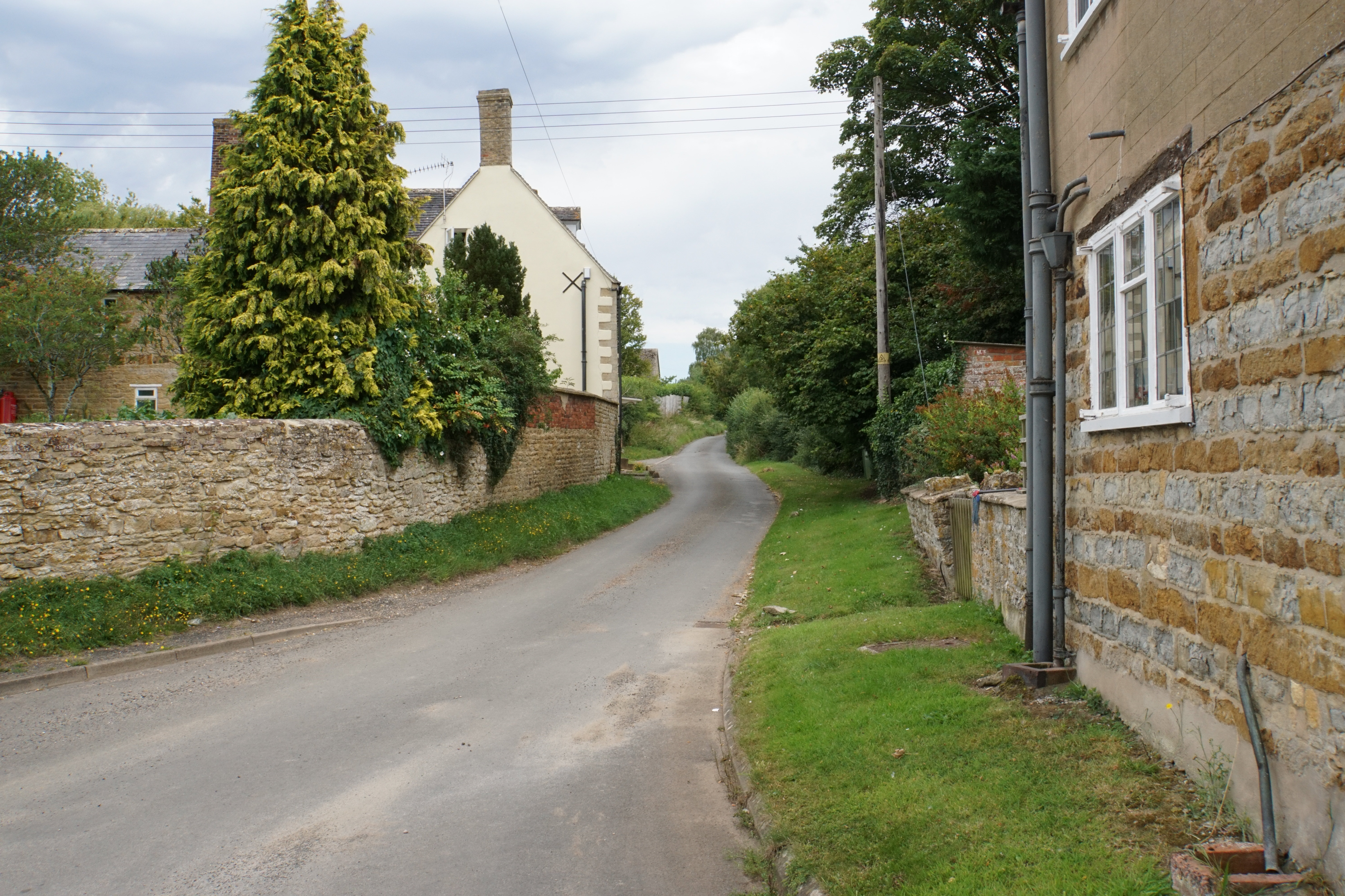
Burmington is a charming village located in the county of Warwickshire, England. Situated in the heart of the picturesque countryside, it offers a peaceful and idyllic setting for residents and visitors alike. With a population of around 300 people, it maintains a close-knit community atmosphere.

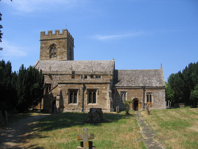
The village is known for its rich history, dating back many centuries. It is mentioned in the Domesday Book of 1086, and remnants of its past can still be seen in the form of historical buildings and landmarks. The St. Barnabas Church, a Grade II listed building, is a prominent feature in Burmington, with its striking architecture and beautiful stained glass windows.

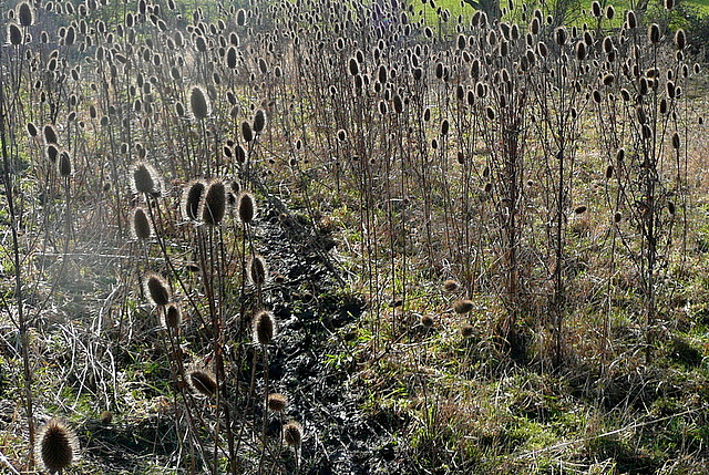
Nature enthusiasts will find themselves immersed in the natural beauty that surrounds the village. The rolling hills, lush meadows, and winding streams provide ample opportunities for outdoor activities such as hiking, cycling, and picnicking. The River Stour, which flows through Burmington, offers a serene spot for fishing enthusiasts.

Despite its small size, Burmington has a strong sense of community spirit. The village hosts various social events and gatherings throughout the year, including a summer fete and a Christmas market. The local pub, The George and Dragon, serves as a popular meeting place for locals and visitors, offering a warm and friendly atmosphere.

Overall, Burmington is a quaint and picturesque village that offers a peaceful retreat from the bustling city life. Its rich history, natural beauty, and strong community spirit make it a truly special place to live or visit.

If you have any feedback on the listing, please let us know in the comments section below.

Burmington Images

Images are sourced within 2km of 52.039532/-1.616796 or Grid Reference SP2637. Thanks to Geograph Open Source API. All images are credited.

Raised granary Old staddle stones used as ornaments are a common sight in country districts,  but it is rare to find them still in their original position as in this timber-framed granary with brick infilling, where their purpose is to support the structure clear of the ground and out of the reach of vermin.  For more detail see <a href="https://www.geograph.org.uk/photo/1674578">SP2637 : High off the ground</a> (I see that honey is no longer for sale!)
Raised granary
Old staddle stones used as ornaments are a common sight in country districts, but it is rare to find them still in their original position as in this timber-framed granary with brick infilling, where their purpose is to support the structure clear of the ground and out of the reach of vermin. For more detail see SP2637 : High off the ground (I see that honey is no longer for sale!)
Wolford Fields Cottages The two cottages are alongside the A3400 road (formerly the A34).
Wolford Fields Cottages
The two cottages are alongside the A3400 road (formerly the A34).
Wolford Fields Farm [1] The farm is offering a variety of produce and other services.  Perhaps the logs go well with the raspberries.  The A3400 road is to the right.
Wolford Fields Farm [1]
The farm is offering a variety of produce and other services. Perhaps the logs go well with the raspberries. The A3400 road is to the right.
Wolford Fields Farm [2] The working part of the farm, seen from the A3400 road.
Wolford Fields Farm [2]
The working part of the farm, seen from the A3400 road.
Wolford Fields Farm [3] The farmhouse, seen from the A3400 road.
Wolford Fields Farm [3]
The farmhouse, seen from the A3400 road.
Tree near Tidmington Probably a pine of some description.
Tree near Tidmington
Probably a pine of some description.
Bridleway ford at Tidmington This ford on the Knee Brook is found on the bridleway to Todenham. The track becomes a byway just beyond the ford itself.
Bridleway ford at Tidmington
This ford on the Knee Brook is found on the bridleway to Todenham. The track becomes a byway just beyond the ford itself.
Barcheston church It is difficult to get a good view of the church from this direction.  This is from Shakespeare's Way, which runs through a thinly populated orchard here.
Barcheston church
It is difficult to get a good view of the church from this direction. This is from Shakespeare's Way, which runs through a thinly populated orchard here.
Barcheston hamlet The Shakespeare's Way guide describes Barcheston as "minute hamlet" which seems somewhat tautologous.  Unless of course the guide is thinking of a miniature version of the Prince of Denmark, of whom there was no evidence.  There is a cast iron village water pump adjacent to this barn conversion though.
Barcheston hamlet
The Shakespeare's Way guide describes Barcheston as "minute hamlet" which seems somewhat tautologous. Unless of course the guide is thinking of a miniature version of the Prince of Denmark, of whom there was no evidence. There is a cast iron village water pump adjacent to this barn conversion though.
Teasels on the path We were heading directly in to low winter sun, which was backlighting this profusion of teasels adjacent to the footpath, part of Shakespeare's Way.
Teasels on the path
We were heading directly in to low winter sun, which was backlighting this profusion of teasels adjacent to the footpath, part of Shakespeare's Way.
Shakespeare's Way near Willington The path crosses this pasture adjacent to the River Stour, with more pasture on the far bank.
Shakespeare's Way near Willington
The path crosses this pasture adjacent to the River Stour, with more pasture on the far bank.
Bridge at Bridge Farm This bridge carries a farm access track across the River Stour, and is also a public footpath.  It is not used by Shakespeare's Way though, which stays on this side.
Bridge at Bridge Farm
This bridge carries a farm access track across the River Stour, and is also a public footpath. It is not used by Shakespeare's Way though, which stays on this side.
Cottage in Willington Shakespeare's Way passes the door.  Note the bread oven.
Cottage in Willington
Shakespeare's Way passes the door. Note the bread oven.
Cottages in Willington A corner of the village showing a couple of the cottages, the postbox and the village noticeboard.  Shakespeare's Way passes here.
Cottages in Willington
A corner of the village showing a couple of the cottages, the postbox and the village noticeboard. Shakespeare's Way passes here.
Rest near College Farm College Farm is in the background.  Shakespeare's Way passes this bench, a good point for a tea stop.
Rest near College Farm
College Farm is in the background. Shakespeare's Way passes this bench, a good point for a tea stop.
Approaching Willington Straight ahead for Willington, and also Shakespeare's Way.
Approaching Willington
Straight ahead for Willington, and also Shakespeare's Way.
Towards Ivy Ground Spinney Shakespeare's Way uses this footpath, diagonally across this field towards the spinney, on the right, and beyond.  It contains very claggy clay soil.
Towards Ivy Ground Spinney
Shakespeare's Way uses this footpath, diagonally across this field towards the spinney, on the right, and beyond. It contains very claggy clay soil.
Near Ivy Ground Spinney The spinney is to the left.  The footpath, used by Shakespeare's Way, crosses from one claggy clay field to another here.
Near Ivy Ground Spinney
The spinney is to the left. The footpath, used by Shakespeare's Way, crosses from one claggy clay field to another here.
Show me another place!

Burmington is located at Grid Ref: SP2637 (Lat: 52.039532, Lng: -1.616796)

Administrative County: Warwickshire

District: Stratford-on-Avon

Police Authority: Warwickshire

What 3 Words

///treatable.megawatt.deliver. Near Shipston on Stour, Warwickshire

Nearby Locations

Burmington

Related Wikis

Burmington

Burmington is a village and civil parish in Warwickshire, England. It is 2 miles (3 km) south of Shipston-on-Stour. The population at the 2001 Census was...

Tidmington

Tidmington is a village and civil parish in the Stratford-on-Avon District of Warwickshire, England. It is 11 miles (18 km) south from the town of Stratford...

Barcheston

Barcheston is a village and civil parish in the Stratford-on-Avon district of Warwickshire, England. The village is on the east bank of the River Stour...

Willington, Warwickshire

Willington is a village in Warwickshire, England. Population details are included within Barcheston. The origin of the place-name is from Old English tun...

Shipston-on-Stour

Shipston-on-Stour is a town and civil parish in the Stratford-on-Avon District in southern Warwickshire, England. It is located on the banks of the River...

Shipston-on-Stour Rural District

Shipston on Stour was a rural district in England from 1894 to 1974. [1] The district covered an area around Shipston-on-Stour. Originally it was a detached...

Evolution of Worcestershire county boundaries since 1844

The administrative boundaries of Worcestershire, England have been fluid for over 150 years since the first major changes in 1844. There were many detached...

Little Wolford

Little Wolford is a hamlet and civil parish in the Stratford-on-Avon district of Warwickshire, England. With the neighbouring parish of Great Wolford it...

Nearby Amenities

Located within 500m of 52.039532,-1.616796
Bus Stop
Church
Bus: yes
Naptan AtcoCode: 4200F013400
Naptan Bearing: NW
Naptan CommonName: Church
Naptan Indicator: Adj
Naptan NaptanCode: wardgada
Naptan Street: Main Street
Naptan Verified: no
Public Transport: platform
Source: naptan_import
Lat/Long: 52.0395208/-1.6167498
Bus Stop
Orchard View
Bus: yes
Naptan AtcoCode: 4200F013500
Naptan Bearing: NW
Naptan CommonName: Orchard View
Naptan Indicator: Adj
Naptan NaptanCode: wardgadg
Naptan Street: Main Street
Naptan Verified: no
Public Transport: platform
Source: naptan_import
Lat/Long: 52.0387342/-1.6147176
Turn
Naptan AtcoCode: 4200F013600
Naptan Bearing: S
Naptan BusStopType: CUS
Naptan CommonName: Turn
Naptan Indicator: Adj
Naptan NaptanCode: wardgadj
Naptan Street: Shipston Road
Naptan Verified: no
Source: naptan_import
Lat/Long: 52.0396846/-1.6194331
Turn
Naptan AtcoCode: 4200F013601
Naptan Bearing: N
Naptan BusStopType: CUS
Naptan CommonName: Turn
Naptan Indicator: Opp
Naptan NaptanCode: wardjdtw
Naptan Street: Shipston Road
Naptan Verified: no
Source: naptan_import
Lat/Long: 52.0396673/-1.619652
Give Way
Direction: forward
Source: Warwicks CC Aerial Imagery 2013
Lat/Long: 52.0375384/-1.6119082
Burmington
Place: village
Wikidata: Q4999473
Lat/Long: 52.039303/-1.615362
Post Box
Collection Times: Mo-Fr 15:15; Sa 08:00
Operator: Royal Mail
Operator Wikidata: Q638098
Post Box Type: lamp
Ref: CV36 141
Royal Cypher: EIIR
Royal Cypher Wikidata: Q33102113
Source: survey
Lat/Long: 52.0395625/-1.616671
Barrier: stile
Lat/Long: 52.0408394/-1.6161517
Barrier: kissing_gate
Lat/Long: 52.0398438/-1.6173591
Give Way
Direction: backward
Source: Warwicks CC Aerial Imagery 2013
Lat/Long: 52.0397425/-1.6195212
Stop
Direction: backward
Source: Warwicks CC Aerial Imagery 2013
Stop: minor
Lat/Long: 52.037584/-1.6118636
Brand: National Grid
Brand Wikidata: Q1465461
Material: wood
Operator: National Grid Electricity Distribution
Operator Old: Western Power Distribution
Operator Wikidata: Q7988183
Owner: National Grid Electricity Distribution (West Midlands) Plc
Owner Wikidata: Q114397791
Power: pole
Lat/Long: 52.0407352/-1.6225593
Burmington Mill
Brand: National Grid
Brand Wikidata: Q1465461
Frequency: 50
Material: wood
Operator: National Grid Electricity Distribution
Operator Old: Western Power Distribution
Operator Wikidata: Q7988183
Owner: National Grid Electricity Distribution (West Midlands) Plc
Owner Wikidata: Q114397791
Power: pole
Transformer: distribution
Voltage Primary: 11000
Lat/Long: 52.0408355/-1.6218746
Material: wood
Power: pole
Lat/Long: 52.0410715/-1.6214161
Material: wood
Power: pole
Lat/Long: 52.0405037/-1.6217602
Brand: National Grid
Brand Wikidata: Q1465461
Material: wood
Operator: National Grid Electricity Distribution
Operator Old: Western Power Distribution
Operator Wikidata: Q7988183
Owner: National Grid Electricity Distribution (West Midlands) Plc
Owner Wikidata: Q114397791
Power: pole
Lat/Long: 52.0411355/-1.6227948
Material: wood
Power: pole
Lat/Long: 52.0403206/-1.6217247
Material: wood
Power: pole
Lat/Long: 52.0413247/-1.6215387
Brand: National Grid
Brand Wikidata: Q1465461
Material: wood
Operator: National Grid Electricity Distribution
Operator Old: Western Power Distribution
Operator Wikidata: Q7988183
Owner: National Grid Electricity Distribution (West Midlands) Plc
Owner Wikidata: Q114397791
Power: pole
Lat/Long: 52.0408975/-1.623667
Man Made: utility_pole
Material: steel
Operator: Openreach
Utility: telecom
Lat/Long: 52.0403949/-1.6207751
Man Made: utility_pole
Material: wood
Operator: Openreach
Utility: telecom
Lat/Long: 52.0406824/-1.6211782
Material: wood
Power: pole
Lat/Long: 52.0417298/-1.6215948
Location Transition: yes
Power: pole
Lat/Long: 52.0373935/-1.6109589
Burmington Village
Location Transition: yes
Power: pole
Transformer: distribution
Voltage Primary: 11000
Lat/Long: 52.0391911/-1.6152611
Location Transition: yes
Power: pole
Lat/Long: 52.0380555/-1.6132649
Power: pole
Lat/Long: 52.0375865/-1.6121236
Power: pole
Lat/Long: 52.0372384/-1.610979
The data included in this document is from www.openstreetmap.org. The data is made available under ODbL.

Have you been to Burmington?

Leave your review of Burmington below (or comments, questions and feedback).