Coed Helen

Wood, Forest in Caernarfonshire

Wales

Coed Helen

Ffordd osgoi Caernarfon a Bontnewydd / Caernarfon and Bontnewydd bypass
Ffordd osgoi Caernarfon a Bontnewydd / Caernarfon and Bontnewydd bypass Credit: Ceri Thomas

Coed Helen is a woodland area located in the county of Caernarfonshire, Wales. Situated just outside the town of Caernarfon, it covers an area of approximately 85 acres. The woodland is a mix of native and non-native tree species, creating a diverse and picturesque landscape.

Coed Helen offers a range of recreational activities for visitors to enjoy. There are numerous walking trails and paths that wind through the woods, allowing visitors to explore the natural beauty of the area. The paths are well-maintained and suitable for people of all ages and abilities.

The woodland is also home to a variety of wildlife, making it a popular spot for nature enthusiasts. Birdwatchers can often spot a range of species, including woodpeckers, buzzards, and owls. Squirrels and rabbits are also commonly seen within the woodland.

Coed Helen provides a peaceful and tranquil environment, away from the hustle and bustle of urban life. It is a popular spot for locals and tourists alike, who come to enjoy the beauty and serenity of the woodland. Picnic areas and benches are scattered throughout the woods, allowing visitors to relax and take in the surroundings.

Overall, Coed Helen is a beautiful woodland area in Caernarfonshire, offering a range of recreational activities and a chance to connect with nature. It is a must-visit destination for those seeking a peaceful escape in a stunning natural setting.

If you have any feedback on the listing, please let us know in the comments section below.

Coed Helen Images

Images are sourced within 2km of 53.135583/-4.2807947 or Grid Reference SH4762. Thanks to Geograph Open Source API. All images are credited.

Ffordd osgoi Caernarfon a Bontnewydd / Caernarfon and Bontnewydd bypass
Y Maes, Caernarfon View across Y Maes (Castle Square), Caernarfon.
Y Maes, Caernarfon
View across Y Maes (Castle Square), Caernarfon.
Croeso i Gaernarfon - Welcome to Caernarfon Access to part of the site of the Caernarfon/Dinas/Llanwnda by-pass. This  huge project, started in 2019, is due to be completed by early 2022.
Croeso i Gaernarfon - Welcome to Caernarfon
Access to part of the site of the Caernarfon/Dinas/Llanwnda by-pass. This huge project, started in 2019, is due to be completed by early 2022.
Arwyddion ar ffordd osgoi Bontnewydd / Signs on Bontnewydd by-pass Taken during a charity walk before opening.
Arwyddion ar ffordd osgoi Bontnewydd / Signs on Bontnewydd by-pass
Taken during a charity walk before opening.
Taith gerdded elusennol  / Charity walk Taken on the Bontnewydd by-pass
Taith gerdded elusennol / Charity walk
Taken on the Bontnewydd by-pass
Segontium Roman Fort Bathhouse The bathhouse was excavated in 1977. This photograph was taken in 1980.
Segontium Roman Fort Bathhouse
The bathhouse was excavated in 1977. This photograph was taken in 1980.
WHR train waiting near Ffordd Pant A Welsh Highland railway train from Caernarvon waits at the level crossing off Ffordd Pant (Pant Road) to cross and continue on towards Bontnewydd and Dinas.  The locomotive is ex South African Railways Garratt 2-6-2+2-6-2 Class NGG16 No. 87.
WHR train waiting near Ffordd Pant
A Welsh Highland railway train from Caernarvon waits at the level crossing off Ffordd Pant (Pant Road) to cross and continue on towards Bontnewydd and Dinas. The locomotive is ex South African Railways Garratt 2-6-2+2-6-2 Class NGG16 No. 87.
Fron Goch garden centre - outside cafe area A super, IMO, garden centre which caters for all ages.
Fron Goch garden centre - outside cafe area
A super, IMO, garden centre which caters for all ages.
Massey Ferguson tractor Presumably used for the marine vessels close by.
Massey Ferguson tractor
Presumably used for the marine vessels close by.
Moored vessels beside the Wales Coast path On Foryd Road.
Some of these may not have moved in years. See <a href="https://www.geograph.org.uk/photo/5475471">SH4661 : Boats beside the Wales Coast Path</a>
Moored vessels beside the Wales Coast path
On Foryd Road. Some of these may not have moved in years. See SH4661 : Boats beside the Wales Coast Path
Caernarfon Castle The large vessel is the historic motor yacht Britain a former lightship which is owned and operated by the Viscount Shipping Line.
Edward I and his military architect Master James of St George erected a castle, town walls and a quay all at the same time. This gigantic building project eventually took 47 years and cost a staggering £25,000. (Source Cadw)
Caernarfon Castle
The large vessel is the historic motor yacht Britain a former lightship which is owned and operated by the Viscount Shipping Line. Edward I and his military architect Master James of St George erected a castle, town walls and a quay all at the same time. This gigantic building project eventually took 47 years and cost a staggering £25,000. (Source Cadw)
The Anglesey pub A wonderful spot for a pint in summer.
The Anglesey pub
A wonderful spot for a pint in summer.
The Celtic Royal Hotel A very historic hotel. See <span class="nowrap"><a title="https://celtic-royal.co.uk/history/" rel="nofollow ugc noopener" href="https://celtic-royal.co.uk/history/">Link</a><img style="margin-left:2px;" alt="External link" title="External link - shift click to open in new window" src="https://s1.geograph.org.uk/img/external.png" width="10" height="10"/></span>
The Celtic Royal Hotel
A very historic hotel. See LinkExternal link
Buoy oh buoy Along the West Coast path foreshore.
Buoy oh buoy
Along the West Coast path foreshore.
Caernarfon harbour
Caernarfon harbour
Caernarfon Castle and Pont Aber Featuring the Eagle Tower in the centre of the image.
Edward I and his military architect Master James of St George erected a castle, town walls and a quay all at the same time. This gigantic building project eventually took 47 years and cost a staggering £25,000. (Source Cadw)
Caernarfon Castle and Pont Aber
Featuring the Eagle Tower in the centre of the image. Edward I and his military architect Master James of St George erected a castle, town walls and a quay all at the same time. This gigantic building project eventually took 47 years and cost a staggering £25,000. (Source Cadw)
Caernarfon Golf clubhouse A challenging course given the prevailing wind coming across the Menai Straits.
Caernarfon Golf clubhouse
A challenging course given the prevailing wind coming across the Menai Straits.
Marine equipment on roadside at Llanfaglan
Show me another place!

Coed Helen is located at Grid Ref: SH4762 (Lat: 53.135583, Lng: -4.2807947)

Unitary Authority: Gwynedd

Police Authority: North Wales

What 3 Words

///shapes.energy.arts. Near Caernarfon, Gwynedd

Related Wikis

Aber Swing Bridge

The Aber Swing Bridge, also known as the Pont yr Aber and Caernarfon swing bridge, is a pedestrian swing bridge in Gwynedd, Wales. This footbridge crosses...

Seiont (electoral ward)

Seiont is an electoral ward in the town of Caernarfon, Gwynedd, Wales, electing councillors to the town council and Gwynedd Council. == Description... ==

Aber Afon Seiont

Afon Seiont is a Site of Special Scientific Interest (or SSSI) in West Gwynedd, Wales. It is protected by law and has been designated as a Site of Special...
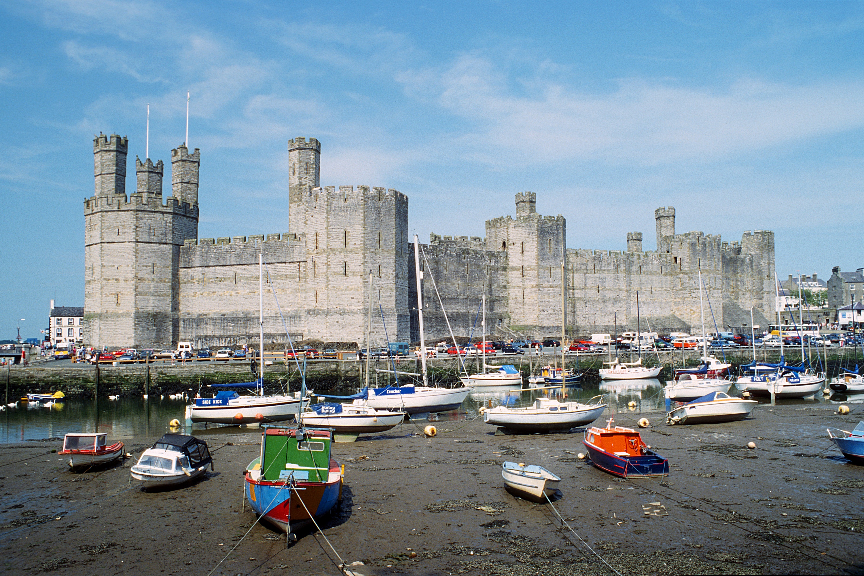
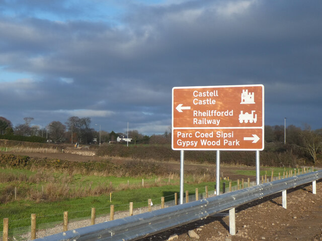
Caernarfon Castle

Caernarfon Castle (Welsh: Castell Caernarfon; Welsh pronunciation: [kastɛɬ kaɨrˈnarvɔn]) is a medieval fortress in Gwynedd, north-west Wales. The first...

County Hall, Caernarfon

County Hall (Welsh: Neuadd y Sir Caernarfon) is a former municipal facility at Castle Ditch in Caernarfon, Wales. The County Hall, which was the headquarters...

Carnarvon Castle railway station

Carnarvon Castle railway station was opened in 1856 by the narrow gauge Nantlle Railway near the foot of what is today the Allt Y Castell which slopes...

Council Offices, Caernarfon

The Council Offices (Welsh: Swyddfa'r Cyngor) is a municipal facility at Shirehall Street in Caernarfon, Wales. The structure, which is the headquarters...

Porth yr Aur

Porth yr Aur is a Grade I listed 13th-century fortification in Caernarfon which forms part of Caernarfon Castle's medieval defences. Originally known as...

Nearby Amenities

Located within 500m of 53.135583,-4.2807947
Source: PGS
Lat/Long: 53.1394494/-4.2786315
Source: PGS
Lat/Long: 53.1387729/-4.278366
Source: PGS
Lat/Long: 53.1387599/-4.2764186
Source: PGS
Lat/Long: 53.1387332/-4.2762918
Source: PGS
Lat/Long: 53.1386576/-4.275977
Source: PGS
Lat/Long: 53.1383216/-4.2750396
Source: PGS
Lat/Long: 53.1336702/-4.274265
Source: PGS
Lat/Long: 53.1342001/-4.2739289
Source: PGS
Lat/Long: 53.1344557/-4.2736829
Source: PGS
Lat/Long: 53.1368921/-4.2737959
Source: PGS
Lat/Long: 53.1370735/-4.2743572
Source: PGS
Lat/Long: 53.1372888/-4.274811
Source: PGS
Lat/Long: 53.1376555/-4.2757613
Source: PGS
Lat/Long: 53.1377467/-4.2758066
Source: PGS
Lat/Long: 53.1378955/-4.2774776
Source: PGS
Lat/Long: 53.139257/-4.2799272
Source: PGS
Lat/Long: 53.1393683/-4.2803848
Caernarfon
Alt Name Ur: کائرنارفون
Is In: Gwynedd,Cymru,Wales,UK
Is In Country: United Kingdom
Is In Country Code: GB
Is In County: Gwynedd
Name Cy: Caernarfon
Name Ru: Карнарвон
Name Ur: کرنارون
Name Zh: 加拿分
Old Name En: Carnarvon;Caernarvon
Place: town
Population: 9730
Population Date: 2011-03-27
Postal Code: LL
Source Population: https://www.nomisweb.co.uk
Wikidata: Q428829
Wikipedia: en:Caernarfon
Lat/Long: 53.1394364/-4.2769751
Bench
Source: Bing
Lat/Long: 53.1394107/-4.2825382
Turning Circle
Lat/Long: 53.1389076/-4.2781068
Coed Helen Hill
Ele: 48
Natural: peak
Lat/Long: 53.136855/-4.2797493
Man Made: tower
Operator: EE telecoms
Ref: 15853
Lat/Long: 53.1367856/-4.2796886
Barrier: lift_gate
Lat/Long: 53.135598/-4.2787246
Barrier: kissing_gate
Lat/Long: 53.1376053/-4.2812631
Barrier: kissing_gate
Lat/Long: 53.1385851/-4.2861233
Barrier: kissing_gate
Lat/Long: 53.1376478/-4.2784431
Man Made: flagpole
Lat/Long: 53.139292/-4.2781636
Hiking: yes
Information: guidepost
Tourism: information
Lat/Long: 53.1391444/-4.2783701
Bench
Lat/Long: 53.1391074/-4.2763585
Waste Basket
Colour: green
Material: metal
Survey Date: 2022-08-16
Waste: litter
Lat/Long: 53.1388828/-4.2795444
Barrier: bollard
Lat/Long: 53.1389255/-4.2757743
Barrier: bollard
Lat/Long: 53.1389176/-4.2757589
The data included in this document is from www.openstreetmap.org. The data is made available under ODbL.

Have you been to Coed Helen?

Leave your review of Coed Helen below (or comments, questions and feedback).