Allt Cwm Feinog
Wood, Forest in Cardiganshire
Wales
Allt Cwm Feinog

Allt Cwm Feinog is a picturesque woodland located in the county of Cardiganshire, Wales. Spread across a vast area, this enchanting forest is known for its abundant natural beauty and diverse wildlife. Renowned for its tranquility and serenity, Allt Cwm Feinog offers a serene escape for nature enthusiasts and hikers alike.
The woodland is dominated by a mix of deciduous and coniferous trees, creating a rich tapestry of colors throughout the seasons. Towering oak, beech, and birch trees provide shade and shelter for an array of woodland creatures, including deer, foxes, and various bird species. The forest floor is carpeted with a variety of wildflowers, adding to the area's vibrant atmosphere.
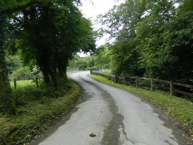
Allt Cwm Feinog boasts a network of well-marked trails, making it an ideal destination for outdoor activities such as hiking, walking, and birdwatching. The paths wind their way through the forest, offering breathtaking views of the surrounding countryside and the nearby River Teifi. Visitors can also explore the hidden gems within the woodland, such as the cascading waterfalls and secluded picnic spots.
The woodland is managed by local authorities, ensuring its preservation and protection for future generations to enjoy. Access to Allt Cwm Feinog is free, and the site is open to the public throughout the year. It is recommended to bring appropriate footwear and clothing when visiting, as the paths can become muddy after rainfall.
Overall, Allt Cwm Feinog is a natural haven that showcases the beauty of the Welsh countryside. Its lush vegetation, diverse wildlife, and tranquil ambiance make it a must-visit destination for nature lovers and those seeking solace in the great outdoors.
If you have any feedback on the listing, please let us know in the comments section below.
Allt Cwm Feinog Images
Images are sourced within 2km of 52.187512/-4.2391248 or Grid Reference SN4756. Thanks to Geograph Open Source API. All images are credited.


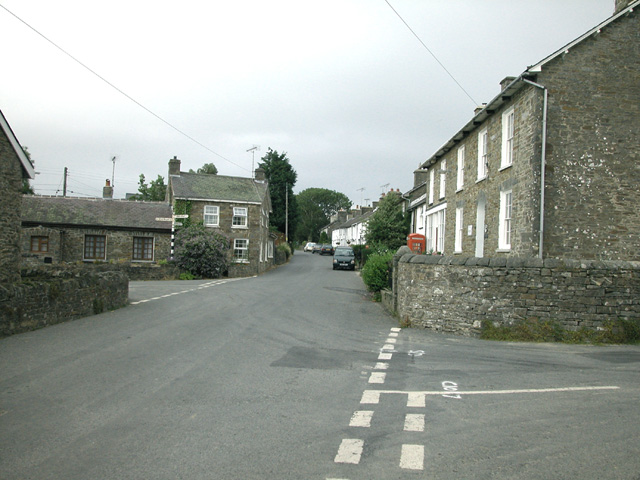
![Mydroilyn Pentref Mydroilyn gyda chyn Dafarn y Red Lion ar y dde.
The village of Mydroilyn (trans. the confluence of the Mydr [river] and the Eilin [stream]) with the former Red Lion Public House on the right.](https://s0.geograph.org.uk/geophotos/06/78/96/6789624_a89b3c5a.jpg)


Allt Cwm Feinog is located at Grid Ref: SN4756 (Lat: 52.187512, Lng: -4.2391248)
Unitary Authority: Ceredigion
Police Authority: Dyfed Powys
What 3 Words
///unusable.veal.unspoiled. Near Llanarth, Ceredigion
Nearby Locations
Related Wikis

Dihewyd
Dihewyd is a parish in the county of Ceredigion, West Wales with a population of about 200 people. It is 5 miles (8 km) from Aberaeron and 8 miles (13...

Mydroilyn
Mydroilyn is a village in the parish of Llanarth, Ceredigion, Wales, situated along the B4342 road. The name of the village is derived from the confluence...
Oakford, Ceredigion
Oakford (Welsh Derwen Gam) is a hamlet in the Welsh county of Ceredigion. It is some 5 miles (8 km) south of the coastal town of Aberaeron. == External... ==

Foelallt
Foelallt is a small village in the community of Ciliau Aeron, Ceredigion, Wales, which is 66.2 miles (106.6 km) from Cardiff and 180.2 miles (290 km)...

Llanerch-Ayron Halt railway station
Llanerch-Ayron Halt was a small railway station on the Aberayron branch of the Carmarthen to Aberystwyth Line in the Welsh county of Ceredigion serving...
Crossways Halt railway station
Crossways Halt was a small railway station on the Aberayron branch of the Carmarthen to Aberystwyth Line in the Welsh county of Ceredigion serving the...

Llanerchaeron
Llanerchaeron, known as "Llanayron House" to its nineteenth-century occupants, is a grade I listed mansion on the River Aeron, designed and built in 1795...
Ciliau Aeron
Ciliau Aeron (English: where the valley of the river Aeron narrows) is a community and small village 4 miles from Aberaeron in Ceredigion, Wales on the...
Have you been to Allt Cwm Feinog?
Leave your review of Allt Cwm Feinog below (or comments, questions and feedback).