Allt y Llan

Wood, Forest in Carmarthenshire

Wales

Allt y Llan

Rhyd, Nant Aerau ar y trac i / Ford, Nant Aerau over the track to Cwmere, Llanllawddog
Rhyd, Nant Aerau ar y trac i / Ford, Nant Aerau over the track to Cwmere, Llanllawddog Credit: David Jones

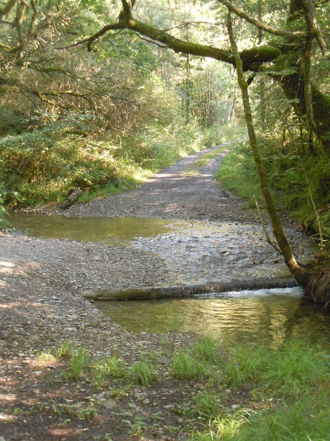
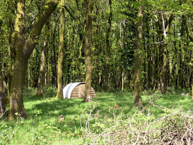
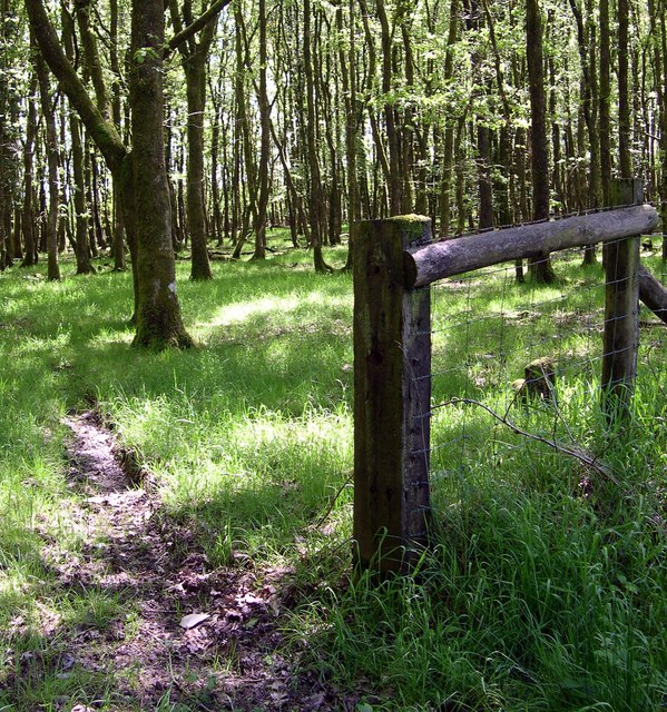
Allt y Llan is a picturesque woodland located in Carmarthenshire, Wales. Covering an area of approximately 300 acres, it is a stunning natural attraction that offers visitors a peaceful and enchanting experience.

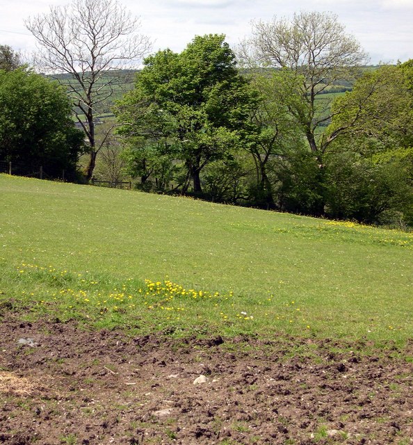
The woodland is predominantly composed of native broadleaf trees, including oak, beech, and ash, which create a diverse and vibrant ecosystem. The forest floor is adorned with a carpet of wildflowers, such as bluebells and primroses, adding to the beauty of the surroundings.

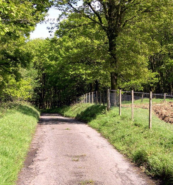
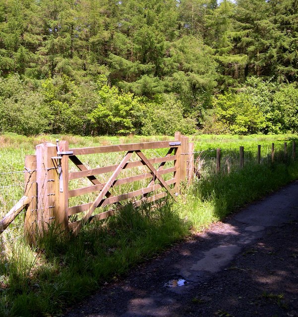
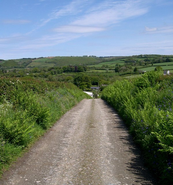
Walking trails wind through the woodland, providing visitors with the opportunity to explore its hidden treasures. These paths are well-maintained and suitable for all ages and abilities, making Allt y Llan an accessible destination for nature enthusiasts and families alike.

The woodland is home to a variety of wildlife, including birds such as woodpeckers, tawny owls, and red kites. It is also a haven for small mammals like squirrels and badgers, as well as numerous species of insects and butterflies.

Allt y Llan offers more than just natural beauty. It also has a rich history, with evidence of ancient settlements and mining activities dating back centuries. Visitors can discover remnants of the past, such as old mine workings and abandoned cottages, which add an intriguing element to the woodland experience.

Overall, Allt y Llan in Carmarthenshire is a captivating woodland that showcases the diverse and breathtaking beauty of the Welsh countryside. Whether it's for a leisurely walk, birdwatching, or simply enjoying the tranquility of nature, this woodland is sure to leave visitors with lasting memories.

If you have any feedback on the listing, please let us know in the comments section below.

Allt y Llan Images

Images are sourced within 2km of 51.94417/-4.2477005 or Grid Reference SN4529. Thanks to Geograph Open Source API. All images are credited.

Rhyd, Nant Aerau ar y trac i / Ford, Nant Aerau over the track to Cwmere, Llanllawddog
Straight road south of Alltwalis
A485 at Dolau Bach
A485 at Dolau Bach
Heol A485 Road Cerddwyr ar yr A485 ger Ffarm Llwynglas

Walkers on the A485 near Llwynglas Farm (trans. green grove)
Heol A485 Road
Cerddwyr ar yr A485 ger Ffarm Llwynglas Walkers on the A485 near Llwynglas Farm (trans. green grove)
Uwchben / Above Nant Aerau Stream Llwybr yn uchel uwchben Nant Aerau. Nid oes modd cerdded y llwybr i gyda gan fod ei ochr ddwyreinol wedi ei rwsytro gan dyfiant trwchus. 

A path high above the Aerau Stream. It is not possible to walk the whole path as it is blocked at its eastern end with thick undergrowth.
Uwchben / Above Nant Aerau Stream
Llwybr yn uchel uwchben Nant Aerau. Nid oes modd cerdded y llwybr i gyda gan fod ei ochr ddwyreinol wedi ei rwsytro gan dyfiant trwchus. A path high above the Aerau Stream. It is not possible to walk the whole path as it is blocked at its eastern end with thick undergrowth.
The A485 north of Rhydargaeau
Arosfan bws Un o arosfannau bws newydd yn Sir Gaerfyrddin.
One of the new type of bus shelters in Carmarthenshire.
Arosfan bws
Un o arosfannau bws newydd yn Sir Gaerfyrddin. One of the new type of bus shelters in Carmarthenshire.
Cwmyronnen Uchaf This upland farm provides an unexpected enclave in the middle of the forest. It is approached via the forestry tracks that wind about through the stands of timber. In the distance you can see the hills above Dolgran.
Cwmyronnen Uchaf
This upland farm provides an unexpected enclave in the middle of the forest. It is approached via the forestry tracks that wind about through the stands of timber. In the distance you can see the hills above Dolgran.
Forestry Junction This is the junction between several forest tracks. The Forestry Commission spreads plenty of crushed stone on these tracks to accommodate the heavy equipment they use. In the distance a mast is just visible on the skyline.
Forestry Junction
This is the junction between several forest tracks. The Forestry Commission spreads plenty of crushed stone on these tracks to accommodate the heavy equipment they use. In the distance a mast is just visible on the skyline.
Forest Track A track through Brechfa Forest that is not longer much used by the Forestry Commission. The plantations are of coniferous trees like spruce and fir but deciduous trees have managed to establish themselves along the verges of the track. These are mostly hazel, sallow and ash.
Forest Track
A track through Brechfa Forest that is not longer much used by the Forestry Commission. The plantations are of coniferous trees like spruce and fir but deciduous trees have managed to establish themselves along the verges of the track. These are mostly hazel, sallow and ash.
Under the Greenwood Tree At the edge of the forest track, deciduous trees grow. They provide light shade and mosses, ferns and a few other plants inhabit the ground below. Deeper into the plantation the coniferous trees cast such deep shade that nothing much grows beneath them.
Under the Greenwood Tree
At the edge of the forest track, deciduous trees grow. They provide light shade and mosses, ferns and a few other plants inhabit the ground below. Deeper into the plantation the coniferous trees cast such deep shade that nothing much grows beneath them.
More houses ahead This is not the last house on this narrow lane.
More houses ahead
This is not the last house on this narrow lane.
Who lives here? Shelter for small animals, in woods near Patygof.
Who lives here?
Shelter for small animals, in woods near Patygof.
Road to Lan-clyn-Adda.
Woodland gate at Lan-clyn- Adda.
Woodland between Pantygof & Lan-clyn- Adda.
Track between Llwyncalenig &Penwaun.
Farmland at Llwyncalenig.
Show me another place!

Allt y Llan is located at Grid Ref: SN4529 (Lat: 51.94417, Lng: -4.2477005)

Unitary Authority: Carmarthenshire

Police Authority: Dyfed Powys

What 3 Words

///traders.outgrown.belonged. Near Pencader, Carmarthenshire

Related Wikis

Llanllawddog

Llanllawddog () is a community located in Carmarthenshire, south-west Wales. The population of the community taken at the 2011 census was 703.Llanllawddog...

Pontarsais

Pontarsais is a village in Carmarthenshire, Wales, 5 miles (8 km) north of Carmarthen and 57 miles (92 km) miles northwest of Cardiff (Caerdydd). The nearest...

Alltwalis

Alltwalis is a village in Carmarthen, Carmarthenshire, Wales. It has a wind farm called Alltwalis Wind Farm. == References == == External links == Media...

Alltwalis Wind Farm

The Alltwalis Wind Farm is a wind farm near Brechfa Forest located to the north of the town of Carmarthen in Wales. The facility is composed of 10 wind...

Mynydd Ystyfflau-Carn

Mynydd Ystyfflau-Carn is a Site of Special Scientific Interest in Carmarthenshire, Wales. == See also == List of Sites of Special Scientific Interest in...

Llanpumsaint

Llanpumsaint (; Welsh "Llan" church + "pum" five + "saint" saint(s)) is a village and community in Carmarthenshire, Wales. In the 2001 UK Census, Llanpumsaint...

Rhydargaeau

Rhydargaeau is a village in Carmarthenshire, Wales. It lies along the A485 road which connects it to Pontarsais in the north and Peniel and Carmarthen...

Rhosydd Llanpumsaint

Rhosydd Llanpumsaint is a Site of Special Scientific Interest (SSSI) in Carmarthenshire, Wales. == SSSI == Rhosydd Llanpumsaint SSSI is located approximately...

Nearby Amenities

Located within 500m of 51.94417,-4.2477005
Place Of Worship
Religion: christian
Lat/Long: 51.9418206/-4.2448267
Llanllawddog
Place: village
Population: 703
Wikidata: Q6661636
Wikipedia: en:Llanllawddog
Lat/Long: 51.9426937/-4.2455143
The data included in this document is from www.openstreetmap.org. The data is made available under ODbL.

Have you been to Allt y Llan?

Leave your review of Allt y Llan below (or comments, questions and feedback).