Allt Nantegryd

Wood, Forest in Cardiganshire

Wales

Allt Nantegryd

Derelict water mill at Dolwallter There's a whole complex of associated stone buildings just below level of the B4459. It's the sort of place that needs a sympatetic restoration......
Derelict water mill at Dolwallter Credit: Stuart Logan

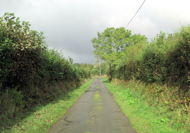
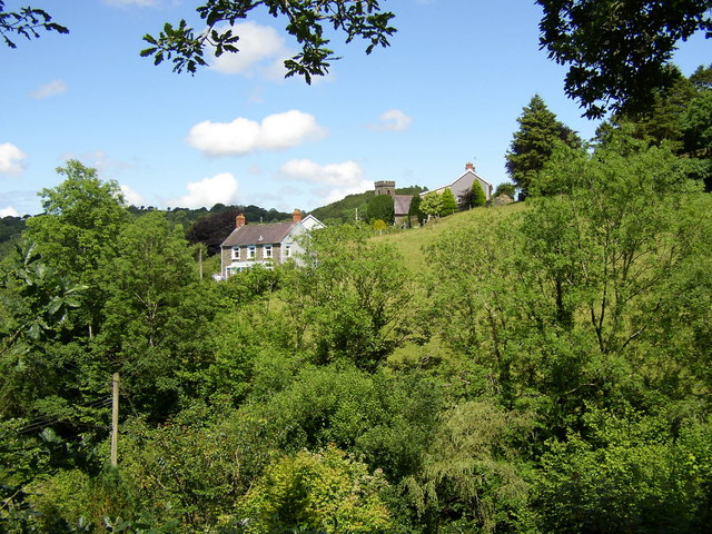
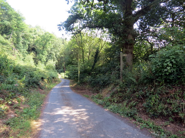
Allt Nantegryd is a picturesque woodland located in Cardiganshire, Wales. Spanning over a vast area, this forest is known for its natural beauty and diverse flora and fauna. The woodland is situated on the outskirts of a small village, offering a peaceful and serene environment for visitors to enjoy.

The forest is characterized by its dense canopy of tall trees, including oak, beech, and pine. These towering trees provide shade and shelter for a variety of wildlife species. Allt Nantegryd is home to a wide range of animals, such as deer, foxes, badgers, and various bird species. Birdwatchers can often spot woodpeckers, owls, and warblers amidst the trees.

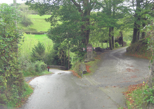
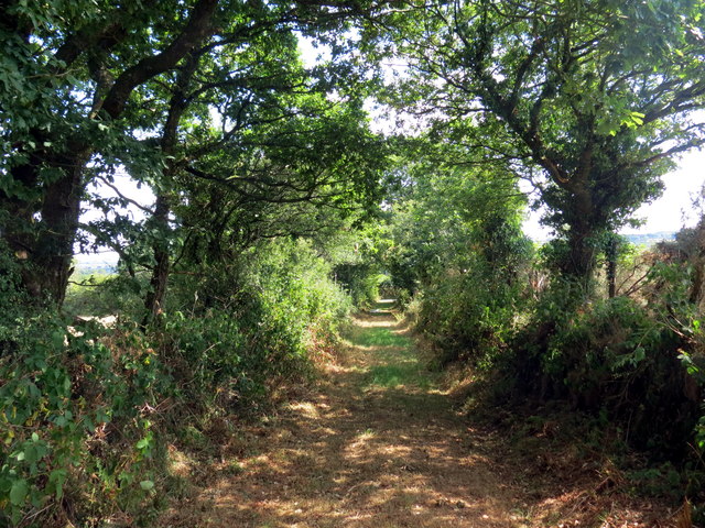
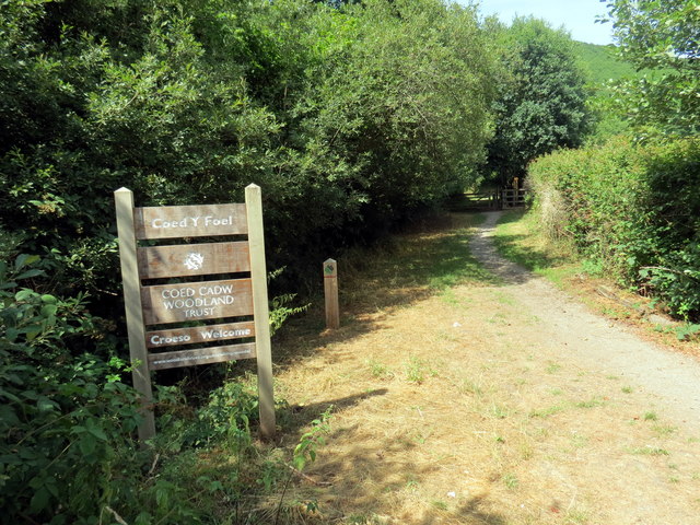
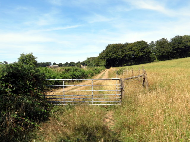
A network of well-maintained trails runs throughout the forest, allowing visitors to explore the area on foot or by bike. These paths provide scenic viewpoints and lead to charming spots, including a tranquil stream that meanders through the woodland. The stream is a popular spot for picnics and provides a refreshing escape from the summer heat.

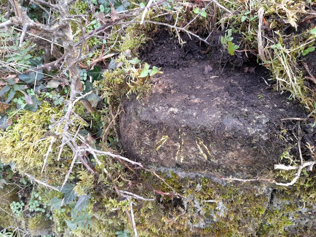
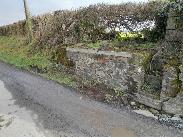
Allt Nantegryd is also known for its rich history. The forest has been utilized by humans for centuries, with evidence of ancient settlements and farming activities found in the area. Archaeological enthusiasts can explore these remnants, gaining insights into the past.

Overall, Allt Nantegryd offers a haven for nature lovers, hikers, and history enthusiasts. Its lush greenery, diverse wildlife, and peaceful ambiance make it a beloved destination for both locals and tourists seeking to immerse themselves in the beauty of the Welsh countryside.

If you have any feedback on the listing, please let us know in the comments section below.

Allt Nantegryd Images

Images are sourced within 2km of 52.054886/-4.2687032 or Grid Reference SN4442. Thanks to Geograph Open Source API. All images are credited.

Derelict water mill at Dolwallter There's a whole complex of associated stone buildings just below level of the B4459. It's the sort of place that needs a sympatetic restoration......
Derelict water mill at Dolwallter
There's a whole complex of associated stone buildings just below level of the B4459. It's the sort of place that needs a sympatetic restoration......
B4459 north of Dolbantau
Pont Dolfor This old stone bridge carries a minor road over Afon Clettwr.
Pont Dolfor
This old stone bridge carries a minor road over Afon Clettwr.
Pasture in the Afon Clettwr valley Although the little river is not directly visible it's running between the double row of trees in the centre right of the picture.
Pasture in the Afon Clettwr valley
Although the little river is not directly visible it's running between the double row of trees in the centre right of the picture.
Two unnamed roads form T-junction east of Pen-rhiw
Entrance to Rock Mill On the brown sign it states 'Melin Wlan', Rock Mill, Woollen Mill. Interesting because this is the last remaining, water-powered, commercial Woollen Mill still working in Wales. The Mill was built in the 1890s by the great grandfather of the present owner and operator, Mr Donald Morgan. See: <span class="nowrap"><a title="http://www.welshmills.org.uk/rockcd.m0.html" rel="nofollow ugc noopener" href="http://www.welshmills.org.uk/rockcd.m0.html">Link</a><img style="margin-left:2px;" alt="External link" title="External link - shift click to open in new window" src="https://s1.geograph.org.uk/img/external.png" width="10" height="10"/></span>
Entrance to Rock Mill
On the brown sign it states 'Melin Wlan', Rock Mill, Woollen Mill. Interesting because this is the last remaining, water-powered, commercial Woollen Mill still working in Wales. The Mill was built in the 1890s by the great grandfather of the present owner and operator, Mr Donald Morgan. See: LinkExternal link
The substantial bus shelter at Capel Dewi Very useful if waiting for the infrequent bus in the rain!
The substantial bus shelter at Capel Dewi
Very useful if waiting for the infrequent bus in the rain!
The graveyard at Capel Dewi Unlike some, this is very well maintained.
The graveyard at Capel Dewi
Unlike some, this is very well maintained.
Capel Dewi taken from Rock Mill A particularly attractive piece of countryside.  The Afon Clettwr, a tributary of the Teifi, runs through the trees at the bottom of the picture.
Capel Dewi taken from Rock Mill
A particularly attractive piece of countryside. The Afon Clettwr, a tributary of the Teifi, runs through the trees at the bottom of the picture.
Ordnance Survey Rivet This OS rivet can be found on the churn stand at the entrance to Cors-y-fran. It marks a point 202.393m above mean sea level. <a title="https://www.geograph.org.uk/photo/7400859" href="https://www.geograph.org.uk/photo/7400859">Link</a>
Ordnance Survey Rivet
This OS rivet can be found on the churn stand at the entrance to Cors-y-fran. It marks a point 202.393m above mean sea level. Link
Churn Stand There is an Ordnance Survey rivet on the top of the stand. <a title="https://www.geograph.org.uk/photo/7400858" href="https://www.geograph.org.uk/photo/7400858">Link</a>
Churn Stand
There is an Ordnance Survey rivet on the top of the stand. Link
Llwybr ceffyl ger Penrhiw / A bridleway near Penrhiw Llwybr ceffyl yn agosau at heol fach ger Ffarm Penrhiw.

A bridleway approaching a minor road near Penrhiw Farm (trans. hilltop).
Llwybr ceffyl ger Penrhiw / A bridleway near Penrhiw
Llwybr ceffyl yn agosau at heol fach ger Ffarm Penrhiw. A bridleway approaching a minor road near Penrhiw Farm (trans. hilltop).
Llwybr yn gadael heol / Footpath exiting a road Arwyddbost yn nodi'r man lle mae'r llwybr yn gadael heol fach.

A signpost marks the location where the path exits a minor road.
Llwybr yn gadael heol / Footpath exiting a road
Arwyddbost yn nodi'r man lle mae'r llwybr yn gadael heol fach. A signpost marks the location where the path exits a minor road.
Coed y Foel Llwybr caniataol yn rhoi mynediad i Goed y Foel, coedwig sydd o dan gofal Ymddiriedolaeth Coed Cadw.

A permissive path heading towards Coed y Foed (trans. wood of the bare hilltop). The woodland is owned by the Coed Cadw Trust.
Coed y Foel
Llwybr caniataol yn rhoi mynediad i Goed y Foel, coedwig sydd o dan gofal Ymddiriedolaeth Coed Cadw. A permissive path heading towards Coed y Foed (trans. wood of the bare hilltop). The woodland is owned by the Coed Cadw Trust.
Coed y Foel Llwybr o fewn Gwarchodfa Natur Coed y Foel.

A path within Coed y Foel (trans. bare hilltop wood) Nature Reserve.
Coed y Foel
Llwybr o fewn Gwarchodfa Natur Coed y Foel. A path within Coed y Foel (trans. bare hilltop wood) Nature Reserve.
Tuag at Flaen Cwm / Towards Blaen Cwm Cyffordd o lwybrau ger Blaen Cwm.

A junction of paths near Blaen Cwm (trans. head of the valley).
Tuag at Flaen Cwm / Towards Blaen Cwm
Cyffordd o lwybrau ger Blaen Cwm. A junction of paths near Blaen Cwm (trans. head of the valley).
Llwybr ceffyl ger Blaen Cwm / A bridleway near Blaen Cwm Llwybr ceffyl ger Blaen Cwm.

A bridleway near Blaen Cwm (trans. head of the valley).
Llwybr ceffyl ger Blaen Cwm / A bridleway near Blaen Cwm
Llwybr ceffyl ger Blaen Cwm. A bridleway near Blaen Cwm (trans. head of the valley).
Llwybr ceffyl  / Bridleway Llwybr ceffyl yr ucheldir yn mynd drwy gae gwair

An upland bridleway going through a hay field.
Llwybr ceffyl / Bridleway
Llwybr ceffyl yr ucheldir yn mynd drwy gae gwair An upland bridleway going through a hay field.
Show me another place!

Allt Nantegryd is located at Grid Ref: SN4442 (Lat: 52.054886, Lng: -4.2687032)

Unitary Authority: Ceredigion

Police Authority: Dyfed Powys

What 3 Words

///fattest.potential.whirlpool. Near Llandysul, Ceredigion

Nearby Locations

Derlwyn Allt Nantegryd

Related Wikis

Rock Mill Llandysul

Rock Mill Llandysul (Welsh: Melin Wlân), in Capel Dewi, Llandysul, Ceredigion, is the last woollen mill in Wales to be powered by a water wheel. ��2�...

Derlwyn, Ceredigion

Derlwyn is a small village in the community of Llandysul, Ceredigion, Wales, which is 61.4 miles (98.8 km) from Cardiff and 180.9 miles (291.1 km) from...

Capel Dewi, Llandysul

Capel Dewi is a small village in the county of Ceredigion, Wales. The village lies in the Clettwr Valley mostly on the eastern bank of the River Clettwr...

Bryngolau

Bryngolau is a small village in the community of Llandysul, Ceredigion, Wales, which is 62.2 miles (100.1 km) from Cardiff and 181.5 miles (292.1 km)...

Waunifor

Waunifor or Waun Ifor (Welsh: "Ifor's Meadow") is a historic estate, once the seat of the Lloyd and Bowen families, located in the small village community...

Blaenborthyn

Blaenborthyn is a small village in the community of Llandysul, Ceredigion, Wales, which is 60.4 miles (97.2 km) from Cardiff and 179.9 miles (289.5 km...

Faerdrefawr

Faerdrefawr is a small village in the community of Llandysul, Ceredigion, Wales, which is 62.2 miles (100 km) from Cardiff and 182 miles (293 km) from...

Craig Gwrtheyrn

Craig Gwrtheyrn, or Caer Gwrtheyrn, is an Iron Age hillfort on the south side of the River Teifi, about 1.2 miles (1.9 km) west of the village of Llanfihangel...

Nearby Amenities

Located within 500m of 52.054886,-4.2687032
Dairy Cottages
Internet Access: wlan
Internet Access Fee: no
Operator: Cwmtegryd
Phone: +44 1559 363163
Smoking: outside
Tourism: chalet
Website: https://www.holidaycottageswestwales.co.uk/
Lat/Long: 52.0536339/-4.2700419
The data included in this document is from www.openstreetmap.org. The data is made available under ODbL.

Have you been to Allt Nantegryd?

Leave your review of Allt Nantegryd below (or comments, questions and feedback).