Corws

Wood, Forest in Carmarthenshire

Wales

Corws

Cattle grid Cattle grid at entrance to Gwastod Mawr.
Cattle grid Credit: Alan Hughes

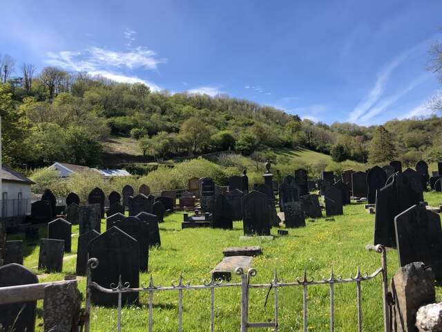
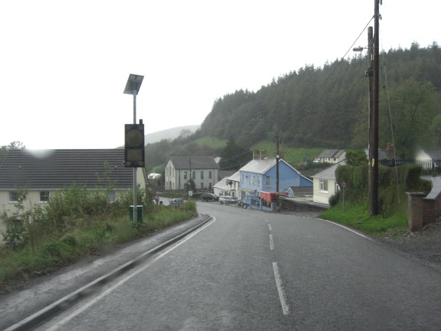
Corws is a small village located in the county of Carmarthenshire, Wales. Situated in the southwestern part of the country, Corws is known for its picturesque woodlands and forests, making it an idyllic destination for nature lovers and outdoor enthusiasts.

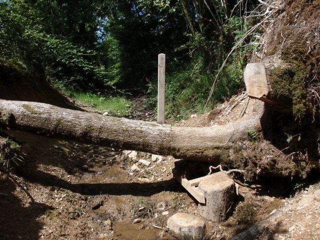
The village is nestled amidst the lush greenery of the Carmarthenshire countryside, offering a tranquil and serene atmosphere. The woodlands surrounding Corws are abundant with diverse flora and fauna, including a variety of native tree species such as oak, beech, and birch. These forests provide a habitat for numerous bird species, making it a haven for birdwatchers.

Corws boasts several walking trails and hiking routes, allowing visitors to explore and immerse themselves in the natural beauty of the area. These paths wind through the enchanting woodlands, offering stunning views and opportunities to spot wildlife along the way.

The village itself is small and quaint, with a close-knit community that preserves its rich cultural heritage. Traditional Welsh customs and festivals are celebrated here, providing visitors with a glimpse into the local way of life. The residents of Corws are known for their warm hospitality, welcoming tourists and making them feel at home.

Corws is also a gateway to other attractions in Carmarthenshire, such as the Brecon Beacons National Park and the nearby town of Carmarthen, which offers a range of amenities including shops, restaurants, and historical sites.

Overall, Corws is a hidden gem in the Welsh countryside, offering stunning woodlands, a peaceful ambiance, and a chance to reconnect with nature.

If you have any feedback on the listing, please let us know in the comments section below.

Corws Images

Images are sourced within 2km of 51.96511/-4.2884905 or Grid Reference SN4232. Thanks to Geograph Open Source API. All images are credited.

Cattle grid Cattle grid at entrance to Gwastod Mawr.
Cattle grid
Cattle grid at entrance to Gwastod Mawr.
Cemetery at Troed y Rhiw Independent Chapel, Alltwalis
Ordnance Survey Cut Mark This OS cut mark can be found on the east parapet of the bridge. It marks a point 129.168m above mean sea level.
Ordnance Survey Cut Mark
This OS cut mark can be found on the east parapet of the bridge. It marks a point 129.168m above mean sea level.
Wayside plant sale House in Alltwalis with plants for sale
Wayside plant sale
House in Alltwalis with plants for sale
Ty Coffi Mason Coffee House, Alltwalis
Ysgol Gynradd Alltwalis Junior School
Sticil anarferol / Unusual stile Yn sgil tirlithiad fe gwympodd colfen ar draws llwybr cyhoeddus. Felly, gwnaed sticil anarferol o'r boncyff. 

Following a landslide a tree had fallen across a public footpath. Sombody has made an unusual stile from the tree trunk.
Sticil anarferol / Unusual stile
Yn sgil tirlithiad fe gwympodd colfen ar draws llwybr cyhoeddus. Felly, gwnaed sticil anarferol o'r boncyff. Following a landslide a tree had fallen across a public footpath. Sombody has made an unusual stile from the tree trunk.
Llwybr cyhoeddus Skanda Vale / Skanda Vale public footpath Hen heol gart a arwain o Ffarm Cwm Creigiau Fawr i fyny at Ffarm Pengraigygigfran (wedi ei llyncu bellach gan goedwig goniferaidd). Mae Cwm Creigiau Fawr bellach yn deml adnabyddus a elwir yn Skanda Vale. Mae'r trac wedi cael ei israddio i lwybr cyhoeddus. 

An old cart track ascending from the former farm of Cwm Creigiau Fawr (valley of the rocks (river)) towards Pengraigygigfran Farm (Top of the raven's rock/hill). The latter has long been engulfed by a conifer plantation. Cwm Creigiau Fawr is today known as Skanda Vale, a well known religious temple. The track has been downgraded to a footpath.
Llwybr cyhoeddus Skanda Vale / Skanda Vale public footpath
Hen heol gart a arwain o Ffarm Cwm Creigiau Fawr i fyny at Ffarm Pengraigygigfran (wedi ei llyncu bellach gan goedwig goniferaidd). Mae Cwm Creigiau Fawr bellach yn deml adnabyddus a elwir yn Skanda Vale. Mae'r trac wedi cael ei israddio i lwybr cyhoeddus. An old cart track ascending from the former farm of Cwm Creigiau Fawr (valley of the rocks (river)) towards Pengraigygigfran Farm (Top of the raven's rock/hill). The latter has long been engulfed by a conifer plantation. Cwm Creigiau Fawr is today known as Skanda Vale, a well known religious temple. The track has been downgraded to a footpath.
Llwybr drwy gae gwenith/ path through wheatfield Llwybr cyhoeddus sy'n mynd drwy gae o wenith ar fryn a elwir yr Esgair rhwng Ffermydd Pantyllyn a safle hen Ffarm Penyresgair. Dengys Map OS 1831 taw hen heol ydoedd ond mae hi wedi hen golli ei bri. Dynoda hen fapiau hefyd y bodolai dair garn ar y gefnen a elwir 'Crugiau' ond does dim son amdanynt ar y mapiau modern. 

A public right of way goes through a field of wheat on a hill known as Yr Esgair (The Ridge) between Pantyllyn Farm and the site of the former Penyresgair Farm. The 1831 OS Map shows the path to be a highway but it has long been downgraded to a mere footpath. Old maps also show the existence of three cairns on the ridge known as 'Crugiau' (Mounds) but they do not appear on modern maps.
Llwybr drwy gae gwenith/ path through wheatfield
Llwybr cyhoeddus sy'n mynd drwy gae o wenith ar fryn a elwir yr Esgair rhwng Ffermydd Pantyllyn a safle hen Ffarm Penyresgair. Dengys Map OS 1831 taw hen heol ydoedd ond mae hi wedi hen golli ei bri. Dynoda hen fapiau hefyd y bodolai dair garn ar y gefnen a elwir 'Crugiau' ond does dim son amdanynt ar y mapiau modern. A public right of way goes through a field of wheat on a hill known as Yr Esgair (The Ridge) between Pantyllyn Farm and the site of the former Penyresgair Farm. The 1831 OS Map shows the path to be a highway but it has long been downgraded to a mere footpath. Old maps also show the existence of three cairns on the ridge known as 'Crugiau' (Mounds) but they do not appear on modern maps.
Bus Stop Shelter and Public Convenience, with Post Box, Alltwalis This combined Bus Stop Shelter and Public Convenience (Ladies to the left, Gents to the right) has a plaque recording that it was opened by Cllr J E Davies of the Newcastle Emlyn Rural District Council in 1974. 1974 is a significant date as it is the year that the Newcastle Emlyn Rural District Council was abolished as part of the local government reorganisation of that year. This shelter would have been provided as a permanent reminder of what rural communities will have lost when the large County of Dyfed was created with its lack of any true local focus. It is also a memorial that the RDC was probably blowed if it was going to have any cash reserves to pass on to the successor Authority, and so probably a number of small scale projects will have been funded for completion in early 1974 of which this would have been one.
Bus Stop Shelter and Public Convenience, with Post Box, Alltwalis
This combined Bus Stop Shelter and Public Convenience (Ladies to the left, Gents to the right) has a plaque recording that it was opened by Cllr J E Davies of the Newcastle Emlyn Rural District Council in 1974. 1974 is a significant date as it is the year that the Newcastle Emlyn Rural District Council was abolished as part of the local government reorganisation of that year. This shelter would have been provided as a permanent reminder of what rural communities will have lost when the large County of Dyfed was created with its lack of any true local focus. It is also a memorial that the RDC was probably blowed if it was going to have any cash reserves to pass on to the successor Authority, and so probably a number of small scale projects will have been funded for completion in early 1974 of which this would have been one.
A485 passes through Alltwalis
A485 entering Alltwalis
Straight road south of Alltwalis
Start of Footpath The footpath begins here, but you have to climb a rusty gate with a barbed wire topping first. Trig point just visible in field.
Start of Footpath
The footpath begins here, but you have to climb a rusty gate with a barbed wire topping first. Trig point just visible in field.
Footpath near Llanpumsaint A refreshing change to find a usable footpath
Footpath near Llanpumsaint
A refreshing change to find a usable footpath
Former Carmarthen to Aberystwyth railway
Footpath bridge over Nant Aeron A very solid footbridge leading to a path through the woods
Footpath bridge over Nant Aeron
A very solid footbridge leading to a path through the woods
Disused chapel, Alltwalis
Show me another place!

Corws is located at Grid Ref: SN4232 (Lat: 51.96511, Lng: -4.2884905)

Unitary Authority: Carmarthenshire

Police Authority: Dyfed Powys

What 3 Words

///busy.workloads.washable. Near Pencader, Carmarthenshire

Nearby Locations

Corws

Related Wikis

Skanda Vale

Skanda Vale is a non-denominational spiritual centre and monastery located in Carmarthenshire, Wales, near the village of Llanpumsaint. Founded in 1973...

Alltwalis

Alltwalis is a village in Carmarthen, Carmarthenshire, Wales. It has a wind farm called Alltwalis Wind Farm. == References == == External links == Media...

Pencader Tunnel

Pencader Tunnel is an abandoned railway tunnel on the old trackbed of the Carmarthen to Aberystwyth main line in south-west Wales. It was originally bored...

Dolgran

Dolgran is a small hamlet located in a narrow, steep-sided valley approximately one and a half miles to the south west of Pencader, Carmarthenshire, Wales...

Have you been to Corws?

Leave your review of Corws below (or comments, questions and feedback).