Coed y Marchog

Wood, Forest in Carmarthenshire

Wales

Coed y Marchog

Bethel CM Chapel Pembrey on the main road opposite the church
Bethel CM Chapel Pembrey Credit: Ruth Jowett

Coed y Marchog is a picturesque woodland located in Carmarthenshire, Wales. Spread across an area of approximately 100 hectares, this forest is known for its natural beauty, diverse wildlife, and tranquil atmosphere. The name "Coed y Marchog" translates to "Wood of the Knight" in English, reflecting the historical significance of the area.

The woodland is predominantly composed of native broadleaf species, including oak, beech, and ash trees. These towering trees create a dense canopy, providing shade and shelter for a variety of flora and fauna. Bluebells, wild garlic, and ferns flourish on the forest floor during the spring and summer months, adding vibrant colors to the landscape.

Coed y Marchog is home to numerous species of birds, such as woodpeckers, owls, and warblers. Wildlife enthusiasts may also spot mammals like badgers, foxes, and deer roaming freely within the forest. The area is designated as a Site of Special Scientific Interest (SSSI) due to its rich biodiversity and conservation importance.

Visitors can explore Coed y Marchog through a network of well-maintained footpaths and trails. These paths meander through the woodland, offering breathtaking views of the surrounding countryside. Nature lovers can enjoy activities such as birdwatching, photography, and hiking in this serene environment.

Coed y Marchog is a popular destination for locals and tourists alike, providing an escape from the hustle and bustle of everyday life. Its natural charm and peaceful ambiance make it a perfect place to connect with nature and appreciate the beauty of the Welsh countryside.

If you have any feedback on the listing, please let us know in the comments section below.

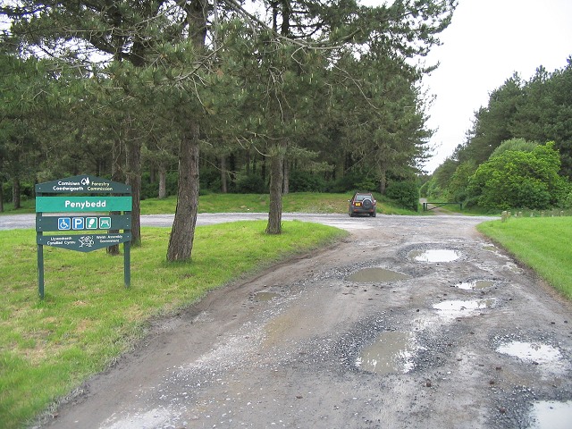
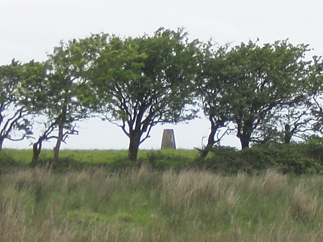
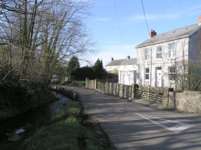
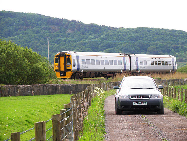
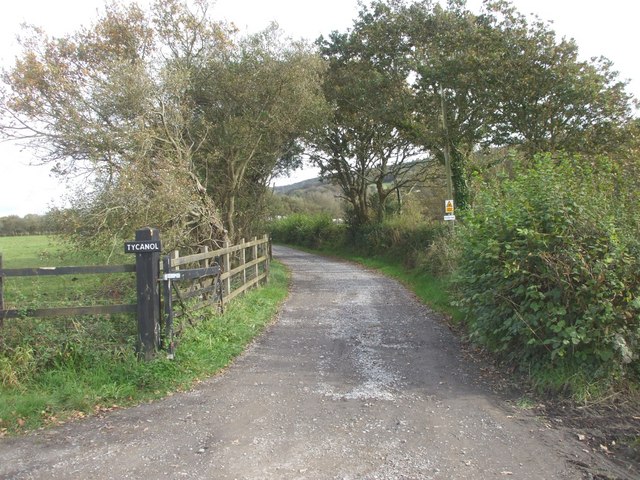
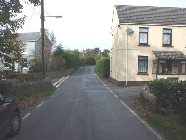
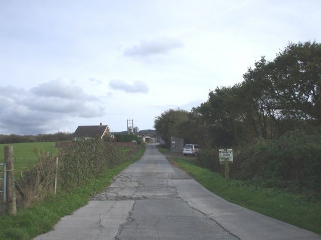
Coed y Marchog Images

Images are sourced within 2km of 51.696999/-4.2803746 or Grid Reference SN4202. Thanks to Geograph Open Source API. All images are credited.

Bethel CM Chapel Pembrey on the main road opposite the church
Bethel CM Chapel Pembrey
on the main road opposite the church
Entrance to Penybedd forest, Pembrey This forest is on the approach road to Pembrey Country Park, but completely separated from it.
Entrance to Penybedd forest, Pembrey
This forest is on the approach road to Pembrey Country Park, but completely separated from it.
Trig pillar on Pembrey Mountain No marked right of way aywhere near this one, so a shot from the adjacent road will have to suffice.
Trig pillar on Pembrey Mountain
No marked right of way aywhere near this one, so a shot from the adjacent road will have to suffice.
Hump Back Bridge This little bridge is now obsolete - it once spanned a railway but the rails were lifted a long time ago and now only a wet trackway runs beneath.
Hump Back Bridge
This little bridge is now obsolete - it once spanned a railway but the rails were lifted a long time ago and now only a wet trackway runs beneath.
Road junction near a stream This narrow country road followed a stream.  Ordnance Survey maps implied that there is a public telephone box nearby, but I didn't see one.
Road junction near a stream
This narrow country road followed a stream. Ordnance Survey maps implied that there is a public telephone box nearby, but I didn't see one.
Randell Square, Pembrey Red Lion Pub and St. Illtyd's Church
Randell Square, Pembrey
Red Lion Pub and St. Illtyd's Church
Kissing Gate on St. Illtyd's Way A Kissing Gate with a view overlooking Furnace on the St. Illtyd's Way public footpath.
Kissing Gate on St. Illtyd's Way
A Kissing Gate with a view overlooking Furnace on the St. Illtyd's Way public footpath.
Dismantled railway line Looking at all the undergrowth, it's hard to believe this was once a railway line. The photograph was taken in the very corner of the grid which is almost all flat farmland.
Dismantled railway line
Looking at all the undergrowth, it's hard to believe this was once a railway line. The photograph was taken in the very corner of the grid which is almost all flat farmland.
Farmland near Kidwelly Shot of the type of farmland that seems typical of this square.
Farmland near Kidwelly
Shot of the type of farmland that seems typical of this square.
Road and Rail A train heads for Kidwelly whilst an Audi chooses just the right moment to come along this very quiet track.
Road and Rail
A train heads for Kidwelly whilst an Audi chooses just the right moment to come along this very quiet track.
Side of Pembrey Forest National Cycle Route 4 just skirts this square.
Side of Pembrey Forest
National Cycle Route 4 just skirts this square.
Pembrey Park Caravan Club site A mostly empty site on our arrival on a Friday.
Pembrey Park Caravan Club site
A mostly empty site on our arrival on a Friday.
Driveway to Ty Canol
Bridge on the B4137
Bridge on the B4137
Farm entrance
Farm entrance
Field with a view Looking towards the Gower Peninsula.
Field with a view
Looking towards the Gower Peninsula.
St. Illtyd's Church, Pembrey The present building was probably constructed between the 13th and 15th centuries. Pembrey (or Penbre) Church was a landmark for shipping in the hazardous Burry Estuary, where many came to grief on the Cefn Sidan sands. Over 200 sailors are buried in the churchyard. The circular structure outside the churchyard wall is a cattle pound. This was used to impound stray cattle, which their owners could reclaim after paying a fee. (This description paraphrased from the useful information board by the church gate).
St. Illtyd's Church, Pembrey
The present building was probably constructed between the 13th and 15th centuries. Pembrey (or Penbre) Church was a landmark for shipping in the hazardous Burry Estuary, where many came to grief on the Cefn Sidan sands. Over 200 sailors are buried in the churchyard. The circular structure outside the churchyard wall is a cattle pound. This was used to impound stray cattle, which their owners could reclaim after paying a fee. (This description paraphrased from the useful information board by the church gate).
Pembrey Post Office
Pembrey Post Office
Show me another place!

Coed y Marchog is located at Grid Ref: SN4202 (Lat: 51.696999, Lng: -4.2803746)

Unitary Authority: Carmarthenshire

Police Authority: Dyfed Powys

What 3 Words

///others.headlight.impresses. Near Burry Port, Carmarthenshire

Nearby Locations

Coed Rhyal Coed y Marchog

Related Wikis

Gwernydd Penbre

Gwernydd Penbre is a Site of Special Scientific Interest (SSSI) in Carmarthenshire, Wales. It is also spelled by DEFRA and Natural Resources Wales as Gwernydd...

Craiglon Bridge Halt railway station

Craiglon Bridge Halt railway station may have served the Craig-Lon Colliery and its workers near Pembrey, but this business was closed in the 1930s. It...

Court Farm, Pembrey

Court Farm in Pembrey, Carmarthenshire, Wales, is an ancient and formerly imposing manor house which is now an overgrown ruin, but structurally sound,...

Pembrey railway station

Pembrey railway station or Pembrey Halt railway station served the village of Pen-bre or Pembrey. It continued to serve the inhabitants of the area between...

Nearby Amenities

Located within 500m of 51.696999,-4.2803746
Barrier: kissing_gate
Lat/Long: 51.6989704/-4.2822279
Barrier: kissing_gate
Lat/Long: 51.6998368/-4.2839102
Barrier: kissing_gate
Lat/Long: 51.6966977/-4.2790584
Barrier: kissing_gate
Lat/Long: 51.6981904/-4.2800142
Man Made: tower
Lat/Long: 51.6945231/-4.2768252
Man Made: tower
Lat/Long: 51.6944982/-4.2753687
Barrier: stile
Lat/Long: 51.6992518/-4.2753904
Barrier: kissing_gate
Lat/Long: 51.6950887/-4.2750737
Barrier: kissing_gate
Lat/Long: 51.6967755/-4.2745907
Barrier: kissing_gate
Lat/Long: 51.6958078/-4.2747396
The data included in this document is from www.openstreetmap.org. The data is made available under ODbL.

Have you been to Coed y Marchog?

Leave your review of Coed y Marchog below (or comments, questions and feedback).