Allt Pen-pistyll

Wood, Forest in Carmarthenshire

Wales

Allt Pen-pistyll

Llandysul Food Festival Carreg-las Dancers with keen youngsters performing "Dilwyn"
Llandysul Food Festival Credit: chris whitehouse

Allt Pen-pistyll is a picturesque woodland located in Carmarthenshire, Wales. Covering an area of approximately 100 hectares, it is a haven of natural beauty and tranquility. The woodland is characterized by its dense canopy of tall, majestic trees, creating a lush and vibrant environment.

The diverse ecosystem of Allt Pen-pistyll is home to a wide range of flora and fauna. The woodland floor is covered with a carpet of ferns, mosses, and wildflowers, adding to its enchanting atmosphere. Native tree species, such as oak, beech, and ash, dominate the landscape, providing a rich habitat for various bird species, including the melodious song thrush and the elusive tawny owl.

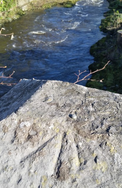
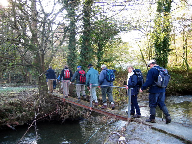
Walking through Allt Pen-pistyll, visitors can enjoy the soothing sounds of a babbling brook that meanders through the woodland. This stream, known as the Nant Pen-pistyll, adds to the charm of the area, providing a tranquil spot for picnics or simply a moment of reflection.

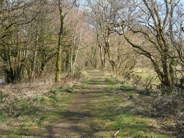
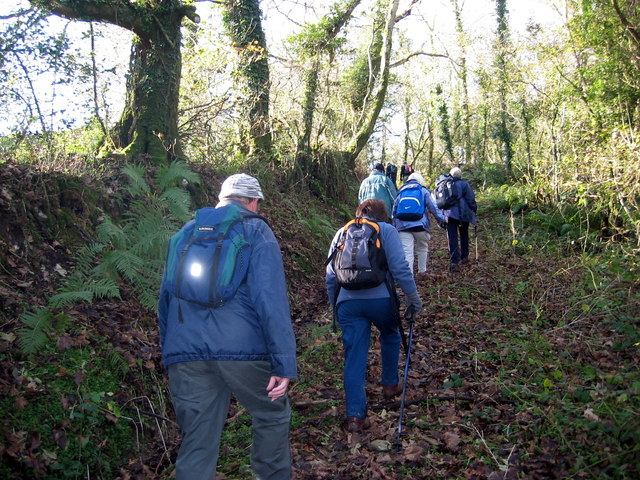
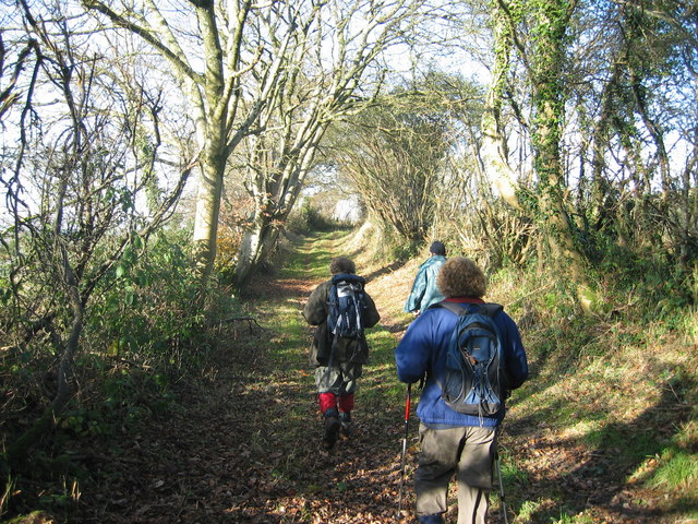
The woodland is also a popular destination for outdoor enthusiasts, offering a network of well-maintained footpaths and trails. These paths weave through the trees, allowing visitors to explore the beauty of the woodland at their own pace. The area is particularly popular with hikers and nature lovers, who relish the opportunity to immerse themselves in the natural wonders of Allt Pen-pistyll.

Allt Pen-pistyll is not only a haven for nature lovers, but it also serves as an important conservation area, with efforts in place to protect and preserve its unique ecosystem.

If you have any feedback on the listing, please let us know in the comments section below.

Allt Pen-pistyll Images

Images are sourced within 2km of 52.022289/-4.3039156 or Grid Reference SN4238. Thanks to Geograph Open Source API. All images are credited.
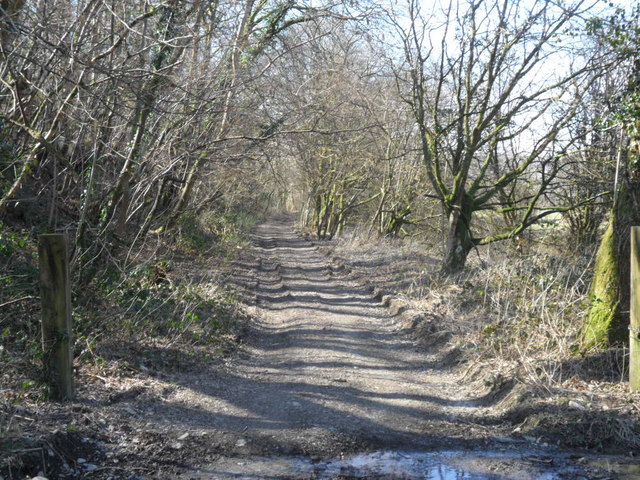
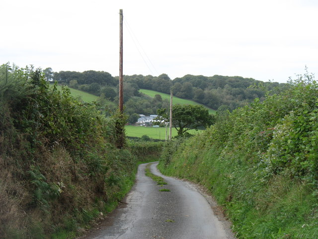
Llandysul Food Festival Carreg-las Dancers with keen youngsters performing "Dilwyn"
Llandysul Food Festival
Carreg-las Dancers with keen youngsters performing "Dilwyn"
Llandysul Food Festival Not the best of weather, Carreg-las dancing took place on the sheltered stage as the grass was very wet and slippery, one could be forgiven if this photo was mistaken for a "Punch and Judy Show"! 2010 photo is <a href="https://www.geograph.org.uk/photo/2763690">SN4140 : Llandysul Food Festival</a> perfect weather!
Llandysul Food Festival
Not the best of weather, Carreg-las dancing took place on the sheltered stage as the grass was very wet and slippery, one could be forgiven if this photo was mistaken for a "Punch and Judy Show"! 2010 photo is SN4140 : Llandysul Food Festival perfect weather!
Site of Llandysul Station Yard The new Llandysul bypass, on the right,goes across the site of Llandysul Station, closed as part of the Beeching Plan.  The long building on the left is all that is left of the station's goods facilities.  Sidings ran alongside and wagons were unloaded directly into them.
Site of Llandysul Station Yard
The new Llandysul bypass, on the right,goes across the site of Llandysul Station, closed as part of the Beeching Plan. The long building on the left is all that is left of the station's goods facilities. Sidings ran alongside and wagons were unloaded directly into them.
Wind Turbine at Blaen Pant
Overgrown Stile The sign may be putting off some walkers.
Overgrown Stile
The sign may be putting off some walkers.
Station Road, Pont-Tyweli
Ordnance Survey Rivet This OS rivet can be found on the NE parapet of Llandysul Bridge. It marks a point 61.714m above mean sea level.
Ordnance Survey Rivet
This OS rivet can be found on the NE parapet of Llandysul Bridge. It marks a point 61.714m above mean sea level.
Ordnance Survey Cut Mark This OS cut mark can be found on the Half Moon. It marks a point 59.278m above mean sea level.
Ordnance Survey Cut Mark
This OS cut mark can be found on the Half Moon. It marks a point 59.278m above mean sea level.
Lane junction with B4336 near Llandysul
Disused trackbed of the Newcastle Emlyn branch Looking towards Llandysul, this is the trackbed of the Carmarthen and Cardigan Railway's line to Llandysul, later extended to Newcastle Emlyn by the GWR.  This part of the line is now a footpath.
Disused trackbed of the Newcastle Emlyn branch
Looking towards Llandysul, this is the trackbed of the Carmarthen and Cardigan Railway's line to Llandysul, later extended to Newcastle Emlyn by the GWR. This part of the line is now a footpath.
Disused trackbed of the Newcastle Emlyn branch Facing towards Pencader, this is the Carmarthen and Cardigan Railway's line to Llandysul, eventually extended to Newcastle Emlyn by the GWR.  This part of the trackbed is now in private ownership.
Disused trackbed of the Newcastle Emlyn branch
Facing towards Pencader, this is the Carmarthen and Cardigan Railway's line to Llandysul, eventually extended to Newcastle Emlyn by the GWR. This part of the trackbed is now in private ownership.
Site of former Llandyssul station, 2004 View SE, towards Pencader: ex-GWR Pencader - Newcastle Emlyn branch. Passenger services on the branch ceased from 15/9/52, goods not until 22/9/73 (Llandyssul from 5/9/65). In 2004 the site was in commercial use, but in more recent years it has been incorporated in a great new Llandyssul by-pass.
Site of former Llandyssul station, 2004
View SE, towards Pencader: ex-GWR Pencader - Newcastle Emlyn branch. Passenger services on the branch ceased from 15/9/52, goods not until 22/9/73 (Llandyssul from 5/9/65). In 2004 the site was in commercial use, but in more recent years it has been incorporated in a great new Llandyssul by-pass.
Pompren Afon Tyweli / Tyweli River footbridge Cerddwyr yn croesi Afon Tyweli. 

Walkers crossing the Tyweli River.
Pompren Afon Tyweli / Tyweli River footbridge
Cerddwyr yn croesi Afon Tyweli. Walkers crossing the Tyweli River.
Ger Felin Gwyddil / Near Felin Gwyddil Cerddwyr yn dilyn trac o Felin Gwyddil.

Walkers following a track from Felin Gwyddil (trans. Gwyddil [stream] mill).
Ger Felin Gwyddil / Near Felin Gwyddil
Cerddwyr yn dilyn trac o Felin Gwyddil. Walkers following a track from Felin Gwyddil (trans. Gwyddil [stream] mill).
Tuag at Ben Pistyll / Towards Pen Pistyll Cerddwyr yn dilyn llwybr lan at Ben Pistyll.

Walkers ascending along a path towards Pen Pistyll (trans. top of the spring).
Tuag at Ben Pistyll / Towards Pen Pistyll
Cerddwyr yn dilyn llwybr lan at Ben Pistyll. Walkers ascending along a path towards Pen Pistyll (trans. top of the spring).
Llwybr Llwynffynnon / Llwynffynnon Path Cerddwyr yn dilyn llwybr cyhoeddus tuag at Ffarm Llwynffynnon.

Walkers following a public footpath towards Llwynffynnon Farm (trans. grove of the well).
Llwybr Llwynffynnon / Llwynffynnon Path
Cerddwyr yn dilyn llwybr cyhoeddus tuag at Ffarm Llwynffynnon. Walkers following a public footpath towards Llwynffynnon Farm (trans. grove of the well).
Uwchben Troedrhiw Fawr / Above Troedrhiw Fawr Cerddwyr uwchben Ffarm Troedrhiw Fawr. Yr anheddiad yn y pellter yw Llandysul.

Walkers above Troedrhiw Fawr Farm (trans. foot of the hill). The settlement in the distance is Llandysul (trans. St Tysul's church).
Uwchben Troedrhiw Fawr / Above Troedrhiw Fawr
Cerddwyr uwchben Ffarm Troedrhiw Fawr. Yr anheddiad yn y pellter yw Llandysul. Walkers above Troedrhiw Fawr Farm (trans. foot of the hill). The settlement in the distance is Llandysul (trans. St Tysul's church).
A lane near Llandysul Looking down to Blaen-y-waun.
A lane near Llandysul
Looking down to Blaen-y-waun.
Show me another place!

Allt Pen-pistyll is located at Grid Ref: SN4238 (Lat: 52.022289, Lng: -4.3039156)

Unitary Authority: Carmarthenshire

Police Authority: Dyfed Powys

What 3 Words

///distilled.guitar.duty. Near Llandysul, Ceredigion

Related Wikis

Llandyssul railway station

Llandyssul (previously Llandyssil) was a railway station near the village of Llandysul, West Wales, on the originally broad gauge Teifi Valley line of...

Llandysul

Llandysul, also spelt Llandyssul, is a small town and community in the county of Ceredigion, Wales. As a community it consists of the townships of Capel...

Craig Gwrtheyrn

Craig Gwrtheyrn, or Caer Gwrtheyrn, is an Iron Age hillfort on the south side of the River Teifi, about 1.2 miles (1.9 km) west of the village of Llanfihangel...

Ysgol Dyffryn Teifi

Ysgol Dyffryn Teifi was a bilingual (Welsh and English) comprehensive school in Llandysul, Ceredigion. It stood on the site of the previous Llandysul Grammar...

Pencader Junction railway station

Pencader Junction railway station served the village of Pencader, Carmarthenshire, Wales, from 1866 to 1880 on the Manchester and Milford Railway. ��2...

Pentrecwrt

Pentrecwrt (or Pentrecourt) is a village in north Carmarthenshire, Wales on the A486 road halfway between Carmarthen and New Quay. == History == Pencastell...

Pentrecourt Platform railway station

Pentrecourt Platform was a minor railway station near the village of Pentrecwrt, West Wales, on the originally broad gauge Teifi Valley line of the Carmarthen...

Pencader railway station

Pencader railway station served the village of Pencader, Carmarthenshire, Wales, from 1864 to 1965 on the Carmarthen and Cardigan Railway. == History... ==

Nearby Amenities

Located within 500m of 52.022289,-4.3039156
The data included in this document is from www.openstreetmap.org. The data is made available under ODbL.

Have you been to Allt Pen-pistyll?

Leave your review of Allt Pen-pistyll below (or comments, questions and feedback).