Allt Pant-swllt

Wood, Forest in Cardiganshire

Wales

Allt Pant-swllt

Valley north of Talgarreg
Valley north of Talgarreg Credit: M J Roscoe

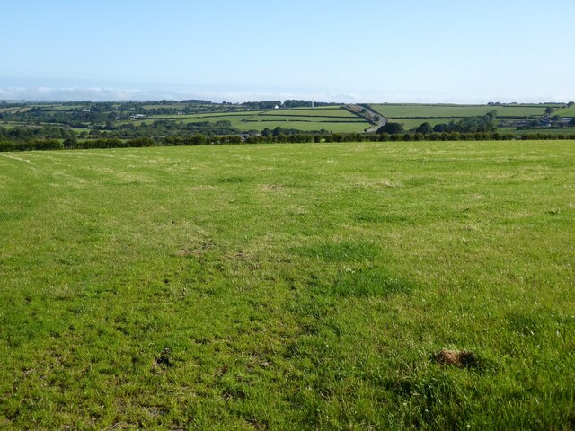
Allt Pant-swllt is a dense woodland located in Cardiganshire, Wales. Covering an area of approximately 100 acres, it is a prominent feature within the region. The woodland is situated on a hilly terrain, with an elevation ranging from 150 to 300 meters above sea level.

Allt Pant-swllt is mainly composed of a mixture of broadleaf species, including oak, beech, ash, and birch trees. The forest floor is carpeted with a rich layer of mosses, ferns, and wildflowers, creating a vibrant and diverse understory. This lush environment provides a suitable habitat for a variety of wildlife, including numerous bird species, small mammals, and insects.

The woodland is crisscrossed by a network of walking trails, allowing visitors to explore its natural beauty. These paths meander through the forest, leading visitors to breathtaking viewpoints, babbling brooks, and hidden clearings. The tranquil atmosphere and picturesque scenery make Allt Pant-swllt a popular destination for nature enthusiasts, hikers, and photographers.

The woodland is managed by a local conservation organization, which ensures its preservation and sustainability. Regular maintenance activities such as tree planting, selective pruning, and removal of invasive species are carried out to maintain the health and vitality of the forest.

Allt Pant-swllt holds significant ecological importance within the region, contributing to the preservation of biodiversity and the provision of ecosystem services. Its peaceful ambiance and natural beauty make it a cherished natural asset in Cardiganshire, attracting visitors from near and far who seek solace in the serenity of the woods.

If you have any feedback on the listing, please let us know in the comments section below.

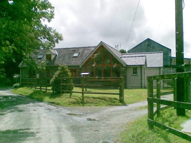
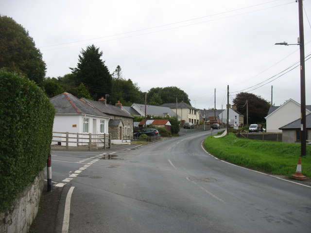
Allt Pant-swllt Images

Images are sourced within 2km of 52.143839/-4.3157848 or Grid Reference SN4152. Thanks to Geograph Open Source API. All images are credited.

Valley north of Talgarreg
Glan-yr-Afon Arms, Talgarreg
B4338 east of Pantrhiwddulais As the road climbs towards 800 feet AMSL it begins to encounter hill-fog from and approaching frontal system.
B4338 east of Pantrhiwddulais
As the road climbs towards 800 feet AMSL it begins to encounter hill-fog from and approaching frontal system.
B4338 reaches its summit level As befits a road reaching more than 900 feet AMSL this useful 'B' road is now into the base of the low stratus associated with a warm sector depression. This is hill fog, seen as an un-named minor road crosses near Pant-y-grugos. Looking closely the viewer can also make out red-mist; sprayed onto the signposts!
B4338 reaches its summit level
As befits a road reaching more than 900 feet AMSL this useful 'B' road is now into the base of the low stratus associated with a warm sector depression. This is hill fog, seen as an un-named minor road crosses near Pant-y-grugos. Looking closely the viewer can also make out red-mist; sprayed onto the signposts!
The Old Mill
The Old Mill
Ordnance Survey Cut Mark This OS cut mark can be found on the front of the Glanrafon Arms. It marks a point 194.894m above mean sea level.
Ordnance Survey Cut Mark
This OS cut mark can be found on the front of the Glanrafon Arms. It marks a point 194.894m above mean sea level.
The B4459 in Talgarreg
Old Milepost by the A486, south of Synod Inn, Llanarth Parish Newquay flat top casting by the A486, in parish of Llanarth (Ceredigion District), South of Synod Inn, 1km South on 300m South of drive to Pantsod.

Inscription reads:-
: NEW QUAY / 5 / MILES : : LLANDYSSUL / 10 MILES :

Grade II listed by Cadw. Reference Number: 17739
<span class="nowrap"><a title="https://cadwpublic-api.azurewebsites.net/reports/listedbuilding/FullReport?lang=&id=17739" rel="nofollow ugc noopener" href="https://cadwpublic-api.azurewebsites.net/reports/listedbuilding/FullReport?lang=&id=17739">Link</a><img style="margin-left:2px;" alt="External link" title="External link - shift click to open in new window" src="https://s1.geograph.org.uk/img/external.png" width="10" height="10"/></span>

Surveyed

Milestone Society National ID: CRD_NQLD05.
Old Milepost by the A486, south of Synod Inn, Llanarth Parish
Newquay flat top casting by the A486, in parish of Llanarth (Ceredigion District), South of Synod Inn, 1km South on 300m South of drive to Pantsod. Inscription reads:- : NEW QUAY / 5 / MILES : : LLANDYSSUL / 10 MILES : Grade II listed by Cadw. Reference Number: 17739 LinkExternal link Surveyed Milestone Society National ID: CRD_NQLD05.
Capel Pisgah, Talgarreg
Crossroads south of Synod Inn Crossroads on the A4338 to the south of Synod Inn.
Crossroads south of Synod Inn
Crossroads on the A4338 to the south of Synod Inn.
Farmland near Synod Inn Farmland to the south of Synod Inn.
Farmland near Synod Inn
Farmland to the south of Synod Inn.
Farmland near Lluestfach View north towards Synod Inn across farmland near Lluestfach.  The A486 can be seen in the middle distance.
Farmland near Lluestfach
View north towards Synod Inn across farmland near Lluestfach. The A486 can be seen in the middle distance.
A field at Telgarreg A field beside the B4338 to the north-west of Talgarreg.
A field at Telgarreg
A field beside the B4338 to the north-west of Talgarreg.
Houses at Brynglowon The houses are on a minor road just off the A486.
Houses at Brynglowon
The houses are on a minor road just off the A486.
Fields near A486 and minor road to Pisgah The wooden fence running across the picture borders the A486; the hillside road in the background goes to Pisgah.
Fields near A486 and minor road to Pisgah
The wooden fence running across the picture borders the A486; the hillside road in the background goes to Pisgah.
Glan-yr-Afon Arms Glan-yr-Afon Arms on the B4459 in Talgarreg.
Glan-yr-Afon Arms
Glan-yr-Afon Arms on the B4459 in Talgarreg.
Telecommunications Mast Telecommunications Mast at Mount Farm near Synod Inn just off the B4338.
Telecommunications Mast
Telecommunications Mast at Mount Farm near Synod Inn just off the B4338.
Sheep at the crossroads There are famously many more sheep than people in New Zealand; perhaps the same is true of Wales, to a lesser extent.  These sheep in a field opposite a small wood and road junction were a mongrel flock with some, including one in the middle distance, looking distinctly pig- or dog-like in sheep's clothing.
Sheep at the crossroads
There are famously many more sheep than people in New Zealand; perhaps the same is true of Wales, to a lesser extent. These sheep in a field opposite a small wood and road junction were a mongrel flock with some, including one in the middle distance, looking distinctly pig- or dog-like in sheep's clothing.
Show me another place!

Allt Pant-swllt is located at Grid Ref: SN4152 (Lat: 52.143839, Lng: -4.3157848)

Unitary Authority: Ceredigion

Police Authority: Dyfed Powys

What 3 Words

///weaned.mothering.shaves. Near Llanllwchaiarn, Ceredigion

Nearby Locations

Allt Pant-swllt

Related Wikis

Talgarreg

Talgarreg is a small village in the county of Ceredigion, Wales. == Culture, history & amenities == Economically it is sustained by farming, though there...

Crugyreryr

Crugyreryr is a hamlet in the community of Llandysiliogogo, Ceredigion, Wales, which is 65.9 miles (106 km) from Cardiff and 183.5 miles (295.3 km) from...

Dolgerdd

Dolgerdd is a hamlet in the community of Llandysiliogogo, Ceredigion, Wales, which is 65.6 miles (105.5 km) from Cardiff and 183.2 miles (294.8 km) from...

Rhos Llawr Cwrt National Nature Reserve

Rhos Llawr Cwrt National Nature Reserve nestles in the base of the Clettwr valley, some 10 kilometres from the Ceredigion coast, between Ffostrasol and...

Rhyd-y-Beillen

Rhyd-y-Beillen is a hamlet in the community of Llanarth, Ceredigion, Wales, which is 68.5 miles (110.2 km) from Cardiff and 185.1 miles (297.9 km) from...

Bwlchyfadfa

Bwlchyfadfa is a hamlet in the community of Llandysul, Ceredigion, Wales, which is 64.9 miles (104.4 km) from Cardiff and 182.5 miles (293.8 km) from London...

Hafodiwan

Hafodiwan is a hamlet in the community of Llandysiliogogo, Ceredigion, Wales, which is 69.6 miles (112 km) from Cardiff and 186.6 miles (300.2 km) from...

Pen-cae

Pencae is a village in the community of Llanarth, Ceredigion, Wales, which is 68.2 miles (109.8 km) from Cardiff and 184 miles (296 km) from London. Pencae...

Nearby Amenities

Located within 500m of 52.143839,-4.3157848
Place: farm
Lat/Long: 52.1467492/-4.3101964
The data included in this document is from www.openstreetmap.org. The data is made available under ODbL.

Have you been to Allt Pant-swllt?

Leave your review of Allt Pant-swllt below (or comments, questions and feedback).