Allt Nant-y-castell

Wood, Forest in Carmarthenshire

Wales

Allt Nant-y-castell

Trig point 259 metres above sea level.
Trig point Credit: Marion Phillips

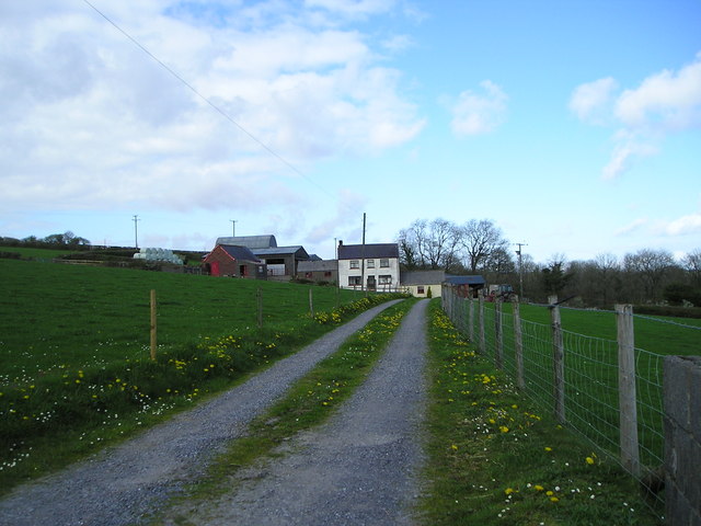
Allt Nant-y-castell is a picturesque woodland located in Carmarthenshire, Wales. Covering an area of approximately 50 hectares, the forest is nestled within the beautiful rolling hills of the Welsh countryside. It is a popular destination for nature enthusiasts and hikers due to its stunning landscapes and abundant wildlife.

The woodland is characterized by a diverse range of tree species, including oak, beech, and birch, which create a lush and vibrant atmosphere. The forest floor is covered in a thick carpet of moss and ferns, providing a rich habitat for a variety of flora and fauna.

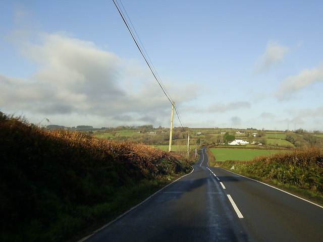
Visitors to Allt Nant-y-castell can enjoy a network of well-maintained trails that wind through the forest, allowing for leisurely walks or more challenging hikes. The paths offer breathtaking views of the surrounding countryside, making it an ideal spot for photography enthusiasts.

The forest is also home to a wide array of wildlife, including deer, foxes, and a variety of bird species. Birdwatchers can spot species such as woodpeckers and owls, while lucky visitors might even catch a glimpse of the elusive red squirrel.

Allt Nant-y-castell is well-equipped with facilities, including car parking, picnic areas, and information boards providing details about the local flora and fauna. It is also easily accessible, with nearby road links and public transportation options.

Overall, Allt Nant-y-castell is a captivating woodland that offers visitors a tranquil escape into nature. Its stunning scenery, diverse wildlife, and well-maintained trails make it a must-visit destination for anyone seeking a peaceful and immersive outdoor experience in Carmarthenshire.

If you have any feedback on the listing, please let us know in the comments section below.

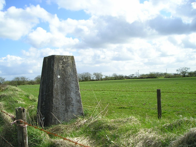
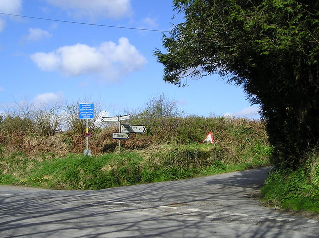
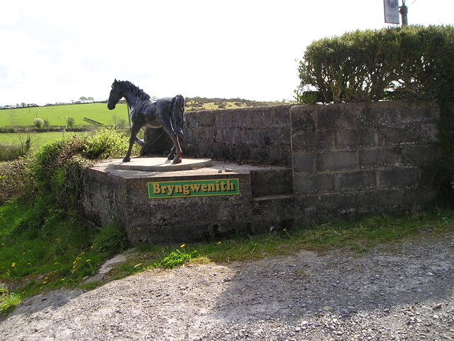
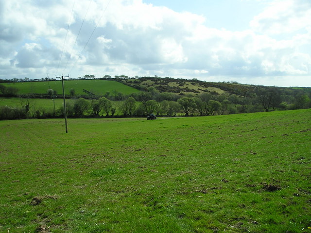
Allt Nant-y-castell Images

Images are sourced within 2km of 51.943305/-4.3959132 or Grid Reference SN3529. Thanks to Geograph Open Source API. All images are credited.

Trig point 259 metres above sea level.
Trig point
259 metres above sea level.
Multi-sign road junction
Milk stand New use for an old milk stand.
Milk stand
New use for an old milk stand.
Chain harrowing The tractor is pulling a harrow that smooths out projections such as molehills and aerates the turf.
Chain harrowing
The tractor is pulling a harrow that smooths out projections such as molehills and aerates the turf.
Blaenffynnon Farm with a stock of "green" silage bales, a colour designed to blend into the landscape!
Blaenffynnon
Farm with a stock of "green" silage bales, a colour designed to blend into the landscape!
Bend in the road near Hermon A view of the bend in the road and the pylons near the entrance to Ty'r Parc, on the B4333 heading for Hermon.
Bend in the road near Hermon
A view of the bend in the road and the pylons near the entrance to Ty'r Parc, on the B4333 heading for Hermon.
B4333 heading for Hermon A view from the top of a hill of the B4333 heading for Hermon.
B4333 heading for Hermon
A view from the top of a hill of the B4333 heading for Hermon.
Chapel and graveyard, Hermon A view of the chapel, graveyard and the B4333 from the car park, opposite the chapel.
Chapel and graveyard, Hermon
A view of the chapel, graveyard and the B4333 from the car park, opposite the chapel.
B4333 leaving Hermon A view of the northern part of Hermon on the B4333 heading for Newcastle Emlyn.
B4333 leaving Hermon
A view of the northern part of Hermon on the B4333 heading for Newcastle Emlyn.
Llwybr Hermon Path Gât fochyn ar lwybr cyhoeddus yn Hermon.

A kissing gate on a public path in Hermon.
Llwybr Hermon Path
Gât fochyn ar lwybr cyhoeddus yn Hermon. A kissing gate on a public path in Hermon.
Nant Gochen Cerddwyr yn rhydio Nant Gochen ger Hermon.

Walkers fording Nant Gochen stream near Hermon
Nant Gochen
Cerddwyr yn rhydio Nant Gochen ger Hermon. Walkers fording Nant Gochen stream near Hermon
Nant Cwm Rhys Llwybr cyhoeddus yn rhydio Nant Cwm Rhys. Gerllaw safai TY Coch a Chwm, dau anhedd-dy lle mae olion un ohynt i'w gweld ar y chwith.

A public footpath fording Nant Cwm Rhys (trans. Rhys's valley stream). At this location stood two properties called Ty Coch (trans. red house) and Cwm (trans. valley), the scant remains of one of them can be seen on the left.
Nant Cwm Rhys
Llwybr cyhoeddus yn rhydio Nant Cwm Rhys. Gerllaw safai TY Coch a Chwm, dau anhedd-dy lle mae olion un ohynt i'w gweld ar y chwith. A public footpath fording Nant Cwm Rhys (trans. Rhys's valley stream). At this location stood two properties called Ty Coch (trans. red house) and Cwm (trans. valley), the scant remains of one of them can be seen on the left.
Ysgol Nantcwmrhys / Nantcwmrhys School Llwybr cyhoeddus yn mynd heibio i adfeilion ysgol anghysbell Nantcwmrhys (1880-1956).

A public footpath passing the ruins of the once remote Nantcwmrhys School (1880-1956).
Ysgol Nantcwmrhys / Nantcwmrhys School
Llwybr cyhoeddus yn mynd heibio i adfeilion ysgol anghysbell Nantcwmrhys (1880-1956). A public footpath passing the ruins of the once remote Nantcwmrhys School (1880-1956).
Ordnance Survey Cut Mark This OS cut mark can be found on the west face of the Hermon Chapel. It marks a point 239.637m above mean sea level.
Ordnance Survey Cut Mark
This OS cut mark can be found on the west face of the Hermon Chapel. It marks a point 239.637m above mean sea level.
Capel Hermon There is an OS cut mark on the front of the Chapel.
Capel Hermon
There is an OS cut mark on the front of the Chapel.
Large wind turbine Large wind turbine west of Cwmduad
Large wind turbine
Large wind turbine west of Cwmduad
Capel yr Annibynwyr, Hermon
Burial ground, Hermon
Show me another place!

Allt Nant-y-castell is located at Grid Ref: SN3529 (Lat: 51.943305, Lng: -4.3959132)

Unitary Authority: Carmarthenshire

Police Authority: Dyfed Powys

What 3 Words

///lanes.tech.skidding. Near Abernant, Carmarthenshire

Nearby Locations

Allt Nant-y-castell

Related Wikis

Cwmduad

Cwmduad (Welsh "Cwm" valley + "duad" blackness (river Duad, in English Blackcombe)) is a village in Carmarthenshire, West Wales. == Location == Cwmduad...

Blaenycoed

Blaenycoed, or Blaen-y-coed is a village situated between Carmarthen and Newcastle Emlyn, Wales, of 17 houses, a Welsh Independents chapel, a postbox and...

Cynwyl Elfed

Cynwyl Elfed (; sometimes Conwyl and formerly anglicised as Conwil Elvet or Conwil in Elvet) is a village and community in the county of Carmarthenshire...

Cynwyl Elfed transmitting station

The Cynwyl Elfed television relay station is sited on high ground to the east of the village of Cynwyl Elfed to the north of Carmarthen. It was originally...

Caeau Nantsais

Caeau Nantsais are two fields next to a that are a Site of Special Scientific Interest in Carmarthen & Dinefwr, Wales. == See also == List of Sites of...

Conwil railway station

Conwil was a railway station near the village of Cynwyl Elfed in Carmarthenshire, Wales, serving the hamlet and the rural locale. It was once a thriving...

Talog, Carmarthenshire

Talog is a small rural village in Carmarthenshire, Wales, located on the River Cywyn, about seven miles north-west of the town of Carmarthen. It is in...

Danycoed Halt railway station

Danycoed Halt, which is Welsh for below the trees, was built by the Gwili Railway in the late 1990s and opened in 2001. It is the current northern terminus...

Have you been to Allt Nant-y-castell?

Leave your review of Allt Nant-y-castell below (or comments, questions and feedback).