Burghill

Settlement in Herefordshire

England

Burghill

Canon Pyon Road near Arundel Farm The road runs south to Hereford
Canon Pyon Road near Arundel Farm Credit: Julian P Guffogg

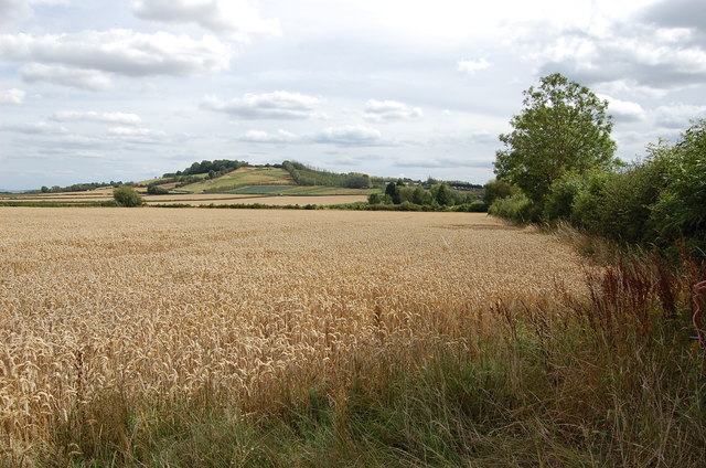
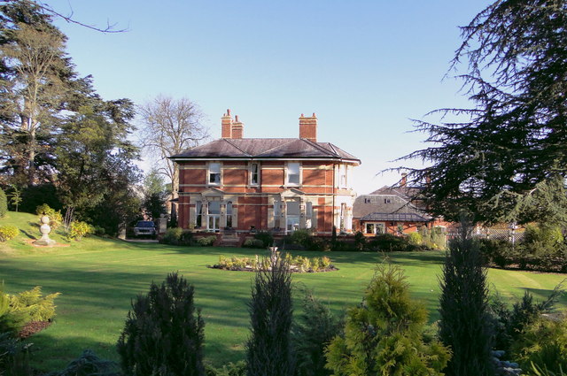
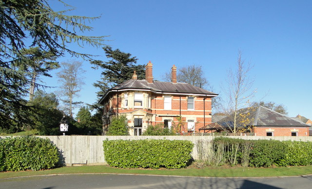
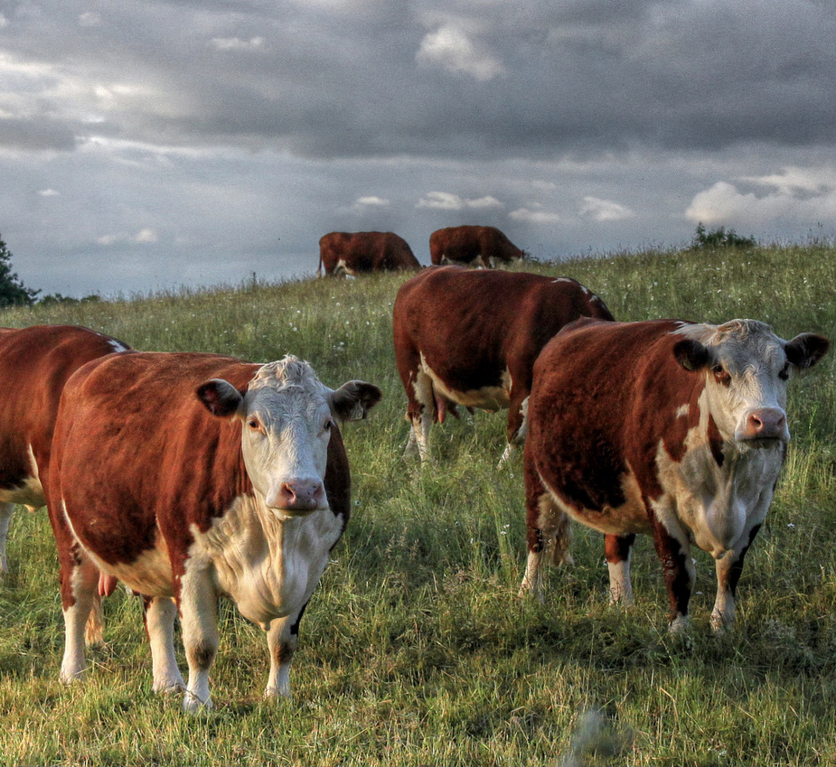
Burghill is a small village located in Herefordshire, England. Situated approximately four miles north-west of the city of Hereford, Burghill is a picturesque rural community surrounded by rolling green fields and farmland. The village is known for its charming historic buildings, including a 12th-century church and a number of traditional timber-framed houses.

Burghill is a close-knit community with a population of around 1,000 residents. The village has a primary school, a village hall, and a local pub, providing essential amenities for its residents. The surrounding countryside offers plenty of opportunities for outdoor activities such as walking, cycling, and horse riding.

The village has a rich history, with evidence of human settlement dating back to Roman times. Today, Burghill retains much of its historic charm, with well-preserved buildings and a strong sense of community pride. The village is a popular destination for those seeking a peaceful and idyllic rural retreat, while still being within easy reach of the amenities and attractions of Hereford city.

If you have any feedback on the listing, please let us know in the comments section below.

Burghill Images

Images are sourced within 2km of 52.095425/-2.7627926 or Grid Reference SO4744. Thanks to Geograph Open Source API. All images are credited.

Canon Pyon Road near Arundel Farm The road runs south to Hereford
Canon Pyon Road near Arundel Farm
The road runs south to Hereford
Drive to Arundel Farm
Wheat Field
Wheat Field
Herefordshire oast houses
The former Superintendent's House, Hereford County Asylum Once the home of the Superintendent of St Mary's Hospital, as the County Asylum was known in its later years. Opened in 1871, the hospital closed in 1995. Now a fabulous house on the edge of a high class private development which incorporated many of the original hospital buildings.
The former Superintendent's House, Hereford County Asylum
Once the home of the Superintendent of St Mary's Hospital, as the County Asylum was known in its later years. Opened in 1871, the hospital closed in 1995. Now a fabulous house on the edge of a high class private development which incorporated many of the original hospital buildings.
The Superintendent's House, St Mary's Hospital Once the home of the Superintendent of St Mary's Hospital, as the Hereford County Asylum was known in its later years. Opened in 1871, the hospital closed in 1995. Now a fabulous house on the edge of a high class private development which incorporated many of the original hospital buildings.
The Superintendent's House, St Mary's Hospital
Once the home of the Superintendent of St Mary's Hospital, as the Hereford County Asylum was known in its later years. Opened in 1871, the hospital closed in 1995. Now a fabulous house on the edge of a high class private development which incorporated many of the original hospital buildings.
The Porter's Lodge, St Mary's Hospital Now a delightful private home, this was the Porter's Lodge of the Hereford County Asylum, later renamed St Mary's Hospital. The hospital finally closed in 1995 and many of the buildings have been preserved, converted into fantastic houses.
The Porter's Lodge, St Mary's Hospital
Now a delightful private home, this was the Porter's Lodge of the Hereford County Asylum, later renamed St Mary's Hospital. The hospital finally closed in 1995 and many of the buildings have been preserved, converted into fantastic houses.
Former Administration block, Hereford County Asylum Now an impressive private home, this was the Administration block of the Hereford County Asylum, later renamed St Mary's Hospital. The hospital finally closed in 1995 and many of the buildings have been preserved, converted into fantastic houses.
Former Administration block, Hereford County Asylum
Now an impressive private home, this was the Administration block of the Hereford County Asylum, later renamed St Mary's Hospital. The hospital finally closed in 1995 and many of the buildings have been preserved, converted into fantastic houses.
The Obelisk, St Mary's The formal garden layout at the heart of this prestigious housing development on the site of St Mary's, the former Hereford County Asylum, which finally closed in 1994.
The Obelisk, St Mary's
The formal garden layout at the heart of this prestigious housing development on the site of St Mary's, the former Hereford County Asylum, which finally closed in 1994.
Burghill Court Handsome Georgian country house on the edge of this prosperous village just outside Hereford.
Burghill Court
Handsome Georgian country house on the edge of this prosperous village just outside Hereford.
Female ward extension block, Hereford County Asylum Latterly renamed St Mary's Hospital, the site finally closed in 1994/5. The handsome Victorian ward buildings, dating from 1871, have been converted into very desirable housing.
Female ward extension block, Hereford County Asylum
Latterly renamed St Mary's Hospital, the site finally closed in 1994/5. The handsome Victorian ward buildings, dating from 1871, have been converted into very desirable housing.
Recent harvest A rape crop safely gathered in near Lower Burlton.
Recent harvest
A rape crop safely gathered in near Lower Burlton.
Herefordshire pastures Looking west from the Burghill Road with Credenhill Wood in the distance.
Herefordshire pastures
Looking west from the Burghill Road with Credenhill Wood in the distance.
Towtree Lane Some cottages and a farm on this narrow Herefordshire Lane.
Towtree Lane
Some cottages and a farm on this narrow Herefordshire Lane.
Barn by Towtree Lane A substantial building currently empty.
Barn by Towtree Lane
A substantial building currently empty.
Small field off Towtree Lane Heading for a second cut of haylage for 2012.
Small field off Towtree Lane
Heading for a second cut of haylage for 2012.
Crate of apples Crate of apples from Tillington fruit farm
Crate of apples
Crate of apples from Tillington fruit farm
Burghill Court, Burghill The concealment of a bay by the rapacious ivy has a disorienting effect on the facade. Its removal since this photo shows that there are windows underneath (see <a href="https://www.geograph.org.uk/photo/2746786">SO4744 : Burghill Court</a>). The house was built c1773-76 for Benjamin Biddulph, almost certainly to the designs of Anthony Keck. Quite a grand Greek Doric porch. Grade II listed.
Keck's design has been ill-served by later alterations, possibly connected to its division into two separate residences, as evidenced by a pre-partition photo of c1865: <a href="https://www.geograph.org.uk/photo/4757375">SO4744 : Burghill Court, Burghill (c1865)</a>.
------------------------------------------------------------------------------------------------------------
Keck (1726-97) was one of a breed of skilled, provincial builder-architects who, during the C18th and early C19th, created substantial parts of the built fabric of the country that we see today. He established a practice in Gloucestershire and worked mainly there and in Worcestershire and Herefordshire. He designed a number of pleasing medium-sized country houses, that mainstay of successful Georgian architects, and was also involved in designing locks on the Stroudwater Canal.
------------------------------------------------------------------------------------------------------------
Burghill Court, Burghill
The concealment of a bay by the rapacious ivy has a disorienting effect on the facade. Its removal since this photo shows that there are windows underneath (see SO4744 : Burghill Court). The house was built c1773-76 for Benjamin Biddulph, almost certainly to the designs of Anthony Keck. Quite a grand Greek Doric porch. Grade II listed. Keck's design has been ill-served by later alterations, possibly connected to its division into two separate residences, as evidenced by a pre-partition photo of c1865: SO4744 : Burghill Court, Burghill (c1865). ------------------------------------------------------------------------------------------------------------ Keck (1726-97) was one of a breed of skilled, provincial builder-architects who, during the C18th and early C19th, created substantial parts of the built fabric of the country that we see today. He established a practice in Gloucestershire and worked mainly there and in Worcestershire and Herefordshire. He designed a number of pleasing medium-sized country houses, that mainstay of successful Georgian architects, and was also involved in designing locks on the Stroudwater Canal. ------------------------------------------------------------------------------------------------------------
Show me another place!

Burghill is located at Grid Ref: SO4744 (Lat: 52.095425, Lng: -2.7627926)

Unitary Authority: County of Herefordshire

Police Authority: West Mercia

What 3 Words

///trucked.ivory.carriage. Near Credenhill, Herefordshire

Nearby Locations

Burghill

Related Wikis

Burghill

Burghill is a village and civil parish in Herefordshire, England, north-west of Hereford. The parish includes the villages of Burghill, Tillington, Portway...

St Mary's Hospital, Burghill

St. Mary's Hospital was a psychiatric facility located in the village of Burghill, Herefordshire. == History == Herefordshire initially utilised subscription...

Herefordshire

Herefordshire ( HERR-if-ərd-sheer, -⁠shər) is a ceremonial county in the West Midlands of England. It is bordered by Gloucestershire to the south-east...

Upper Lyde

Upper Lyde is a small village in Herefordshire, England, around 4 miles (6 km) north of Hereford city centre. It forms part of the Pipe and Lyde civil...

Nearby Amenities

Located within 500m of 52.095425,-2.7627926
Burghill
Place: village
Wikidata: Q2163243
Lat/Long: 52.0960708/-2.7643597
Bus Stop
Leasown
Naptan AtcoCode: 2090A072600
Naptan Bearing: SE
Naptan CommonName: Leasown
Naptan Indicator: adj
Naptan Landmark: Post Box
Naptan NaptanCode: heradjat
Naptan Street: Burghill village road
Naptan Verified: no
Source: naptan_import
Lat/Long: 52.0974031/-2.7651273
Leasown
Naptan AtcoCode: 2090A18419
Naptan Bearing: SE
Naptan BusStopType: CUS
Naptan CommonName: Leasown
Naptan Indicator: opp
Naptan Landmark: opp Leasown Houses
Naptan NaptanCode: heragptp
Naptan Street: Burghill village road
Naptan Verified: no
Source: naptan_import
Lat/Long: 52.097354/-2.7652642
Turning Circle
Lat/Long: 52.0936499/-2.7591629
Generator Method: photovoltaic
Generator Output Electricity: yes
Generator Source: solar
Generator Type: solar_photovoltaic_panel
Location: roof
Power: generator
Lat/Long: 52.0946374/-2.7601352
Generator Method: photovoltaic
Generator Output Electricity: yes
Generator Source: solar
Generator Type: solar_photovoltaic_panel
Location: roof
Power: generator
Lat/Long: 52.0940689/-2.7638072
Generator Method: photovoltaic
Generator Output Electricity: yes
Generator Source: solar
Generator Type: solar_photovoltaic_panel
Location: roof
Power: generator
Lat/Long: 52.0955684/-2.7614951
Generator Method: photovoltaic
Generator Output Electricity: yes
Generator Source: solar
Generator Type: solar_photovoltaic_panel
Location: roof
Power: generator
Lat/Long: 52.0982987/-2.7671063
Generator Method: photovoltaic
Generator Output Electricity: yes
Generator Source: solar
Generator Type: solar_photovoltaic_panel
Location: roof
Power: generator
Lat/Long: 52.0985904/-2.767683
Generator Method: photovoltaic
Generator Output Electricity: yes
Generator Source: solar
Generator Type: solar_photovoltaic_panel
Location: roof
Power: generator
Lat/Long: 52.0977006/-2.767632
Generator Method: photovoltaic
Generator Output Electricity: yes
Generator Source: solar
Generator Type: solar_photovoltaic_panel
Location: roof
Power: generator
Lat/Long: 52.0975589/-2.7669427
Barrier: stile
Source: Bing
Lat/Long: 52.0924991/-2.763831
Public Bookcase
Burghill Book Exchange
Booth: KX100
Disused Amenity: telephone
Man Made: telephone_box
Public Bookcase Type: phone_box
Lat/Long: 52.095656/-2.7611535
Post Box
Post Box Type: lamp
Royal Cypher: EIIR
Royal Cypher Wikidata: Q33102113
Lat/Long: 52.0956526/-2.7612085
Post Box
Lat/Long: 52.0974492/-2.7652144
Barrier: bollard
Lat/Long: 52.0971812/-2.7679723
Barrier: cycle_barrier
Bicycle: yes
Lat/Long: 52.0979035/-2.7676242
Barrier: bollard
Lat/Long: 52.0970878/-2.7679778
Barrier: cycle_barrier
Bicycle: yes
Foot: yes
Motor Vehicle: no
Lat/Long: 52.096723/-2.7679284
The data included in this document is from www.openstreetmap.org. The data is made available under ODbL.

Have you been to Burghill?

Leave your review of Burghill below (or comments, questions and feedback).