Coed Cefn Llanfair

Wood, Forest in Caernarfonshire

Wales

Coed Cefn Llanfair

North Wales WWII defences: RAF Penrhos - Air Raid Shelter  (1) -
Air Raid Shelter: EDoB ID: e61394

On a dispersed site, located next to a probable maintenance/workshop hangar.

<a href="https://www.geograph.org.uk/photo/6944913">SH3334 : North Wales WWII defences: RAF Penrhos - Air Raid Shelter  (2)</a>
North Wales WWII defences: RAF Penrhos - Air Raid Shelter (1) Credit: Mike Searle

Coed Cefn Llanfair is a picturesque woodland located in Caernarfonshire, Wales. Spread across a vast area, it is a haven for nature enthusiasts and those seeking tranquility amidst the beauty of the Welsh countryside. The woodland is situated near the village of Llanfair, offering a convenient escape from the bustling city life.

The forest boasts a diverse range of flora and fauna, with its dense canopy of trees creating a soothing atmosphere. Visitors can explore the various walking trails that wind through the woodland, allowing them to immerse themselves in the natural wonders that Coed Cefn Llanfair has to offer.

The ancient woodland is home to a rich variety of tree species, including oak, ash, beech, and birch. These majestic trees provide a habitat for numerous wildlife species, such as squirrels, badgers, and a wide array of bird species. Birdwatchers will be delighted to spot woodpeckers, owls, and songbirds among the leafy branches.

Moreover, Coed Cefn Llanfair is renowned for its stunning displays of wildflowers during the spring and summer months. The forest floor becomes a carpet of vibrant colors, with bluebells, primroses, and daffodils creating a mesmerizing sight.

To enhance the visitor experience, the woodland offers picnic areas and benches, allowing visitors to relax and appreciate the serenity of their surroundings. The forest is also a popular destination for nature photography and painting enthusiasts, showcasing the beauty of the landscape in various artistic forms.

Overall, Coed Cefn Llanfair is a captivating woodland with its lush greenery, diverse wildlife, and serene atmosphere. It is a cherished natural gem that showcases the enchanting allure of the Welsh countryside.

If you have any feedback on the listing, please let us know in the comments section below.

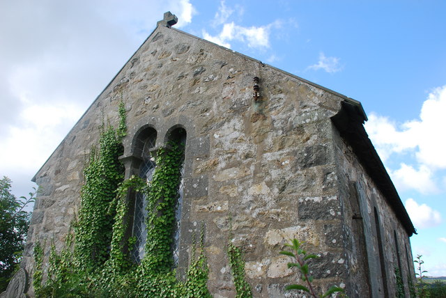
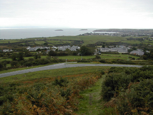
Coed Cefn Llanfair Images

Images are sourced within 2km of 52.876161/-4.4932393 or Grid Reference SH3233. Thanks to Geograph Open Source API. All images are credited.

North Wales WWII defences: RAF Penrhos - Air Raid Shelter  (1) -
Air Raid Shelter: EDoB ID: e61394

On a dispersed site, located next to a probable maintenance/workshop hangar.

<a href="https://www.geograph.org.uk/photo/6944913">SH3334 : North Wales WWII defences: RAF Penrhos - Air Raid Shelter  (2)</a>
North Wales WWII defences: RAF Penrhos - Air Raid Shelter (1)
- Air Raid Shelter: EDoB ID: e61394 On a dispersed site, located next to a probable maintenance/workshop hangar. SH3334 : North Wales WWII defences: RAF Penrhos - Air Raid Shelter (2)
North Wales WWII defences: RAF Penrhos - Air Raid Shelter  (2) -
Air Raid Shelter: EDoB ID: e61394

<a href="https://www.geograph.org.uk/photo/6944916">SH3334 : North Wales WWII defences: RAF Penrhos - disused hangar  (1)</a>
North Wales WWII defences: RAF Penrhos - Air Raid Shelter (2)
North Wales WWII defences: RAF Penrhos - disused hangar  (1) A now derelict hangar remote from the airfield, that was probably a maintenance workshop of some kind.

<a href="https://www.geograph.org.uk/photo/6944917">SH3334 : North Wales WWII defences: RAF Penrhos - disused hangar  (2)</a>
North Wales WWII defences: RAF Penrhos - disused hangar (1)
A now derelict hangar remote from the airfield, that was probably a maintenance workshop of some kind. SH3334 : North Wales WWII defences: RAF Penrhos - disused hangar (2)
North Wales WWII defences: RAF Penrhos - disused hangar  (2) -
START: <a href="https://www.geograph.org.uk/photo/5409513">SH3333 : North Wales WWII defences: RAF Penrhos - pillbox (1)</a>
North Wales WWII defences: RAF Penrhos - disused hangar (2)
Y Llong/Ship Inn, Llanbedrog
A499 nearing Llanbedrog
B4413 Ffordd Pedrog in Llanbedrog
Road heading North A view of the road heading northward to Allt Ddu, taken from the top of the roadside bank with its legacy of last year's bracken crop. In the distance the coastal hills near to Nefyn appear as islands in a sea fog which is pushing inland on a northely breeze.
Road heading North
A view of the road heading northward to Allt Ddu, taken from the top of the roadside bank with its legacy of last year's bracken crop. In the distance the coastal hills near to Nefyn appear as islands in a sea fog which is pushing inland on a northely breeze.
Field with ewes and lambs Warm Spring sunshine has started the grass growing and is getting the new lambs off to a good start. This view is to the East taking in the B4415 as it drops towards Rhyd-y-clafdy.
Field with ewes and lambs
Warm Spring sunshine has started the grass growing and is getting the new lambs off to a good start. This view is to the East taking in the B4415 as it drops towards Rhyd-y-clafdy.
Disused quarry A small, disused quarry at the roadside is developed in a localised outcrop of a rhyolitic tuff called the Bodgadle Member, of Ordovician, Caradoc age and associated with volcanic activity in the Pwllheli and Llanbedrog area. This rock has a very pale colour when weathered and can be seen as distinctive outcrops on the edge of the hill (e.g. <a href="https://www.geograph.org.uk/photo/1989291">SH3135 : View across pastureland towards Bodgadle Farm</a>).
Disused quarry
A small, disused quarry at the roadside is developed in a localised outcrop of a rhyolitic tuff called the Bodgadle Member, of Ordovician, Caradoc age and associated with volcanic activity in the Pwllheli and Llanbedrog area. This rock has a very pale colour when weathered and can be seen as distinctive outcrops on the edge of the hill (e.g. SH3135 : View across pastureland towards Bodgadle Farm).
Capel Peniel This large Calvinistic Methodist chapel is no longer in use, services now being held since 2004 in Peniel Newydd, the schoolroom.
Capel Peniel
This large Calvinistic Methodist chapel is no longer in use, services now being held since 2004 in Peniel Newydd, the schoolroom.
Tŷ Capel Peniel The former chapel house of <a href="https://www.geograph.org.uk/photo/2719937">SH3231 : Capel Peniel</a>
Tŷ Capel Peniel
The former chapel house of SH3231 : Capel Peniel
Peniel Newydd The building to the left is now used for services.
See <a href="https://www.geograph.org.uk/photo/2719937">SH3231 : Capel Peniel</a>
Peniel Newydd
The building to the left is now used for services. See SH3231 : Capel Peniel
Tan Capel Peniel See <a href="https://www.geograph.org.uk/photo/2719937">SH3231 : Capel Peniel</a>
Tan Capel Peniel
Capel Rehoboth A Wesleyan Methodist chapel standing just up the hill from the Calvinistic Methodist Capel Peniel.
Capel Rehoboth
A Wesleyan Methodist chapel standing just up the hill from the Calvinistic Methodist Capel Peniel.
Capel Rehoboth Date plaque on <a href="https://www.geograph.org.uk/photo/2719941">SH3231 : Capel Rehoboth</a>
Capel Rehoboth
Date plaque on SH3231 : Capel Rehoboth
Capel Rhydyclafdy
Capel Rhydyclafdy
Capel Rhydyclafdy
Capel Rhydyclafdy
Show me another place!

Coed Cefn Llanfair is located at Grid Ref: SH3233 (Lat: 52.876161, Lng: -4.4932393)

Unitary Authority: Gwynedd

Police Authority: North Wales

What 3 Words

///raced.twin.escapades. Near Pwllheli, Gwynedd

Related Wikis

Penyberth

Penyberth was a farmhouse at Penrhos, on the Llŷn Peninsula near Pwllheli, Gwynedd, which had been the home to generations of patrons of poets, and also...

Rhydyclafdy

Rhydyclafdy (or Rhyd-y-clafdy) is a small village close to the southern coast of the Llŷn Peninsula in the Welsh county of Gwynedd. It lies 2.8 miles...

RAF Penrhos

Royal Air Force Penrhos, or more simply RAF Penrhos, is a former Royal Air Force airfield located near Penrhos, Gwynedd and 14.7 miles (23.7 km) west of...

Llanfihangel Bachellaeth

Llanfihangel Bachellaeth is a former civil parish in the Welsh county of Gwynedd. It was abolished in 1934, and incorporated into Buan. == References ==

Llanbedrog

Llanbedrog is a village and community on the Llŷn peninsula of Gwynedd in Wales. It is situated on the south side of the peninsula on the A499 between...

Penrhos, Gwynedd

Penrhos is a village and former civil parish in the Welsh county of Gwynedd, located on the Llŷn Peninsula. The parish was abolished in 1934, and incorporated...

Mynytho

Mynytho is a small village in the parish of Llanengan near the southern coast of the Llŷn Peninsula in northwestern Wales. It consists of a few houses...

Mynydd Tir y Cwmwd

Mynydd Tir y Cwmwd (The Headland) is an area of about 175 acres (708,000 m2) in north Wales to the south of the village of Llanbedrog. From the top of...

Nearby Amenities

Located within 500m of 52.876161,-4.4932393
Power: pole
Lat/Long: 52.8762062/-4.4982335
Power: pole
Lat/Long: 52.8768424/-4.4980833
Power: pole
Lat/Long: 52.8781196/-4.4977239
Power: pole
Lat/Long: 52.8789257/-4.4973537
Power: pole
Lat/Long: 52.8796444/-4.4969997
Power: pole
Lat/Long: 52.8803323/-4.4959563
Power: pole
Lat/Long: 52.8798273/-4.4972786
Power: pole
Lat/Long: 52.8788221/-4.4976193
Power: pole
Lat/Long: 52.8781989/-4.4978499
Power: pole
Lat/Long: 52.8770034/-4.498204
Power: pole
Lat/Long: 52.8761794/-4.4984481
Power: pole
Lat/Long: 52.8754923/-4.4990999
Power: pole
Lat/Long: 52.8747978/-4.4997999
Direction: SW
Generator Method: photovoltaic
Generator Output Electricity: yes
Generator Solar Modules: 16
Generator Source: solar
Generator Type: solar_photovoltaic_panel
Location: roof
Power: generator
Lat/Long: 52.8769686/-4.487789
The data included in this document is from www.openstreetmap.org. The data is made available under ODbL.

Have you been to Coed Cefn Llanfair?

Leave your review of Coed Cefn Llanfair below (or comments, questions and feedback).