Coed Bodgadle

Wood, Forest in Caernarfonshire

Wales

Coed Bodgadle

Tuag at Foel Caerau / Towards Moel Caerau Cerddwyr yn mynd I gyfeiriad Moel Caearau, y bryn yn y pellter.

Walkers heading towards Moel Caearau (trans. bare hilltop of the forts), the hill in the distance.
Tuag at Foel Caerau / Towards Moel Caerau Credit: Alan Richards

Coed Bodgadle is a scenic woodland located in Caernarfonshire, Wales. Situated near the town of Caernarfon, it covers an area of approximately 500 acres. The woodland is nestled within the Snowdonia National Park, renowned for its natural beauty and diverse wildlife.

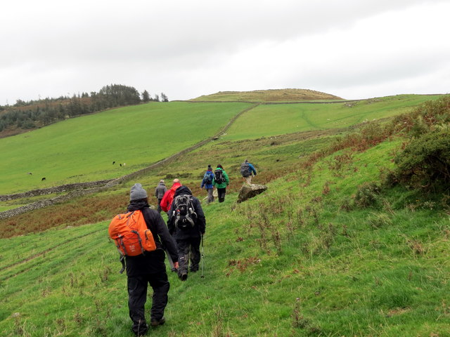
Coed Bodgadle features a mix of native tree species, including oak, birch, and ash, which create a lush and vibrant canopy. The forest floor is covered with an array of wildflowers and ferns, adding to its enchanting appeal. The woodland is crisscrossed by a network of walking trails, allowing visitors to explore its serene surroundings.

As a protected area, Coed Bodgadle is home to a wide range of fauna. Birdwatchers can spot various species such as buzzards, woodpeckers, and owls, while lucky visitors may even catch a glimpse of red squirrels darting through the trees. The forest also provides a habitat for small mammals like rabbits, foxes, and badgers.

The woodland has historical significance too, with remnants of ancient settlements and burial grounds dating back to the Bronze Age. These archaeological features add an element of intrigue and cultural importance to Coed Bodgadle.

In recent years, the woodland has become a popular destination for nature lovers, hikers, and photographers seeking solace in its tranquil ambiance. Whether it's a leisurely stroll, birdwatching, or simply enjoying the breathtaking scenery, Coed Bodgadle offers a peaceful retreat for all who venture into its embrace.

If you have any feedback on the listing, please let us know in the comments section below.

Coed Bodgadle Images

Images are sourced within 2km of 52.887666/-4.5202864 or Grid Reference SH3035. Thanks to Geograph Open Source API. All images are credited.

Tuag at Foel Caerau / Towards Moel Caerau Cerddwyr yn mynd I gyfeiriad Moel Caearau, y bryn yn y pellter.

Walkers heading towards Moel Caearau (trans. bare hilltop of the forts), the hill in the distance.
Tuag at Foel Caerau / Towards Moel Caerau
Cerddwyr yn mynd I gyfeiriad Moel Caearau, y bryn yn y pellter. Walkers heading towards Moel Caearau (trans. bare hilltop of the forts), the hill in the distance.
Llwybr Caerau Uchaf / Upper Caerau Path Cerddwyr yn dilyn llwybr cyhoeddus tuag at Ffarm Caerau Uchaf.

Walkers following a public footpath towards Caerau Uchaf Farm (trans. upper forts).
Llwybr Caerau Uchaf / Upper Caerau Path
Cerddwyr yn dilyn llwybr cyhoeddus tuag at Ffarm Caerau Uchaf. Walkers following a public footpath towards Caerau Uchaf Farm (trans. upper forts).
Tuag at Garn Bach / Towards Garn Bach Cerddwyr yn dilyn llwybr cyhoeddus tuag at Garn Bach, y bryncyn yn y pellter.

Walkers following a public footpath towards Garn Fach (trans. little rock), the hillock in the distance.
Tuag at Garn Bach / Towards Garn Bach
Cerddwyr yn dilyn llwybr cyhoeddus tuag at Garn Bach, y bryncyn yn y pellter. Walkers following a public footpath towards Garn Fach (trans. little rock), the hillock in the distance.
Dringo Garn Bach / Ascending Garn Bach Cerddwr yn dringo lan Garn Bach.

A walker ascending Garn Bach (trans. little cairn).
Dringo Garn Bach / Ascending Garn Bach
Cerddwr yn dringo lan Garn Bach. A walker ascending Garn Bach (trans. little cairn).
Modern Milestone by the B4415, Nant Saethon Stone post by the B4415, in parish of Llanengan (Gwynedd District), Nant Saethon, East side of road, North of Inkerman Bridge and West of Carn Saethon hillfort. Modern replica of a Caernarvon chamfered milestone.

Inscription reads:-
.......MLS.
PWLLHELI 6
SARN 5
ABERDARON 11

To be surveyed

Milestone Society National ID: CAE_PWAD06
Modern Milestone by the B4415, Nant Saethon
Stone post by the B4415, in parish of Llanengan (Gwynedd District), Nant Saethon, East side of road, North of Inkerman Bridge and West of Carn Saethon hillfort. Modern replica of a Caernarvon chamfered milestone. Inscription reads:- .......MLS. PWLLHELI 6 SARN 5 ABERDARON 11 To be surveyed Milestone Society National ID: CAE_PWAD06
Access road for Caerau Uchaf The quite lengthy access road to the farm at Caerau Uchaf leaves a minor road from which the image was recorded. The cloud-shadowed hill in the distance is Moel Caerau.
Access road for Caerau Uchaf
The quite lengthy access road to the farm at Caerau Uchaf leaves a minor road from which the image was recorded. The cloud-shadowed hill in the distance is Moel Caerau.
Field with ewes and lambs Warm Spring sunshine has started the grass growing and is getting the new lambs off to a good start. This view is to the East taking in the B4415 as it drops towards Rhyd-y-clafdy.
Field with ewes and lambs
Warm Spring sunshine has started the grass growing and is getting the new lambs off to a good start. This view is to the East taking in the B4415 as it drops towards Rhyd-y-clafdy.
Disused quarry A small, disused quarry at the roadside is developed in a localised outcrop of a rhyolitic tuff called the Bodgadle Member, of Ordovician, Caradoc age and associated with volcanic activity in the Pwllheli and Llanbedrog area. This rock has a very pale colour when weathered and can be seen as distinctive outcrops on the edge of the hill (e.g. <a href="https://www.geograph.org.uk/photo/1989291">SH3135 : View across pastureland towards Bodgadle Farm</a>).
Disused quarry
A small, disused quarry at the roadside is developed in a localised outcrop of a rhyolitic tuff called the Bodgadle Member, of Ordovician, Caradoc age and associated with volcanic activity in the Pwllheli and Llanbedrog area. This rock has a very pale colour when weathered and can be seen as distinctive outcrops on the edge of the hill (e.g. SH3135 : View across pastureland towards Bodgadle Farm).
Road junction near Garnfadryn Both roads lead to Botwnnog, the one on the right via Garnfadryn.
Road junction near Garnfadryn
Both roads lead to Botwnnog, the one on the right via Garnfadryn.
Llanfihangel Bachellaeth church The church appears to be disused - certainly as a place of worship and possibly as an artists studio which others have reported it having been. The graveyard is badly overgrown. Hills of the northern Lleyn Peninsula are seen in the distance to the left of the building.
Llanfihangel Bachellaeth church
The church appears to be disused - certainly as a place of worship and possibly as an artists studio which others have reported it having been. The graveyard is badly overgrown. Hills of the northern Lleyn Peninsula are seen in the distance to the left of the building.
Tyddyn-yr-haint Tyddyn-yr-haint, the farmhouse along the road, is a ruin lying below the modest hill, Carneddol. The distant mountains at the left side of the image are those of the northern Lleyn Peninsula; those to the right are the peaks of northern Snowdonia.
Tyddyn-yr-haint
Tyddyn-yr-haint, the farmhouse along the road, is a ruin lying below the modest hill, Carneddol. The distant mountains at the left side of the image are those of the northern Lleyn Peninsula; those to the right are the peaks of northern Snowdonia.
Llanfihangel farm Seen over the churchyard wall.
Llanfihangel farm
Seen over the churchyard wall.
The stile in the churchyard wall
Milestone - Pwllheli 5
Arwydd pentref Rhyd-y-Clafdy / Rhyd-y-Clafdy village sign
Cae Silwair / Silage field
Tyddyn-yr-Haint
Tyddyn-yr-Haint
Eglwys Llanfihangel Bechellaeth
Show me another place!

Coed Bodgadle is located at Grid Ref: SH3035 (Lat: 52.887666, Lng: -4.5202864)

Unitary Authority: Gwynedd

Police Authority: North Wales

What 3 Words

///connector.barrel.brave. Near Nefyn, Gwynedd

Nearby Locations

Coed Bodgadle

Related Wikis

Llanfihangel Bachellaeth

Llanfihangel Bachellaeth is a former civil parish in the Welsh county of Gwynedd. It was abolished in 1934, and incorporated into Buan. == References ==

Cors Geirch National Nature Reserve

Cors Geirch National Nature Reserve is an extensive wetland site on the Llŷn Peninsula, in the central part of the valley that runs between Nefyn and Pwllheli...

Rhydyclafdy

Rhydyclafdy (or Rhyd-y-clafdy) is a small village close to the southern coast of the Llŷn Peninsula in the Welsh county of Gwynedd. It lies 2.8 miles...

Carn Fadryn

Carn Fadryn, sometimes Carn Fadrun or Garn Fadryn, is a five-hectare Iron Age hillfort and is the name of the mountain on which the fort is situated. It...

Nearby Amenities

Located within 500m of 52.887666,-4.5202864
Power: pole
Lat/Long: 52.8836003/-4.5192218
Power: pole
Lat/Long: 52.884047/-4.5202115
Power: pole
Lat/Long: 52.8845698/-4.5215178
Power: pole
Lat/Long: 52.8844953/-4.5224834
Power: pole
Lat/Long: 52.884382/-4.5238902
Power: pole
Lat/Long: 52.8843019/-4.5250086
The data included in this document is from www.openstreetmap.org. The data is made available under ODbL.

Have you been to Coed Bodgadle?

Leave your review of Coed Bodgadle below (or comments, questions and feedback).