Allt Gothi

Wood, Forest in Cardiganshire

Wales

Allt Gothi

Pen Lan Bagged high point in field and reservoir with Alex and Smudge.
Name: Pen Lan
Hill number: 15425
Height:183m / 600ft
Parent (Ma/M): 2221  Rhos Ymryson
Section:31C: South-West Wales
County/UA: Cardiganshire [Ceredigion] (CoU)
Class: Tump (100-199m)
Grid ref:SN252471 (est)
Drop: 36m
Col:147m  SN245459
Pen Lan Credit: Rude Health

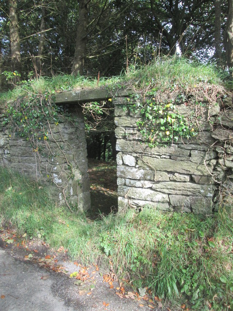
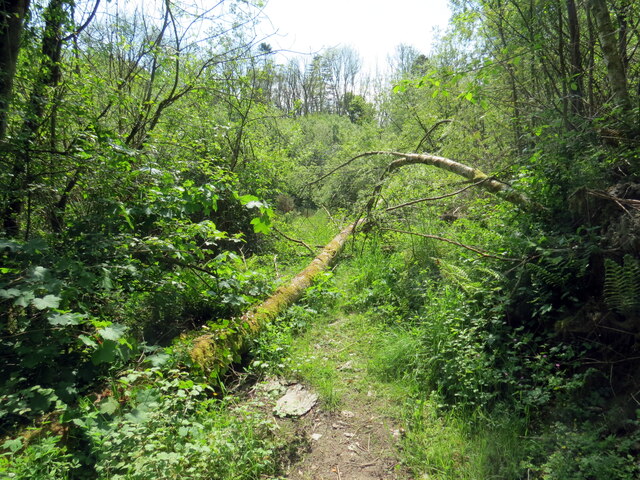
Allt Gothi is a small woodland located in Cardiganshire, Wales. It is situated in the rural countryside, surrounded by rolling hills and picturesque landscapes. The woodland covers an area of approximately 50 acres and consists primarily of mixed deciduous and coniferous trees.

The name "Allt Gothi" is derived from the Welsh language, with "Allt" meaning "wooded slope" and "Gothi" meaning "priest." The origin of this name remains unclear, but it is believed to have historical significance related to the area's past.

The woodland offers a peaceful and tranquil environment, attracting nature enthusiasts and hikers alike. Visitors can explore the well-maintained trails that wind through the forest, providing opportunities for leisurely walks and birdwatching. The diverse range of tree species, including oak, beech, and spruce, offers a vibrant display of colors throughout the seasons.

Allt Gothi is also home to a variety of wildlife, including deer, foxes, and numerous bird species. The woodland provides a natural habitat for these animals, creating a rich ecosystem that visitors can observe and appreciate. Additionally, the presence of a small stream within the woodland adds to its natural beauty and provides a refreshing spot for visitors to relax and enjoy the surroundings.

Overall, Allt Gothi in Cardiganshire is a charming woodland that offers a peaceful retreat for nature lovers. Its diverse flora and fauna, well-maintained trails, and scenic landscapes make it an ideal destination for those seeking a connection with nature.

If you have any feedback on the listing, please let us know in the comments section below.

Allt Gothi Images

Images are sourced within 2km of 52.083606/-4.538501 or Grid Reference SN2645. Thanks to Geograph Open Source API. All images are credited.

Pen Lan Bagged high point in field and reservoir with Alex and Smudge.
Name: Pen Lan
Hill number: 15425
Height:183m / 600ft
Parent (Ma/M): 2221  Rhos Ymryson
Section:31C: South-West Wales
County/UA: Cardiganshire [Ceredigion] (CoU)
Class: Tump (100-199m)
Grid ref:SN252471 (est)
Drop: 36m
Col:147m  SN245459
Pen Lan
Bagged high point in field and reservoir with Alex and Smudge. Name: Pen Lan Hill number: 15425 Height:183m / 600ft Parent (Ma/M): 2221 Rhos Ymryson Section:31C: South-West Wales County/UA: Cardiganshire [Ceredigion] (CoU) Class: Tump (100-199m) Grid ref:SN252471 (est) Drop: 36m Col:147m SN245459
Scotland Hill Trig has been uprooted and relocated to the SSE gate corner. Up track from SE and cattle pasture gates.to find trig on way to TUMP summit. It doesn't get much better than bagging Scotland Hill in Wales.
Name: Scotland Hill
Hill number: 15420
Height:185m / 607ft
Parent (Ma/M): 2221  Rhos Ymryson
Section:31C: South-West Wales
County/UA: Cardiganshire [Ceredigion] (CoU)
Class: Tump (100-199m)
Grid ref:SN248453 (est)
Drop: 48m
Col:137m  SN270486
Scotland Hill
Trig has been uprooted and relocated to the SSE gate corner. Up track from SE and cattle pasture gates.to find trig on way to TUMP summit. It doesn't get much better than bagging Scotland Hill in Wales. Name: Scotland Hill Hill number: 15420 Height:185m / 607ft Parent (Ma/M): 2221 Rhos Ymryson Section:31C: South-West Wales County/UA: Cardiganshire [Ceredigion] (CoU) Class: Tump (100-199m) Grid ref:SN248453 (est) Drop: 48m Col:137m SN270486
Pen Bryn-Bwa Trig Point Trig has been uprooted from the summit of Scotland Hill and relocated to the SSE gate corner. Up track from SE + cattle pasture gates.to find trig on way to TUMP summit. It doesn't get much better than bagging Scotland Hill in Wales.
Pen Bryn-Bwa Trig Point
Trig has been uprooted from the summit of Scotland Hill and relocated to the SSE gate corner. Up track from SE + cattle pasture gates.to find trig on way to TUMP summit. It doesn't get much better than bagging Scotland Hill in Wales.
Ordnance Survey Cut Mark This OS cut mark can be found at the entrance through the wall to Noyadd Trefawr. It marks a point 136.005m above mean sea level. <a title="https://www.geograph.org.uk/photo/4668540" href="https://www.geograph.org.uk/photo/4668540">Link</a>
Ordnance Survey Cut Mark
This OS cut mark can be found at the entrance through the wall to Noyadd Trefawr. It marks a point 136.005m above mean sea level. Link
Entrance in Wall There is an OS cut mark to the right of the entrance. <a title="https://www.geograph.org.uk/photo/4668534" href="https://www.geograph.org.uk/photo/4668534">Link</a>
Entrance in Wall
There is an OS cut mark to the right of the entrance. Link
The uprooted and moved Pen Bryn-Bwa Triangulation Pillar This pillar used to stand on the Tumuli at SN 2487 4537 but now stands abandoned in a nearby gateway.
Looking westward.
The uprooted and moved Pen Bryn-Bwa Triangulation Pillar
This pillar used to stand on the Tumuli at SN 2487 4537 but now stands abandoned in a nearby gateway. Looking westward.
War memorial,  Neuadd Cross Memorial on B4570 (foreground) at crossroads; The 'one way' sign detracts from the setting and seems superfluous for a short stretch of road.
War memorial, Neuadd Cross
Memorial on B4570 (foreground) at crossroads; The 'one way' sign detracts from the setting and seems superfluous for a short stretch of road.
Road to Beulah Minor road (direction sign obscured) from Neuadd Cross.
Road to Beulah
Minor road (direction sign obscured) from Neuadd Cross.
Old Milestone by the B4570, Neuadd Cross, Beulah parish Cardigan tombstone by the B4570, in parish of Beulah (Ceredigion District), West of Neuadd Cross, opposite Ffynnoncripil, on verge under bracken.

Inscription reads:-
TO
CARDIGAN
5 MILES
{arrow->}
Carved bench mark on centre face.

Grade II listed by Cadw.
Reference Number: 17966 <span class="nowrap"><a title="https://cadwpublic-api.azurewebsites.net/reports/listedbuilding/FullReport?lang=&id=17966" rel="nofollow ugc noopener" href="https://cadwpublic-api.azurewebsites.net/reports/listedbuilding/FullReport?lang=&id=17966">Link</a><img style="margin-left:2px;" alt="External link" title="External link - shift click to open in new window" src="https://s1.geograph.org.uk/img/external.png" width="10" height="10"/></span>

Surveyed

Milestone Society National ID: CRD_CALA05
Old Milestone by the B4570, Neuadd Cross, Beulah parish
Cardigan tombstone by the B4570, in parish of Beulah (Ceredigion District), West of Neuadd Cross, opposite Ffynnoncripil, on verge under bracken. Inscription reads:- TO CARDIGAN 5 MILES {arrow->} Carved bench mark on centre face. Grade II listed by Cadw. Reference Number: 17966 LinkExternal link Surveyed Milestone Society National ID: CRD_CALA05
Old Milestone by the B4570, Nantgwgan, Beulah parish Cardigan tombstone by the B4570, in parish of Beulah (Ceredigion District), Nantgwgan, South of Ponthirwaun, on verge.

Inscription reads:-
TO
CARDIGAN
6 MILES
Carved bench mark middle face.

Grade II listed by Cadw.
Reference Number: 17974 <span class="nowrap"><a title="https://cadwpublic-api.azurewebsites.net/reports/listedbuilding/FullReport?lang=&id=17974" rel="nofollow ugc noopener" href="https://cadwpublic-api.azurewebsites.net/reports/listedbuilding/FullReport?lang=&id=17974">Link</a><img style="margin-left:2px;" alt="External link" title="External link - shift click to open in new window" src="https://s1.geograph.org.uk/img/external.png" width="10" height="10"/></span>

Surveyed

Milestone Society National ID: CRD_CALA06
Old Milestone by the B4570, Nantgwgan, Beulah parish
Cardigan tombstone by the B4570, in parish of Beulah (Ceredigion District), Nantgwgan, South of Ponthirwaun, on verge. Inscription reads:- TO CARDIGAN 6 MILES Carved bench mark middle face. Grade II listed by Cadw. Reference Number: 17974 LinkExternal link Surveyed Milestone Society National ID: CRD_CALA06
Ordnance Survey Cut Mark This hidden and damaged OS cut mark can be found on the gatepost east side of the road. It marks a point 101.517m above mean sea level.
Ordnance Survey Cut Mark
This hidden and damaged OS cut mark can be found on the gatepost east side of the road. It marks a point 101.517m above mean sea level.
Ordnance Survey Cut Mark This OS cut mark can be found on the gatepost NW side of the road. It marks a point 133.698m above mean sea level.
Ordnance Survey Cut Mark
This OS cut mark can be found on the gatepost NW side of the road. It marks a point 133.698m above mean sea level.
Ordnance Survey Cut Mark This OS cut mark can be found on Pant Glas Cottage. It marks a point 68.753m above mean sea level.
Ordnance Survey Cut Mark
This OS cut mark can be found on Pant Glas Cottage. It marks a point 68.753m above mean sea level.
Smartened-up Churn Stand
Ordnance Survey 1GL Bolt This OS bolt can be found on the SW angle of the chapel. It marks a point 56.6178m above mean sea level.
Ordnance Survey 1GL Bolt
This OS bolt can be found on the SW angle of the chapel. It marks a point 56.6178m above mean sea level.
Ordnance Survey Cut Mark This OS cut mark can be found on the boulder NW side of the road. It marks a point 124.633m above mean sea level.
Ordnance Survey Cut Mark
This OS cut mark can be found on the boulder NW side of the road. It marks a point 124.633m above mean sea level.
Pont y Cwm Pont y Cwm yn rhychwantu Afon Hirwaun. Ar adeg ysgrifennu hwn mae'r bont ar gau oherwydd difrod strwythurol. 

Pont y Cwm (trans. valley bridge) spanning Afon Hirwaun (trans. long meadow / fen river). At the time of writing the bridge is closed due to structural damage.
Pont y Cwm
Pont y Cwm yn rhychwantu Afon Hirwaun. Ar adeg ysgrifennu hwn mae'r bont ar gau oherwydd difrod strwythurol. Pont y Cwm (trans. valley bridge) spanning Afon Hirwaun (trans. long meadow / fen river). At the time of writing the bridge is closed due to structural damage.
Llwybr ceffyl Pont y Cwm / Pont y Cwm bridleway Colfen wedi cwympo yn groes i lwybr ceffyl ger Pont y cwm.

A fallen tree on a bridleway near Pont y Cwm (trans. valley bridge).
Llwybr ceffyl Pont y Cwm / Pont y Cwm bridleway
Colfen wedi cwympo yn groes i lwybr ceffyl ger Pont y cwm. A fallen tree on a bridleway near Pont y Cwm (trans. valley bridge).
Show me another place!

Allt Gothi is located at Grid Ref: SN2645 (Lat: 52.083606, Lng: -4.538501)

Unitary Authority: Ceredigion

Police Authority: Dyfed Powys

What 3 Words

///audibly.pats.layover. Near Aberporth, Ceredigion

Related Wikis

Neuadd Trefawr

Neuadd Trefawr (sometimes misspelt Noyadd Trefawr) is a small village in the community of Beulah, Ceredigion, Wales, which is 71.9 miles (115.8 km) from...

Ponthirwaun

Ponthirwaun is a hamlet in the community of Beulah, Ceredigion, Wales, which is 71.3 miles (114.8 km) from Cardiff and 192.5 miles (309.7 km) from London...

Blaen-pant

Blaen-pant is a small village in the community of Beulah, Ceredigion, Wales, which is 71.5 miles (115 km) from Cardiff and 192.8 miles (310.3 km) from...

Pant-gwyn, Ceredigion

Pant-gwyn is a small village in the community of Llangoedmor, Ceredigion, Wales, which is 72.8 miles (117.1 km) from Cardiff and 193.9 miles (312.1 km...

Capel Tygwydd

Capel Tygwydd is a hamlet in the community of Beulah, Ceredigion, Wales, which is 70.3 miles (113.1 km) from Cardiff and 191.7 miles (308.5 km) from London...

Beulah, Ceredigion

Beulah (Welsh: Bwla) is a small village, wider community and electoral ward located halfway between the market town of Newcastle Emlyn and the seaside...

Llandygwydd

Llandygwydd is a small settlement in Ceredigion, west Wales, between Newcastle Emlyn and the town of Cardigan. == Amenities & History == A small stream...

Pantinker

Pantinker is a small village in the community of Llangoedmor, Ceredigion, Wales, which is 73.1 miles (117.6 km) from Cardiff and 194.4 miles (312.9 km...

Nearby Amenities

Located within 500m of 52.083606,-4.538501
Direction: SSE
Generator Method: photovoltaic
Generator Output Electricity: yes
Generator Solar Modules: 15
Generator Source: solar
Generator Type: solar_photovoltaic_panel
Location: roof
Power: generator
Lat/Long: 52.0834307/-4.5457177
Direction: S
Generator Method: photovoltaic
Generator Output Electricity: yes
Generator Solar Modules: 22
Generator Source: solar
Generator Type: solar_photovoltaic_panel
Location: roof
Power: generator
Lat/Long: 52.0834117/-4.5444895
Give Way
Direction: backward
Lat/Long: 52.0817159/-4.5446409
Give Way
Direction: forward
Lat/Long: 52.0815606/-4.5447765
Historic: memorial
Material: stone
Memorial: cross
Start Date: 1922-07-22
War Memorial: yes
Lat/Long: 52.0816174/-4.5446363
Give Way
Direction: forward
Lat/Long: 52.0815934/-4.5444826
Give Way
Direction: forward
Lat/Long: 52.0815177/-4.5444381
Neuadd Cross
Place: hamlet
Lat/Long: 52.0816855/-4.5442793
Man Made: utility_pole
Lat/Long: 52.0823133/-4.5440004
Man Made: utility_pole
Lat/Long: 52.0830536/-4.5428296
Man Made: utility_pole
Lat/Long: 52.0820349/-4.544515
The data included in this document is from www.openstreetmap.org. The data is made available under ODbL.

Have you been to Allt Gothi?

Leave your review of Allt Gothi below (or comments, questions and feedback).