Allt Cwm-gôf
Wood, Forest in Pembrokeshire
Wales
Allt Cwm-gôf

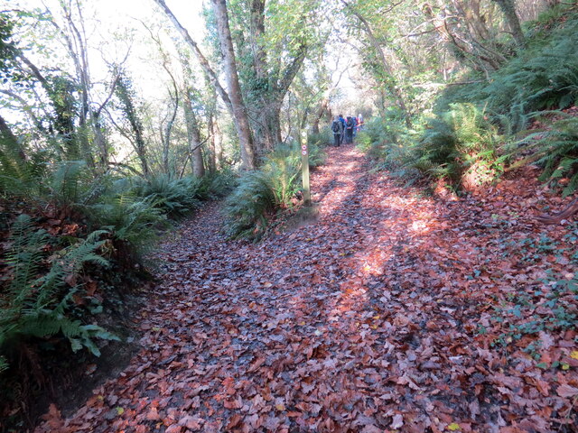
Allt Cwm-gôf is a picturesque woodland located in Pembrokeshire, Wales. Covering an area of approximately 100 acres, it is known for its rich biodiversity and stunning natural beauty. The woodland is nestled within the rolling hills of the Pembrokeshire Coast National Park, providing visitors with a tranquil and serene environment.
The forest is predominantly composed of native broadleaf trees, such as oak, beech, and ash. The tall, majestic trees create a dense canopy, allowing only dappled sunlight to filter through to the forest floor. This creates a unique and enchanting atmosphere, perfect for exploring and immersing oneself in nature.
Allt Cwm-gôf is home to a diverse range of wildlife, including various bird species, small mammals, and insects. Birdwatchers can spot species such as woodpeckers, owls, and red kites among the treetops. The forest also provides a habitat for rare and protected species, such as the otter and the lesser horseshoe bat.
A network of walking trails winds through the woodland, offering visitors the opportunity to discover its hidden treasures. These paths lead to secluded clearings, babbling brooks, and moss-covered rocks, creating a sense of adventure and discovery.
Allt Cwm-gôf is a popular destination for nature lovers, hikers, and photographers who are drawn to its natural beauty and tranquility. It offers a peaceful retreat from the hustle and bustle of everyday life, allowing visitors to connect with nature and experience the magic of the Welsh countryside.
If you have any feedback on the listing, please let us know in the comments section below.
Allt Cwm-gôf Images
Images are sourced within 2km of 52.060587/-4.6725415 or Grid Reference SN1643. Thanks to Geograph Open Source API. All images are credited.


![A487, South of Cardigan There used to be an Ordnance Survey OSBM bolt benchmark at this location, which was used on the Haverford West to Cardigan line (G077) of the Third Geodetic Levelling of England &amp; Wales in 1954. Description: OSBM Bolt on concrete block, SE side of road on production of hedge opposite. Abstract G 65: <span class="nowrap"><a title="http://discovery.nationalarchives.gov.uk/SearchUI/details?Uri=C11264473" rel="nofollow ugc noopener" href="http://discovery.nationalarchives.gov.uk/SearchUI/details?Uri=C11264473">Link</a><img style="margin-left:2px;" alt="External link" title="External link - shift click to open in new window" src="https://s1.geograph.org.uk/img/external.png" width="10" height="10"/></span> [OS 54/754]](https://s0.geograph.org.uk/geophotos/07/24/83/7248352_6c435b25.jpg)


Allt Cwm-gôf is located at Grid Ref: SN1643 (Lat: 52.060587, Lng: -4.6725415)
Unitary Authority: Pembrokeshire
Police Authority: Dyfed Powys
What 3 Words
///swatting.dive.could. Near Cardigan, Ceredigion
Nearby Locations
Related Wikis
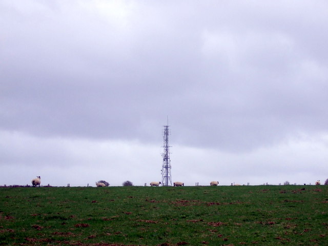
Cardigan transmitting station
The Cardigan transmitting station is a broadcasting and telecommunications facility located at Penwaun in Pembrokeshire, Wales, about 3 km to the south...

St Dogmaels television relay station
The St Dogmaels television relay station is a broadcasting and telecommunications facility located just above the village of St Dogmaels in Pembrokeshire...

Bridell
Bridell (Welsh: Y Bridell) is a small settlement and parish in north Pembrokeshire, Wales. The parish includes the village of Pen-y-bryn. Together with...
St Dogmaels
St Dogmaels (Welsh: Llandudoch) is a village, parish and community in Pembrokeshire, Wales, on the estuary of the River Teifi, a mile downstream from the...
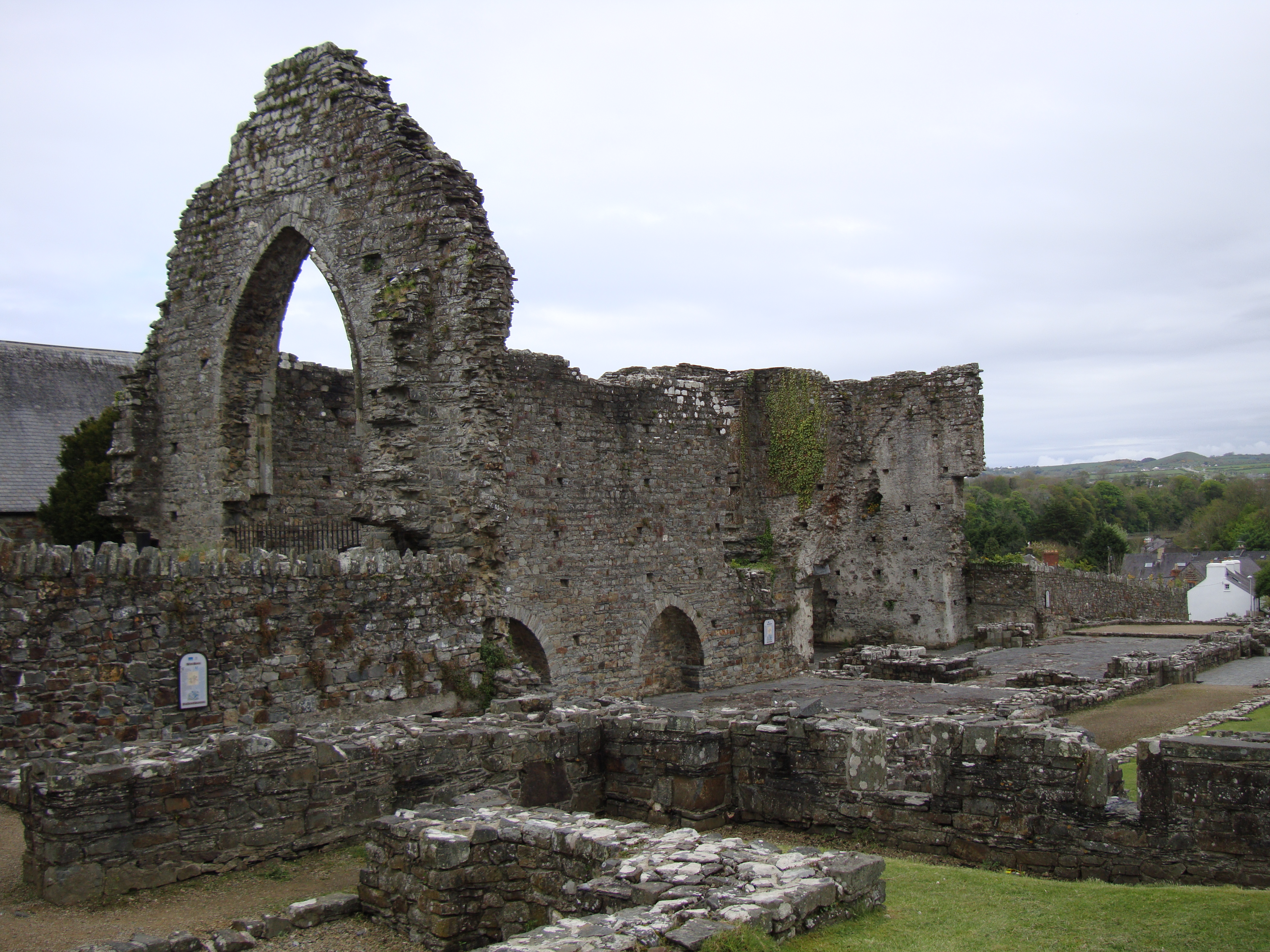
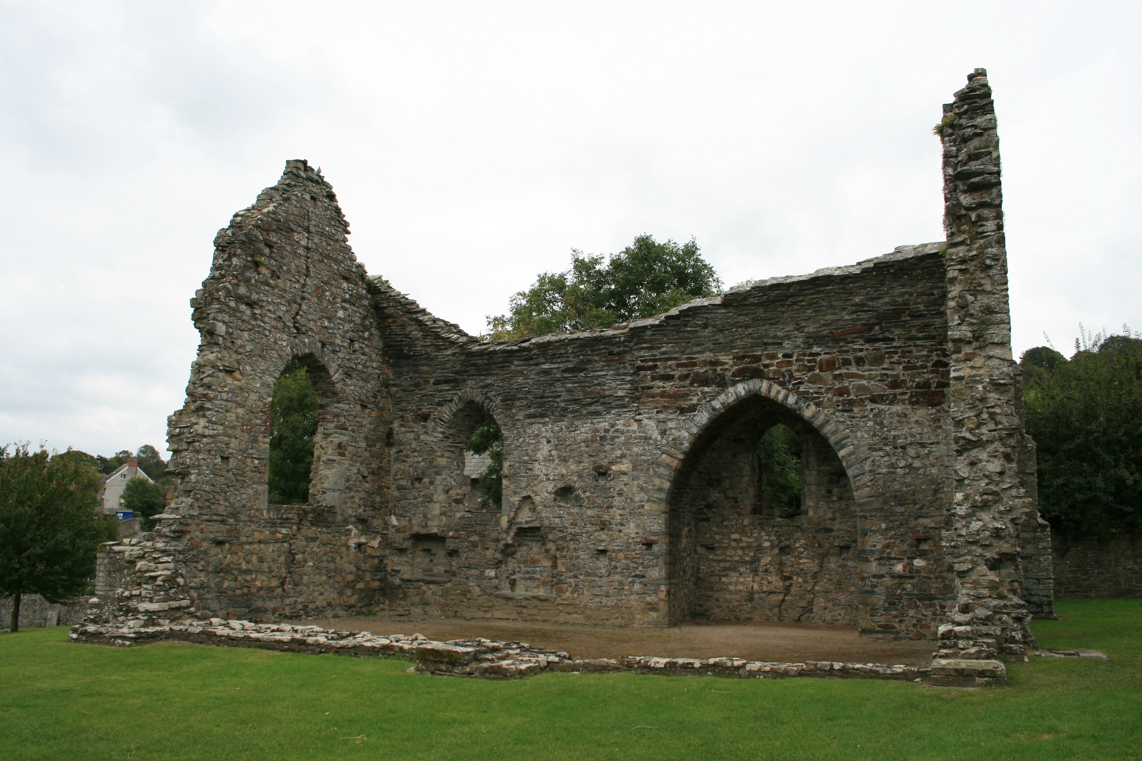
Abbey of St Mary, St Dogmaels
The Abbey of St Mary (also known as St Dogmaels Abbey) is Grade I listed ruined abbey in St Dogmaels in Pembrokeshire, Wales, on the banks of the River...
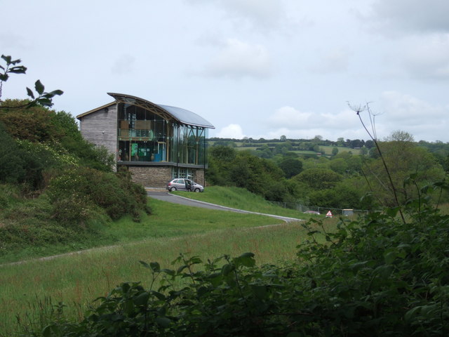
Welsh Wildlife Centre
The Welsh Wildlife Centre is a wildlife reserve covering Teifi Marshes, near Cilgerran on the Pembrokeshire/Ceredigion border, Wales. The site is located...
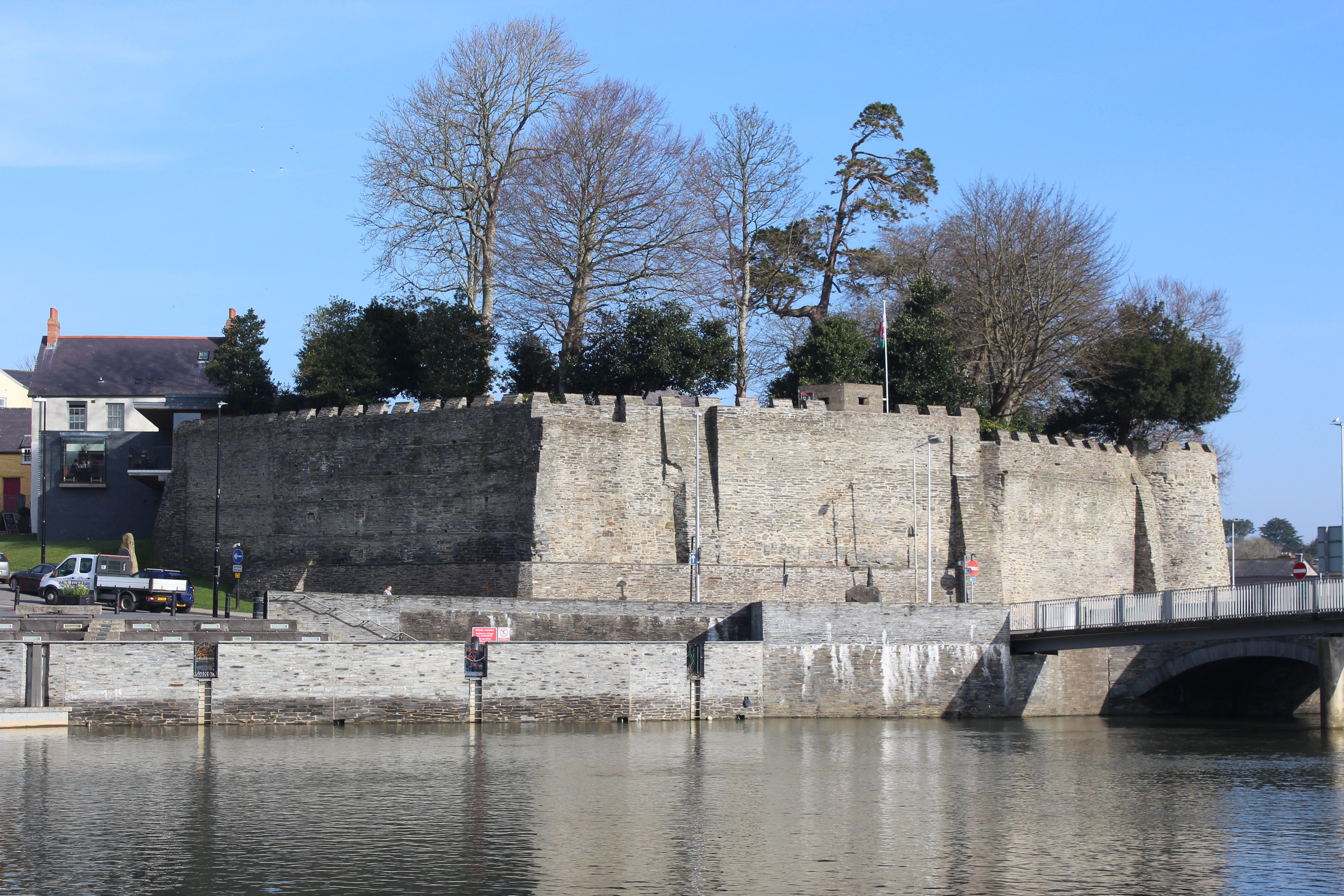
Cardigan Castle
Cardigan Castle (Welsh: Castell Aberteifi) is a castle overlooking the River Teifi in Cardigan, Ceredigion, Wales. It is a Grade I listed building. The...
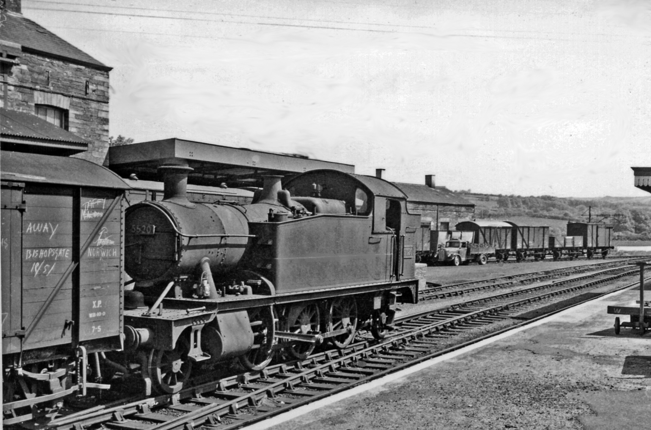
Cardigan railway station
Cardigan railway station in the county town of Cardigan, Ceredigion was the terminus of the Whitland and Cardigan Railway, opened on 31 August 1886. The...
Nearby Amenities
Located within 500m of 52.060587,-4.6725415Have you been to Allt Cwm-gôf?
Leave your review of Allt Cwm-gôf below (or comments, questions and feedback).