Animal and Bird Park
Wood, Forest in Pembrokeshire
Wales
Animal and Bird Park

Located in the heart of Pembrokeshire, Wales, the Animal and Bird Park is a captivating attraction that immerses visitors in the natural beauty and diversity of the region's woodlands and forests. Spanning over a vast area, the park is home to a wide array of animal and bird species, offering a unique opportunity for animal lovers and nature enthusiasts to observe and learn about the fascinating creatures that inhabit these habitats.
The park's lush woodlands provide a serene and picturesque setting for visitors to explore. Towering trees, vibrant flora, and meandering pathways create an immersive environment that transports guests into a world of tranquility. As visitors venture through the park, they have the chance to encounter an extensive variety of animals, including deer, foxes, badgers, and wild boars. The park's knowledgeable staff members are always on hand to provide insightful information about the animals, their habitats, and their behaviors.
In addition to the woodland animals, the park is a haven for bird enthusiasts. Over 100 species of birds can be found here, ranging from native British birds like owls, woodpeckers, and finches to exotic birds from around the world. The park's aviaries and bird enclosures are carefully designed to mimic the natural habitats of these feathered friends, allowing them to thrive in a secure and comfortable environment.
Animal and Bird Park, Pembrokeshire, also offers various educational programs and interactive experiences for visitors of all ages. Guided tours, feeding sessions, and bird handling sessions are just some of the activities available, providing a deeper understanding and appreciation for the park's inhabitants and their conservation.
Overall, the Animal and Bird Park, Pembrokeshire, is a must-visit destination for anyone seeking an immersive nature experience. With its stunning woodlands, diverse animal and bird species, and educational opportunities, the park offers a memorable and enriching experience for all who venture within its borders.
If you have any feedback on the listing, please let us know in the comments section below.
Animal and Bird Park Images
Images are sourced within 2km of 51.735152/-4.696885 or Grid Reference SN1307. Thanks to Geograph Open Source API. All images are credited.


Animal and Bird Park is located at Grid Ref: SN1307 (Lat: 51.735152, Lng: -4.696885)
Unitary Authority: Pembrokeshire
Police Authority: Dyfed Powys
What 3 Words
///restores.owner.lazy. Near Kilgetty, Pembrokeshire
Nearby Locations
Related Wikis

Stepaside, Pembrokeshire
Stepaside is a village six miles north of Tenby, Pembrokeshire, in the community and parish of Amroth. The population in the 2011 census was 619. Once...

Sardis, southeast Pembrokeshire
Sardis is a small village in Pembrokeshire, belonging to the Community of Saundersfoot. It lies just south of Stepaside and northwest of Wisemans Bridge...

Carmarthen West and South Pembrokeshire (UK Parliament constituency)
Carmarthen West and South Pembrokeshire (Welsh: Gorllewin Caerfyrddin a De Sir Benfro) is a constituency of the House of Commons of the Parliament of the...

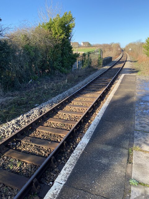
Kilgetty railway station
Kilgetty railway station serves Kilgetty in Pembrokeshire, Wales. The station is a request stop so passengers wishing to alight should make their intentions...
Nearby Amenities
Located within 500m of 51.735152,-4.696885Have you been to Animal and Bird Park?
Leave your review of Animal and Bird Park below (or comments, questions and feedback).