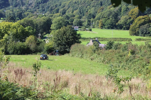
Allt y Gelli

Wood, Forest in Pembrokeshire

Wales

Allt y Gelli

Pentre Ifan stones Dating back 5000 years, these stones were at the centre of a larger monument. The cap-stone weighs 16 tonnes. It's apparently uncertain what it might have been for.
Pentre Ifan stones Credit: Nigel Thompson

The requested URL returned error: 429 Too Many Requests

If you have any feedback on the listing, please let us know in the comments section below.

Allt y Gelli Images

Images are sourced within 2km of 52.007627/-4.7552589 or Grid Reference SN1037. Thanks to Geograph Open Source API. All images are credited.

Pentre Ifan stones Dating back 5000 years, these stones were at the centre of a larger monument. The cap-stone weighs 16 tonnes. It's apparently uncertain what it might have been for.
Pentre Ifan stones
Dating back 5000 years, these stones were at the centre of a larger monument. The cap-stone weighs 16 tonnes. It's apparently uncertain what it might have been for.
Salutation Inn Country Inn with roadside seating
Salutation Inn
Country Inn with roadside seating
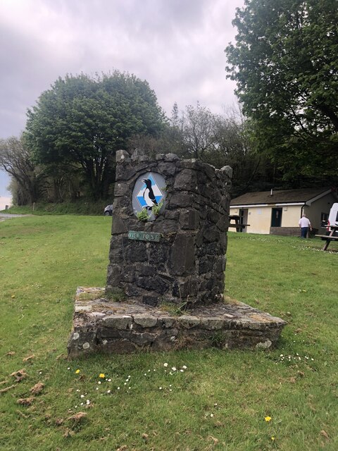
Puffin image on a View Point This image also appears on advertising for local potatoes, coastal shuttle buses and various food products - all things Pembroke! The viewpoint is in a lay-by on the A487 heading west towards Felindre Farchog
Puffin image on a View Point
This image also appears on advertising for local potatoes, coastal shuttle buses and various food products - all things Pembroke! The viewpoint is in a lay-by on the A487 heading west towards Felindre Farchog
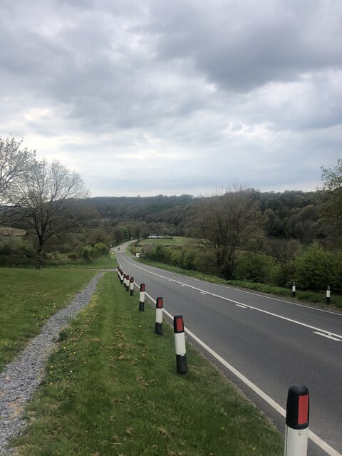
A487 heading downhill towards Felindre Farchog
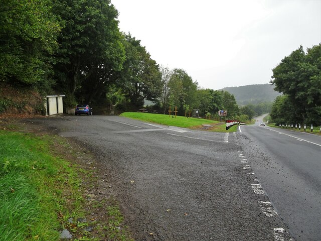
Lay-by off A487 near Wenallt
Penwern, near Pentre Ifan stones
The A487 passing through Felindre
Old  school and courthouse, Felindre Farchog At the side of the road, the plaque by the front door states it was originally a College dating from the early C17 It later became"Llysdy Arglwydd Cemmaes" (Courthouse of the lords of Cemmaes) and has now been refurbished as a private dwelling
Old school and courthouse, Felindre Farchog
At the side of the road, the plaque by the front door states it was originally a College dating from the early C17 It later became"Llysdy Arglwydd Cemmaes" (Courthouse of the lords of Cemmaes) and has now been refurbished as a private dwelling
B4329 at Mwnant Farm
B4329 crossing the River Nevern
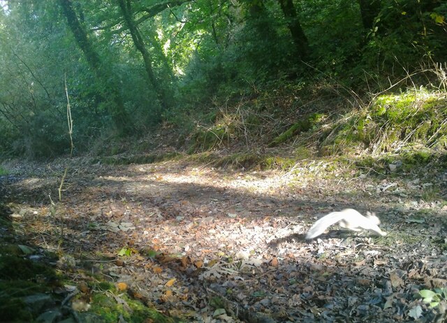
Track in Pengelli Forest with squirrel Taken in daylight at 08:58 with a wildlife camera, attached to a tree by the track. See <a title="https://www.geograph.org.uk/photo/7588512" href="https://www.geograph.org.uk/photo/7588512">Link</a> for a night view with a badger.
Track in Pengelli Forest with squirrel
Taken in daylight at 08:58 with a wildlife camera, attached to a tree by the track. See Link for a night view with a badger.
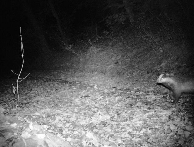
Badger at night in Pengelli Forest Taken in infra-red at 23:53 with a wildlife camera, attached to a tree by the track.
See <a title="https://www.geograph.org.uk/photo/7587266" href="https://www.geograph.org.uk/photo/7587266">Link</a> for a daytime view.
Badger at night in Pengelli Forest
Taken in infra-red at 23:53 with a wildlife camera, attached to a tree by the track. See Link for a daytime view.
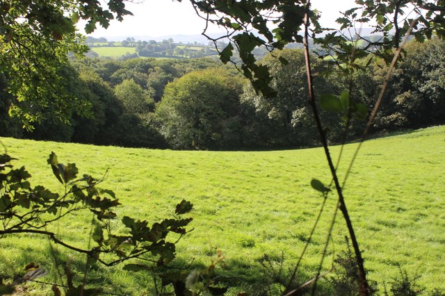
Meadow by Pant-teg Wood Hillside meadow between Pant-teg Wood, to the east, and minor road.
Meadow by Pant-teg Wood
Hillside meadow between Pant-teg Wood, to the east, and minor road.
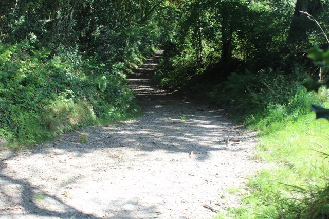
Track by woodland Public footpath on stony track.
Track by woodland
Public footpath on stony track.
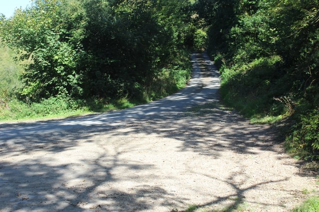
Minor road up from Felindre Farchog Narrow road carrying NCR 82 through part of the North Pembrokeshire woodlands.
Minor road up from Felindre Farchog
Narrow road carrying NCR 82 through part of the North Pembrokeshire woodlands.
Hillside field above A487 Grass fields in valley.
Hillside field above A487
Grass fields in valley.
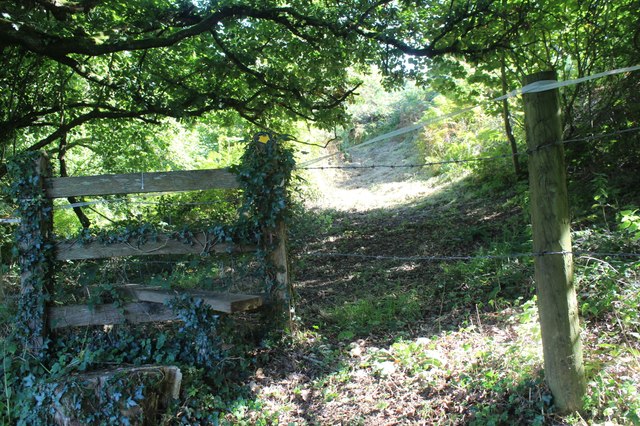
Stile on bank by A487 Stile at top of steps at start of public footpath towards Pen-y-benglog. The stile seems to be further east than shown on the OS map.
Stile on bank by A487
Stile at top of steps at start of public footpath towards Pen-y-benglog. The stile seems to be further east than shown on the OS map.
Craig Rhosyfelin Craig Rhosyfelin lle cred rhai archaeolegwyr fod o leiaf un o'r cerrig glesision yng Nghor y Cewri wedi dod o'r fan hon.

Craig Rhosyfelin (trans. mill moor rock) where some archaeologists believe that at least one of the bluestones at Stonehenge came from.
Craig Rhosyfelin
Craig Rhosyfelin lle cred rhai archaeolegwyr fod o leiaf un o'r cerrig glesision yng Nghor y Cewri wedi dod o'r fan hon. Craig Rhosyfelin (trans. mill moor rock) where some archaeologists believe that at least one of the bluestones at Stonehenge came from.
Show me another place!

Allt y Gelli is located at Grid Ref: SN1037 (Lat: 52.007627, Lng: -4.7552589)

Unitary Authority: Pembrokeshire

Police Authority: Dyfed Powys

What 3 Words

///stared.denoting.secondly. Near Nevern, Pembrokeshire

Nearby Locations

Allt y Gelli

Related Wikis

Church of St Dogfael, Meline

The Church of St Dogfael, Meline, Pembrokeshire, Wales is a redundant church dating from the 19th century. A Grade II listed building, the church is now...

Castell Henllys

Castell Henllys (Welsh, "castle of the old court") is an archaeological site near Nevern in north Pembrokeshire, Wales. The Iron Age hillfort has been...

Meline, Pembrokeshire

Meline (also recorded as Meliney and Melinau) is a parish in the Diocese of St David's in north Pembrokeshire, Wales. There is no settlement of this name...

Pentre Ifan

Pentre Ifan (literally "Evan's Village") is the name of an ancient manor in the community and parish of Nevern, Pembrokeshire, Wales. It is 11 miles...

Nearby Amenities

Located within 500m of 52.007627,-4.7552589
Barrier: cattle_grid
Lat/Long: 52.0089044/-4.7618237
Power: pole
Lat/Long: 52.0118623/-4.7562777
Power: pole
Lat/Long: 52.0117302/-4.7555213
Material: wood
Power: pole
Lat/Long: 52.0115668/-4.7545772
Material: wood
Power: pole
Lat/Long: 52.0114/-4.753625
Material: wood
Power: pole
Lat/Long: 52.0112461/-4.7528086
Material: wood
Power: pole
Lat/Long: 52.0110043/-4.7513398
Material: wood
Power: pole
Lat/Long: 52.0108474/-4.7505064
The data included in this document is from www.openstreetmap.org. The data is made available under ODbL.

Have you been to Allt y Gelli?

Leave your review of Allt y Gelli below (or comments, questions and feedback).