Allt Llyn-dyfrion
Wood, Forest in Pembrokeshire
Wales
Allt Llyn-dyfrion

Allt Llyn-dyfrion is a picturesque woodland located in the county of Pembrokeshire, Wales. Spread across an area of approximately 50 acres, this enchanting forest boasts a diverse range of flora and fauna, making it a popular destination for nature enthusiasts and hikers alike.
The woodland is characterized by its dense canopy of ancient oak trees, which provide a tranquil and shaded environment for visitors to explore. The forest floor is adorned with a vibrant carpet of wildflowers, including bluebells, primroses, and wood anemones, creating a stunning display of colors during the spring months.
Aside from its natural beauty, Allt Llyn-dyfrion is also home to a variety of wildlife species. Rare birds such as the pied flycatcher and redstart can be spotted flitting through the treetops, while elusive mammals like badgers and foxes inhabit the undergrowth. Additionally, the forest is known for its population of red squirrels, which are a delight to observe as they scurry among the branches.
Visitors to Allt Llyn-dyfrion can enjoy a network of well-maintained footpaths and trails, allowing for leisurely strolls or more challenging hikes. The forest is also equipped with picnic areas and benches, providing the perfect spot to relax and soak in the serene surroundings.
Overall, Allt Llyn-dyfrion in Pembrokeshire offers a captivating escape into nature, with its ancient woodland, diverse wildlife, and tranquil atmosphere. It is a must-visit destination for those seeking a peaceful retreat or a chance to reconnect with the natural world.
If you have any feedback on the listing, please let us know in the comments section below.
Allt Llyn-dyfrion Images
Images are sourced within 2km of 51.886996/-4.750443 or Grid Reference SN1024. Thanks to Geograph Open Source API. All images are credited.


Allt Llyn-dyfrion is located at Grid Ref: SN1024 (Lat: 51.886996, Lng: -4.750443)
Unitary Authority: Pembrokeshire
Police Authority: Dyfed Powys
What 3 Words
///cosmic.land.mega. Near Glandwr, Pembrokeshire
Nearby Locations
Related Wikis

Llanycefn railway station
Llanycefn railway station, also known as Llan-y-cefn railway station, served the hamlet of Llanycefn, Pembrokeshire in the parish of Maenclochog, Wales...
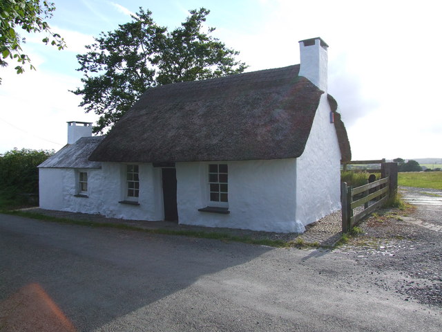
Penrhos Cottage
Penrhos Cottage is a very small cottage situated to the south east of Maenclochog. It was built as a ty un nos (house built in one night) around 1800,...
Llangolman
Llangolman () is a village and parish in the southeastern Preseli Hills in Pembrokeshire, Wales. It is part of the community of Mynachlog-ddu. There are...
Llandeilo Llwydarth
Llandeilo Llwydarth () or Llandilo is an ancient area and parish in the Preseli Hills between Llangolman and Maenclochog in the community of Maenclochog...

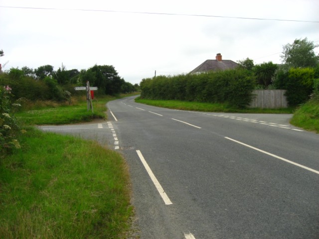
A478 road
The A478 road is a major road in Wales. The route is from its junction with the A487 at Cardigan, Ceredigion, to Tenby, Pembrokeshire. It crosses the Preseli...
Temple Druid
Temple Druid is a grade II listed John Nash house in west Wales, Pembrokeshire, Great Britain. Temple Druid, named after a series of standing stones and...
Llandissilio
Llandissilio is a village and parish in the community of Llandissilio West in east Pembrokeshire, Wales on the A478 road between Efailwen to the north...
Dungleddy
The Hundred of Dungleddy was a hundred in the centre of Pembrokeshire, Wales. It had its origins in the pre-Norman cantref of Deugleddyf. It derives its...
Nearby Amenities
Located within 500m of 51.886996,-4.750443Have you been to Allt Llyn-dyfrion?
Leave your review of Allt Llyn-dyfrion below (or comments, questions and feedback).