Burcher

Settlement in Herefordshire

England

Burcher

Wapley Hill Wood A small deer on one of the tracks in the woods below Wapley Hill
Wapley Hill Wood Credit: Raymond Perry

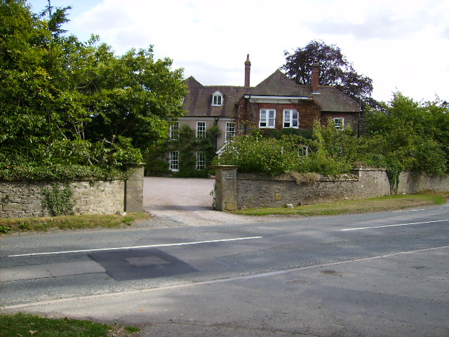
Burcher is a small village located in the county of Herefordshire, England. It is situated in the beautiful countryside, surrounded by rolling hills and picturesque landscapes. As of the last census, the population of Burcher was approximately 200 residents.

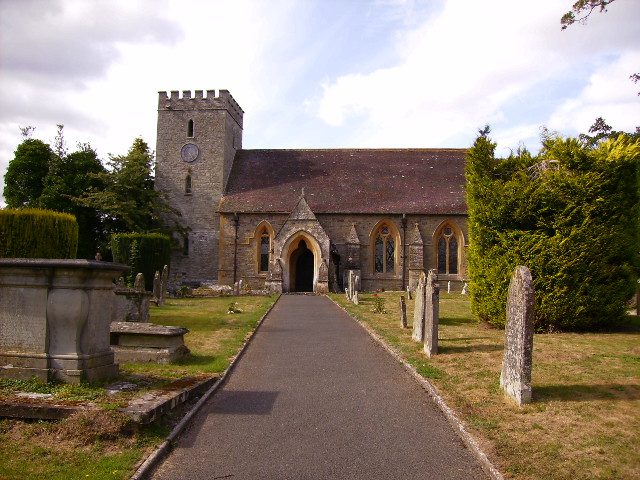
The village is known for its quaint and charming atmosphere. It boasts a traditional village green, where locals often gather for community events and activities. Burcher is also home to a historic church, which dates back several centuries and serves as a prominent landmark in the area.

The economy of Burcher revolves primarily around agriculture, with many residents engaged in farming and livestock rearing. The village is known for its fertile soil and is renowned for producing high-quality crops and livestock.

Despite its small size, Burcher offers a range of amenities to its residents. There is a local pub, which serves as a social hub for the community, as well as a village hall that hosts various events and gatherings throughout the year. Burcher also benefits from a primary school, providing education to the children of the village and surrounding areas.

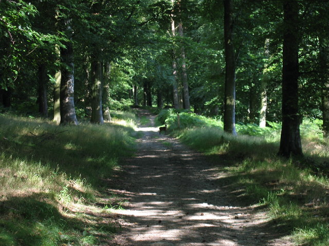
The natural beauty and tranquility of Burcher make it an attractive destination for tourists and nature enthusiasts. The village offers numerous walking trails and outdoor activities, allowing visitors to explore the stunning countryside and enjoy the peaceful surroundings.

Overall, Burcher is a charming and close-knit community, offering a serene rural lifestyle amidst the idyllic landscapes of Herefordshire.

If you have any feedback on the listing, please let us know in the comments section below.

Burcher Images

Images are sourced within 2km of 52.237519/-2.976718 or Grid Reference SO3360. Thanks to Geograph Open Source API. All images are credited.

Wapley Hill Wood A small deer on one of the tracks in the woods below Wapley Hill
Wapley Hill Wood
A small deer on one of the tracks in the woods below Wapley Hill
Wapley Hill Wood - Herefordshire Trail A large part of this square is woodland. This is part of the Herefordshire trail leading through the lower part of the wood to Stansbatch
Wapley Hill Wood - Herefordshire Trail
A large part of this square is woodland. This is part of the Herefordshire trail leading through the lower part of the wood to Stansbatch
Herefordshire Trail between Green Lane Farm and Titley Ripening corn - Titley is in the trees at the bottom of the hill
Herefordshire Trail between Green Lane Farm and Titley
Ripening corn - Titley is in the trees at the bottom of the hill
Mortimer Trail Just below Waply Hill Wood and above Stansbatch - looking south
Mortimer Trail
Just below Waply Hill Wood and above Stansbatch - looking south
Field below Wapley Hill on the Mortimer Trail Good view over N Herefordshire from here
Field below Wapley Hill on the Mortimer Trail
Good view over N Herefordshire from here
Titley Church Taken from about SO330603 from the Mortimer Trail in the field just behind the church. SMR record is at <span class="nowrap"><a title="http://www.smr.herefordshire.gov.uk/db.php?smr_no=7094" rel="nofollow ugc noopener" href="http://www.smr.herefordshire.gov.uk/db.php?smr_no=7094">Link</a><img style="margin-left:2px;" alt="External link" title="External link - shift click to open in new window" src="https://s1.geograph.org.uk/img/external.png" width="10" height="10"/></span>
Titley Church
Taken from about SO330603 from the Mortimer Trail in the field just behind the church. SMR record is at LinkExternal link
Typical green lane found on the Mortimer Trail
Newly built house near Green Lane Farm The Mortimer Trail passes this new build (2006).
Newly built house near Green Lane Farm
The Mortimer Trail passes this new build (2006).
Green Lane Farm buildings and yard
Looking back to Green Lane Farm on the Mortimer Trail
Old traditional Caravans on land near Titley
A close up view of St Peter's church and graveyard in Titley
The Old Vicarage Directly across the B4355 road from Titley Church
The Old Vicarage
Directly across the B4355 road from Titley Church
The Cenotaph in Titley
Remains of old railway bridge near Horseway Head The track from where the picture was taken forms part of the Mortimer Trail, a long distance path that runs from Kington to Ludlow Castle.
Remains of old railway bridge near Horseway Head
The track from where the picture was taken forms part of the Mortimer Trail, a long distance path that runs from Kington to Ludlow Castle.
Old railway trackbed near Ashley View south-east from the point where the old Presteigne branch line crosses the entrance road to Ashley.
<span class="nowrap"><a title="http://www.smr.herefordshire.gov.uk/post-medieval/railways/king_prest.htm" rel="nofollow ugc noopener" href="http://www.smr.herefordshire.gov.uk/post-medieval/railways/king_prest.htm">Link</a><img style="margin-left:2px;" alt="External link" title="External link - shift click to open in new window" src="https://s1.geograph.org.uk/img/external.png" width="10" height="10"/></span>
Old railway trackbed near Ashley
View south-east from the point where the old Presteigne branch line crosses the entrance road to Ashley. LinkExternal link
Ashley Cottage View northwards to the cottage with Ashley Vallet behind.
Ashley Cottage
View northwards to the cottage with Ashley Vallet behind.
Stansbatch House Large 18th/19th century house at the foot of Wapley Hill, with commanding views.
Stansbatch House
Large 18th/19th century house at the foot of Wapley Hill, with commanding views.
Show me another place!

Burcher is located at Grid Ref: SO3360 (Lat: 52.237519, Lng: -2.976718)

Unitary Authority: County of Herefordshire

Police Authority: West Mercia

What 3 Words

///hurls.diverts.segmented. Near Presteigne, Powys

Related Wikis

Titley Priory

Titley Priory was a priory near Titley in Herefordshire, England at grid reference SO32966011. == References ==

Titley, Herefordshire

Titley is a village and civil parish in Herefordshire, England. It lies on the B4355 between Kington and Presteigne. In the 2001 census the parish had...
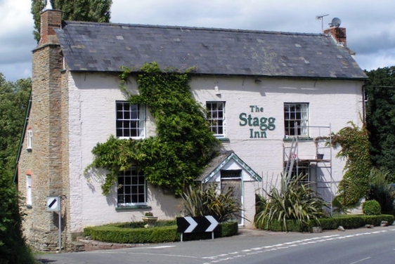
The Stagg Inn

The Stagg Inn is a restaurant located in Titley, Herefordshire, England. As of 2015, the restaurant holds one star in the Michelin Guide. The Stagg was...

Titley Pool

Titley Pool is a lake in Herefordshire, England. It is situated at Titley, 3 kilometres (1.9 mi) north west of the town of Kington. It is a naturally...

Nearby Amenities

Located within 500m of 52.237519,-2.976718
Titley
Is In: Herefordshire,England,UK
Place: village
Source: npe
Wikidata: Q2433852
Lat/Long: 52.2347651/-2.9799616
Bus Stop
Monument
Bus: yes
Naptan AtcoCode: 2090A139200
Naptan Bearing: SW
Naptan CommonName: Monument
Naptan Indicator: opp
Naptan Landmark: Monument
Naptan NaptanCode: heragdam
Naptan Street: B4355
Naptan Verified: no
Public Transport: platform
Source: naptan_import
Lat/Long: 52.234188/-2.9812129
Bus Stop
Monument
Bus: yes
Naptan AtcoCode: 2090A18235
Naptan Bearing: NE
Naptan BusStopType: CUS
Naptan CommonName: Monument
Naptan Indicator: adj
Naptan Landmark: Monument
Naptan NaptanCode: heragmaj
Naptan Street: B4355
Naptan Verified: no
Public Transport: platform
Source: naptan_import
Lat/Long: 52.234748/-2.9809031
Barrier: stile
Material: wood
Source: survey;gps
Stile: stepover
Lat/Long: 52.2359752/-2.9792241
Historic: memorial
Memorial: war_memorial
Lat/Long: 52.2342366/-2.9813811
Information: guidepost
Tourism: information
Lat/Long: 52.2362612/-2.980591
The data included in this document is from www.openstreetmap.org. The data is made available under ODbL.

Have you been to Burcher?

Leave your review of Burcher below (or comments, questions and feedback).