Cwm Wood
Wood, Forest in Pembrokeshire
Wales
Cwm Wood

Cwm Wood is a picturesque forest located in the county of Pembrokeshire, Wales. It is situated on the western coast of the country, near the village of Cwm. The wood covers an area of approximately 100 acres and is known for its stunning natural beauty and diverse wildlife.
The forest is predominantly made up of native broadleaf trees, including oak, beech, and ash, which create a lush and vibrant canopy. These trees provide a habitat for a variety of species, including small mammals such as squirrels and voles, as well as numerous bird species like woodpeckers and owls.
Cwm Wood is crisscrossed by a network of walking trails, allowing visitors to explore and appreciate its tranquil surroundings. These paths lead through dense undergrowth, past babbling brooks, and across quaint wooden bridges. The area is particularly enchanting during springtime when the forest floor is scattered with a colorful carpet of bluebells and wildflowers.
This woodland area is also home to a number of historical features, including the remnants of old stone walls and ruins of former buildings. These remnants provide a glimpse into the rich history and heritage of the area.
Cwm Wood is a popular destination for nature lovers, hikers, and photographers, who flock to the area to experience its natural splendor. Whether it is for a leisurely stroll, birdwatching, or simply immersing oneself in the peaceful atmosphere, Cwm Wood offers a charming and idyllic retreat from the hustle and bustle of everyday life.
If you have any feedback on the listing, please let us know in the comments section below.
Cwm Wood Images
Images are sourced within 2km of 51.824212/-4.8037537 or Grid Reference SN0617. Thanks to Geograph Open Source API. All images are credited.


Cwm Wood is located at Grid Ref: SN0617 (Lat: 51.824212, Lng: -4.8037537)
Unitary Authority: Pembrokeshire
Police Authority: Dyfed Powys
What 3 Words
///inform.moguls.excusing. Near Wiston, Pembrokeshire
Nearby Locations
Related Wikis
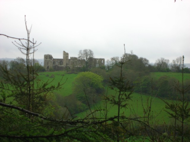
Llawhaden Castle
Llawhaden Castle (Welsh: Castell Llanhuadain) (grid reference SN 073175) is a ruined castle in Llawhaden, Pembrokeshire, Wales, 10 miles (16 km) east of...
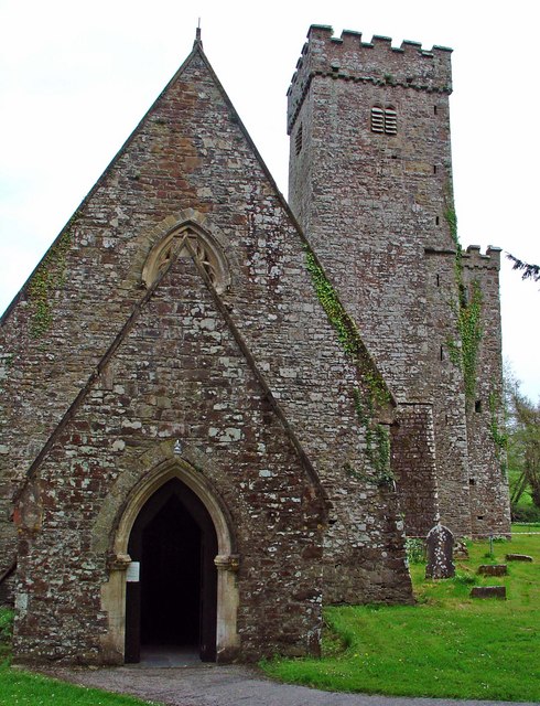
Llawhaden
Llawhaden (Welsh: Llanhuadain) is a village, parish and community in the Hundred of Dungleddy (Welsh: Daugleddyf), Pembrokeshire, West Wales. The community...
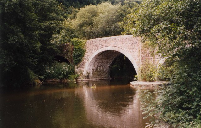
Llawhaden Bridge
Llawhaden Bridge is a Grade II* listed medieval stone arch bridge spanning the Eastern Cleddau river near Llawhaden village in Pembrokeshire, Wales, in...

Robeston Wathen Quarries
Robeston Wathen Quarries is a Site of Special Scientific Interest (or SSSI) in Pembrokeshire, South Wales, immediately to the north of the village of Robeston...
Nearby Amenities
Located within 500m of 51.824212,-4.8037537Have you been to Cwm Wood?
Leave your review of Cwm Wood below (or comments, questions and feedback).