Coed Felen

Wood, Forest in Pembrokeshire

Wales

Coed Felen

Ordnance Survey Cut Mark This OS cut mark can be found on the NE angle of St Mary's Church. It marks a point 68.434m above mean sea level.
Ordnance Survey Cut Mark Credit: Adrian Dust

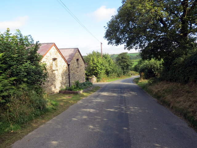
Coed Felen, located in Pembrokeshire, Wales, is a picturesque wood and forest area that offers a serene and tranquil escape for nature enthusiasts. Spanning over a significant area, Coed Felen is characterized by its lush greenery, towering trees, and diverse wildlife.

The woodland is predominantly composed of native species such as oak, ash, and beech, creating a rich and varied ecosystem. The dense forest canopy provides a sheltered environment for a wide range of flora and fauna, including birds, mammals, and insects. Birdwatchers can spot species such as woodpeckers, owls, and various songbirds amidst the rustling leaves.

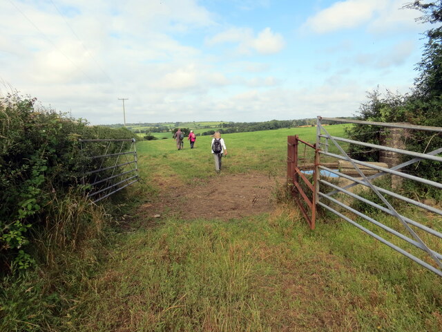
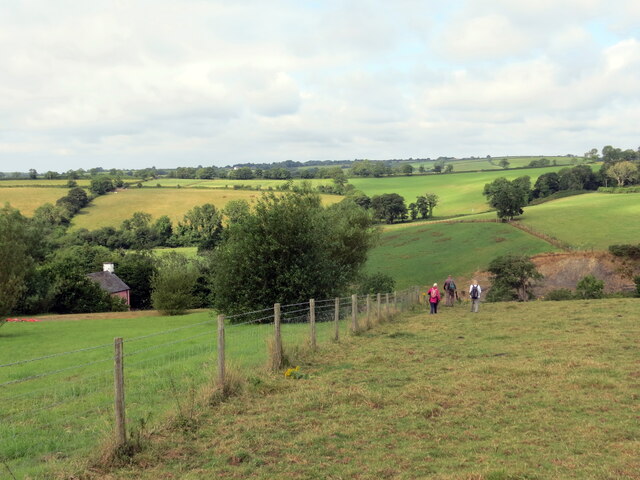
Coed Felen also offers a network of well-maintained walking trails, allowing visitors to explore the wood at their own pace. These paths meander through the forest, leading to enchanting clearings, bubbling streams, and secluded picnic spots. The wood exudes a sense of tranquility, making it an ideal location for those seeking solitude and relaxation.

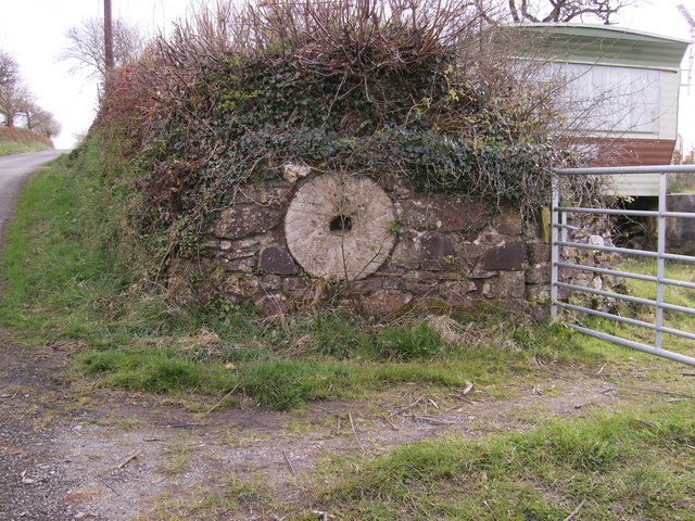
For those interested in the history of the area, Coed Felen has remnants of ancient settlements and archaeological sites, adding a layer of intrigue to the natural beauty. The wood has been carefully managed, preserving its unique ecosystem and ensuring its continued existence for future generations to enjoy.

Whether it's for a leisurely stroll, birdwatching, or a peaceful retreat into nature, Coed Felen offers a haven of serenity and natural beauty in the heart of Pembrokeshire.

If you have any feedback on the listing, please let us know in the comments section below.

Coed Felen Images

Images are sourced within 2km of 51.869078/-4.8192715 or Grid Reference SN0622. Thanks to Geograph Open Source API. All images are credited.

Ordnance Survey Cut Mark This OS cut mark can be found on the NE angle of St Mary's Church. It marks a point 68.434m above mean sea level.
Ordnance Survey Cut Mark
This OS cut mark can be found on the NE angle of St Mary's Church. It marks a point 68.434m above mean sea level.
Field gateway Footpath to New Mill.
Field gateway
Footpath to New Mill.
St Martin’s Church, Clarbeston
Ordnance Survey Cut Mark This OS cut mark can be found on the SW face of St Martin's Church. It marks a point 69.531m above mean sea level.
Ordnance Survey Cut Mark
This OS cut mark can be found on the SW face of St Martin's Church. It marks a point 69.531m above mean sea level.
Ordnance Survey Cut Mark This OS cut mark can be found on the SW face of Carmel Chapel. It marks a point 72.396m above mean sea level.
Ordnance Survey Cut Mark
This OS cut mark can be found on the SW face of Carmel Chapel. It marks a point 72.396m above mean sea level.
Parish Church, Clarbeston Dedicated to St Martin of Tours. The name Clarbeston can be explained in an early (1230) reference to it: "ecclesia Sti. Martini de villa Clarenbaldi"; Clarenbald was a Flemish name, and the dedication to the military saint indicates that he was more a fighter than a farmer. The Welsh name of the parish, Treglarbes, is simply a translation of the English. Clarbeston is south of the Landsker, which here follows the Afon Syfni.
Parish Church, Clarbeston
Dedicated to St Martin of Tours. The name Clarbeston can be explained in an early (1230) reference to it: "ecclesia Sti. Martini de villa Clarenbaldi"; Clarenbald was a Flemish name, and the dedication to the military saint indicates that he was more a fighter than a farmer. The Welsh name of the parish, Treglarbes, is simply a translation of the English. Clarbeston is south of the Landsker, which here follows the Afon Syfni.
Porch: Clarbeston parish church The base of the tower is fenced off due to falling masonry, and this temporary structure protects those using the only door. The church was re-built on the ancient site in 1841, and is now not in good shape.
Porch: Clarbeston parish church
The base of the tower is fenced off due to falling masonry, and this temporary structure protects those using the only door. The church was re-built on the ancient site in 1841, and is now not in good shape.
Carmel Particular Baptist chapel, Clarbeston The original chapel on this site was built in 1804, but this building was completed in 1874.
Carmel Particular Baptist chapel, Clarbeston
The original chapel on this site was built in 1804, but this building was completed in 1874.
The Green, Clarbeston Clarbeston used to have an open village green, ringed by cottages. To the left is Clarbeston farm house, and to the right is the smithy.
The Green, Clarbeston
Clarbeston used to have an open village green, ringed by cottages. To the left is Clarbeston farm house, and to the right is the smithy.
Meadow in the Syfni valley, Clarbeston Syfni is the local pronunciation of the river name, and is the spelling in some, but not all, OS maps. More literary variants are Syfynwy, Syfynfi, Syfnau. The name is derived from the same Celtic name (Sumina) as the Somme in France. The river for some distance marks the traditional Landsker or language boundary, English on this side and Welsh on the other. It also marked the boundary in the Hundred of Dungleddy between the Marcher barons' land to the south and west and the bishop's lands to the north and east.
Meadow in the Syfni valley, Clarbeston
Syfni is the local pronunciation of the river name, and is the spelling in some, but not all, OS maps. More literary variants are Syfynwy, Syfynfi, Syfnau. The name is derived from the same Celtic name (Sumina) as the Somme in France. The river for some distance marks the traditional Landsker or language boundary, English on this side and Welsh on the other. It also marked the boundary in the Hundred of Dungleddy between the Marcher barons' land to the south and west and the bishop's lands to the north and east.
Stepaside Bridge, Clarbeston The bridge crosses the Afon Syfni, and gets its name from what used to be a pub on the far side. Syfni is the local pronunciation of the river name, and is the spelling in some, but not all, OS maps. More literary variants are Syfynwy, Syfynfi, Syfnau. The name is derived from the same Celtic name (Sumina) as the Somme in France. The river for some distance marks the traditional Landsker or language boundary, English on this side and Welsh on the other. It also marked the boundary in the Hundred of Dungleddy between the Marcher barons' land to the south and west and the bishop's lands to the north and east.
Stepaside Bridge, Clarbeston
The bridge crosses the Afon Syfni, and gets its name from what used to be a pub on the far side. Syfni is the local pronunciation of the river name, and is the spelling in some, but not all, OS maps. More literary variants are Syfynwy, Syfynfi, Syfnau. The name is derived from the same Celtic name (Sumina) as the Somme in France. The river for some distance marks the traditional Landsker or language boundary, English on this side and Welsh on the other. It also marked the boundary in the Hundred of Dungleddy between the Marcher barons' land to the south and west and the bishop's lands to the north and east.
Heol ger Ffarm Forehill / Road near Forehill Farm Heol yn mynd heibio i anhedd-dy ger Ffarm Forehill.

A road passing a property near Fore Hill Farm.
Heol ger Ffarm Forehill / Road near Forehill Farm
Heol yn mynd heibio i anhedd-dy ger Ffarm Forehill. A road passing a property near Fore Hill Farm.
Llwybr ger Ffarm Wood Park / Path near Wood Park Farm Cerddwyr yn dilyn llwybr troed cyhoeddus ger Ffarm Wood Park.

Walkers following a public footpath near Wood Park Farm.
Llwybr ger Ffarm Wood Park / Path near Wood Park Farm
Cerddwyr yn dilyn llwybr troed cyhoeddus ger Ffarm Wood Park. Walkers following a public footpath near Wood Park Farm.
Llwybr ger Cwm Hill / Path near Cwm Hill Cerddwyr yn mynd i lawr y waered ger anhedd-dy o'r enw Cwm Hill.

Walkers descending a field near a property known as Cwm Hill.
Llwybr ger Cwm Hill / Path near Cwm Hill
Cerddwyr yn mynd i lawr y waered ger anhedd-dy o'r enw Cwm Hill. Walkers descending a field near a property known as Cwm Hill.
Redundant Mill stone Nice use of a mill stone, Forehill Farm.
Redundant Mill stone
Nice use of a mill stone, Forehill Farm.
Bletherston church Bletherston church is dedicated to St Mary.
Bletherston church
Bletherston church is dedicated to St Mary.
Bletherston church Entrance gate to St Mary's church, Bletherston.
Bletherston church
Entrance gate to St Mary's church, Bletherston.
Farmland at Bletherston View across farmland at Bletherston to the Preseli Hills in the distance.
Farmland at Bletherston
View across farmland at Bletherston to the Preseli Hills in the distance.
Show me another place!

Coed Felen is located at Grid Ref: SN0622 (Lat: 51.869078, Lng: -4.8192715)

Unitary Authority: Pembrokeshire

Police Authority: Dyfed Powys

What 3 Words

///fountain.moss.proves. Near Wiston, Pembrokeshire

Related Wikis

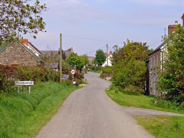
Penffordd, Pembrokeshire

Penffordd or Pen-ffordd is a small village in the community of New Moat, Pembrokeshire, Wales, in the parish of Bletherston. It lies approximately 10.8...

Bletherston

Bletherston (Welsh: Trefelen) is a small settlement and parish in Pembrokeshire, Wales. It is in the middle of eastern Pembrokeshire, 6 miles (9.7 km)...

New Moat

New Moat (Welsh: Y Mot) is a village, parish and community in Pembrokeshire, Wales. It extends from the southern edges of Mynydd Preseli to the Pembrokeshire...

Llys y Fran

Llys y Fran is a small village and parish in the community of New Moat on the southern slopes of the Preseli Mountains in Pembrokeshire, Wales. The parish...

Have you been to Coed Felen?

Leave your review of Coed Felen below (or comments, questions and feedback).