Coed Gelli-fawr

Wood, Forest in Pembrokeshire

Wales

Coed Gelli-fawr

Ordnance Survey Cut Mark This OS cut mark can be found on a large stone west side of the road. It marks a point 579.1ft above mean sea level.
Ordnance Survey Cut Mark Credit: Adrian Dust

Coed Gelli-fawr is a charming woodland area located in Pembrokeshire, Wales. The forest spans across a vast area, encompassing a variety of tree species including oak, beech, and birch. The lush greenery and dense foliage create a peaceful and tranquil atmosphere, making it a popular spot for nature enthusiasts and hikers.

Visitors to Coed Gelli-fawr can explore the numerous walking trails that wind through the forest, offering stunning views of the surrounding countryside. The diverse flora and fauna found within the woodland provide a rich habitat for wildlife such as birds, squirrels, and deer.

The forest is also home to a number of historical sites, including ancient ruins and megalithic monuments, adding to its mystical and enchanting appeal. Additionally, there are picnic areas and rest spots scattered throughout the woodland, making it a perfect destination for a day out with family and friends.

Overall, Coed Gelli-fawr is a hidden gem in Pembrokeshire, offering a peaceful retreat from the hustle and bustle of everyday life. Its natural beauty and serene ambiance make it a must-visit destination for anyone looking to connect with nature.

If you have any feedback on the listing, please let us know in the comments section below.

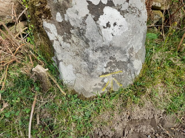
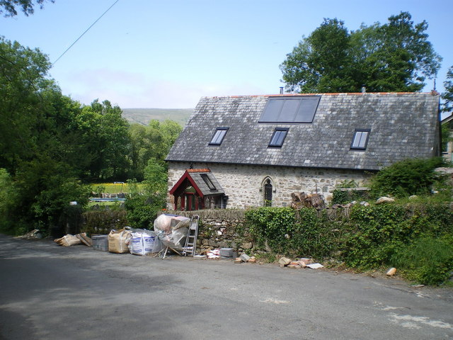
Coed Gelli-fawr Images

Images are sourced within 2km of 51.980155/-4.82642 or Grid Reference SN0535. Thanks to Geograph Open Source API. All images are credited.

Ordnance Survey Cut Mark This OS cut mark can be found on a large stone west side of the road. It marks a point 579.1ft above mean sea level.
Ordnance Survey Cut Mark
This OS cut mark can be found on a large stone west side of the road. It marks a point 579.1ft above mean sea level.
Moorland above Tafarn-y-bwlch View from road towards Gernos-fach; the rock on the skyline is Carn Ingli, Mynydd Carningli.
Moorland above Tafarn-y-bwlch
View from road towards Gernos-fach; the rock on the skyline is Carn Ingli, Mynydd Carningli.
About Sychpant
About Sychpant
Path through woodland in Cwm Gwaun The path here climbs steeply through woodland towards the fields above the valley side. The path seems more used by animals than human feet.
Path through woodland in Cwm Gwaun
The path here climbs steeply through woodland towards the fields above the valley side. The path seems more used by animals than human feet.
Footpath in woodland above the Gwaun valley The woodland does permit some views across the valley towards Carningli.
Footpath in woodland above the Gwaun valley
The woodland does permit some views across the valley towards Carningli.
English Longhorn cattle at Llanerch in Cwm Gwaun This breed originates in the North of England I believe but of course readily take to the pastures of the Gwaun Valley and look very relaxed and at home.
English Longhorn cattle at Llanerch in Cwm Gwaun
This breed originates in the North of England I believe but of course readily take to the pastures of the Gwaun Valley and look very relaxed and at home.
Longhorn cattle at Llanerch in Cwm Gwaun "Sniff, sniiiff! Who can I scent on the breeze, disturbing my nap?" A recently recumbent Longhorn detects my presence and then notices my movement as I take his photo.
Longhorn cattle at Llanerch in Cwm Gwaun
"Sniff, sniiiff! Who can I scent on the breeze, disturbing my nap?" A recently recumbent Longhorn detects my presence and then notices my movement as I take his photo.
Fox cub in the lane I was walking up the lane and became aware of 'barking' ahead of me and looked up to see a puzzled brown face looking up at me from ten feet away. "Funny cat - dog" I thought - "Fox!" and smilingly fumbled for my camera during which time he or she turned tail, still emitting little 'barks' and ran back up the lane to this point, from where he / she climbed the bank on a well used fox path and ran up into the wood, still calling. From behind a tree bole a smug adult foxy face looked back at me and I again raised my camera and zoomed in, starting to depress the 'shutter' only to see a red bushy brush disappear deeper into the wood, leaving me laughing and foolish below.
Fox cub in the lane
I was walking up the lane and became aware of 'barking' ahead of me and looked up to see a puzzled brown face looking up at me from ten feet away. "Funny cat - dog" I thought - "Fox!" and smilingly fumbled for my camera during which time he or she turned tail, still emitting little 'barks' and ran back up the lane to this point, from where he / she climbed the bank on a well used fox path and ran up into the wood, still calling. From behind a tree bole a smug adult foxy face looked back at me and I again raised my camera and zoomed in, starting to depress the 'shutter' only to see a red bushy brush disappear deeper into the wood, leaving me laughing and foolish below.
Carn Edward These 'twin' tors are both referred to in the name I presume, though the one on the right with its distinctive conical peak may well be the named one. A suitable point for a rest, a well earned brew and some scran while admiring the western end of the Preseli ridge over the valley of Cwm Gwaun.
Carn Edward
These 'twin' tors are both referred to in the name I presume, though the one on the right with its distinctive conical peak may well be the named one. A suitable point for a rest, a well earned brew and some scran while admiring the western end of the Preseli ridge over the valley of Cwm Gwaun.
Old railway wagons as sheds at Penlanisaf You don't see as many old railway wagons on farms as you used to. They were common when I was a lad but, like these two examples, are aging fast and being replaced by more purpose designed storage. The old implement is of even greater vintage.
Old railway wagons as sheds at Penlanisaf
You don't see as many old railway wagons on farms as you used to. They were common when I was a lad but, like these two examples, are aging fast and being replaced by more purpose designed storage. The old implement is of even greater vintage.
Cilgwyn chapel - post renovation & conversion The old chapel at the roadside near Cilgwyn, now converted to a house since <a href="https://www.geograph.org.uk/photo/645410">SN0735 : Cilgwyn Chapel</a> and <a href="https://www.geograph.org.uk/photo/294774">SN0735 : St Mary's Church, Cilgwyn</a> were taken.
Cilgwyn chapel - post renovation & conversion
The old chapel at the roadside near Cilgwyn, now converted to a house since SN0735 : Cilgwyn Chapel and SN0735 : St Mary's Church, Cilgwyn were taken.
Trefach Farm
Trefach Farm
Farm buildings at Trefach
Trefach standing stone / menhir A full description and history is at <a href="https://www.geograph.org.uk/photo/294762">SN0635 : Trefach menhir</a>; the Coflein database lists it as the Y Garreg-Hir stone, at <span class="nowrap"><a title="http://www.coflein.gov.uk/en/site/304309/details/Y+GARREG-HIR%3BTRE-FACH+STONE/" rel="nofollow ugc noopener" href="http://www.coflein.gov.uk/en/site/304309/details/Y+GARREG-HIR%3BTRE-FACH+STONE/">Link</a><img style="margin-left:2px;" alt="External link" title="External link - shift click to open in new window" src="https://s1.geograph.org.uk/img/external.png" width="10" height="10"/></span>
Trefach standing stone / menhir
A full description and history is at SN0635 : Trefach menhir; the Coflein database lists it as the Y Garreg-Hir stone, at LinkExternal link
Bridge over the upper reaches of the Afon Gwaun The stream here drains the northern side of Carreg Lladron, then heads off via a large bog to become the Afon Gwaun proper.
Bridge over the upper reaches of the Afon Gwaun
The stream here drains the northern side of Carreg Lladron, then heads off via a large bog to become the Afon Gwaun proper.
Rough grazing land at Gellifawr
Pentrisil Farm The near corner of the buildings are just about within SN0534, most of the farm is within SN0634.
Pentrisil Farm
The near corner of the buildings are just about within SN0534, most of the farm is within SN0634.
Fast bends on a narrow lane Well, they'd have been taken fast if I'd been cycling downhill, but they were just a bit too 'up' for that sort of shennanigans.
Fast bends on a narrow lane
Well, they'd have been taken fast if I'd been cycling downhill, but they were just a bit too 'up' for that sort of shennanigans.
Show me another place!

Coed Gelli-fawr is located at Grid Ref: SN0535 (Lat: 51.980155, Lng: -4.82642)

Unitary Authority: Pembrokeshire

Police Authority: Dyfed Powys

What 3 Words

///occupations.regretted.mixing. Near Newport, Pembrokeshire

Nearby Locations

Coed Gelli-fawr Cwm Collen

Related Wikis

Gallt Llanerch - Coed Gelli-deg

Gallt Llanerch - Coed Gelli-deg is a Site of Special Scientific Interest (or SSSI) in the Gwaun Valley, Pembrokeshire, South Wales. It has been designated...

Dyffryn Gwaun

Dyffryn Gwaun is a Site of Special Scientific Interest (SSSI) in Pembrokeshire, South Wales. It has been designated as a Site of Special Scientific Interest...

Cwm Bach, Sychpant

Cwm Bach, Sychpant is a Site of Special Scientific Interest (or "SSSI") in Pembrokeshire, South Wales. It has been designated as a Site of Special Scientific...

Allt Pontfaen - Coed Gelli-fawr

Allt Pontfaen - Coed Gelli-fawr is a Site of Special Scientific Interest (or SSSI) in Pembrokeshire, South Wales which starts at Allt Pontfaen and finishes...

Nearby Amenities

Located within 500m of 51.980155,-4.82642
Trefach Standing Stone
Archaeological Site: megalith
Heritage: 2
Heritage Operator: cadw
Historic: archaeological_site
Historic Civilization: neolithic
Ref Cadw: PE202
Lat/Long: 51.9800893/-4.8203991
The data included in this document is from www.openstreetmap.org. The data is made available under ODbL.

Have you been to Coed Gelli-fawr?

Leave your review of Coed Gelli-fawr below (or comments, questions and feedback).