Buntingford

Settlement in Hertfordshire East Hertfordshire

England

Buntingford

Layston Church Near Buntingford, Layston Village was abandoned a long time ago.
Layston Church Credit: mym

Buntingford is a charming market town located in the county of Hertfordshire, England. Situated approximately 30 miles north of London, it falls within the East Hertfordshire district. The town has a population of around 6,000 people and is known for its picturesque setting and historic architecture.

Buntingford is believed to have ancient origins, with evidence of Roman and Saxon settlements in the area. The town's name is derived from "Bunta's Ford," referring to a crossing point on the River Rib. Today, the river remains a prominent feature, adding to the town's scenic beauty.

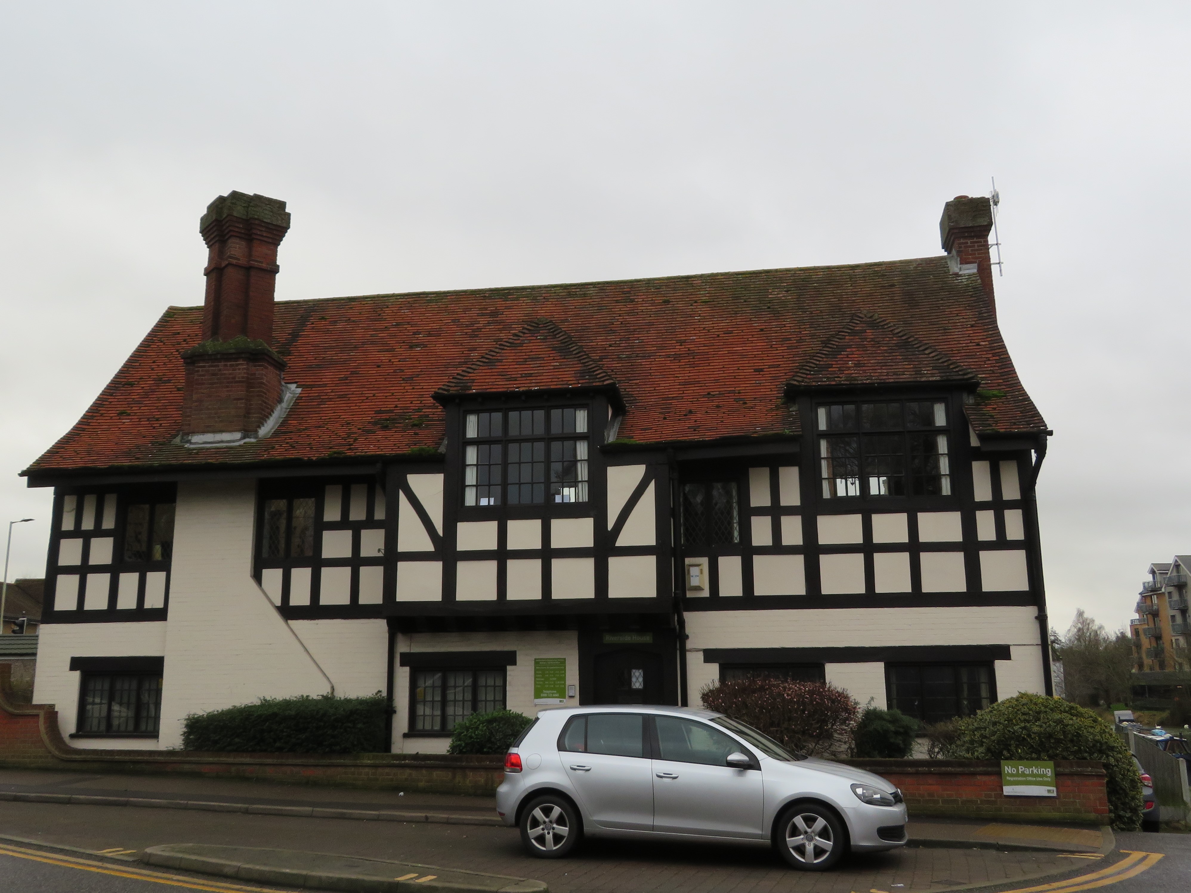
The town center is characterized by its well-preserved Georgian and Victorian buildings, giving Buntingford a distinct traditional feel. High Street, the main thoroughfare, is lined with independent shops, boutiques, and cafes, offering a unique shopping experience. The town also has a weekly market, attracting locals and visitors alike.

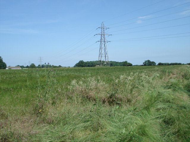
Buntingford boasts several recreational facilities, including a leisure center, sports clubs, and green spaces such as the Buntingford Recreation Ground. The town is surrounded by picturesque countryside, making it an ideal base for outdoor activities like walking and cycling.

Transport links are convenient, with the A10 road passing through Buntingford, providing easy access to nearby towns and cities. The town also has regular bus services to surrounding areas.

Overall, Buntingford is a delightful town that combines historical charm with modern amenities, making it an attractive place to live or visit in Hertfordshire.

If you have any feedback on the listing, please let us know in the comments section below.
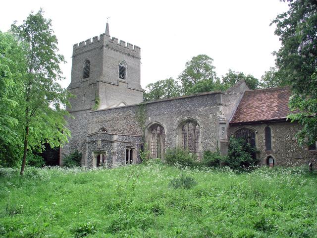
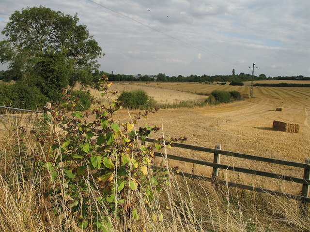
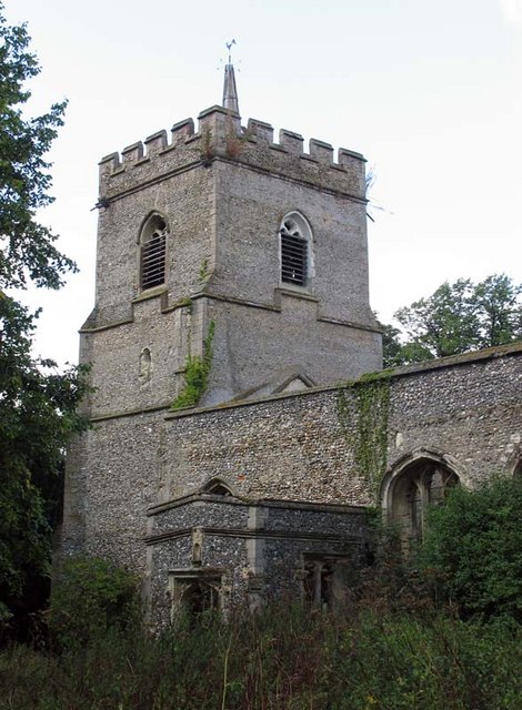
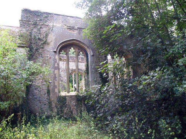
Buntingford Images

Images are sourced within 2km of 51.945315/-0.017601 or Grid Reference TL3629. Thanks to Geograph Open Source API. All images are credited.

Layston Church Near Buntingford, Layston Village was abandoned a long time ago.
Layston Church
Near Buntingford, Layston Village was abandoned a long time ago.
Farmland near Buntingford A footpath to Park Farm Industrial Estate and Buntingford can be seen cutting diagonally across the fields in the photo.  A Burdock stands out in the foreground.  The flower heads distribute the seed by sticking to passing animals - great fun to throw at your friends clothes when you're a child.
Farmland near Buntingford
A footpath to Park Farm Industrial Estate and Buntingford can be seen cutting diagonally across the fields in the photo. A Burdock stands out in the foreground. The flower heads distribute the seed by sticking to passing animals - great fun to throw at your friends clothes when you're a child.
Harvesting Combine harvester trundles across a field mowing the wheat on a Sunday evening.  In the foreground is a bale of straw.
Harvesting
Combine harvester trundles across a field mowing the wheat on a Sunday evening. In the foreground is a bale of straw.
St Bartholomew, Layston, Herts - Ruin
St Bartholomew, Layston, Herts - Ruin Holy water stoup
St Bartholomew, Layston, Herts - Ruin
Holy water stoup
St Bartholomew, Layston, Herts - Ruin
Pylons and bridleway, Brown's Corner, Wyddial
View to Beauchamps Plantation and Moles Farm
A view of Corney Bury Farm from Ermine Street
Buntingford from the air Looking east, with the A10 skirting round the west side of the village. A rather poor view in overcast evening light.
Buntingford from the air
Looking east, with the A10 skirting round the west side of the village. A rather poor view in overcast evening light.
Footbridge over the A10 The A10 runs 161 miles from London to King's Lynn. via Cambridge and Ely. 
<span class="nowrap"><a title="http://www.sabre-roads.org.uk/wiki/index.php?title=A10" rel="nofollow ugc noopener" href="http://www.sabre-roads.org.uk/wiki/index.php?title=A10">Link</a><img style="margin-left:2px;" alt="External link" title="External link - shift click to open in new window" src="https://s1.geograph.org.uk/img/external.png" width="10" height="10"/></span>
Footbridge over the A10
The A10 runs 161 miles from London to King's Lynn. via Cambridge and Ely. LinkExternal link
Road sign, A10, Buntingford Bypass The A10 runs 161 miles from London to King's Lynn. via Cambridge and Ely. 
<span class="nowrap"><a title="http://www.sabre-roads.org.uk/wiki/index.php?title=A10" rel="nofollow ugc noopener" href="http://www.sabre-roads.org.uk/wiki/index.php?title=A10">Link</a><img style="margin-left:2px;" alt="External link" title="External link - shift click to open in new window" src="https://s1.geograph.org.uk/img/external.png" width="10" height="10"/></span>
Road sign, A10, Buntingford Bypass
The A10 runs 161 miles from London to King's Lynn. via Cambridge and Ely. LinkExternal link
Show me another place!

Buntingford is located at Grid Ref: TL3629 (Lat: 51.945315, Lng: -0.017601)

Administrative County: Hertfordshire

District: East Hertfordshire

Police Authority: Hertfordshire

What 3 Words

///wicked.grinders.slurs. Near Buntingford, Hertfordshire

Nearby Locations

Buntingford Newtown

Related Wikis

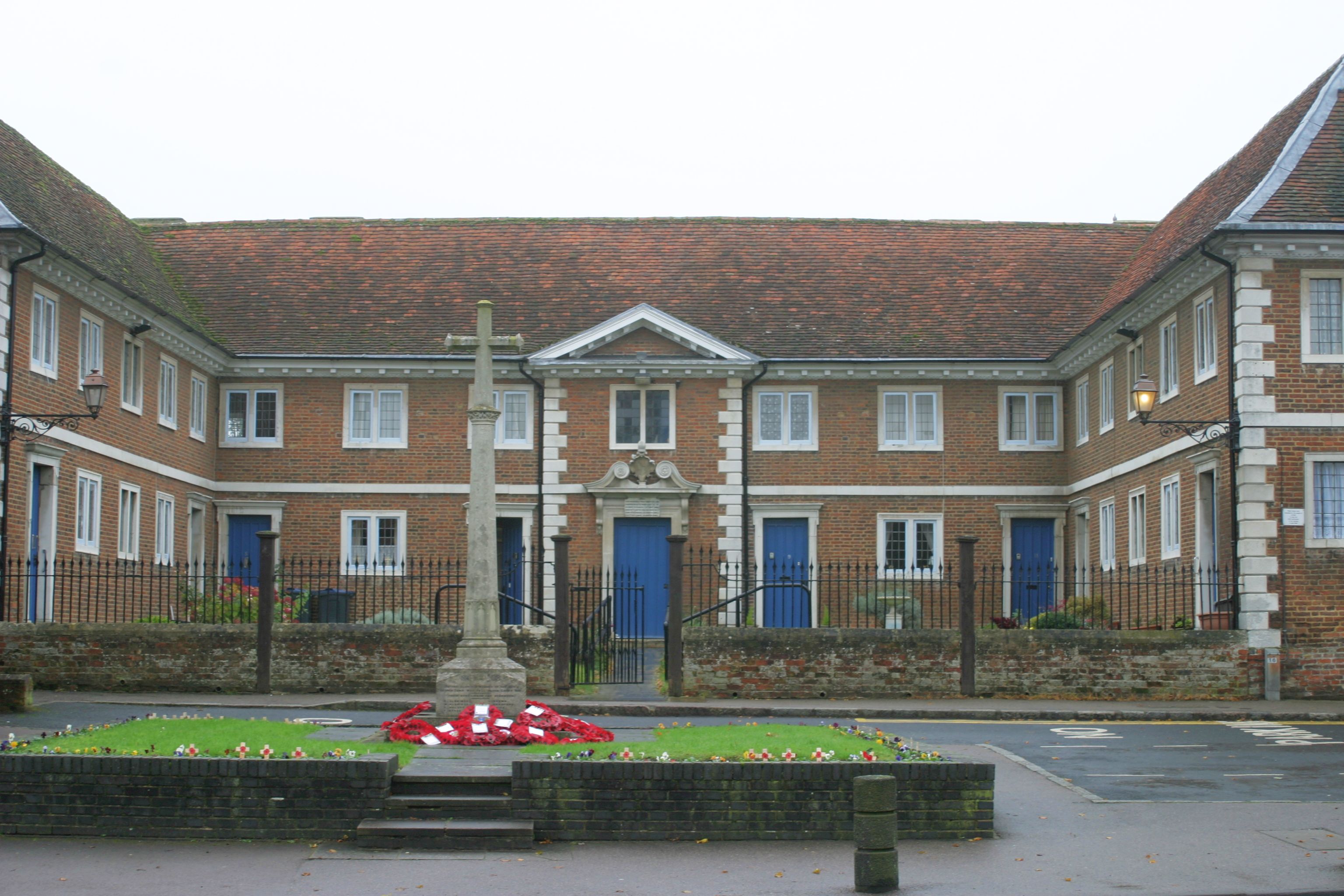
Buntingford almshouses

Buntingford Almshouses is a grade II* listed building on the High street of the Hertfordshire town of Buntingford. The building was erected in 1684 by...

Braughing Rural District

Braughing was a rural district in Hertfordshire, England from 1935 to 1974. == Creation == Braughing Rural District was created on 1 April 1935 under a...

Buntingford Rural District

Buntingford Rural District was a rural district in Hertfordshire, England from 1894 to 1935, covering the town of Buntingford and a number of surrounding...

Benson Memorial Church

The Benson Memorial Church, dedicated to St Richard of Chichester, is an English Roman Catholic church in the Hertfordshire town of Buntingford. Its name...

Nearby Amenities

Located within 500m of 51.945315,-0.017601
Buntingford
Created By: Potlatch 0.5d
Place: town
Lat/Long: 51.94672/-0.0172746
Mini Roundabout
Direction: clockwise
Lat/Long: 51.9453644/-0.0176426
Mini Roundabout
Direction: clockwise
Lat/Long: 51.9465274/-0.0222245
Buntingford
Historic Railway: station
Railway: site
Source: NPE
Wikidata: Q4997941
Lat/Long: 51.9411944/-0.0165353
Waterway: weir
Lat/Long: 51.9489629/-0.0175673
Noexit: yes
Lat/Long: 51.9479219/-0.0220582
Pub
The Crown
Addr City: Buntingford
Addr Country: GB
Addr Housenumber: 17
Addr Postcode: SG9 9AB
Addr Street: High Street
Phone: +44 1763 271422
Wikidata: Q26583512
Lat/Long: 51.9459348/-0.0187164
Bench
Lat/Long: 51.9454639/-0.0242549
Toilets
Check Date: 2021-09-19
Fee: no
Female: yes
Male: yes
Wheelchair: yes
Lat/Long: 51.947733/-0.020684
Bus Stop
Bridgefoot
Bench: no
Bin: no
Bus: yes
Lit: yes
Naptan AtcoCode: 210021302880
Naptan Bearing: W
Naptan CommonName: Bridgefoot
Naptan Crossing: Bridgefoot
Naptan Indicator: opp
Naptan Landmark: Bridgefoot
Naptan NaptanCode: hrtdtpaj
Naptan ShortCommonName: NA
Naptan Street: Hare Street Road
Naptan Verified: no
Public Transport: platform
Shelter: no
Source: naptan_import
Tactile Paving: yes
Lat/Long: 51.9455768/-0.0160501
Bus Stop
The Crown Inn
Bench: yes
Bin: yes
Bus: yes
Lit: yes
Naptan AtcoCode: 210021302900
Naptan Bearing: NW
Naptan CommonName: The Crown Inn
Naptan Crossing: Crown PH
Naptan Indicator: o/s
Naptan Landmark: Crown PH
Naptan NaptanCode: hrtdtpam
Naptan ShortCommonName: NA
Naptan Street: High Street
Naptan Verified: no
Public Transport: platform
Shelter: yes
Source: naptan_import
Tactile Paving: no
Lat/Long: 51.9460586/-0.0185671
Bus Stop
The Crown Inn
Bench: yes
Bin: yes
Bus: yes
Lit: yes
Naptan AtcoCode: 210021309840
Naptan Bearing: SE
Naptan CommonName: The Crown Inn
Naptan Crossing: Crown PH
Naptan Indicator: opp
Naptan Landmark: Crown PH
Naptan NaptanCode: hrtdpgtm
Naptan ShortCommonName: NA
Naptan Street: High Street
Naptan Verified: no
Public Transport: platform
Shelter: yes
Source: naptan_import
Tactile Paving: no
Lat/Long: 51.9458913/-0.0180651
Bus Stop
Bridgefoot
Bench: no
Bin: no
Bus: yes
Lit: yes
Naptan AtcoCode: 210021309860
Naptan Bearing: E
Naptan CommonName: Bridgefoot
Naptan Crossing: Sunny Hill
Naptan Indicator: adj
Naptan Landmark: Sunny Hill
Naptan NaptanCode: hrtdpgtp
Naptan ShortCommonName: NA
Naptan Street: Hare Street Road
Naptan Verified: no
Public Transport: platform
Shelter: no
Source: naptan_import
Tactile Paving: yes
Lat/Long: 51.9457203/-0.0154908
Post Box
SG9 9AA – Buntingford Branch Office | Baldock Road
Collection Times: Mo-Fr 17:30, Sa 12:00
Post Box Type: wall
Ref: SG9 135
Royal Cypher: no
Lat/Long: 51.9465912/-0.020065
Basras Supermarket
Shop: convenience
Lat/Long: 51.9466187/-0.0198666
Budgens
Addr Country: GB
Addr Postcode: SG9 9BL
Addr Street: Baldock Road
Brand: McColl's
Brand Wikidata: Q16997477
Shop: convenience
Lat/Long: 51.9465208/-0.0200281
Post Box
Layston Meadow
Collection Times: Mo-Fr 17:00; Sa 09:30
Ref: SG9 136
Royal Cypher: EIIR
Royal Cypher Wikidata: Q33102113
Lat/Long: 51.9417326/-0.0150616
Bus Stop
Aspenden Road
Bus: yes
Naptan AtcoCode: 210021309905
Naptan NaptanCode: hrtjajpw
Public Transport: platform
Lat/Long: 51.9413948/-0.0147928
Note: Way split owing to bus route 25 terminating.
Lat/Long: 51.9461465/-0.0185286
Post Box
Sunny Hill
Check Date: 2021-08-15
Collection Times: Mo-Fr 17:15; Sa 07:15
Ref: SG9 99
Lat/Long: 51.9457951/-0.0149491
Atm
Lat/Long: 51.9452569/-0.0171795
Crossing
Button Operated: yes
Crossing: traffic_signals
Crossing Island: no
Kerb: lowered
Tactile Paving: yes
Traffic Signals: yes
Lat/Long: 51.9465243/-0.0226776
Crossing
Crossing: marked
Crossing Island: no
Crossing Markings: yes
Crossing Ref: zebra
Kerb: lowered
Tactile Paving: yes
Lat/Long: 51.9467152/-0.0195514
Crossing
Crossing: zebra
Crossing Island: no
Crossing Markings: zebra
Crossing Ref: zebra
Tactile Paving: yes
Traffic Calming: table
Lat/Long: 51.9451424/-0.0175099
Bank
Barclays
Atm: yes
Brand: Barclays
Brand Wikidata: Q245343
Lat/Long: 51.946472/-0.019068
Recycling
Location: overground
Recycling Clothes: yes
Recycling Shoes: yes
Recycling Type: container
Lat/Long: 51.9448171/-0.0168522
Power: pole
Lat/Long: 51.9414027/-0.0209587
Note: This was the site of the Railway pub. This has now been demolished
Lat/Long: 51.9421205/-0.0158772
Pub
The Fox and Duck
Wikidata: Q26394639
Lat/Long: 51.9483203/-0.0182427
Pharmacy
Allied Pharmacy
Addr Housenumber: 29
Addr Postcode: SG9 9AB
Addr Street: High Street
Brand: Allied Pharmacies
Brand Wikidata: Q116272370
Dispensing: yes
Email: allied.buntingford@nhs.net
Opening Hours: Mo-Fr 09:00-18:00; Sa 09:00-17:00
Phone: 01763 271 406
Website: https://alliedpharmacies.com/pharmacy/allied-pharmacy-buntingford
Lat/Long: 51.946655/-0.019142
Crossing
Crossing: unmarked
Crossing Island: no
Crossing Markings: no
Tactile Paving: yes
Lat/Long: 51.9437911/-0.0139649
Addr City: Buntingford
Addr County: Hertfordshire
Addr Housenumber: 123
Addr Street: Snells Mead
Lat/Long: 51.943762/-0.0144385
Addr City: Buntingford
Addr County: Hertfordshire
Addr Housenumber: 44
Addr Street: Snells Mead
Lat/Long: 51.943365/-0.0153784
Defibrillator
Emergency: defibrillator
Ref GB The Circuit: C3D22ED3-09A8-4203-BC43-ADC200B0D1DA
Lat/Long: 51.9428339/-0.0198679
Doctors
Healthcare: doctor
Lat/Long: 51.9489991/-0.0217664
Addr Postcode: SG9 9FZ
Building: yes
Lat/Long: 51.9459596/-0.0178286
Addr Postcode: SG9 9FQ
Building: yes
Lat/Long: 51.9476649/-0.0206061
Bonney's Boutique
Addr Housenumber: 47
Shop: clothes
Lat/Long: 51.9472343/-0.0193548
Brides of Buntingford
Shop: clothes
Lat/Long: 51.9471797/-0.0193132
Piggotts Family Butchers
Shop: butcher
Lat/Long: 51.9468747/-0.019159
Turning Circle
Lat/Long: 51.9496639/-0.0165775
Crossing
Crossing: unmarked
Crossing Island: no
Crossing Markings: no
Tactile Paving: yes
Lat/Long: 51.943057/-0.0124696
Direction: both
Surface: cobblestone
Traffic Calming: choker
Lat/Long: 51.9490718/-0.020553
Defibrillator
Defibrillator Location: Wall.
Emergency: defibrillator
Indoor: no
Lat/Long: 51.9445348/-0.0168821
Bench
Backrest: yes
Lat/Long: 51.9468134/-0.0190264
Bench
Backrest: yes
Lat/Long: 51.9467795/-0.0190049
Waste Basket
Lat/Long: 51.9467936/-0.0190385
Direction: both
Traffic Calming: bump
Lat/Long: 51.9467335/-0.0222097
Direction: both
Traffic Calming: bump
Lat/Long: 51.9476334/-0.022481
Direction: both
Traffic Calming: bump
Lat/Long: 51.9480988/-0.0227589
Crossing
Lat/Long: 51.946772/-0.0122891
Crossing
Lat/Long: 51.9418143/-0.0217503
Crossing
Lat/Long: 51.9465582/-0.0244774
Crossing
Crossing: unmarked
Crossing Island: no
Crossing Markings: no
Kerb: flush
Tactile Paving: no
Lat/Long: 51.9432742/-0.0161499
Direction: 125
Information: board
Tourism: information
Lat/Long: 51.9458147/-0.011413
Crossing
Crossing: unmarked
Crossing Island: no
Crossing Markings: no
Tactile Paving: yes
Traffic Calming: table
Lat/Long: 51.9412408/-0.0146706
Crossing
Crossing: unmarked
Crossing Island: no
Crossing Markings: no
Traffic Calming: table
Lat/Long: 51.9417783/-0.0150938
Noexit: yes
Lat/Long: 51.9472808/-0.0203712
Historic: memorial
Memorial: war_memorial
Lat/Long: 51.9458496/-0.0183972
Telephone
Booth: K6
Covered: booth
Listed Status: Grade II
Operator: BT
Phone: +44 1763 271354
Wikidata: Q26543310
Lat/Long: 51.9459612/-0.0184387
Bench
Backrest: yes
Lat/Long: 51.9459415/-0.0184146
Crossing
Crossing: unmarked
Crossing Island: no
Crossing Markings: no
Kerb: lowered
Tactile Paving: yes
Traffic Calming: table
Lat/Long: 51.94539/-0.0174617
Crossing
Crossing: unmarked
Crossing Island: no
Crossing Markings: no
Tactile Paving: yes
Lat/Long: 51.9464245/-0.0114265
Historic: milestone
Lat/Long: 51.9456876/-0.0180955
Crossing
Crossing: unmarked
Crossing Island: no
Crossing Markings: no
Tactile Paving: yes
Lat/Long: 51.9465817/-0.011329
Crossing
Lat/Long: 51.9470978/-0.012896
Crossing
Crossing: unmarked
Crossing Island: no
Crossing Markings: no
Tactile Paving: yes
Lat/Long: 51.9467528/-0.011639
Crossing
Crossing: unmarked
Crossing Island: no
Crossing Markings: no
Lat/Long: 51.9479614/-0.0135283
Crossing
Crossing: uncontrolled
Crossing Island: no
Crossing Markings: surface
Lat/Long: 51.948104/-0.0139163
Meadow Vale
Place: neighbourhood
Lat/Long: 51.9437994/-0.011912
Bus Stop
Aspenden Road
Bus: yes
Naptan AtcoCode: 210021302825
Naptan NaptanCode: hrtjajpt
Public Transport: platform
Lat/Long: 51.9429205/-0.0161417
Crossing
Crossing: unmarked
Crossing Markings: no
Lat/Long: 51.9448417/-0.0172095
Entrance: yes
Lat/Long: 51.9445522/-0.0169031
Crossing
Crossing: unmarked
Crossing Island: no
Crossing Markings: no
Tactile Paving: yes
Lat/Long: 51.9423119/-0.0157854
Crossing
Crossing: unmarked
Crossing Island: no
Crossing Markings: no
Tactile Paving: yes
Lat/Long: 51.9424117/-0.0158633
Crossing
Crossing: unmarked
Crossing Markings: no
Lat/Long: 51.943863/-0.0167853
Crossing
Crossing: zebra
Crossing Island: no
Crossing Markings: zebra
Tactile Paving: yes
Traffic Calming: table
Lat/Long: 51.9419423/-0.0153431
Traffic Calming: island
Lat/Long: 51.9423636/-0.0158257
Waste Basket
Waste: dog_excrement
Lat/Long: 51.9466293/-0.0242331
Post Box
Operator: Royal Mail
Operator Wikidata: Q638098
Post Box Mounting: pier
Post Box Type: lamp
Ref: SG9 48
Lat/Long: 51.9444332/-0.0214668
Library
Buntingford Library
Addr Housenumber: 77
Addr Postcode: SG9 9AE
Addr Street: High Street
Contact Facebook: BuntingfordLibrary
Internet Access: wlan
Opening Hours: Mo-Tu, Th 10:00-17:30; Fr 14:00-17:30; Sa 09:00-13:00
Operator: Hertfordshire County Council
Website: https://www.hertfordshire.gov.uk/services/libraries-and-archives/library-opening-hours/buntingford-library.aspx
Lat/Long: 51.9486046/-0.0203459
Barrier: bollard
Lat/Long: 51.9447364/-0.0106201
Barrier: bollard
Lat/Long: 51.9446492/-0.0106108
Barrier: bollard
Lat/Long: 51.9446649/-0.0107405
Barrier: bollard
Lat/Long: 51.9447158/-0.0104792
Crossing
Crossing: zebra
Crossing Island: no
Tactile Paving: yes
Traffic Calming: table
Lat/Long: 51.9433296/-0.0163692
Barrier: bollard
Lat/Long: 51.9445626/-0.0107157
Crossing
Crossing: unmarked
Crossing Island: no
Crossing Markings: no
Tactile Paving: yes
Lat/Long: 51.9439373/-0.0167628
Advertising: board
Direction: 110
Lat/Long: 51.9424794/-0.0158854
Fast Food
The Chippy
Addr Housenumber: 83
Addr Postcode: SG9 9AE
Addr Street: High Street
Contact Facebook: https://facebook.com/https://facebook.com/people/The-Chippy/100085753942781
Cuisine: fish_and_chips
Phone: +44 1763 271962
Lat/Long: 51.9487283/-0.0203825
Post Office
Addr Country: GB
Addr Postcode: SG9 9BL
Addr Street: Baldock Road
Brand: Post Office
Brand Wikidata: Q1783168
Opening Hours: Mo-Fr 09:00-17:00; Sa 09:00-13:00
Operator: Budgens
Operator Wikidata: Q16997477
Ref Pol Id: 95
Website: https://www.postoffice.co.uk/branch-finder/0521299/buntingford
Lat/Long: 51.9464789/-0.0200158
Atm
Lat/Long: 51.9481989/-0.0200124
Parcel Locker
Lat/Long: 51.9450858/-0.0170281
Dentist
Buntingford Dental Clinic
Addr City: Buntingford
Addr Housenumber: 23
Addr Postcode: SG9 9AB
Addr Street: High Street
Healthcare: dentist
Opening Hours: Mo-Fr 09:00-17:00
Website: https://www.colosseumdental.co.uk/practices/buntingford-dental-clinic
Lat/Long: 51.9463771/-0.0190162
Attend2Health
Addr City: Buntingford
Addr Housenumber: 27
Addr Postcode: SG9 9AB
Addr Street: High Street
Healthcare: physiotherapist
Phone: +44 1763 87 80 87
Website: https://www.attend2health.co.uk/
Lat/Long: 51.9465285/-0.0190902
Restaurant
SONA
Addr Housenumber: 35
Addr Postcode: SG9 9AD
Addr Street: High Street
Cuisine: curry
Website: https://www.sona-buntingford.co.uk/
Lat/Long: 51.9468375/-0.0191339
Days
Addr City: Buntingford
Addr Housenumber: 28
Addr Postcode: SG9 9AQ
Addr Street: High Street
Brand: https://daysbakery.com/best-hertfordshire-bakery-buntingford/
Brand Website: https://daysbakery.com/best-hertfordshire-bakery-buntingford/
Opening Hours: Mo-Fr 07:00-15:30; Sa 07:00-15:00
Phone: +44 1763 271722
Shop: bakery
Website: https://daysbakery.com/
Website Menu: https://daysbakery.com/our-food/
Lat/Long: 51.9474152/-0.0192885
Pharmacy
Buntingford Pharmacy
Addr Housenumber: 55
Addr Postcode: SG9 9AD
Addr Street: High Street
Phone: 01763271512
Lat/Long: 51.9476101/-0.0196288
J. Oliver Radley Opticians
Addr Housenumber: 36
Addr Postcode: SG9 9AQ
Addr Street: High Street
Contact Facebook: J.OliverRadley
Email: info@radleyopticians.com
Opening Hours: Mo-Fr 09:00-17:30; Sa 09:00-16:00
Phone: 01763 273300
Shop: optician
Website: https://www.radleyopticians.com
Lat/Long: 51.9477635/-0.0195063
Cafe
The Buntingford Coffee Shop
Addr Housenumber: 61
Addr Postcode: SG9 9AE
Addr Street: High Street
Contact Facebook: BuntCoffee
Contact Instagram: buntcoffee
Contact Twitter: BuntCoffee
Cuisine: breakfast;cake;coffee_shop;sandwich
Opening Hours: Mo-Fr 08:00-17:00; Sa 09:00-17:00; Su 10:00-15:00
Phone: 01763 273940
Website: https://www.thebuntingfordcoffeeshop.co.uk
Lat/Long: 51.9479378/-0.0198965
Dentist
The Dentist
Addr Housenumber: 63
Addr Postcode: SG9 9AE
Addr Street: High Street
Email: dentistbuntingford@gmail.com
Opening Hours: Mo-Th 09:00-17:30; Fr 09:00-12:30
Phone: 01763 271 695
Website: http://www.thedentistbuntingford.com/
Lat/Long: 51.9480549/-0.0199416
Crossing
Crossing: unmarked
Crossing Island: no
Crossing Markings: no
Tactile Paving: yes
Lat/Long: 51.9454788/-0.0172047
Crossing
Crossing: unmarked
Crossing Island: no
Crossing Markings: no
Tactile Paving: yes
Lat/Long: 51.9428689/-0.0123205
Crossing
Crossing: unmarked
Crossing Island: no
Crossing Markings: no
Tactile Paving: yes
Lat/Long: 51.9429814/-0.0123204
Crossing
Crossing: unmarked
Crossing Island: no
Crossing Markings: no
Tactile Paving: yes
Lat/Long: 51.9436042/-0.0124797
Crossing
Crossing: unmarked
Crossing Island: no
Crossing Markings: no
Tactile Paving: yes
Lat/Long: 51.9435163/-0.0125659
Crossing
Crossing: unmarked
Crossing Island: no
Crossing Markings: no
Tactile Paving: yes
Lat/Long: 51.943206/-0.0116072
The data included in this document is from www.openstreetmap.org. The data is made available under ODbL.

Have you been to Buntingford?

Leave your review of Buntingford below (or comments, questions and feedback).