Allt Bellaf

Wood, Forest in Pembrokeshire

Wales

Allt Bellaf

Llwybr ger Ffarm Wood Park / Path near Wood Park Farm Cerddwyr yn dilyn llwybr troed cyhoeddus ger Ffarm Wood Park.

Walkers following a public footpath near Wood Park Farm.
Llwybr ger Ffarm Wood Park / Path near Wood Park Farm Credit: Alan Richards

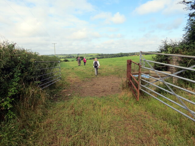
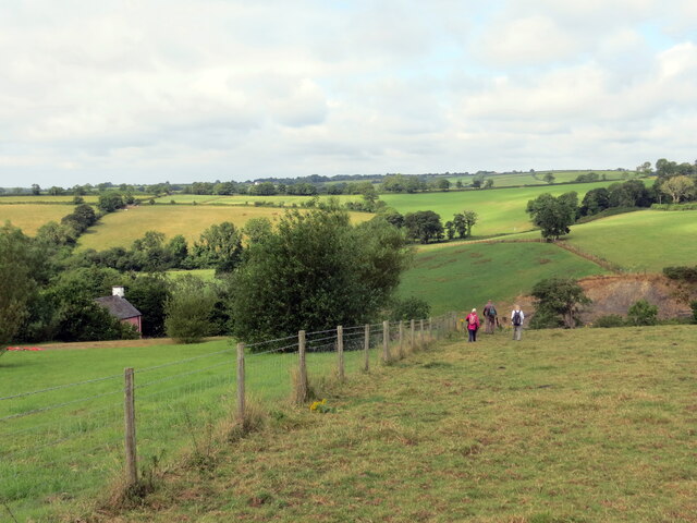
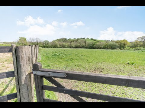
Allt Bellaf, located in Pembrokeshire, is a picturesque wood and forest area that covers a significant portion of the region. Spanning across a vast expanse, this natural haven is known for its stunning landscapes, diverse wildlife, and rich biodiversity.

The woodland is primarily composed of native tree species such as oak, beech, and birch, forming a dense and enchanting canopy that offers shade and shelter to a multitude of plant and animal species. The forest floor is adorned with a vibrant carpet of wildflowers, ferns, and mosses, creating a stunning tapestry of colors and textures.

Allt Bellaf is a haven for nature enthusiasts, offering a plethora of activities for visitors to enjoy. Hiking trails meander through the forest, allowing visitors to immerse themselves in the tranquility of nature while observing the diverse wildlife that calls this place home. Birdwatchers will be delighted by the variety of species that frequent the area, including woodpeckers, owls, and songbirds.

For those seeking a more leisurely experience, picnic areas are scattered throughout the wood, providing a perfect spot to relax and enjoy the beauty of the surroundings. The forest also offers opportunities for photography and nature study, with its abundant flora and fauna providing endless subjects to capture and learn about.

Allt Bellaf is a true gem in the heart of Pembrokeshire, offering visitors a chance to connect with nature and experience the beauty of a pristine wood and forest environment. Its lush greenery, tranquil atmosphere, and abundant wildlife make it a must-visit destination for both locals and tourists alike.

If you have any feedback on the listing, please let us know in the comments section below.
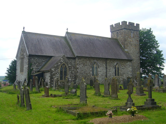
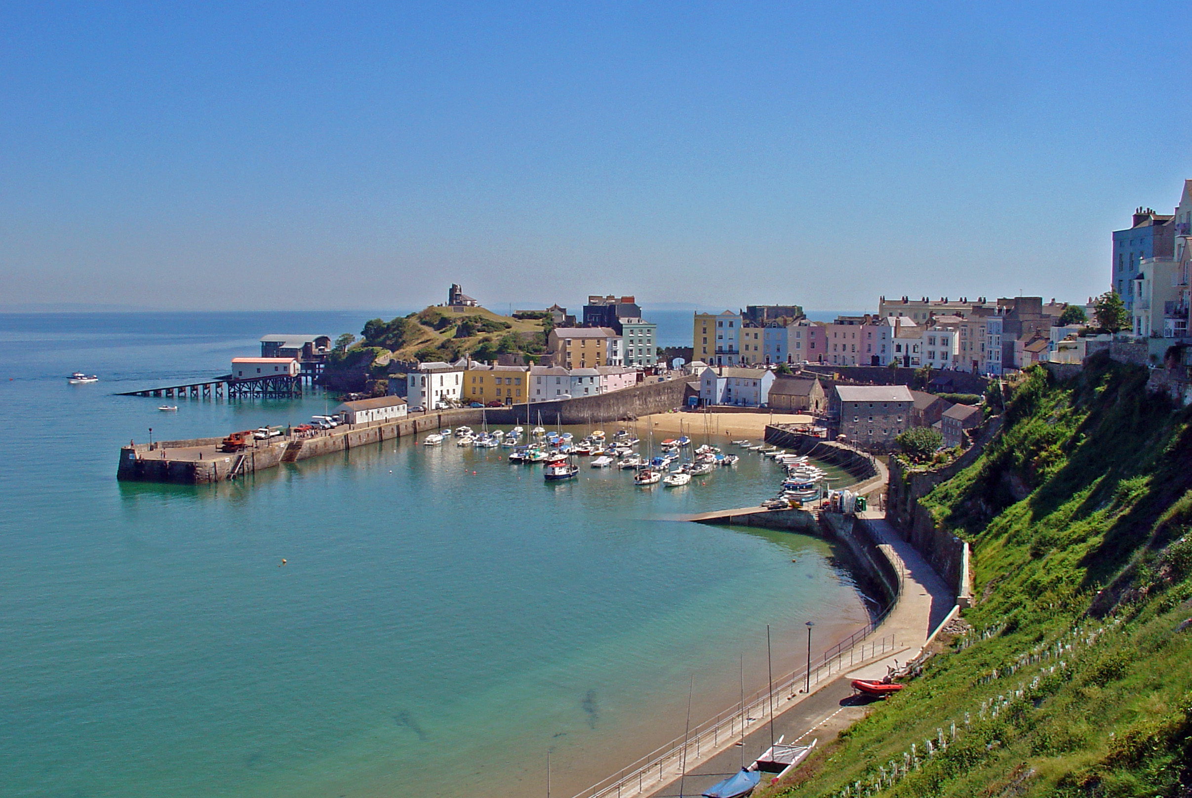
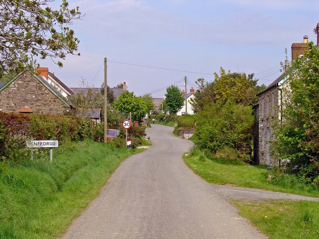
Allt Bellaf Images

Images are sourced within 2km of 51.86636/-4.8466157 or Grid Reference SN0422. Thanks to Geograph Open Source API. All images are credited.

Llwybr ger Ffarm Wood Park / Path near Wood Park Farm Cerddwyr yn dilyn llwybr troed cyhoeddus ger Ffarm Wood Park.

Walkers following a public footpath near Wood Park Farm.
Llwybr ger Ffarm Wood Park / Path near Wood Park Farm
Cerddwyr yn dilyn llwybr troed cyhoeddus ger Ffarm Wood Park. Walkers following a public footpath near Wood Park Farm.
Llwybr ger Cwm Hill / Path near Cwm Hill Cerddwyr yn mynd i lawr y waered ger anhedd-dy o'r enw Cwm Hill.

Walkers descending a field near a property known as Cwm Hill.
Llwybr ger Cwm Hill / Path near Cwm Hill
Cerddwyr yn mynd i lawr y waered ger anhedd-dy o'r enw Cwm Hill. Walkers descending a field near a property known as Cwm Hill.
Field gateway Footpath to New Mill.
Field gateway
Footpath to New Mill.
St Martin’s Church, Clarbeston
Road junction by Knock Farm The entrance to Knock Farm can be seen from the road junction near Clarbeston Road.
Road junction by Knock Farm
The entrance to Knock Farm can be seen from the road junction near Clarbeston Road.
Ploughed field near Park Stone Ploughed field near Park Stone south of New Moat.
Ploughed field near Park Stone
Ploughed field near Park Stone south of New Moat.
House overlooking Step-a-side Bridge View to a house from Step-a-side Bridge which crosses Afon Syfynwy.
House overlooking Step-a-side Bridge
View to a house from Step-a-side Bridge which crosses Afon Syfynwy.
Farmland near Walton Mill Farmland near Walton Mill above the Syfynwy valley.
Farmland near Walton Mill
Farmland near Walton Mill above the Syfynwy valley.
Fence across a field Fence across a field near Parc-y-delyn.
Fence across a field
Fence across a field near Parc-y-delyn.
Pont Crwca and Afon Syfynwy Pont Crwca and Afon Syfynwy with Southfield Villa on the right.
Pont Crwca and Afon Syfynwy
Pont Crwca and Afon Syfynwy with Southfield Villa on the right.
Pont Crwca and Afon Syfynwy Road junction at Pont Crwca which crosses Afon Syfynwy.
Pont Crwca and Afon Syfynwy
Road junction at Pont Crwca which crosses Afon Syfynwy.
Llys-y-frân dam valve house
Country road near Cockold Country road near Cockold near Clarbeston.
Country road near Cockold
Country road near Cockold near Clarbeston.
Llwybr ceffyl Llys y Fran / Llys y Fran bridleway Llwybr ceffyl yn Llys y Fran.

A bridleway in Llys y Fran (trans. crow court).
Llwybr ceffyl Llys y Fran / Llys y Fran bridleway
Llwybr ceffyl yn Llys y Fran. A bridleway in Llys y Fran (trans. crow court).
Llwybr Eglwys Llys y Fran Church Path Llwybr cyhoeddus yn arwain tuag at Eglwys Sant Meilyr, Llys y Fran.

A public footpath heading in the direction of St Meilyr's Church, Llys y Fran (trans. crow court).
Llwybr Eglwys Llys y Fran Church Path
Llwybr cyhoeddus yn arwain tuag at Eglwys Sant Meilyr, Llys y Fran. A public footpath heading in the direction of St Meilyr's Church, Llys y Fran (trans. crow court).
Llwybr Ceffyl Llys y Fran Bridleway Llwybr ceffyl yn arwain tuag at bentre Llys y Fran.

A public footpath heading in the direction of Llys y Fran village (trans. crow court).
Llwybr Ceffyl Llys y Fran Bridleway
Llwybr ceffyl yn arwain tuag at bentre Llys y Fran. A public footpath heading in the direction of Llys y Fran village (trans. crow court).
Llwybr Parc y Delyn Path Llwybr cyhoeddus yn arwain tuag at anhedd-dy Parc y Delyn o Bont Step-aside.

A public footpath heading in the direction of a property known as Parc y Delyn (trans. harp field) from Step-aside Bridge.
Llwybr Parc y Delyn Path
Llwybr cyhoeddus yn arwain tuag at anhedd-dy Parc y Delyn o Bont Step-aside. A public footpath heading in the direction of a property known as Parc y Delyn (trans. harp field) from Step-aside Bridge.
Ger Pont Step-aside / Near Step-aside Bridge Heol yn arwain at Bont Step-aside.

A road approaching Step-aside Bridge.
Ger Pont Step-aside / Near Step-aside Bridge
Heol yn arwain at Bont Step-aside. A road approaching Step-aside Bridge.
Show me another place!

Allt Bellaf is located at Grid Ref: SN0422 (Lat: 51.86636, Lng: -4.8466157)

Unitary Authority: Pembrokeshire

Police Authority: Dyfed Powys

What 3 Words

///uses.jazz.apparatus. Near Wiston, Pembrokeshire

Nearby Locations

Allt Bellaf Pentrose Wood

Related Wikis

Related Videos

A walk and a whittle at LLys y Fran Reservoir / Life in the slow lane

This was Paul and my first trip out to LLys y Fran Reservoir. We found it online and saw that there was a circular walk around the ...

LLys y Fran Reservoir, Wales. #VisitWales #Llysyfran #Pembrokeshire #LakeinWales #Reservoir

Hello everyone today me and my daughter will walk you around Llys y Fran Lake and visitor centre in Pembrokeshire.This place is ...

Llys y Fran Lakeview Campsite, Llys y Fran Lake Pembrokeshire

Llyn Llys-y-Frân Lake, Pembrokeshire is an ideal location to enjoy the great outdoors. It is one of Dwr Cymru / Welsh Water ...

Incredible Cottage in Seven Acres with Stables & Two Bedroom Annex in Clarbeston Road, Pembrokeshire

Sitting in seven acres Cornmill is a home to truly love and cherish. Originating from the agricultural buildings of a pig and cow ...

Nearby Amenities

Located within 500m of 51.86636,-4.8466157
Give Way
Direction: backward
Lat/Long: 51.8622963/-4.8486604
Give Way
Direction: forward
Lat/Long: 51.8646488/-4.8532137
Give Way
Direction: forward
Lat/Long: 51.8680298/-4.8527441
Direction: 175
Generator Method: photovoltaic
Generator Output Electricity: yes
Generator Solar Modules: 16
Generator Source: solar
Generator Type: solar_photovoltaic_panel
Location: roof
Power: generator
Lat/Long: 51.8635235/-4.8431937
The data included in this document is from www.openstreetmap.org. The data is made available under ODbL.

Have you been to Allt Bellaf?

Leave your review of Allt Bellaf below (or comments, questions and feedback).