Broad Moor Wood

Wood, Forest in Pembrokeshire

Wales

Broad Moor Wood

Farm buildings at Stiniog The farm buildings at Stiniog, viewed from the country road between Trecwn and Puncheston. The Preseli hills can be seen in the distance.
Farm buildings at Stiniog Credit: Martyn Harries

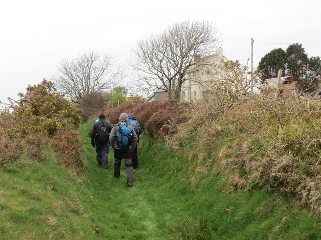
Broad Moor Wood is a picturesque woodland located in the county of Pembrokeshire, Wales. Spanning over a vast area of land, it is a delightful destination for nature enthusiasts and hikers alike. The wood is situated near the village of Broad Moor, nestled between rolling hills and meandering rivers.

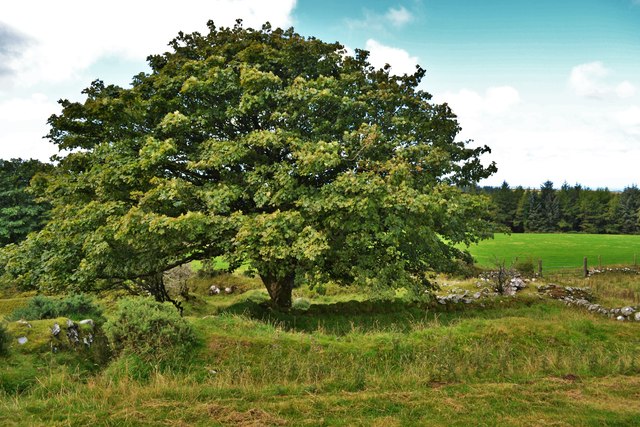
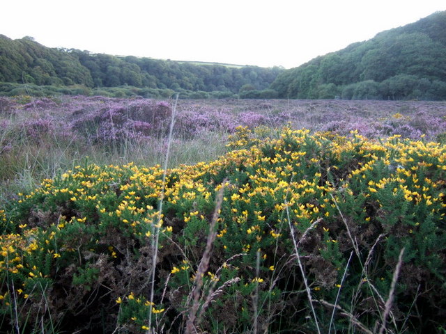
The woodland is home to a diverse range of flora and fauna, making it a haven for wildlife. Towering oak trees dominate the landscape, their branches stretching towards the sky, while beech, ash, and hazel trees provide a rich tapestry of color throughout the changing seasons. Bluebells, primroses, and wild garlic carpet the forest floor, creating a stunning display of natural beauty.

The wood offers a variety of walking trails, allowing visitors to explore its enchanting surroundings. These trails offer breathtaking views of the surrounding countryside, with occasional glimpses of the nearby coastline. Birdwatchers can spot a multitude of species, including woodpeckers, owls, and various songbirds.

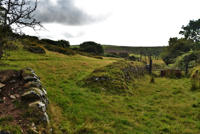
Broad Moor Wood also holds historical significance, with traces of ancient settlements and archaeological sites scattered throughout the area. These remnants offer a glimpse into the past and provide an opportunity for visitors to learn about the rich history of the region.

Overall, Broad Moor Wood is a captivating destination that offers a tranquil escape from the hustle and bustle of everyday life. Its natural beauty, diverse wildlife, and historical significance make it a must-visit location for nature lovers and history enthusiasts alike.

If you have any feedback on the listing, please let us know in the comments section below.

Broad Moor Wood Images

Images are sourced within 2km of 51.953498/-4.9304728 or Grid Reference SM9832. Thanks to Geograph Open Source API. All images are credited.

Farm buildings at Stiniog The farm buildings at Stiniog, viewed from the country road between Trecwn and Puncheston. The Preseli hills can be seen in the distance.
Farm buildings at Stiniog
The farm buildings at Stiniog, viewed from the country road between Trecwn and Puncheston. The Preseli hills can be seen in the distance.
No Through Road near Llys-y-defaid No through road leading to Garn Deifog, off the minor road between Trecwn and Puncheston.
No Through Road near Llys-y-defaid
No through road leading to Garn Deifog, off the minor road between Trecwn and Puncheston.
Country Road near Tygrug This short stretch of road is just within the relevant grid square, leading to the entrance to Tygrug.
Country Road near Tygrug
This short stretch of road is just within the relevant grid square, leading to the entrance to Tygrug.
Country Road near Tygrug View of the country road heading for Puncheston near Tygrug. The Preseli hills can be seen in the distance.
Country Road near Tygrug
View of the country road heading for Puncheston near Tygrug. The Preseli hills can be seen in the distance.
Passing place on the road to Trecwn A view of a passing place along a minor road between the B4313 and A40.
Passing place on the road to Trecwn
A view of a passing place along a minor road between the B4313 and A40.
Llwybr Penlan Oleu Path Cerddwyr yn dilyn llwybr hynafol i gyfeiriad Eglwys Llanychaer. Yt anhedd-dy ar dde yw Ffarm Penlan Oleu. 

Walkers following an ancient path in the direction of Llanychaer Church. The property on the right is Penlan Oleu Farm (trans. top of the bright hill).
Llwybr Penlan Oleu Path
Cerddwyr yn dilyn llwybr hynafol i gyfeiriad Eglwys Llanychaer. Yt anhedd-dy ar dde yw Ffarm Penlan Oleu. Walkers following an ancient path in the direction of Llanychaer Church. The property on the right is Penlan Oleu Farm (trans. top of the bright hill).
Llwybr ger Pant y gwartheg / Footpath near Pantygwartheg Llwybr dymunol iawn ger Ffarm Pantygwartheg sy'n arwain lan at yr ucheldir.

A pleasant footpath near Pantygwartheg Farm (trans. cattle hollow) which ascends towards the uplands.
Llwybr ger Pant y gwartheg / Footpath near Pantygwartheg
Llwybr dymunol iawn ger Ffarm Pantygwartheg sy'n arwain lan at yr ucheldir. A pleasant footpath near Pantygwartheg Farm (trans. cattle hollow) which ascends towards the uplands.
Country Road near Penlan Oleu A couple of sheep on the road near the entrance to Penlan Oleu.
Country Road near Penlan Oleu
A couple of sheep on the road near the entrance to Penlan Oleu.
Passing place near Mynydd Graig-lwyd This passing place is on an unclassified road between Fagwyr-fran and Penffordd, heading for Llanychaer.
Passing place near Mynydd Graig-lwyd
This passing place is on an unclassified road between Fagwyr-fran and Penffordd, heading for Llanychaer.
Penffordd Trac yn mynd heibio i anhedd-dy o'r enw Penffordd ger cyffordd. 

A track passing a property known as Penffordd (trans. top of the hill) near a junction.
Penffordd
Trac yn mynd heibio i anhedd-dy o'r enw Penffordd ger cyffordd. A track passing a property known as Penffordd (trans. top of the hill) near a junction.
Penlan Oleu From the public right of way behind the farm on Kilkiffeth Mountain
Penlan Oleu
From the public right of way behind the farm on Kilkiffeth Mountain
Pentre Newydd Hill Parked above Cilgelynen then used first gate to access field to join footpath for a short way before using line of gates to access field of quiet cattle to gain summit.
Name: Pentre Newydd Hill
Hill number: 5245
Height: 217m / 712ft
Parent (Ma/M): 2208  Foel Cwmcerwyn
Section: 31C: South-West Wales
County/UA: Pembrokeshire [Sir Benfro] (CoU)
Class: Hump, Tump (200-299m)
Grid ref: SM987329 (est)
Drop: 110m
Col: 107m  SM992332
Pentre Newydd Hill
Parked above Cilgelynen then used first gate to access field to join footpath for a short way before using line of gates to access field of quiet cattle to gain summit. Name: Pentre Newydd Hill Hill number: 5245 Height: 217m / 712ft Parent (Ma/M): 2208 Foel Cwmcerwyn Section: 31C: South-West Wales County/UA: Pembrokeshire [Sir Benfro] (CoU) Class: Hump, Tump (200-299m) Grid ref: SM987329 (est) Drop: 110m Col: 107m SM992332
Sheep Pens Sheep pens seen en route to Pentre Newydd Hill.
Sheep Pens
Sheep pens seen en route to Pentre Newydd Hill.
Remains Of Ty'r-lan, Llanychaer One of at least eight cottages within half a mile (1888). See the link for old map/ superimposed modern Bing aerial ... <span class="nowrap"><a title="http://maps.nls.uk/geo/explore/#zoom=16&lat=51.9598&lon=-4.9164&layers=171" rel="nofollow ugc noopener" href="http://maps.nls.uk/geo/explore/#zoom=16&lat=51.9598&lon=-4.9164&layers=171">Link</a><img style="margin-left:2px;" alt="External link" title="External link - shift click to open in new window" src="https://s1.geograph.org.uk/img/external.png" width="10" height="10"/></span>
Remains Of Ty'r-lan, Llanychaer
One of at least eight cottages within half a mile (1888). See the link for old map/ superimposed modern Bing aerial ... LinkExternal link
Path To Llain Waun Isaf and Uchaf And Blaen Waen, Llanychaer See link to old 1888 map ... <span class="nowrap"><a title="http://maps.nls.uk/geo/explore/#zoom=16&lat=51.9595&lon=-4.9163&layers=171" rel="nofollow ugc noopener" href="http://maps.nls.uk/geo/explore/#zoom=16&lat=51.9595&lon=-4.9163&layers=171">Link</a><img style="margin-left:2px;" alt="External link" title="External link - shift click to open in new window" src="https://s1.geograph.org.uk/img/external.png" width="10" height="10"/></span>
Path To Llain Waun Isaf and Uchaf And Blaen Waen, Llanychaer
See link to old 1888 map ... LinkExternal link
Path Near Penlan Oleu Once the main track to the settlement of eight cottages, it is now only accessible to walkers but one gets the feeling that it is quite ancient. Bounded on both sides by large boulders (some are quite immense). On the horizon is the sea and the harbours of Fishguard and Goodwick
Path Near Penlan Oleu
Once the main track to the settlement of eight cottages, it is now only accessible to walkers but one gets the feeling that it is quite ancient. Bounded on both sides by large boulders (some are quite immense). On the horizon is the sea and the harbours of Fishguard and Goodwick
Penlan Oleu, Llanychaer Parish In a glorious setting with panoramic views to Goodwick Harbour and ferry port
Penlan Oleu, Llanychaer Parish
In a glorious setting with panoramic views to Goodwick Harbour and ferry port
Cattle grid Cattle grid at entrance to Gelli Farm.
Cattle grid
Cattle grid at entrance to Gelli Farm.
Show me another place!

Broad Moor Wood is located at Grid Ref: SM9832 (Lat: 51.953498, Lng: -4.9304728)

Unitary Authority: Pembrokeshire

Police Authority: Dyfed Powys

What 3 Words

///steroids.hinders.splints. Near Scleddau, Pembrokeshire

Related Wikis

Llanychaer

Llanychaer (English: church on the Aer, a tributary of the River Gwaun) is a small rural village and parish in the community of Cwm Gwaun, north Pembrokeshire...
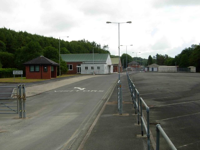
RNAD Trecwn

RNAD Trecwn is a decommissioned Royal Navy Armaments Depot, south of Fishguard in the village of Trecwn, Pembrokeshire, West Wales. Built in 1938 to store...

Trecwn

Trecwn (Welsh: Trecŵn [trɛˈkuːn]) is a village in Pembrokeshire, west Wales, 1.6 miles (2.6 km) east of the A40 (Fishguard to Haverfordwest) road in the...

Esgyrn Bottom

Esgyrn Bottom is a Site of Special Scientific Interest (or SSSI) in Pembrokeshire, South Wales. It has been designated as a Site of Special Scientific...

Have you been to Broad Moor Wood?

Leave your review of Broad Moor Wood below (or comments, questions and feedback).