Bowen's Wood
Wood, Forest in Pembrokeshire
Wales
Bowen's Wood

Bowen's Wood is a beautiful woodland located in Pembrokeshire, Wales. Covering an area of approximately 20 acres, the wood is known for its diverse range of tree species, including oak, beech, and ash. The woodland is popular with hikers, nature enthusiasts, and bird watchers, offering a peaceful and tranquil setting for visitors to explore.
The woodland is home to a variety of wildlife, including deer, squirrels, and a wide array of bird species. Visitors may also come across rare plants and wildflowers while wandering through the winding paths of Bowen's Wood.
The wood is well-maintained, with clearly marked trails and picnic areas for visitors to enjoy. There are also designated spots for bird watching and wildlife observation, making it a great destination for nature lovers.
Bowen's Wood is easily accessible by car and is located near the town of Narberth, making it a convenient day trip for those looking to escape the hustle and bustle of urban life. Whether you're looking for a peaceful stroll through nature or hoping to catch a glimpse of some of Wales' most beautiful wildlife, Bowen's Wood is a must-visit destination in Pembrokeshire.
If you have any feedback on the listing, please let us know in the comments section below.
Bowen's Wood Images
Images are sourced within 2km of 51.808161/-4.952702 or Grid Reference SM9616. Thanks to Geograph Open Source API. All images are credited.


Bowen's Wood is located at Grid Ref: SM9616 (Lat: 51.808161, Lng: -4.952702)
Unitary Authority: Pembrokeshire
Police Authority: Dyfed Powys
What 3 Words
///resolves.takeovers.unable. Near Haverfordwest, Pembrokeshire
Nearby Locations
Related Wikis
Prendergast, Pembrokeshire
Prendergast is a former village and parish in Pembrokeshire, Wales, now a suburb of Haverfordwest, Pembrokeshire's county town. The name survives as an...

Haverfordwest High VC School
Haverfordwest High VC School is a secondary school in Haverfordwest, Pembrokeshire, Wales, that teaches through the medium of English. It opened in September...

Haverfordwest railway station
Haverfordwest railway station serves the town of Haverfordwest in Pembrokeshire, Wales. It is 63 miles (101 km) west of Swansea on the Milford Haven branch...
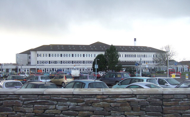
Withybush General Hospital
Withybush General Hospital (Welsh: Ysbyty Cyffredinol Llwynhelyg) is a district general hospital in Haverfordwest, Pembrokeshire, Wales. It is managed...
Nearby Amenities
Located within 500m of 51.808161,-4.952702Have you been to Bowen's Wood?
Leave your review of Bowen's Wood below (or comments, questions and feedback).