Allt Llanstinan

Wood, Forest in Pembrokeshire

Wales

Allt Llanstinan

Something's Cooking distance sign, Letterston Alongside the A40 270 yards (llath in Welsh) from Something's Cooking. <a title="https://www.geograph.org.uk/photo/6065578" href="https://www.geograph.org.uk/photo/6065578">Link</a>
Something's Cooking distance sign, Letterston Credit: Jaggery

Allt Llanstinan is a picturesque woodland located in the county of Pembrokeshire, Wales. Spanning an area of approximately 50 acres, this enchanting forest is nestled within the rolling hills of the region, offering a tranquil retreat for nature enthusiasts and outdoor lovers.

The woodland consists primarily of deciduous trees, including oak, beech, and ash, which create a rich and diverse ecosystem. The canopy of the forest provides shelter for a wide range of wildlife, including birds, squirrels, and various species of insects. Additionally, the forest floor is adorned with a carpet of bluebells during the spring, adding a burst of vibrant color to the peaceful surroundings.

Allt Llanstinan boasts several well-marked trails that wind through the woodland, allowing visitors to explore its natural beauty at their own pace. These paths lead to hidden glens, babbling brooks, and even a small waterfall, creating a sense of adventure and discovery.

The forest is also home to a variety of plant species, including wildflowers and ferns, which thrive in the damp and shaded areas. This makes Allt Llanstinan an ideal location for botany enthusiasts to study and observe the unique flora of the region.

In addition to its natural wonders, Allt Llanstinan holds historical significance as well. Ruins of an ancient stone circle can be found within the forest, providing a glimpse into the area's rich past and adding an element of mystery to the overall experience.

Overall, Allt Llanstinan in Pembrokeshire offers a delightful blend of natural beauty, wildlife, and cultural heritage, making it a must-visit destination for those seeking a peaceful and immersive woodland experience.

If you have any feedback on the listing, please let us know in the comments section below.

Allt Llanstinan Images

Images are sourced within 2km of 51.947418/-4.9905323 or Grid Reference SM9431. Thanks to Geograph Open Source API. All images are credited.

Something's Cooking distance sign, Letterston Alongside the A40 270 yards (llath in Welsh) from Something's Cooking. <a title="https://www.geograph.org.uk/photo/6065578" href="https://www.geograph.org.uk/photo/6065578">Link</a>
Something's Cooking distance sign, Letterston
Alongside the A40 270 yards (llath in Welsh) from Something's Cooking. Link
Track to Fronrhydd This shows the start of the long track to Fronrhydd, taken from the country road near Trecwn.
Track to Fronrhydd
This shows the start of the long track to Fronrhydd, taken from the country road near Trecwn.
Bend in the road towards Rhydyfarchnad View along the bend in the road towards the farm buildings near Rhydyfarchnad.
Bend in the road towards Rhydyfarchnad
View along the bend in the road towards the farm buildings near Rhydyfarchnad.
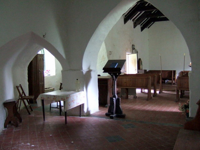
Road to St.Mary's Church, Llanfair-Nant -y -Gof The entrance to St.Mary's Church, Llanfair-Nant-y-Gof can be seen in the distance as you approach a sharp bend along the narrow country road from Trecwn.
Road to St.Mary's Church, Llanfair-Nant -y -Gof
The entrance to St.Mary's Church, Llanfair-Nant-y-Gof can be seen in the distance as you approach a sharp bend along the narrow country road from Trecwn.
A40 looking south
A40 looking south
A40 south of Forge Farm
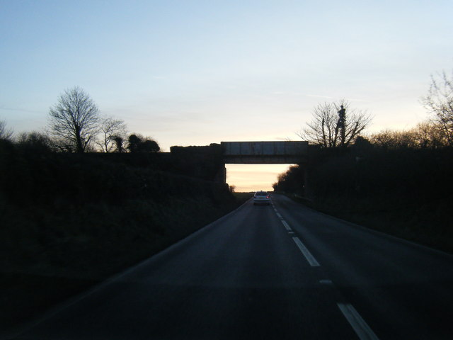
Railway bridge over the A40
A40 at Letterston boundary
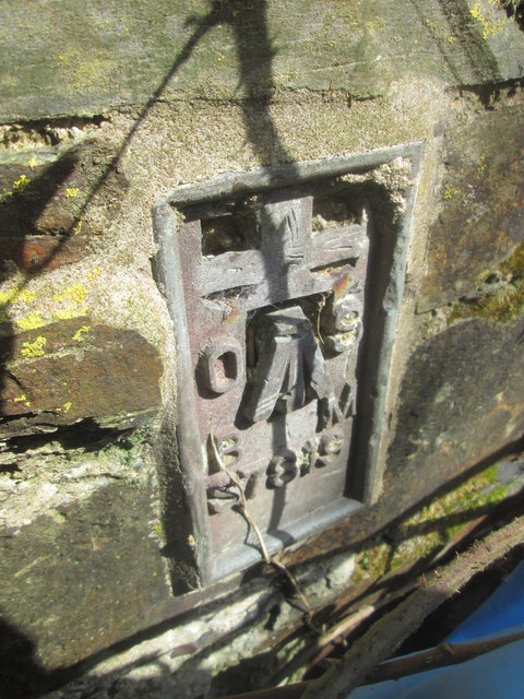
Ordnance Survey Flush Bracket S7819 This can be found on a house at Newbridge.
For more detail see : <span class="nowrap"><a title="http://www.bench-marks.org.uk/bm15123" rel="nofollow ugc noopener" href="http://www.bench-marks.org.uk/bm15123">Link</a><img style="margin-left:2px;" alt="External link" title="External link - shift click to open in new window" src="https://s1.geograph.org.uk/img/external.png" width="10" height="10"/></span>
Ordnance Survey Flush Bracket S7819
This can be found on a house at Newbridge. For more detail see : LinkExternal link
Ordnance Survey Flush Bracket (S7819) This OS Flush Bracket can be found on the south west face of Newbridge cottage. It marks a point 65.406m above mean sea level.
Ordnance Survey Flush Bracket (S7819)
This OS Flush Bracket can be found on the south west face of Newbridge cottage. It marks a point 65.406m above mean sea level.
Ordnance Survey Flush Bracket (S7818) This OS Flush Bracket can be found on a farm building at Ciliau Forge. It marks a point 78.947m above mean sea level.
Ordnance Survey Flush Bracket (S7818)
This OS Flush Bracket can be found on a farm building at Ciliau Forge. It marks a point 78.947m above mean sea level.
Road From Letterston To Fishguard The main A40 trunk road to Ireland, often manic with heavy ferry traffic
Road From Letterston To Fishguard
The main A40 trunk road to Ireland, often manic with heavy ferry traffic
Railway Bridge Between Letterston And Scleddau A person desiring a 'frack free Wales' took his or her life in their hands to highlight their wish!
Railway Bridge Between Letterston And Scleddau
A person desiring a 'frack free Wales' took his or her life in their hands to highlight their wish!
Farmland Between Letterston And Scleddau Grass bagged just before the rains come
Farmland Between Letterston And Scleddau
Grass bagged just before the rains come
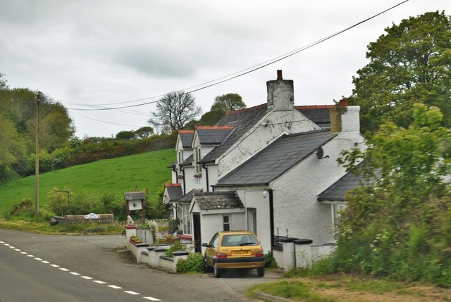
Cottage On The A40 Just Outside Scleddau I do not know the name of the building
Cottage On The A40 Just Outside Scleddau
I do not know the name of the building
Footpath near Letterston
Rhysgwyllt Farm, Letterston
Cut Mark Cwmwyntell Farm Cut Mark at Western end of farm building next to steps. 0.2m Ang, South Facing road side. Behind downpipe.
Cut Mark Cwmwyntell Farm
Cut Mark at Western end of farm building next to steps. 0.2m Ang, South Facing road side. Behind downpipe.
Show me another place!

Allt Llanstinan is located at Grid Ref: SM9431 (Lat: 51.947418, Lng: -4.9905323)

Unitary Authority: Pembrokeshire

Police Authority: Dyfed Powys

What 3 Words

///internet.gravitate.areas. Near Letterston, Pembrokeshire

Nearby Locations

Allt Llanstinan

Related Wikis

Llanstinan

Llanstinan is a rural parish in the community of Scleddau, north Pembrokeshire, Wales, 3 miles (4.8 km) south of Fishguard. == History == === Parish... ===

Jordanston Halt railway station

Jordanston Halt railway station was an intermediate stop on the Great Western Railway's line to Fishguard Harbour. It served the hamlet of Jordanston,...

Preseli Pembrokeshire (Senedd constituency)

Preseli Pembrokeshire (Welsh: Preseli Sir Benfro) is a constituency of the Senedd. It elects one Member of the Senedd by the first past the post method...

Preseli Pembrokeshire

Preseli Pembrokeshire (English: , prÉ™-SEL-ee; Welsh: Preseli Sir Benfro) was one of six local government districts of Dyfed in West Wales from 1974 to...

Nearby Amenities

Located within 500m of 51.947418,-4.9905323
Give Way
Direction: backward
Lat/Long: 51.9517052/-4.9916737
Give Way
Direction: backward
Lat/Long: 51.9451067/-4.995558
The data included in this document is from www.openstreetmap.org. The data is made available under ODbL.

Have you been to Allt Llanstinan?

Leave your review of Allt Llanstinan below (or comments, questions and feedback).