Little Rhyndaston Wood

Wood, Forest in Pembrokeshire

Wales

Little Rhyndaston Wood

Poached bridleway Descending Dudwell Mountain alongside woodland.
Poached bridleway Credit: Alan Hughes

The requested URL returned error: 429 Too Many Requests

If you have any feedback on the listing, please let us know in the comments section below.

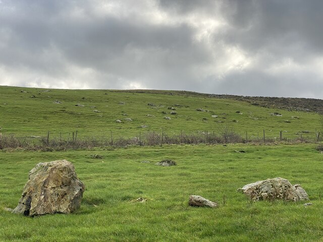
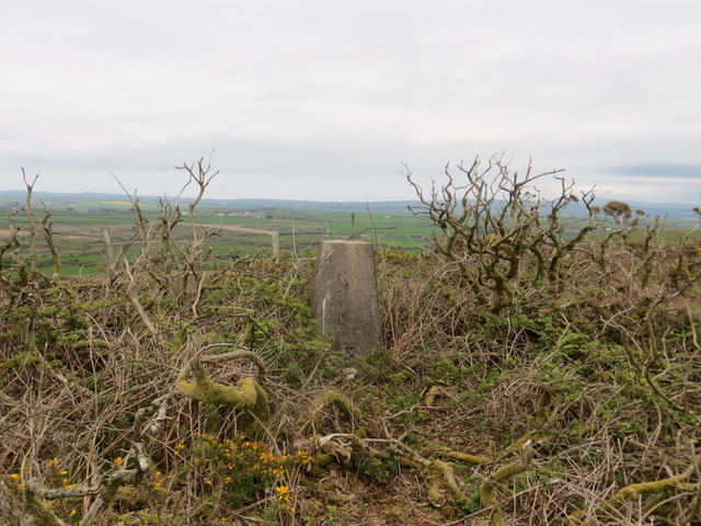
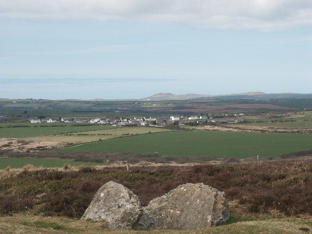
Little Rhyndaston Wood Images

Images are sourced within 2km of 51.872155/-5.0674358 or Grid Reference SM8823. Thanks to Geograph Open Source API. All images are credited.

Poached bridleway Descending Dudwell Mountain alongside woodland.
Poached bridleway
Descending Dudwell Mountain alongside woodland.
Start Naked Farm Unusually named farm at the foot of Dudwell Mountain.
Start Naked Farm
Unusually named farm at the foot of Dudwell Mountain.
Start Naked Farm With a greenhouse stripped of its polythene.
Start Naked Farm
With a greenhouse stripped of its polythene.
Rock-strewn hillside A large number of builders litter the hillside, presumably deposited at the end of the last ice age.
Rock-strewn hillside
A large number of builders litter the hillside, presumably deposited at the end of the last ice age.
Crossroads near Hayscastle Cross A rural crossroads close to 'Hayscastle Tump' and Brynamlwg..
Crossroads near Hayscastle Cross
A rural crossroads close to 'Hayscastle Tump' and Brynamlwg..
Dudwell Mountain Dugswell2's 625th HUMP is Dudwell Mountain. Lovely clear day but a machete is almost required to access trig point in gorse around flattish top.
Name: Dudwell Mountain
Hill number: 5247
Height: 178m / 584ft
Area: 31C: South-West Wales
Class: Hu
Grid ref: SM 90708 23148
Summit feature: trig point: OS measurement
Drop: 109m
Col: 69m  SM888320
Dudwell Mountain
Dugswell2's 625th HUMP is Dudwell Mountain. Lovely clear day but a machete is almost required to access trig point in gorse around flattish top. Name: Dudwell Mountain Hill number: 5247 Height: 178m / 584ft Area: 31C: South-West Wales Class: Hu Grid ref: SM 90708 23148 Summit feature: trig point: OS measurement Drop: 109m Col: 69m SM888320
Ordnance Survey Trig Pillar S6389 This pillar can be found on the highest point of Dudwell Mountain.
Ordnance Survey Trig Pillar S6389
This pillar can be found on the highest point of Dudwell Mountain.
Barns near Hayscastle Tump Looking north from the road to Hayscastle Cross.
Barns near Hayscastle Tump
Looking north from the road to Hayscastle Cross.
Three miles from anywhere The crossroads beside Hayscastle Tump, looking north towards Hayscastle.
Three miles from anywhere
The crossroads beside Hayscastle Tump, looking north towards Hayscastle.
Lane To Start Naked Farm An intriguing name but certainly not a modern pun - it can be found on old maps of the area. See <span class="nowrap"><a title="http://maps.nls.uk/geo/explore/#zoom=15&lat=51.8654&lon=-5.0534&layers=171" rel="nofollow ugc noopener" href="http://maps.nls.uk/geo/explore/#zoom=15&lat=51.8654&lon=-5.0534&layers=171">Link</a><img style="margin-left:2px;" alt="External link" title="External link - shift click to open in new window" src="https://s1.geograph.org.uk/img/external.png" width="10" height="10"/></span>
Lane To Start Naked Farm
An intriguing name but certainly not a modern pun - it can be found on old maps of the area. See LinkExternal link
Sheep grazing near Rhyndaston Fawr Looking south-east towards Tanybryn and the slopes of Dudwell Mountain.
Sheep grazing near Rhyndaston Fawr
Looking south-east towards Tanybryn and the slopes of Dudwell Mountain.
Rhyndaston Fawr farmhouse
Farmyard at Rhyndaston Fawr
Windswept tree near Rhyndaston Fawr Looking south-west from the lane just south of the farm.  The boundary of Rhyndaston Quarry runs along the top of the field.
Windswept tree near Rhyndaston Fawr
Looking south-west from the lane just south of the farm. The boundary of Rhyndaston Quarry runs along the top of the field.
Entrance and weighbridge, Rhyndaston Quarry
Entrance to Rhyndaston Quarry
Lane descending into the valley of Brandy Brook Looking north down the steep lane that leads to the ford.
Lane descending into the valley of Brandy Brook
Looking north down the steep lane that leads to the ford.
Horses at the entrance to Coed y Barch
Show me another place!

Little Rhyndaston Wood is located at Grid Ref: SM8823 (Lat: 51.872155, Lng: -5.0674358)

Unitary Authority: Pembrokeshire

Police Authority: Dyfed Powys

What 3 Words

///drummers.return.similar. Near Camrose, Pembrokeshire

Related Wikis

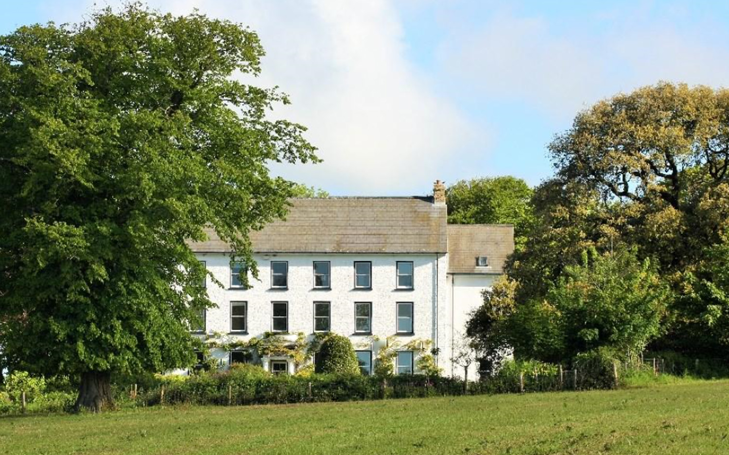
Cuffern Manor, Pembrokeshire

Cuffern Manor in Roch, Pembrokeshire is a house of historical significance and is listed on the Wales Heritage Register. It was built in 1770 by John Rees...
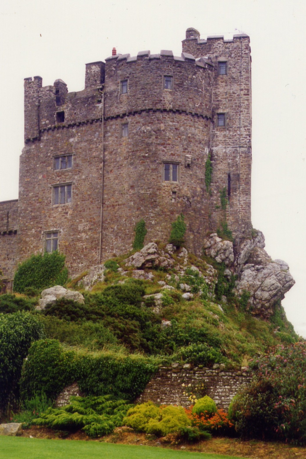
Roch Castle

Roch Castle (Welsh: Castell y Garn) is a 12th-century castle, located at Roch near Haverfordwest, Wales. Built by Norman knight Adam de Rupe in the second...

Hayscastle

Hayscastle or Hays-Castle (Welsh: Cas-lai) is a village, parish and community of Pembrokeshire in West Wales, 7½ miles (N. W. by N.) from Haverfordwest...

Brawdy

Brawdy (Welsh: Breudeth) is a village and community in Pembrokeshire, Wales. == Etymology == The Welsh language name appears to be an archaic form of...

Related Videos

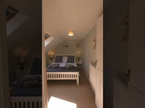
Weavers Cottage Holiday Home in Cuffern near Newgale in Pembrokeshire

coast #visitwales #coastalcottages #pembrokeshire #travel #wales #visitpembrokeshire #holiday #roch #cuffern #newgale #cosy ...

Fat man travels to wales

My trip to the blue lagoon in st David wales.

12 DAYS OF WILKO

WILKO HAVERFORDWEST'S 12 DAYS OF WILKO.

Nearby Amenities

Located within 500m of 51.872155,-5.0674358
Crossing
Lat/Long: 51.870199/-5.0692917
The data included in this document is from www.openstreetmap.org. The data is made available under ODbL.

Have you been to Little Rhyndaston Wood?

Leave your review of Little Rhyndaston Wood below (or comments, questions and feedback).